close
-
Layers w
- Weather Layers
- Pro
- Pro
- Pro
- Pro
- Pro
- Pro
- More Layers
- Pro
- Pro
- Pro
- Pro
-
Upgrade to

3D
Trail Conditions
- Unknown
- Snow Groomed
- Snow Packed
- Snow Covered
- Snow Cover Partial
- Freeze/thaw Cycle
- Icy
- Prevalent Mud
- Wet
- Variable
- Ideal
- Dry
- Very Dry
Trail Flow (Ridden Direction)
Trailforks scans users ridelogs to determine the most popular direction each trail is ridden. A good flowing trail network will have most trails flowing in a single direction according to their intension.
The colour categories are based on what percentage of riders are riding a trail in its intended direction.
The colour categories are based on what percentage of riders are riding a trail in its intended direction.
- > 96%
- > 90%
- > 80%
- > 70%
- > 50%
- < 50%
- bi-directional trail
- no data
Trail Last Ridden
Trailforks scans ridelogs to determine the last time a trail was ridden.
- < 2 days
- < 1 week
- < 2 weeks
- < 1 month
- < 6 months
- > 6 months
Trail Ridden Direction
The intended direction a trail should be ridden.
- Downhill Only
- Downhill Primary
- Both Directions
- Uphill Primary
- Uphill Only
- One Direction
Contribute Details
Colors indicate trail is missing specified detail.
- Description
- Photos
- Description & Photos
- Videos
Trail Popularity ?
Trailforks scans ridelogs to determine which trails are ridden the most in the last 9 months.
Trails are compared with nearby trails in the same city region with a possible 25 colour shades.
Think of this as a heatmap, more rides = more kinetic energy = warmer colors.
- most popular
- popular
- less popular
- not popular
ATV/ORV/OHV Filter
Max Vehicle Width
inches
US Cell Coverage
Legend

Radar Time
Activity Recordings
Trailforks uses anonymized public activity data.
?
Activity Recordings
Trailforks uses anonymized public activity data.
?
Personal Heatmap
▶
Activity Types
all
/
none
▶
Options
2
Date range
month
–
Winter Trails
Warning
A routing network for winter maps does not exist. Selecting trails using the winter trails layer has been disabled.
Missing Trails
Most Popular
Least Popular
Trails are colored based on popularity. The more popular a trail is, the more red. Less popular trails trend towards green.
Jump Magnitude Heatmap
Heatmap of where riders jump on trails. Zoom in to see individual jumps, click circles to view jump details.
BC Backroad Status
![map legend]()
Service Road Atlas is a free to use, community-driven service for viewing and creating reports on the numerous back-country service roads around B.C. and Alberta.

Slope Aspect
Direction the slope faces
Trails Deemphasized
Trails are shown in grey.
Only show trails with no bike usage.
Suggested Layers
Based on selected activity type
Save the current map location and zoom level as your default home location whenever this page is loaded.
Save
No description for Arlington has been added yet!
Login or register to submit one.
Activities Click to view
- Mountain Bike
37 trails
- E-Bike
29 trails
- Adaptive Bike
0 trails
- Hike
34 trails
- Trail Running
34 trails
Region Details
- 9
- 3
- 18
- 2
- 5
Region Status
Open as of Jun 13, 2026Stats
- Avg Trail Rating
- Trails (view details)
- 37
- Trails Mountain Bike
- 37
- Trails E-Bike
- 29
- Trails Hike
- 34
- Trails Trail Running
- 34
- Total Distance
- 33 miles
- Total Descent
- 631 ft
- Total Vertical
- 205 ft
- Highest Trailhead
- 641 ft
- Reports
- 4,223
- Photos
- 68
- Ridden Counter
- 8,183
Sub Regions
-
Red Kane Park
- 7
-
River Legacy Park
- 7
- 1
- 4
-
River Legacy Park Paved Trails
- 2
-
The Woods at Dunlop Park
- 1
- 1
- 1
Popular Arlington Mountain Biking Trails
• 100 ★ 3.8 • 1 mile • 9 ft • 806 •
Popular green difficulty singletrack. This multi-use trail can be used one direction. On average it takes 8 minutes to complete this trail.
• 100 ★ 3.8 • 2 miles • 10 ft • 780 •
Popular green difficulty singletrack. This multi-use trail can be used one direction. On average it takes 7 minutes to complete this trail.
• 95 ★ 3.8 • 2 miles • 12 ft • 743 •
Popular green difficulty singletrack. This multi-use trail can be used one direction and has a moderate overall physical rating with a 12 ft blue climb. On average it takes 7 minutes to complete this trail.
• 90 ★ 4.4 • 2 miles • 8 ft • 714 •
Highly rated popular green difficulty singletrack. This multi-use trail can be used one direction. On average it takes 12 minutes to complete this trail.
• 50 ★ 3.7 • 4,619 ft • 33 ft • 540 •
Moderately popular green difficulty singletrack. This multi-use trail can be used both directions and has a moderate overall physical rating with a 33 ft blue climb. On average it takes 4 minutes to complete this trail.
• 95 ★ 3.7 • 1 mile • 3 ft • 519 •
Popular black diamond difficulty singletrack. This mountain bike primary trail can be used one direction and has a hard overall physical rating with a 3 ft black diamond climb. On average it takes 8 minutes to complete this trail.
• 90 ★ 4.0 • 1 mile • 20 ft • 519 •
Popular green difficulty singletrack. This multi-use trail can be used one direction. On average it takes 8 minutes to complete this trail.
Arlington Mountain Bike Routes
9 miles • 79 ft • 5 • Loop •
This is the 70 mile route for Judgment Day 2026
11 miles • 81 ft • 9 • Loop •
This is the 2026 Judgment Day River Legacy Route for the 100 mile
• 31 miles • 777 ft • 17 •
• 14 miles • 126 ft • 10 •
• 13 miles • 129 ft • 10 •
• 10 miles • 104 ft • 11 •
Videos of Arlington Mountain Bike
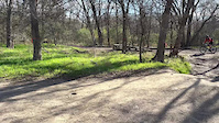
trail: River Legacy Parks
0:06 |
115 |
Jan 22, 2022

trail: East Loop
3:41 |
838 |
Oct 7, 2015

trail: East Loop
0:58 |
411 |
Aug 25, 2015

1:7:45 |
84 |
Aug 30, 2025

trail: West Loop
4:32 |
55 |
Aug 30, 2025 , Arlington

trail: South Loop
7:27 |
53 |
Aug 30, 2025 , Arlington

trail: Ridge Loop
8:17 |
51 |
Aug 30, 2025 , Arlington

trail: East Loop
11:14 |
80 |
Aug 30, 2025 , Arlington
Current Trail Warnings
| status | trail | date | condition | user | info |
|---|---|---|---|---|---|
| Main Line | May 24, 2026 @ 4:33pm (America/Chicago) May 24, 2026 | Wet | dunloptrail FWMBA |
Recent Trail Reports
Activity Feed
| username | action | type | title | date |
|---|---|---|---|---|
| rhayes2702 | wishlist | trail | activity #97200217 and 2 more | Jun 17, 2026 @ 11:49am 1 day |
| My1Ruler | wishlist | region | activity #97051951 | Jun 15, 2026 @ 10:40am Jun 15, 2026 |
| Casey511Harris | add | report | activity #96866790 and 13 more | Jun 13, 2026 @ 5:47am Jun 13, 2026 |
| DavenRemoray | update | route | activity #96686248 | Jun 10, 2026 @ 11:28am Jun 10, 2026 |
| DavenRemoray | update | route | activity #96686228 | Jun 10, 2026 @ 11:28am Jun 10, 2026 |
Recent Comments
| username | type | title | comment | date |
|---|---|---|---|---|
| report | Rode to night and there is a tree down after... | May 7, 2026 @ 6:57pm May 7, 2026 | ||
| report | Overgrown and in dire need of tlc. Even lose... | Apr 25, 2025 @ 9:05am Apr 25, 2025 | ||
| report | Mmmmm M mm | Jun 11, 2023 @ 9:37am Jun 11, 2023 | ||
| report | This was ment for the MTB trail disregard | Nov 20, 2022 @ 6:48am Nov 20, 2022 | ||
| report | Tree across trail | Sep 8, 2020 @ 2:39pm Sep 8, 2020 |
Local Badges
-

Epic Ride Climb 2k1 awarded -

Climbing 10k Badge16 awarded -

Climbing 100k Badge0 awarded -

Epic Ride Descent 2k1 awarded -

Descent 10k Badge16 awarded -

Descent 100k Badge0 awarded
Bike & Skill Parks
| name | type | city | rating |
|---|---|---|---|
| Mosier Valley MX, TX | skill park | Arlington | |
| River Legacy Skill Park | skill park | Arlington | |
| Village Creek MX | skill park | Arlington |
Activity Type Stats
| activitytype | trails | distance | descent | descent distance | total vertical | rating | global rank | state rank | photos | reports | routes | ridelogs |
|---|---|---|---|---|---|---|---|---|---|---|---|---|
| Mountain Bike | 37 | 33 miles | 630 ft | 8 miles | 207 ft | #2,229 | #797 | 67 | 4,223 | 2 | 13,634 | |
| E-Bike | 29 | 32 miles | 548 ft | 8 miles | 207 ft | #3,203 | #1,153 | 4,175 | 444 | |||
| Hike | 34 | 33 miles | 617 ft | 8 miles | 207 ft | #5,201 | #1,834 | 4,183 | 314 | |||
| Trail Running | 34 | 33 miles | 617 ft | 8 miles | 207 ft | #4,578 | #1,418 | 4,183 | 296 |
Frequently Asked Questions About Arlington
▼
What are the best places to ride in Arlington?
Arlington has 4 areas to explore for mountain biking. The top rated areas are:
▼
What are the highest rated mountain biking trails in Arlington?
The highest rated mountain biking trails in Arlington are:
- East Loop (4.2/5)
- River Legacy Parks (4.1/5)
- Bob Findlay Linear Park (4.1/5)
- Ridge Loop (4/5)
- Fun Town (4/5)
▼
What is the best time of the year to ride in Arlington?
Based on ride log data, the most popular months to ride in Arlington are:
- July (244 activities)
- August (123 activities)
- September (111 activities)
▼
Where can I park to ride in Arlington?
There are 2 parking locations listed in Arlington. The most popular parking spots are:
Activities
Trails
Points of Interest
- By brenthillier
 NSMBA TRAILFORKS & contributors
 - Admins: FWMBA, DORBA MAIN
- #3722 - 7,093 views
- arlington activity log | embed map of Arlington mountain bike trails | arlington mountain biking points of interest
Downloading of trail gps tracks in kml & gpx formats is enabled for Arlington.
You must login to download files.