close
-
Layers w
- Weather Layers
- Pro
- Pro
- Pro
- Pro
- Pro
- Pro
- More Layers
- Pro
- Pro
- Pro
- Pro
-
Upgrade to

3D
Trail Conditions
- Unknown
- Snow Groomed
- Snow Packed
- Snow Covered
- Snow Cover Partial
- Freeze/thaw Cycle
- Icy
- Prevalent Mud
- Wet
- Variable
- Ideal
- Dry
- Very Dry
Trail Flow (Ridden Direction)
Trailforks scans users ridelogs to determine the most popular direction each trail is ridden. A good flowing trail network will have most trails flowing in a single direction according to their intension.
The colour categories are based on what percentage of riders are riding a trail in its intended direction.
The colour categories are based on what percentage of riders are riding a trail in its intended direction.
- > 96%
- > 90%
- > 80%
- > 70%
- > 50%
- < 50%
- bi-directional trail
- no data
Trail Last Ridden
Trailforks scans ridelogs to determine the last time a trail was ridden.
- < 2 days
- < 1 week
- < 2 weeks
- < 1 month
- < 6 months
- > 6 months
Trail Ridden Direction
The intended direction a trail should be ridden.
- Downhill Only
- Downhill Primary
- Both Directions
- Uphill Primary
- Uphill Only
- One Direction
Contribute Details
Colors indicate trail is missing specified detail.
- Description
- Photos
- Description & Photos
- Videos
Trail Popularity ?
Trailforks scans ridelogs to determine which trails are ridden the most in the last 9 months.
Trails are compared with nearby trails in the same city region with a possible 25 colour shades.
Think of this as a heatmap, more rides = more kinetic energy = warmer colors.
- most popular
- popular
- less popular
- not popular
ATV/ORV/OHV Filter
Max Vehicle Width
inches
US Cell Coverage
Legend

Radar Time
Activity Recordings
Trailforks uses anonymized public activity data.
?
Activity Recordings
Trailforks uses anonymized public activity data.
?
Personal Heatmap
▶
Activity Types
all
/
none
▶
Options
2
Date range
month
–
Winter Trails
Warning
A routing network for winter maps does not exist. Selecting trails using the winter trails layer has been disabled.
Missing Trails
Most Popular
Least Popular
Trails are colored based on popularity. The more popular a trail is, the more red. Less popular trails trend towards green.
Jump Magnitude Heatmap
Heatmap of where riders jump on trails. Zoom in to see individual jumps, click circles to view jump details.
BC Backroad Status
![map legend]()
Service Road Atlas is a free to use, community-driven service for viewing and creating reports on the numerous back-country service roads around B.C. and Alberta.

Slope Aspect
Direction the slope faces
Trails Deemphasized
Trails are shown in grey.
Only show trails with no bike usage.
Suggested Layers
Based on selected activity type
Save the current map location and zoom level as your default home location whenever this page is loaded.
Save
No description for Armenia has been added yet!
Login or register to submit one.
Activities Click to view
- Mountain Bike
11 trails
- E-Bike
7 trails
- Adaptive Bike
0 trails
- Hike
10 trails
- Trail Running
10 trails
Region Details
- 2
- 6
- 3
Region Status
Caution as of Aug 28, 2024Stats
- Avg Trail Rating
- Trails (view details)
- 11
- Trails Mountain Bike
- 11
- Trails E-Bike
- 7
- Trails Hike
- 10
- Trails Trail Running
- 10
- Total Distance
- 12 miles
- Total Descent
- 8,202 ft
- Total Vertical
- 4,115 ft
- Highest Trailhead
- 10,533 ft
- Reports
- 7
- Photos
- 52
- Ridden Counter
- 239
Popular Armenia Mountain Biking Trails
• 95 ★ 5.0 • 4 miles • 241 ft • 79 •
Popular black diamond difficulty singletrack. This mountain bike primary trail can be used downhill primary and has a hard overall physical rating. On average it takes 53 minutes to complete this trail.
• 100 ★ 5.0 • 2 miles • 203 ft • 26 •
Pista muy tecnica, llena de rocas, grietas y mucha humedad, Camino estrecho y resbaloso cuando se encuentra humeda.
• 75 ★ 0.0 • 4 miles • 229 ft • 13 •
Pista Fluida y con mucho pedaleo, Senderos Estrechos y divertidos
• 5 ★ 0.0 • 2 miles • 51 ft • 4 •
Less popular blue difficulty wilderness trail. This mountain bike primary trail can be used downhill only and has a moderate overall physical rating. It features berm, drop, jump and gap jump. On average it takes 54 minutes to complete this trail.
• 65 ★ 0.0 • 1 mile • 431 ft • 1 • • hike
Moderately popular blue difficulty singletrack. This hike primary trail can be used both directions and has a moderate overall physical rating with a 431 ft green climb. Trail visibility is always easy to follow.
• 5 ★ 0.0 • 3,848 ft • 438 ft • 1 • • hike
Less popular blue difficulty singletrack. This hike primary trail can be used both directions and has a moderate overall physical rating with a 438 ft blue climb. Trail visibility is always easy to follow.
• 5 ★ 0.0 • 4 miles • 529 ft • 1 • • hike
Less popular blue difficulty mixed. This hike primary trail can be used both directions and has a moderate overall physical rating with a 529 ft blue climb. Trail visibility is sometimes hard to follow.
• 5 ★ 0.0 • 3 miles • 221 ft •
Less popular blue difficulty primitive. This multi-use trail can be used downhill primary and has a moderate overall physical rating with a 221 ft blue climb. Trail visibility is sometimes hard to follow.
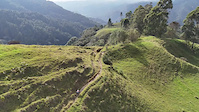
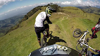
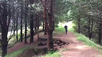
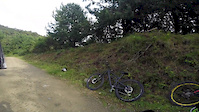
Photos of Armenia Mountain Bike
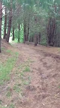
Videos of Armenia Mountain Bike
trail: La Alegria
4:42 |
30 |
Oct 22, 2024
trail: Ventiaderos - La Linea
0:53 |
114 |
Jun 8, 2016
trail: Ventiaderos - La Linea
0:10 |
44 |
Feb 18, 2016
trail: Ventiaderos - La Linea
0:11 |
53 |
Feb 18, 2016
trail: Ventiaderos - La Linea
0:05 |
108 |
Feb 18, 2016
trail: La Alegria
11:27 |
402 |
Apr 7, 2015
Recent Trail Reports
| status | trail | date | condition | info | user |
|---|---|---|---|---|---|
| Km 8 - Salento | Aug 28, 2024 @ 12:00pm Aug 28, 2024 | Variable | Mykimike | ||
| La Alegria | Jan 10, 2024 @ 9:21am Jan 10, 2024 | Ideal | allaroundjoe | ||
| Ventiaderos - La Linea | Feb 14, 2016 @ 5:08pm Feb 14, 2016 | Very Dry | Earango |
Activity Feed
| username | action | type | title | date |
|---|---|---|---|---|
| Tjerro | wishlist | trail | activity #96915403 and 1 more | Jun 13, 2026 @ 2:11pm Jun 13, 2026 |
| Tjerro | wishlist | trail | activity #94687257 | May 14, 2026 @ 7:06am May 14, 2026 |
| Mountainbikesalento | add | photo | activity #88851441 and 1 more | Feb 13, 2026 @ 2:29pm Feb 13, 2026 |
| Karlos23 | ridden | trail | activity #88044439 | Jan 30, 2026 @ 11:41am Jan 30, 2026 |
| nickyspitz | wishlist | trail | activity #85245147 | Dec 8, 2025 @ 4:08am Dec 8, 2025 |
Recent Comments
| username | type | title | comment | date |
|---|---|---|---|---|
| trail | Rutted and slick in sections | Dec 21, 2024 @ 5:40am Dec 21, 2024 | ||
| trail | Kind of gnarly, blue to black | Dec 21, 2024 @ 5:38am Dec 21, 2024 | ||
| trail | @mountainbiketoursalento te ayuda a... | Apr 12, 2021 @ 12:36pm Apr 12, 2021 |
Local Badges
-

Epic Mountain Bike Climb 2k0 awarded -

Climbing 10k Badge0 awarded -

Mountain Biking 100k Badge0 awarded -

Epic Ride Descent 2k0 awarded -

Descent 10k Badge0 awarded -

Descent 100k Badge0 awarded
Activity Type Stats
| activitytype | trails | distance | descent | descent distance | total vertical | rating | global rank | state rank | photos | reports | routes | ridelogs |
|---|---|---|---|---|---|---|---|---|---|---|---|---|
| Mountain Bike | 11 | 12 miles | 8,202 ft | 10 miles | 4,114 ft | #2,065 | #7 | 52 | 7 | 1 | 4,446 | |
| E-Bike | 7 | #1,957 | #14 | 5 | 123 | |||||||
| Hike | 10 | 10 miles | 6,657 ft | 8 miles | 4,114 ft | #2,374 | #7 | 7 | 393 | |||
| Trail Running | 10 | 10 miles | 6,657 ft | 8 miles | 4,114 ft | #1,966 | #7 | 7 | 6 |
Frequently Asked Questions About Armenia
▼
What are the highest rated mountain biking trails in Armenia?
The highest rated mountain biking trails in Armenia are:
- La Alegria (4.2/5)
- Km 8 - Salento (4.1/5)
- La Linea - Puerta Negra (0/5)
- Bosque de Niebla-Finca Montana (0/5)
- Ventiaderos - La Linea (0/5)
▼
What is the best time of the year to ride in Armenia?
Based on ride log data, the most popular months to ride in Armenia are:
- August (23 activities)
- July (17 activities)
- June (15 activities)
▼
Where can I park to ride in Armenia?
Check the Armenia trail map for trailhead and parking information. Community members regularly update access and parking details for trails in the area.
▼
What is the longest trail in Armenia?
The longest trail in Armenia is La Linea - Puerta Negra at 6.9 km. View all trails sorted by distance.
Activities
Trails
Points of Interest
- By mlaracor & contributors
- Admins: apply
- #8154 - 3,459 views
- armenia activity log | embed map of Armenia mountain bike trails |
Downloading of trail gps tracks in kml & gpx formats is enabled for Armenia.
You must login to download files.