close
-
Layers w
- Weather Layers
- Pro
- Pro
- Pro
- Pro
- Pro
- Pro
- More Layers
- Pro
- Pro
- Pro
- Pro
-
Upgrade to

3D
Trail Conditions
- Unknown
- Snow Groomed
- Snow Packed
- Snow Covered
- Snow Cover Partial
- Freeze/thaw Cycle
- Icy
- Prevalent Mud
- Wet
- Variable
- Ideal
- Dry
- Very Dry
Trail Flow (Ridden Direction)
Trailforks scans users ridelogs to determine the most popular direction each trail is ridden. A good flowing trail network will have most trails flowing in a single direction according to their intension.
The colour categories are based on what percentage of riders are riding a trail in its intended direction.
The colour categories are based on what percentage of riders are riding a trail in its intended direction.
- > 96%
- > 90%
- > 80%
- > 70%
- > 50%
- < 50%
- bi-directional trail
- no data
Trail Last Ridden
Trailforks scans ridelogs to determine the last time a trail was ridden.
- < 2 days
- < 1 week
- < 2 weeks
- < 1 month
- < 6 months
- > 6 months
Trail Ridden Direction
The intended direction a trail should be ridden.
- Downhill Only
- Downhill Primary
- Both Directions
- Uphill Primary
- Uphill Only
- One Direction
Contribute Details
Colors indicate trail is missing specified detail.
- Description
- Photos
- Description & Photos
- Videos
Trail Popularity ?
Trailforks scans ridelogs to determine which trails are ridden the most in the last 9 months.
Trails are compared with nearby trails in the same city region with a possible 25 colour shades.
Think of this as a heatmap, more rides = more kinetic energy = warmer colors.
- most popular
- popular
- less popular
- not popular
ATV/ORV/OHV Filter
Max Vehicle Width
inches
US Cell Coverage
Legend

Radar Time
Activity Recordings
Trailforks uses anonymized public activity data.
?
Activity Recordings
Trailforks uses anonymized public activity data.
?
Personal Heatmap
▶
Activity Types
all
/
none
▶
Options
2
Date range
month
–
Winter Trails
Warning
A routing network for winter maps does not exist. Selecting trails using the winter trails layer has been disabled.
Missing Trails
Most Popular
Least Popular
Trails are colored based on popularity. The more popular a trail is, the more red. Less popular trails trend towards green.
Jump Magnitude Heatmap
Heatmap of where riders jump on trails. Zoom in to see individual jumps, click circles to view jump details.
BC Backroad Status
![map legend]()
Service Road Atlas is a free to use, community-driven service for viewing and creating reports on the numerous back-country service roads around B.C. and Alberta.

Slope Aspect
Direction the slope faces
Trails Deemphasized
Trails are shown in grey.
Only show trails with no bike usage.
Suggested Layers
Based on selected activity type
Save the current map location and zoom level as your default home location whenever this page is loaded.
Save
No description for Armidale has been added yet!
Login or register to submit one.
Activities Click to view
- Mountain Bike
142 trails
- E-Bike
46 trails
- Gravel Bike
0 trails
- Adaptive Bike
0 trails
- Winter Fat Bike
0 trails
- Hike
137 trails
- Trail Running
146 trails
Region Details
- 21
- 59
- 51
- 7
Region Status
Open as of Jun 3, 2026Stats
- Avg Trail Rating
- Trails (view details)
- 138
- Trails Mountain Bike
- 143
- Trails E-Bike
- 46
- Trails Hike
- 137
- Trails Trail Running
- 146
- Total Distance
- 44 miles
- Total Descent
- 7,036 ft
- Total Vertical
- 1,458 ft
- Highest Trailhead
- 4,603 ft
- Reports
- 3,222
- Photos
- 67
- Ridden Counter
- 10,550
Sub Regions
-
Armidale State Forest (Piney)
- 31
- 31
- 2
-
Fat Tyre Farm
- 5
- 8
- 1
-
Kookaburra Crest
- 1
-
Oxley Wilds River National Park
- 1
-
Robbers Run
- 2
-
SportUNE MTB Trails
- 22
- 8
- 4
Popular Armidale Mountain Biking Trails
• 95 ★ 5.0 • 1,729 ft • 7 ft • 214 •
is the starting trail leading off from the trailhead. A nice straight forward and fun trail with some twists and bends, suitable for all rider levels.
• 100 ★ 5.0 • 913 ft • 5 ft • 210 •
runs along the southern edge of the pine plantation and is an easy and relatively flat trail with water views over Lake Zot. Nothing hard here.
• 100 ★ 5.0 • 1,534 ft • 60 ft • 201 •
Final section of the track leading back to the trail head. Nice open section of track with one final fence crossing that, as the name suggests, allows you to go ...
• 90 ★ 3.0 • 488 ft • 0 ft • 198 •
A short section of flow track where rejoins . This trail consists of a series of 7 berms on either side of trail, allowing riders to swap from side to side. A fun and flowy section of trail.
• 95 ★ 5.0 • 456 ft • 0 ft • 196 •
For those that don't like berms, this trail acts as a B-line for . Slightly steeper downhill but straight forward.
• 90 ★ 4.0 • 5,092 ft • 43 ft • 187 •
is a great set of trails. Access requires crossing the fence knock-over before dropping up and down along the creek. The trail turns into a very tight and twisty section thru the trees. This section requires some good bike handling to...
• 100 ★ 4.0 • 3,668 ft • 122 ft • 174 •
While the track is a straight forward ride, the climbing on this one makes it just a bit tougher. The climb is constant to the top afer which there are a series of great berms as you drop back down onto .
• 90 ★ 4.0 • 554 ft • 20 ft • 173 •
A short, sharp and tricky trail with a couple of rock drops and a steep punchy climb to the .
Armidale Mountain Bike Routes
Kermit Featured
1 mile • 103 ft • 7 • Loop •
Kermit is an easy graded loop named for beginners. The loop is well marked by signs and easy to follow....
3 miles • 221 ft • 7 • Loop •
A ~5km loop covering the open trails accessible from the Pine Forest Road Carpark.
WEMBO 2023 Race Route Featured
9 miles • 933 ft • 24 • Loop • Race •
This is the race route for the 2023 WEMBO World Championships, to be run in 4-5 November 2023. Course is...
4 miles • 389 ft • 10 • Loop • Race •
This is the shorter race loop for non-categorised, social riders and U13 NIXCs riders for the 2023 Winter...
6 miles • 655 ft • 11 • Loop • Race •
This is the main race loop for age categories and NIXCs riders for the 2023 Winter Series/NIXCS Round.
Photos of Armidale Mountain Bike
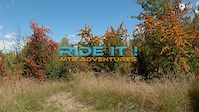
Videos of Armidale Mountain Bike
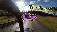
trail: Kookaburra Crest Track
0:40 |
43 |
Oct 2, 2025
trail: Spicks 'n Specks
9:47 |
61 |
May 27, 2022

trail: Hotdog
8:38 |
68 |
May 27, 2022
trail: Mars Attack
9:29 |
110 |
May 27, 2022
trail: Kookaburra Crest Track
3:39 |
170 |
Aug 4, 2020
trail: Axe Head
0:53 |
178 |
Aug 4, 2020
Recent Trail Reports
Activity Feed
| username | action | type | title | date |
|---|---|---|---|---|
| Robocos | wishlist | region | activity #96579891 | Jun 8, 2026 @ 7:06pm Jun 8, 2026 |
| EuanfWEDZm | ridden | trail | activity #95076553 | May 19, 2026 @ 5:27pm May 19, 2026 |
| Coxy471 | ridden | trail | activity #95007719 | May 18, 2026 @ 4:25pm May 18, 2026 |
| EuanfWEDZm | add | photo | activity #94944070 | May 17, 2026 @ 3:12pm May 17, 2026 |
| Addzz | add | report | activity #94877158 and 8 more | May 17, 2026 @ 12:53am May 17, 2026 |
Recent Comments
| username | type | title | comment | date |
|---|---|---|---|---|
| report | Still raw but drying out & bedding in nicely | Aug 10, 2024 @ 1:54am Aug 10, 2024 | ||
| trail | Some trail are in ok condition | Mar 16, 2022 @ 4:54pm Mar 16, 2022 | ||
| trail | Nothing here is rideable. 2yrs minimum since... | Mar 25, 2021 @ 2:16am Mar 25, 2021 | ||
| trail | Fat Tyre Farm is no longer in use. Visited... | Mar 25, 2021 @ 2:10am Mar 25, 2021 | ||
| trail | These trails are no longer usable. No upkeep,... | Mar 25, 2021 @ 2:00am Mar 25, 2021 |
Local Badges
-

The Great Gonzo63 awarded -

Kermit85 awarded -

Big Ride 30k1,498 awarded -

Descent 100k Badge5 awarded -

Epic Ride 50k548 awarded -

Top 10 Trails79 awarded
Activity Type Stats
| activitytype | trails | distance | descent | descent distance | total vertical | rating | global rank | state rank | photos | reports | routes | ridelogs |
|---|---|---|---|---|---|---|---|---|---|---|---|---|
| Mountain Bike | 142 | 44 miles | 7,034 ft | 21 miles | 1,457 ft | #828 | #43 | 60 | 3,222 | 25 | 7,583 | |
| E-Bike | 46 | 11 miles | 1,460 ft | 5 miles | 246 ft | #3,556 | #167 | 2,901 | 10 | 71 | ||
| Hike | 137 | 34 miles | 5,233 ft | 16 miles | 1,457 ft | #3,251 | #90 | 7 | 3,177 | 220 | ||
| Trail Running | 146 | 40 miles | 5,984 ft | 18 miles | 1,457 ft | #2,781 | #78 | 3,191 | 187 |
Frequently Asked Questions About Armidale
▼
What are the best places to ride in Armidale?
Armidale has 8 areas to explore for mountain biking. The top rated areas are:
▼
What are the highest rated mountain biking trails in Armidale?
The highest rated mountain biking trails in Armidale are:
- Ding-Wit (4.4/5)
- Big Dog's Den (4.3/5)
- Kookaburra Crest Track (4.2/5)
- Return Link (4.1/5)
- Desertion (4.1/5)
▼
What is the best time of the year to ride in Armidale?
Based on ride log data, the most popular months to ride in Armidale are:
- December (25 activities)
- February (24 activities)
- June (20 activities)
▼
Where can I park to ride in Armidale?
There are 20 parking locations listed in Armidale. The most popular parking spots are:
- Pine Forest Road Parking
- SportsUNE Trailhead Parking
- Dangarsleigh Monument
- Parking
- Piney Trailhead Parking
Activities
Trails
Points of Interest
- Gorge Lookout Viewpoint
- The Second Long Bridge TTF
- Chandelier Falls Lookout Viewpoint
- Too Many Beers Skinny TTF
- Edgars Lookout Viewpoint
- Wollomombi Campground Camping
- The Roller TTF
- Long Point Camping Area
- The Penstock Viewpoint
- Main Falls Lookout Viewpoint
- Round Mountain (5,190 ft)
- Ben Lomond (4,961 ft)
- The Brothers (4,918 ft)
- By Addzz
 TRAILFORKS NEMTB & contributors
 - Admins: stuartrichardson, NEMTB
- #12104 - 11,439 views
- armidale activity log | embed map of Armidale mountain bike trails | armidale mountain biking points of interest polygons
Downloading of trail gps tracks in kml & gpx formats is enabled for Armidale.
You must login to download files.