close
-
Layers w
- Weather Layers
- Pro
- Pro
- Pro
- Pro
- Pro
- Pro
- More Layers
- Pro
- Pro
- Pro
- Pro
-
Upgrade to

3D
Trail Conditions
- Unknown
- Snow Groomed
- Snow Packed
- Snow Covered
- Snow Cover Partial
- Freeze/thaw Cycle
- Icy
- Prevalent Mud
- Wet
- Variable
- Ideal
- Dry
- Very Dry
Trail Flow (Ridden Direction)
Trailforks scans users ridelogs to determine the most popular direction each trail is ridden. A good flowing trail network will have most trails flowing in a single direction according to their intension.
The colour categories are based on what percentage of riders are riding a trail in its intended direction.
The colour categories are based on what percentage of riders are riding a trail in its intended direction.
- > 96%
- > 90%
- > 80%
- > 70%
- > 50%
- < 50%
- bi-directional trail
- no data
Trail Last Ridden
Trailforks scans ridelogs to determine the last time a trail was ridden.
- < 2 days
- < 1 week
- < 2 weeks
- < 1 month
- < 6 months
- > 6 months
Trail Ridden Direction
The intended direction a trail should be ridden.
- Downhill Only
- Downhill Primary
- Both Directions
- Uphill Primary
- Uphill Only
- One Direction
Contribute Details
Colors indicate trail is missing specified detail.
- Description
- Photos
- Description & Photos
- Videos
Trail Popularity ?
Trailforks scans ridelogs to determine which trails are ridden the most in the last 9 months.
Trails are compared with nearby trails in the same city region with a possible 25 colour shades.
Think of this as a heatmap, more rides = more kinetic energy = warmer colors.
- most popular
- popular
- less popular
- not popular
ATV/ORV/OHV Filter
Max Vehicle Width
inches
US Cell Coverage
Legend

Radar Time
Activity Recordings
Trailforks uses anonymized public activity data.
?
Activity Recordings
Trailforks uses anonymized public activity data.
?
Personal Heatmap
▶
Activity Types
all
/
none
▶
Options
2
Date range
month
–
Winter Trails
Warning
A routing network for winter maps does not exist. Selecting trails using the winter trails layer has been disabled.
Missing Trails
Most Popular
Least Popular
Trails are colored based on popularity. The more popular a trail is, the more red. Less popular trails trend towards green.
Jump Magnitude Heatmap
Heatmap of where riders jump on trails. Zoom in to see individual jumps, click circles to view jump details.
BC Backroad Status
![map legend]()
Service Road Atlas is a free to use, community-driven service for viewing and creating reports on the numerous back-country service roads around B.C. and Alberta.

Slope Aspect
Direction the slope faces
Trails Deemphasized
Trails are shown in grey.
Only show trails with no bike usage.
Suggested Layers
Based on selected activity type
Save the current map location and zoom level as your default home location whenever this page is loaded.
Save
No description for Arnold has been added yet!
Login or register to submit one.
Activities Click to view
- Mountain Bike
76 trails
- E-Bike
2 trails
- Gravel Bike
8 trails
- Adaptive Bike
17 trails
- Horse
66 trails
- Hike
84 trails
- Trail Running
84 trails
Region Details
- 18
- 24
- 30
- 4
Region Status
Open as of Jun 14, 2026Stats
- Avg Trail Rating
- Trails (view details)
- 84
- Trails Mountain Bike
- 76
- Trails E-Bike
- 2
- Trails Gravel Bike
- 8
- Trails Adaptive Bike
- 17
- Trails Winter Fat Bike
- 4
- Trails Horse
- 66
- Trails Hike
- 84
- Trails Trail Running
- 84
- Total Distance
- 65 miles
- Total Descent Distance
- 36 miles
- Total Descent
- 12,885 ft
- Total Vertical
- 2,403 ft
- Highest Trailhead
- 4,878 ft
- Reports
- 1,285
- Photos
- 2,096
- Ridden Counter
- 4,274
Sub Regions
-
Arnold Rim Trail System
- 23
- 29
- 4
-
Calaveras Big Trees State Park
Popular Arnold Mountain Biking Trails
• 100 ★ 3.0 • 4,373 ft • 243 ft • 190 •
The Trail is a non-motorized trail system designed for hikers, mountain bikers and equestrians. ART connects the many wonders of public lands along the Ebbetts Pass National Scenic Byway stretch of Hwy 4 to its communities, creating a...
• 80 ★ 4.0 • 3,241 ft • 49 ft • 153 •
Popular black diamond difficulty singletrack. This multi-use trail can be used both directions and has a hard overall physical rating with a 49 ft black diamond climb. Trail visibility is always easy to follow. On average it takes 10 minutes to complete this trail.
• 100 ★ 4.0 • 1 mile • 105 ft • 136 •
serves as the continuation of , and offers. nice singletrack that parallels Valley View Drive to the south. Starting at the P9 parking area, look for the trail post near a picnic bench. Follow for a very short distance to the 4n40 Fire...
• 85 ★ 5.0 • 2,694 ft • 64 ft • 133 •
Popular green difficulty singletrack. This multi-use trail can be used both directions and has a moderate overall physical rating with a 64 ft blue climb. On average it takes 7 minutes to complete this trail.
• 70 ★ 3.0 • 2,805 ft • 194 ft • 118 •
Popular blue difficulty singletrack. This multi-use trail can be used both directions and has a hard overall physical rating with a 194 ft black diamond climb. Trail visibility is always easy to follow. On average it takes 7 minutes to complete this trail.
• 20 ★ 4.8 • 2,438 ft • 0 ft • 118 •
is the newest trail on the system. A 1/2 mile singletrack flow trail with berms, great views north, and connecting with many other trails around the P9 parking area, TDD can be ridden both uphill and downhill, or you can climb Valley...
• 70 ★ 5.0 • 1,273 ft • 78 ft • 104 •
Spur trail that starts out double track up to the rock and then you can drop off the south side back to the road.
• 95 ★ 4.0 • 3,317 ft • 65 ft • 102 •
continues the easy, beginner-friendly singletrack after you ride . From the water tank, find the entry post on the south side of the tank. Follow Wilma for approximately 1/2 mile, where it junctions with Valley View Drive. From the end...
Arnold Mountain Bike Routes
2 miles • 163 ft • 2 • Loop •
Just short of two miles with less than 200 feet of elevation gain, this route offers a nice outing on a...
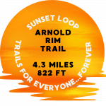
4 miles • 822 ft • 5 • Loop •
: This is an ART classic and the venue for ARTA's guided sunset hikes during the summer. Check...
4 miles • 683 ft • 3 • Loop •
This fun 4-mile loop offers a strenuous workout with rewarding views and diverse terrain. The Loop can be...
12 miles • 1,214 ft • 10 • Out & Back •
March 20th Alternate CalFire MTB Tour.
22 miles • 4,754 ft • 1 • Point to Point •
Experience the ART from end to end. If starting from the Lone Madrone Trailhead on Fullen Road, this route...
★ 5.0 • 6 miles • 698 ft • 0 •
This is a fairly short but fun loop that incorporates a portion of the Arnold Rim Trail (ART), some Forest...
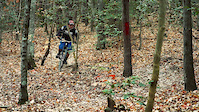
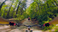
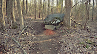
Photos of Arnold Mountain Bike
Videos of Arnold Mountain Bike


Current Trail Warnings
| status | trail | date | condition | user | info |
|---|---|---|---|---|---|
| FR 4N36 | Jun 9, 2026 @ 3:37pm (America/Los_Angeles) Jun 9, 2026 | Dry | jimoc203 ARTA | Large tree blocking the trail,... |
Recent Trail Reports
Activity Feed
| username | action | type | title | date |
|---|---|---|---|---|
| DavidJPJz79 | wishlist | trail | activity #97026111 | Jun 15, 2026 @ 12:12am Jun 15, 2026 |
| karinarta | add | report | activity #97011485 and 10 more | Jun 14, 2026 @ 4:13pm Jun 14, 2026 |
| JordanZIy1FQ | wishlist | trail | activity #96811279 | Jun 12, 2026 @ 9:46am Jun 12, 2026 |
| robarta | comment | report | activity #96672954 | Jun 10, 2026 @ 7:54am Jun 10, 2026 |
| jimoc203 | comment | report | activity #96672650 | Jun 10, 2026 @ 7:49am Jun 10, 2026 |
Recent Comments
| username | type | title | comment | date |
|---|---|---|---|---|
| report | No. It is not on any of the Run the Rim courses. | Jun 10, 2026 @ 7:54am Jun 10, 2026 | ||
| report | Was this cleared by the pre-race trail work? | Jun 10, 2026 @ 7:49am Jun 10, 2026 | ||
| report | Love the video! | Jun 4, 2026 @ 1:13pm Jun 4, 2026 | ||
| report | Excellent! | Jun 4, 2026 @ 1:12pm Jun 4, 2026 | ||
| report | @robarta 4N40 & Dino. Arrow sign ( in... | Jun 2, 2026 @ 8:59pm Jun 2, 2026 |
Local Badges
-

Yabba Dabba Doo10 awarded -
Logging Museum Loop12 awarded -
San Domingo Loop2 awarded -
Sunset Loop3 awarded -

2026 Run the Rim 21k Finisher's Badge sponsored by Mountain Aloha MTB Co.0 awarded -
Cowboy Loop0 awarded
Activity Type Stats
| activitytype | trails | distance | descent | descent distance | total vertical | rating | global rank | state rank | photos | reports | routes | ridelogs |
|---|---|---|---|---|---|---|---|---|---|---|---|---|
| Mountain Bike | 76 | 57 miles | 12,001 ft | 33 miles | 2,313 ft | #2,912 | #1,030 | 1,152 | 1,285 | 9 | 2,147 | |
| E-Bike | 2 | 2 miles | 617 ft | 1 mile | 574 ft | #3,206 | #1,155 | 11 | 629 | 368 | ||
| Gravel Bike | 8 | 9 miles | 1,657 ft | 6 miles | 1,188 ft | #513 | #1,072 | 145 | 1 | 27 | ||
| Adaptive Bike | 17 | 13 miles | 2,687 ft | 9 miles | 1,188 ft | #444 | #1,779 | 217 | ||||
| Winter Fat Bike | 4 | 2 miles | 344 ft | 1 mile | 656 ft | #5,530 | #1,797 | 10 | ||||
| Horse | 66 | 48 miles | 10,135 ft | 26 miles | 1,982 ft | #1,059 | #687 | 745 | 3 | |||
| Hike | 84 | 65 miles | 12,884 ft | 36 miles | 2,402 ft | #1,894 | #822 | 745 | 1,278 | 11 | 883 | |
| Trail Running | 84 | 65 miles | 12,884 ft | 36 miles | 2,402 ft | #471 | #183 | 181 | 1,278 | 11 | 338 |
Frequently Asked Questions About Arnold
▼
What are the best places to ride in Arnold?
Arnold has 2 areas to explore for mountain biking. The top rated areas are:
▼
What are the highest rated mountain biking trails in Arnold?
The highest rated mountain biking trails in Arnold are:
- Yabba Dabba Doo (4.3/5)
- 4N36 to Sunset Loop connector (4.2/5)
- Arnold Rim ADA (4.2/5)
- Arnold Rim Bypass (4.2/5)
- 5N95YA (4.2/5)
▼
What is the best time of the year to ride in Arnold?
Based on ride log data, the most popular months to ride in Arnold are:
- July (25 activities)
- June (23 activities)
- November (18 activities)
▼
Where can I park to ride in Arnold?
There are 14 parking locations listed in Arnold. The most popular parking spots are: View all parking and trailhead locations on the map to plan your visit.
Activities
Trails
Points of Interest
- By brenthillier
 NSMBA TRAILFORKS & contributors
 - Admins: TheAngryTomato, ARTA, newmediasoup
- #12771 - 9,487 views
- arnold activity log | embed map of Arnold mountain bike trails | arnold mountain biking points of interest
Downloading of trail gps tracks in kml & gpx formats is enabled for Arnold.
You must login to download files.