close
-
Layers w
- Weather Layers
- Pro
- Pro
- Pro
- Pro
- Pro
- Pro
- More Layers
- Pro
- Pro
- Pro
- Pro
-
Upgrade to

3D
Trail Conditions
- Unknown
- Snow Groomed
- Snow Packed
- Snow Covered
- Snow Cover Partial
- Freeze/thaw Cycle
- Icy
- Prevalent Mud
- Wet
- Variable
- Ideal
- Dry
- Very Dry
Trail Flow (Ridden Direction)
Trailforks scans users ridelogs to determine the most popular direction each trail is ridden. A good flowing trail network will have most trails flowing in a single direction according to their intension.
The colour categories are based on what percentage of riders are riding a trail in its intended direction.
The colour categories are based on what percentage of riders are riding a trail in its intended direction.
- > 96%
- > 90%
- > 80%
- > 70%
- > 50%
- < 50%
- bi-directional trail
- no data
Trail Last Ridden
Trailforks scans ridelogs to determine the last time a trail was ridden.
- < 2 days
- < 1 week
- < 2 weeks
- < 1 month
- < 6 months
- > 6 months
Trail Ridden Direction
The intended direction a trail should be ridden.
- Downhill Only
- Downhill Primary
- Both Directions
- Uphill Primary
- Uphill Only
- One Direction
Contribute Details
Colors indicate trail is missing specified detail.
- Description
- Photos
- Description & Photos
- Videos
Trail Popularity ?
Trailforks scans ridelogs to determine which trails are ridden the most in the last 9 months.
Trails are compared with nearby trails in the same city region with a possible 25 colour shades.
Think of this as a heatmap, more rides = more kinetic energy = warmer colors.
- most popular
- popular
- less popular
- not popular
ATV/ORV/OHV Filter
Max Vehicle Width
inches
US Cell Coverage
Legend

Radar Time
Activity Recordings
Trailforks uses anonymized public activity data.
?
Activity Recordings
Trailforks uses anonymized public activity data.
?
Personal Heatmap
▶
Activity Types
all
/
none
▶
Options
2
Date range
month
–
Winter Trails
Warning
A routing network for winter maps does not exist. Selecting trails using the winter trails layer has been disabled.
Missing Trails
Most Popular
Least Popular
Trails are colored based on popularity. The more popular a trail is, the more red. Less popular trails trend towards green.
Jump Magnitude Heatmap
Heatmap of where riders jump on trails. Zoom in to see individual jumps, click circles to view jump details.
BC Backroad Status
![map legend]()
Service Road Atlas is a free to use, community-driven service for viewing and creating reports on the numerous back-country service roads around B.C. and Alberta.

Slope Aspect
Direction the slope faces
Trails Deemphasized
Trails are shown in grey.
Only show trails with no bike usage.
Suggested Layers
Based on selected activity type
Save the current map location and zoom level as your default home location whenever this page is loaded.
Save
No description for Arrowtown has been added yet!
Login or register to submit one.
Activities Click to view
- Mountain Bike
3 trails
- Gravel Bike
0 trails
- Hike
24 trails
- Trail Running
23 trails
Region Details
- 2
Region Status
Caution as of May 18, 2026Stats
- Avg Trail Rating
- Trails (view details)
- 23
- Trails Mountain Bike
- 3
- Trails E-Bike
- 3
- Trails Hike
- 24
- Trails Trail Running
- 23
- Total Distance
- 99 miles
- Total Descent Distance
- 38 miles
- Total Descent
- 17,455 ft
- Total Vertical
- 5,552 ft
- Highest Trailhead
- 5,939 ft
- Reports
- 50
- Photos
- 145
- Ridden Counter
- 3,127
Sub Regions
-
Mount Aspiring National Park
Popular Arrowtown Mountain Biking Trails
• ★ 5.0 • 1 mile • 188 ft • 233 •
Alternate finish to the to keep your feet (and bikes) dry by avoiding the numerous river crossings on the Macetown Road. Cross the Norman Smith bridge and push/carry up the steep steps on the far side. The track follows narrow benches...
Arrowtown Mountain Bike Routes
14 miles • 1,846 ft • 2 • Loop •
Nice pedal loop from Arrowtown. Can also be started on Coronet Peak station rd where Hot Rod ends but...
Photos of Arrowtown Mountain Bike
Videos of Arrowtown Mountain Bike
youtuber
![Coronet Loop. From Picnic Table]()
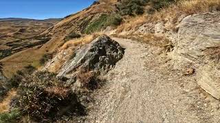
trail: Coronet Loop
5:16 |
116 |
Sep 22, 2025 , Arrowtown
youtuber
![Adventure in the Wilderness: Hiking the...]()

trail: Routeburn Track (Flats)
3:06 |
194 |
Jan 19, 2023 , Arrowtown
youtuber
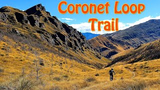
![50KM Coronet Loop Mountain Bike Trail -...]()

trail: Coronet Loop
8:33 |
571 |
May 13, 2022 , Arrowtown
trail: Coronet Loop
30:15 |
701 |
Apr 22, 2022 , Arrowtown
Recent Trail Reports
| status | trail | date | condition | info | user |
|---|---|---|---|---|---|
| Coronet Loop | May 19, 2026 @ 2:30pm (Pacific/Auckland) May 18, 2026 | Ideal | QTWilly | ||
| Arrow Gorge Trail | Apr 28, 2026 @ 1:10pm (Pacific/Auckland) Apr 27, 2026 | Ideal | camerasam |
Activity Feed
| username | action | type | title | date |
|---|---|---|---|---|
| atupoUJ0 | add | photo | activity #97349229 and 1 more | Jun 19, 2026 @ 3:36pm Jun 19, 2026 |
| QTWilly | add | report | activity #95017471 | May 18, 2026 @ 7:39pm May 18, 2026 |
| MabelFWhM2c | wishlist | trail | activity #94879893 | May 17, 2026 @ 2:15am May 17, 2026 |
| camerasam | ridden | trail | activity #93625765 | Apr 28, 2026 @ 8:10pm Apr 28, 2026 |
| AlexeyDubovskoy | wishlist | trail | activity #93617084 | Apr 28, 2026 @ 5:29pm Apr 28, 2026 |
Recent Comments
| username | type | title | comment | date |
|---|---|---|---|---|
| trail | Ridden February 2026. There has been some work... | Feb 28, 2026 @ 10:27am Feb 28, 2026 | ||
| trail | Wonderful! Backcountry trail. Saw no one all... | Feb 24, 2026 @ 12:23am Feb 24, 2026 | ||
| trail | Did the full loop from Arrowtown in early... | Apr 22, 2025 @ 4:27am Apr 22, 2025 | ||
| trail | Did the trail counter clockwise. Very scenic... | Jan 27, 2025 @ 12:55pm Jan 27, 2025 | ||
| report | Trail is already closed as well as pack track... | Nov 15, 2024 @ 11:02am Nov 15, 2024 |
Local Badges
-

Epic Ride Descent 2k11 awarded -

Descent 10k Badge2 awarded -

Descent 100k Badge0 awarded
Activity Type Stats
| activitytype | trails | distance | descent | descent distance | total vertical | rating | global rank | state rank | photos | reports | routes | ridelogs |
|---|---|---|---|---|---|---|---|---|---|---|---|---|
| Mountain Bike | 3 | 15 miles | 3,274 ft | 7 miles | 1,532 ft | #4,368 | #68 | 107 | 49 | 2 | 349 | |
| E-Bike | 3 | 15 miles | 3,274 ft | 7 miles | 1,532 ft | 48 | 2 | 52 | ||||
| Hike | 24 | 99 miles | 17,454 ft | 38 miles | 5,551 ft | #1,422 | #32 | 19 | 50 | 1,988 | ||
| Trail Running | 23 | 99 miles | 17,434 ft | 38 miles | 4,941 ft | #2,448 | #35 | 50 | 1 | 374 |
Frequently Asked Questions About Arrowtown
▼
What are the best places to ride in Arrowtown?
Arrowtown has 1 areas to explore for mountain biking.
▼
What are the highest rated mountain biking trails in Arrowtown?
The highest rated mountain biking trails in Arrowtown are:
- Arrow Gorge Trail (4.1/5)
- Coronet Loop (4/5)
▼
What is the best time of the year to ride in Arrowtown?
Based on ride log data, the most popular months to ride in Arrowtown are:
- April (6 activities)
- August (4 activities)
- July (4 activities)
▼
Where can I park to ride in Arrowtown?
There are 4 parking locations listed in Arrowtown. The most popular parking spots are: View all parking and trailhead locations on the map to plan your visit.
Trails
Points of Interest
- Daleys Hut Cabin
- Dart Hut Cabin
- Shelter Rock Hut Cabin
- Rees River (Boundary) Bridge
- Routeburn Flats Hut Cabin
- Routeburn Falls Hut Cabin
- Mackenzie Hut Cabin
- Lake Lowden Hut Cabin
- Lake Sylvan Campground Camping
- Earnslaw Hut Cabin
- Mount Earnslaw / Pikirakatahi (8,976 ft)
- Mount Head (8,422 ft)
- O'Leary Peak (8,360 ft)
- By bigbikefilmnight & contributors
- Admins: Alps2Ocean-Cycle-Trail, MBO, Dubnyk
- #45397 - 2,241 views
- arrowtown activity log | embed map of Arrowtown mountain bike trails | arrowtown mountain biking points of interest
Downloading of trail gps tracks in kml & gpx formats is enabled for Arrowtown.
You must login to download files.