close
-
Layers w
- Weather Layers
- Pro
- Pro
- Pro
- Pro
- Pro
- Pro
- More Layers
- Pro
- Pro
- Pro
- Pro
-
Upgrade to

3D
Trail Conditions
- Unknown
- Snow Groomed
- Snow Packed
- Snow Covered
- Snow Cover Partial
- Freeze/thaw Cycle
- Icy
- Prevalent Mud
- Wet
- Variable
- Ideal
- Dry
- Very Dry
Trail Flow (Ridden Direction)
Trailforks scans users ridelogs to determine the most popular direction each trail is ridden. A good flowing trail network will have most trails flowing in a single direction according to their intension.
The colour categories are based on what percentage of riders are riding a trail in its intended direction.
The colour categories are based on what percentage of riders are riding a trail in its intended direction.
- > 96%
- > 90%
- > 80%
- > 70%
- > 50%
- < 50%
- bi-directional trail
- no data
Trail Last Ridden
Trailforks scans ridelogs to determine the last time a trail was ridden.
- < 2 days
- < 1 week
- < 2 weeks
- < 1 month
- < 6 months
- > 6 months
Trail Ridden Direction
The intended direction a trail should be ridden.
- Downhill Only
- Downhill Primary
- Both Directions
- Uphill Primary
- Uphill Only
- One Direction
Contribute Details
Colors indicate trail is missing specified detail.
- Description
- Photos
- Description & Photos
- Videos
Trail Popularity ?
Trailforks scans ridelogs to determine which trails are ridden the most in the last 9 months.
Trails are compared with nearby trails in the same city region with a possible 25 colour shades.
Think of this as a heatmap, more rides = more kinetic energy = warmer colors.
- most popular
- popular
- less popular
- not popular
ATV/ORV/OHV Filter
Max Vehicle Width
inches
US Cell Coverage
Legend

Radar Time
Activity Recordings
Trailforks uses anonymized public activity data.
?
Activity Recordings
Trailforks uses anonymized public activity data.
?
Personal Heatmap
▶
Activity Types
all
/
none
▶
Options
2
Date range
month
–
Winter Trails
Warning
A routing network for winter maps does not exist. Selecting trails using the winter trails layer has been disabled.
Missing Trails
Most Popular
Least Popular
Trails are colored based on popularity. The more popular a trail is, the more red. Less popular trails trend towards green.
Jump Magnitude Heatmap
Heatmap of where riders jump on trails. Zoom in to see individual jumps, click circles to view jump details.
BC Backroad Status
![map legend]()
Service Road Atlas is a free to use, community-driven service for viewing and creating reports on the numerous back-country service roads around B.C. and Alberta.

Slope Aspect
Direction the slope faces
Trails Deemphasized
Trails are shown in grey.
Only show trails with no bike usage.
Suggested Layers
Based on selected activity type
Save the current map location and zoom level as your default home location whenever this page is loaded.
Save
No description for Arsiè has been added yet!
Login or register to submit one.
This region uses the Uk/Euro style trail grading system.
Activities Click to view
- Mountain Bike
44 trails
- E-Bike
44 trails
Region Details
- 3
- 4
- 30
Region Status
Open as of Aug 27, 2025Local Trail Association
Stats
- Avg Trail Rating
- Trails (view details)
- 44
- Trails Mountain Bike
- 44
- Trails E-Bike
- 44
- Total Distance
- 44 miles
- Total Descent Distance
- 36 miles
- Total Descent
- 37,343 ft
- Total Vertical
- 3,996 ft
- Highest Trailhead
- 4,887 ft
- Reports
- 11
- Photos
- 46
- Ridden Counter
- 146
Sub Regions
-
Arsiè - Dolomitiriders
- 4
- 30
Popular Arsiè Mountain Biking Trails
• 85 ★ 0.0 • 4,872 ft • 46 ft • 10 •
Popular blue difficulty singletrack. This mountain bike primary trail can be used both directions and has a moderate overall physical rating with a 46 ft black diamond climb. On average it takes 14 minutes to complete this trail.
• 95 ★ 4.0 • 1 mile • 31 ft • 9 •
Primo storico sentiero del gruppo Dolomitiriders. Single track flow e in parte spondato, per metà è sottobosco con qualche radice, poi diventa sassoso. Molto Divertente Climb per E-bike: NO Climb per MTB: NO DIREAZIONE DA SEGUIRE:...
• 100 ★ 0.0 • 1 mile • 185 ft • 9 •
Il sentiero si sviluppa sul crinale della montagna che divide Arsiè da Fonzaso, non ha tratti esposti ed è sempre avvolto dalla vegetazione, va comunque fatta attenzione ad alcuni passaggi. Il fondo è misto sassoso e sottobosco senza...
• 100 ★ 0.0 • 1 mile • 0 ft • 8 •
Il sentiero si sviluppa sul fondo valle che dalla frazione Rivai porta ad Arsiè, non ha tratti esposti ed è sempre avvolto dalla vegetazione, va comunque fatta attenzione ad alcuni passaggi. Il fondo è sassoso e senza particolari...
• 85 ★ 0.0 • 1 mile • 39 ft • 7 •
Popular blue difficulty singletrack. This mountain bike primary trail can be used downhill only and has a moderate overall physical rating. On average it takes 10 minutes to complete this trail.
• 5 ★ 0.0 • 1 mile • 75 ft • 5 •
Less popular blue difficulty singletrack. This mountain bike primary trail can be used downhill primary and has a moderate overall physical rating. On average it takes 7 minutes to complete this trail.
• 90 ★ 0.0 • 4,701 ft • 0 ft • 4 •
Popular blue difficulty singletrack. This mountain bike primary trail can be used both directions and has a moderate overall physical rating with a 0 ft blue climb. On average it takes 30 minutes to complete this trail.
Arsiè Mountain Bike Routes
7 miles • 1,455 ft • 0 • Loop •
Percorso naturalistico in ambiente alpino di media difficolta’; si sviluppa tra strade bianche e...
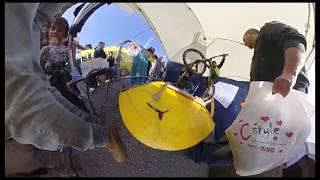
Photos of Arsiè Mountain Bike
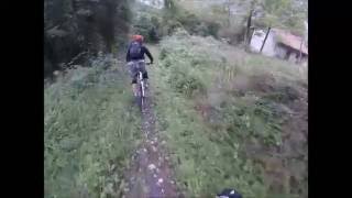
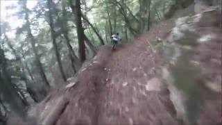
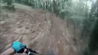
Videos of Arsiè Mountain Bike

trail: Val Cubia
4:02 |
190 |
Oct 21, 2022 , Arsiè

trail: Cresta di Cer
2:27 |
162 |
Oct 18, 2022 , Arsiè

trail: Cresta del Pra
3:54 |
141 |
Oct 17, 2022 , Arsiè
0:15 |
255 |
Oct 25, 2019
trail: Streghe
4:17 |
517 |
Oct 21, 2019 , Arsiè

7:06 |
552 |
Oct 21, 2019 , Arsiè
trail: Frassené
4:51 |
418 |
Oct 21, 2019 , Arsiè
trail: Full8
4:33 |
250 |
Oct 16, 2019 , Arsiè
Recent Trail Reports
| status | trail | date | condition | info | user |
|---|---|---|---|---|---|
| Forte Cima Lan | Aug 27, 2025 @ 7:44am Aug 27, 2025 | Dry | Enobike | ||
| Col de Baio | Jun 9, 2025 @ 1:01pm Jun 9, 2025 | Ideal | alpinebrothers | ||
| Sotto il roccolo verso val nevera | May 24, 2025 @ 9:57am May 24, 2025 | Ideal | LucaChizzali | ||
| Col della Spina | May 24, 2025 @ 9:57am May 24, 2025 | Ideal | LucaChizzali | ||
| Ciod | May 24, 2025 @ 9:57am May 24, 2025 | Ideal | LucaChizzali | ||
| Grotoi | May 24, 2023 @ 1:57am May 24, 2023 | Variable | alexcappellett | ||
| Canalone di Rivai | May 24, 2023 @ 1:48am May 24, 2023 | Ideal | alexcappellett | ||
| Ciod-Incino | Oct 31, 2022 @ 6:00pm Oct 31, 2022 | Ideal | Alessandro1982 | ||
| Incino | Nov 1, 2022 @ 1:00am Nov 1, 2022 | Ideal | Alessandro1982 |
Activity Feed
| username | action | type | title | date |
|---|---|---|---|---|
| ivanHXzG4t | ridden | trail | activity #91968773 | Apr 5, 2026 @ 5:06am Apr 5, 2026 |
| ivanHXzG4t | ridden | trail | activity #91872954 | Apr 4, 2026 @ 12:28am Apr 4, 2026 |
| Enobike | add | report | activity #79046056 | Aug 27, 2025 @ 7:03am Aug 27, 2025 |
| alpinebrothers | add | report | activity #73439532 | Jun 9, 2025 @ 1:01pm Jun 9, 2025 |
| LucaChizzali | add | report | activity #72318487 and 2 more | May 24, 2025 @ 2:16pm May 24, 2025 |
Recent Comments
| username | type | title | comment | date |
|---|---|---|---|---|
| trail | Catastrophic condition. Nothing you must have... | Sep 7, 2022 @ 6:45am Sep 7, 2022 | ||
| trail | Bel sentierino, ho messo 4 stelle e non 5... | May 17, 2020 @ 4:59am May 17, 2020 |
Local Badges
-

Completionist0 awarded -

10 Blue Trails0 awarded -

Epic Mountain Bike Climb 2k74 awarded -

Climbing 10k Badge10 awarded -

Mountain Biking 100k Badge0 awarded -

Epic Ride Descent 2k74 awarded
Activity Type Stats
| activitytype | trails | distance | descent | descent distance | total vertical | rating | global rank | state rank | photos | reports | routes | ridelogs |
|---|---|---|---|---|---|---|---|---|---|---|---|---|
| Mountain Bike | 44 | 44 miles | 37,343 ft | 36 miles | 3,996 ft | #3,696 | #214 | 46 | 11 | 1 | 664 | |
| E-Bike | 44 | 43 miles | 36,604 ft | 36 miles | 3,996 ft | #3,005 | #287 | 10 | 1 | 58 |
Frequently Asked Questions About Arsiè
▼
What are the best places to ride in Arsiè?
Arsiè has 2 areas to explore for mountain biking. The top rated areas are:
▼
What are the highest rated mountain biking trails in Arsiè?
The highest rated mountain biking trails in Arsiè are:
- Ciod-Incino (4.1/5)
- Pinuccia (4/5)
- Full8 (4/5)
- Cresta del Pra (0/5)
- Col della Spina (0/5)
▼
What is the best time of the year to ride in Arsiè?
Based on ride log data, the most popular months to ride in Arsiè are:
- February (3 activities)
- November (3 activities)
- August (2 activities)
▼
Where can I park to ride in Arsiè?
Trails
- By asd-dolomitiriders
 ASDD & contributors
 - Admins: micheletraversi
- #32334 - 1,139 views
- arsiè activity log | embed map of Arsiè mountain bike trails | arsiè mountain biking points of interest
Downloading of trail gps tracks in kml & gpx formats is enabled for Arsiè.
You must login to download files.