close
-
Layers w
- Weather Layers
- Pro
- Pro
- Pro
- Pro
- Pro
- Pro
- More Layers
- Pro
- Pro
- Pro
- Pro
-
Upgrade to

3D
Trail Conditions
- Unknown
- Snow Groomed
- Snow Packed
- Snow Covered
- Snow Cover Partial
- Freeze/thaw Cycle
- Icy
- Prevalent Mud
- Wet
- Variable
- Ideal
- Dry
- Very Dry
Trail Flow (Ridden Direction)
Trailforks scans users ridelogs to determine the most popular direction each trail is ridden. A good flowing trail network will have most trails flowing in a single direction according to their intension.
The colour categories are based on what percentage of riders are riding a trail in its intended direction.
The colour categories are based on what percentage of riders are riding a trail in its intended direction.
- > 96%
- > 90%
- > 80%
- > 70%
- > 50%
- < 50%
- bi-directional trail
- no data
Trail Last Ridden
Trailforks scans ridelogs to determine the last time a trail was ridden.
- < 2 days
- < 1 week
- < 2 weeks
- < 1 month
- < 6 months
- > 6 months
Trail Ridden Direction
The intended direction a trail should be ridden.
- Downhill Only
- Downhill Primary
- Both Directions
- Uphill Primary
- Uphill Only
- One Direction
Contribute Details
Colors indicate trail is missing specified detail.
- Description
- Photos
- Description & Photos
- Videos
Trail Popularity ?
Trailforks scans ridelogs to determine which trails are ridden the most in the last 9 months.
Trails are compared with nearby trails in the same city region with a possible 25 colour shades.
Think of this as a heatmap, more rides = more kinetic energy = warmer colors.
- most popular
- popular
- less popular
- not popular
ATV/ORV/OHV Filter
Max Vehicle Width
inches
US Cell Coverage
Legend

Radar Time
Activity Recordings
Trailforks uses anonymized public activity data.
?
Activity Recordings
Trailforks uses anonymized public activity data.
?
Personal Heatmap
▶
Activity Types
all
/
none
▶
Options
2
Date range
month
–
Winter Trails
Warning
A routing network for winter maps does not exist. Selecting trails using the winter trails layer has been disabled.
Missing Trails
Most Popular
Least Popular
Trails are colored based on popularity. The more popular a trail is, the more red. Less popular trails trend towards green.
Jump Magnitude Heatmap
Heatmap of where riders jump on trails. Zoom in to see individual jumps, click circles to view jump details.
BC Backroad Status
![map legend]()
Service Road Atlas is a free to use, community-driven service for viewing and creating reports on the numerous back-country service roads around B.C. and Alberta.

Slope Aspect
Direction the slope faces
Trails Deemphasized
Trails are shown in grey.
Only show trails with no bike usage.
Suggested Layers
Based on selected activity type
Save the current map location and zoom level as your default home location whenever this page is loaded.
SaveGreat little local trail spot, with loads of good beginner and moderate trails.
Primary Trail Type: Cross-Country
Land Status: City Managed
Land Manager: Carson City Parks, Recreation and Open Space
 google parking directions
 Region Supporters & Maintainers
Activities Click to view
- Mountain Bike
25 trails
- Horse
3 trails
- Hike
27 trails
- Trail Running
27 trails
Region Details
- 4
- 9
- 12
Region Status
Open as of Mar 4, 2026Stats
- Avg Trail Rating
- Trails (view details)
- 27
- Trails Mountain Bike
- 25
- Trails E-Bike
- 1
- Trails Gravel Bike
- 5
- Trails Adaptive Bike
- 5
- Trails Winter Fat Bike
- 6
- Trails Horse
- 3
- Trails Hike
- 27
- Trails Trail Running
- 27
- Total Distance
- 38 miles
- Total Descent
- 4,944 ft
- Total Vertical
- 3,553 ft
- Highest Trailhead
- 8,397 ft
- Reports
- 478
- Photos
- 103
- Ridden Counter
- 9,025
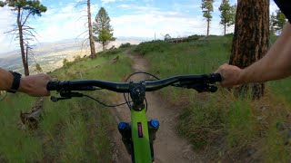
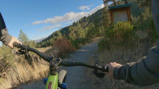
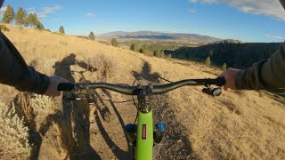
Popular Ash Canyon Mountain Biking Trails
• 100 ★ 4.7 • 7 miles • 1,234 ft • 833 •
Very nicely built trail, with consistent grade and great views. Some small rock features and discrete jumps exist, but this trail has been designed to be appealing for all ability levels -so don't expect any gnar. Great climb in either...
• 100 ★ 3.8 • 3,071 ft • 0 ft • 727 •
This is the main access trail to the Ash Canyon Trail network. The climb up isn't technical but is deceptively steep, the decent can be ripping fast. There is good line of sight for the majority of the trail although it gets a bit...
• 100 ★ 3.0 • 2,382 ft • 0 ft • 717 •
Popular green difficulty singletrack. This multi-use trail can be used both directions and has a easy overall physical rating with a 0 ft green climb. On average it takes 2 minutes to complete this trail.
• 90 ★ 4.4 • 1 mile • 43 ft • 576 •
This is a very fun downhill that parallels Ash Canyon . The trail flows through a narrow canyon lined with cottonwood, aspen, and manzanita; it can become slightly overgrown in the spring time which will limit your line-of-sight. The...
• 95 ★ 4.0 • 2,995 ft • 24 ft • 511 •
Popular green difficulty singletrack. This mountain bike primary trail can be used both directions and has a easy overall physical rating with a 24 ft green climb. On average it takes 3 minutes to complete this trail.
• 100 ★ 4.5 • 3,511 ft • 2 ft • 393 •
Popular green difficulty singletrack. This mountain bike primary trail can be used downhill primary and has a easy overall physical rating with a 2 ft green climb. On average it takes 2 minutes to complete this trail.
• 95 ★ 3.0 • 1,161 ft • 10 ft • 352 •
Short connector that links to and the 206 acres of open space acquired by Carson City in 2019. The trail is dedicated to Carson City's late Mayor Bob Crowell who was an ardent supporter of Carson City trails and open space and who...
Ash Canyon Mountain Bike Routes
★ 5.0 • 13 miles • 2,022 ft • 4 • Loop •
This is a great ride Kings to Ash Canyon, it has some road segments but mostly single track.
16 miles • 4,428 ft • 2 •
• 18 miles • 2,422 ft • 12 •
• 16 miles • 2,492 ft • 10 •
• 15 miles • 2,697 ft • 7 •
• 11 miles • 2,036 ft • 4 •
Photos of Ash Canyon Mountain Bike
Videos of Ash Canyon Mountain Bike
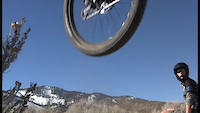
trail: Bob's Trail (Upper)
0:33 |
76 |
May 5, 2022

2:33 |
171 |
Dec 19, 2018
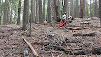
trail: Secret Trail
0:11 |
284 |
Feb 23, 2018
youtuber
![Ash to Kings: Kings DH / Carson City, NV / MTB]()
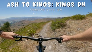
5:56 |
61 |
Sep 2, 2025 , Carson City
youtuber
![Capital to Tahoe / Carson City, NV / MTB]()
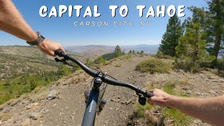
trail: Capital to Tahoe
13:52 |
142 |
Aug 29, 2025 , Carson City
youtuber
![Ash to Kings Trail: Kings Descent / Carson...]()
9:04 |
69 |
Jun 25, 2022 , Carson City
youtuber
![Creek Trail / Carson City, NV / MTB]()
trail: Creek Trail
4:10 |
59 |
Nov 3, 2022 , Carson City
Recent Trail Reports
| status | trail | date | condition | info | user |
|---|---|---|---|---|---|
| Capitol Automotive Trail | Mar 4, 2026 @ 10:30am (America/Los_Angeles) Mar 4, 2026 | Snow Covered | WillieJacobsz Trailforks | ||
| Timberline Road | Mar 4, 2026 @ 10:29am (America/Los_Angeles) Mar 4, 2026 | Snow Covered | WillieJacobsz Trailforks | ||
| V&T Trail | Feb 28, 2026 @ 3:47pm (America/Los_Angeles) Feb 28, 2026 | Snow Covered | namor216 | ||
| Jackrabbit (Bob's Lower) | Feb 28, 2026 @ 3:47pm (America/Los_Angeles) Feb 28, 2026 | Ideal | namor216 | ||
| Postal Route (Bob's Lower) | Feb 28, 2026 @ 3:47pm (America/Los_Angeles) Feb 28, 2026 | Ideal | namor216 | ||
| Bob's Connector | Feb 28, 2026 @ 3:47pm (America/Los_Angeles) Feb 28, 2026 | Ideal | namor216 | ||
| Babyheads Bypass | Feb 28, 2026 @ 3:47pm (America/Los_Angeles) Feb 28, 2026 | Snow Covered | namor216 | ||
| Creek Trail | Feb 28, 2026 @ 3:47pm (America/Los_Angeles) Feb 28, 2026 | Dry | namor216 | ||
| Evidence | Feb 28, 2026 @ 3:47pm (America/Los_Angeles) Feb 28, 2026 | Ideal | namor216 | ||
| Eagle View Trail | Feb 28, 2026 @ 3:47pm (America/Los_Angeles) Feb 28, 2026 | Ideal | namor216 |
Activity Feed
| username | action | type | title | date |
|---|---|---|---|---|
| Hail2Pitt | ridden | trail | activity #96832764 | Jun 12, 2026 @ 3:52pm Jun 12, 2026 |
| uF5U7RXl | wishlist | trail | activity #96713637 | Jun 10, 2026 @ 7:35pm Jun 10, 2026 |
| MarlinH2s3hE | ridden | trail | activity #96565714 | Jun 8, 2026 @ 3:00pm Jun 8, 2026 |
| ChristophemTW8CK | wishlist | route | activity #95821753 | May 29, 2026 @ 8:44pm May 29, 2026 |
| dxEkQUyg | vote | trail | activity #95484754 | May 25, 2026 @ 6:56am May 25, 2026 |
Recent Comments
| username | type | title | comment | date |
|---|---|---|---|---|
| trail | Nice mellow flow | Sep 30, 2025 @ 4:32pm Sep 30, 2025 | ||
| trail | Very well-maintained and flowy trail, with... | Jul 8, 2025 @ 4:56pm Jul 8, 2025 | ||
| report | Upper body is not o | May 23, 2025 @ 10:46am May 23, 2025 | ||
| report | I'm | May 23, 2025 @ 10:44am May 23, 2025 | ||
| report | Ollllloo | May 23, 2025 @ 10:43am May 23, 2025 |
Nearby Areas
| name | distance | ||||
|---|---|---|---|---|---|
| Spooner Lake and Backcountry State Park | 3 | 4 | 2.9 km | ||
| Kings Canyon | 3 | 1 | 3.2 km | ||
| East Shore | 6 | 17 | 8 | 4.2 km | |
| Clear Creek Trail System | 7 | 5 | 6.2 km | ||
| Prison Hill Recreation Area | 6 | 24 | 2 | 6.5 km |
Local Badges
-

Completionist0 awarded
Activity Type Stats
| activitytype | trails | distance | descent | descent distance | total vertical | rating | global rank | state rank | photos | reports | routes | ridelogs |
|---|---|---|---|---|---|---|---|---|---|---|---|---|
| Mountain Bike | 25 | 36 miles | 4,600 ft | 13 miles | 3,553 ft | 101 | 478 | 3 | 5,619 | |||
| E-Bike | 1 | 4,715 ft | 72 ft | 372 | 384 | |||||||
| Gravel Bike | 5 | 9 miles | 1,237 ft | 3 miles | 3,031 ft | #994 | #513 | 45 | 27 | |||
| Adaptive Bike | 5 | 9 miles | 1,237 ft | 3 miles | 3,031 ft | #997 | #515 | 45 | ||||
| Winter Fat Bike | 6 | 12 miles | 2,372 ft | 5 miles | 1,680 ft | #994 | #513 | 139 | 1 | |||
| Horse | 3 | 11 miles | 522 ft | 3 miles | 2,841 ft | #2,169 | #1,175 | 83 | 2 | |||
| Hike | 27 | 38 miles | 4,944 ft | 13 miles | 3,553 ft | #5,464 | #1,964 | 2 | 478 | 3 | 254 | |
| Trail Running | 27 | 38 miles | 4,944 ft | 13 miles | 3,553 ft | #4,453 | #1,283 | 478 | 3 | 419 |
Frequently Asked Questions About Ash Canyon
▼
What are the highest rated mountain biking trails in Ash Canyon?
The highest rated mountain biking trails in Ash Canyon are:
- Ash Canyon to Kings Canyon Trail (4.6/5)
- Creek Trail (4.3/5)
- Vicee Rim (4.2/5)
- Secret Trail (4.1/5)
- Deer Run (4/5)
▼
What is the best time of the year to ride in Ash Canyon?
Based on ride log data, the most popular months to ride in Ash Canyon are:
- April (41 activities)
- July (39 activities)
- June (38 activities)
▼
Where can I park to ride in Ash Canyon?
There are 3 parking locations listed in Ash Canyon. The most popular parking spots are: View all parking and trailhead locations on the map to plan your visit.
▼
What is the longest trail in Ash Canyon?
The longest trail in Ash Canyon is Capital to Tahoe at 10.4 miles. View all trails sorted by distance.
Activities
Trails
Points of Interest
- By TheAngryTomato
 TRAILFORKS & contributors
 - Admins: TAMBA, MP, CCPROP, TAMBA, MP, TAMBA
- #7299 - 9,784 views
- ash canyon activity log | embed map of Ash Canyon mountain bike trails | ash canyon mountain biking points of interest
Downloading of trail gps tracks in kml & gpx formats is enabled for Ash Canyon.
You must login to download files.