close
-
Layers w
- Weather Layers
- Pro
- Pro
- Pro
- Pro
- Pro
- Pro
- More Layers
- Pro
- Pro
- Pro
- Pro
-
Upgrade to

3D
Trail Conditions
- Unknown
- Snow Groomed
- Snow Packed
- Snow Covered
- Snow Cover Partial
- Freeze/thaw Cycle
- Icy
- Prevalent Mud
- Wet
- Variable
- Ideal
- Dry
- Very Dry
Trail Flow (Ridden Direction)
Trailforks scans users ridelogs to determine the most popular direction each trail is ridden. A good flowing trail network will have most trails flowing in a single direction according to their intension.
The colour categories are based on what percentage of riders are riding a trail in its intended direction.
The colour categories are based on what percentage of riders are riding a trail in its intended direction.
- > 96%
- > 90%
- > 80%
- > 70%
- > 50%
- < 50%
- bi-directional trail
- no data
Trail Last Ridden
Trailforks scans ridelogs to determine the last time a trail was ridden.
- < 2 days
- < 1 week
- < 2 weeks
- < 1 month
- < 6 months
- > 6 months
Trail Ridden Direction
The intended direction a trail should be ridden.
- Downhill Only
- Downhill Primary
- Both Directions
- Uphill Primary
- Uphill Only
- One Direction
Contribute Details
Colors indicate trail is missing specified detail.
- Description
- Photos
- Description & Photos
- Videos
Trail Popularity ?
Trailforks scans ridelogs to determine which trails are ridden the most in the last 9 months.
Trails are compared with nearby trails in the same city region with a possible 25 colour shades.
Think of this as a heatmap, more rides = more kinetic energy = warmer colors.
- most popular
- popular
- less popular
- not popular
ATV/ORV/OHV Filter
Max Vehicle Width
inches
US Cell Coverage
Legend

Radar Time
Activity Recordings
Trailforks uses anonymized public activity data.
?
Activity Recordings
Trailforks uses anonymized public activity data.
?
Personal Heatmap
▶
Activity Types
all
/
none
▶
Options
2
Date range
month
–
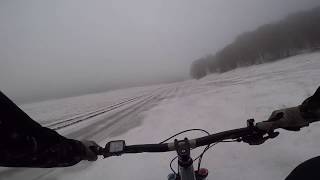
Winter Trails
Warning
A routing network for winter maps does not exist. Selecting trails using the winter trails layer has been disabled.
Missing Trails
Most Popular
Least Popular
Trails are colored based on popularity. The more popular a trail is, the more red. Less popular trails trend towards green.
Jump Magnitude Heatmap
Heatmap of where riders jump on trails. Zoom in to see individual jumps, click circles to view jump details.
BC Backroad Status
![map legend]()
Service Road Atlas is a free to use, community-driven service for viewing and creating reports on the numerous back-country service roads around B.C. and Alberta.

Slope Aspect
Direction the slope faces
Trails Deemphasized
Trails are shown in grey.
Only show trails with no bike usage.
Suggested Layers
Based on selected activity type
Save the current map location and zoom level as your default home location whenever this page is loaded.
Save
No description for Avellino has been added yet!
Login or register to submit one.
This region uses the Uk/Euro style trail grading system.
Activities Click to view
- Mountain Bike
64 trails
- E-Bike
55 trails
- Hike
33 trails
- Trail Running
27 trails
Region Details
- 8
- 10
- 23
Stats
- Avg Trail Rating
- Trails (view details)
- 49
- Trails Mountain Bike
- 64
- Trails E-Bike
- 55
- Trails Gravel Bike
- 2
- Trails Adaptive Bike
- 2
- Trails Horse
- 3
- Trails Hike
- 33
- Trails Trail Running
- 27
- Trails Snowshoe
- 1
- Trails Downhill Ski
- 1
- Trails Backcountry Ski
- 1
- Trails Nordic Ski
- 1
- Total Distance
- 49 miles
- Total Descent
- 22,733 ft
- Total Vertical
- 4,334 ft
- Highest Trailhead
- 4,757 ft
- Reports
- 423
- Photos
- 123
- Ridden Counter
- 1,514
Sub Regions
- Avella (4)
- Avellino (8)
- Peroni Bikepark (11)
- Chiusano di San Domenico (8)
- Monte Tuoro (8)
- Rotondi (6)
- Santo Stefano del sole (10)
- Serino (3)
- Sirignano (1)
- Summonte (1)
- Visciano (4)
- Laceno (0)
- Miscano (0)
- Montevergine Trail Area (10)
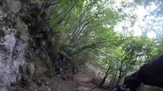
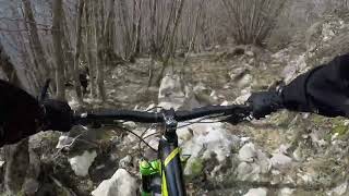
Popular Avellino Mountain Biking Trails
• 95 ★ 4.9 • 4,446 ft • 0 ft • 57 •
Traccia di media difficoltà immersa in una faggeta, molto veloce con drop e salti evitabili. Caratterizzata da assenza di pietre. La traccia termina poco prima di dove si lascia l'asfalto, quindi permette di risalire e di fruire...
• 50 ★ 4.9 • 3,675 ft • 0 ft • 52 •
La traccia inizia dopo aver preso un piccolo sentiero in discesa a bordo a destra della strada asfaltata che porta su. Varcato un cancello (chiudeteli sempre) dopo pochi metri, inizia un single track molto divertente e veloce in alcuni...
• 85 ★ 4.9 • 3,386 ft • 0 ft • 50 •
La traccia inizia in prossimità di un'area picnic, poco lontano dalla fine dell'altra traccia " ". Dopo un single track di terra battuta il percorso si fa rock, con passaggi tra rocce fisse. Le pendenze non sono importanti, ma il...
• 65 ★ 5.0 • 4,055 ft • 22 ft • 49 •
La traccia inizia una volta finita la salita sterrata. A sinistra si vede il sentiero. Fondo di terra battuta e radici per tutto il tempo, veloce inizialmente, nella seconda parte bisogna dare fondo a resistenza e tecnica per affrontare...
• 55 ★ 4.9 • 4,865 ft • 9 ft • 47 •
Traccia che parte da un bel vedere, punto perfetto per una fotoricordo che è diventata un must. Partenza su fondo battuto per poi entrare nella parte di molto panoramica. Qui il gioco si fa duro: radici, pietre mosse e pietre fisse non...
• 100 ★ 5.0 • 1 mile • 0 ft • 24 •
Trail sottobosco di alta quota. Fondo battuto molto scorrevole e veloce. Terreno sempre in ottime condizioni. Curve con sponde.
• 100 ★ 5.0 • 4,117 ft • 0 ft • 22 •
è il trail ideale per chi ama saltare e per chi apprezza lo stile di guida tipico del downhill: velocità, decisione e linee ben definite. Il tracciato apre subito con una sequenza veloce e impegnativa, caratterizzata da gap importanti...
• 45 ★ 4.7 • 2 miles • 13 ft • 19 •
Il combacia con il sentiero CAI 210, parte alle spalle della casina del principe dal campo maggiore, la prima parte è tutta con fondo di pietre smosse naturali, dopo il ripido in pietre si arriva alla panoramica e da quel punto cambia...
Avellino Mountain Bike Routes
★ 5.0 • 20 miles • 4,202 ft • 1 • Loop •
Giro sul fronte di Montevergine che tocca il lago di Montevergine, faggeti, querceti e vedute panoramiche.
★ 5.0 • 72 miles • 11,824 ft • 4 • Loop •
Grande Traversata del Partenio, sentiero che attraversa tutta la cresta del Parco regionale del Partenio....
★ 5.0 • 19 miles • 4,517 ft • 8 • Loop •
The Tuoro ring in "Parco dei Monti Picentini" between the small towns of Chiusano di San Domenico and...
7 miles • 695 ft • 0 •
...........................................................................
7 miles • 695 ft • 0 •
Photos of Avellino Mountain Bike
Videos of Avellino Mountain Bike

0:30 |
10 |
Mar 17, 2021
3:17 |
106 |
Mar 10, 2021
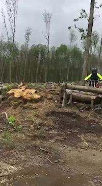
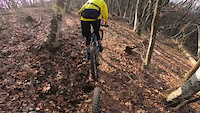
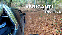
trail: Peroni Line
0:20 |
99 |
Nov 22, 2020
6:06 |
65 |
Jan 24, 2020
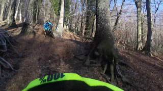
trail: Brigantello
0:49 |
125 |
Aug 24, 2023 , Avellino
trail: Brigantello
0:23 |
96 |
Aug 24, 2023 , Avellino
trail: Brigantello
0:05 |
114 |
Aug 24, 2023 , Avellino
trail: Brigantello
3:53 |
167 |
Aug 24, 2023 , Avellino
Recent Trail Reports
Activity Feed
| username | action | type | title | date |
|---|---|---|---|---|
| spakkaruotefreerider | add | report | activity #93101222 | Apr 21, 2026 @ 12:59pm Apr 21, 2026 |
| spakkaruotefreerider | add | photo | activity #93101195 and 1 more | Apr 21, 2026 @ 12:58pm Apr 21, 2026 |
| Mikyrenny | wishlist | trail | activity #92049062 | Apr 6, 2026 @ 6:54am Apr 6, 2026 |
| antonrea | add | poi | activity #90726855 | Mar 17, 2026 @ 12:06am Mar 17, 2026 |
| antonrea | vote | trail | activity #90443215 | Mar 12, 2026 @ 9:38am Mar 12, 2026 |
Recent Comments
| username | type | title | comment | date |
|---|---|---|---|---|
| trail | Brigantello... il top trail a Montevergine! | Aug 25, 2023 @ 4:44am Aug 25, 2023 | ||
| trail | Trail divertentissimo, flow in sottobosco da... | Aug 25, 2023 @ 4:41am Aug 25, 2023 | ||
| trail | Traccia non difficile, abbastanza pulita e con... | Feb 5, 2020 @ 3:50am Feb 5, 2020 | ||
| trail | E' la traccia piu' divertente del Tuoro,... | Feb 5, 2020 @ 3:49am Feb 5, 2020 | ||
| trail | Divertente la traccia sotto la pineta. I... | Feb 5, 2020 @ 3:47am Feb 5, 2020 |
Activity Type Stats
| activitytype | trails | distance | descent | descent distance | total vertical | rating | global rank | state rank | photos | reports | routes | ridelogs |
|---|---|---|---|---|---|---|---|---|---|---|---|---|
| Mountain Bike | 64 | 49 miles | 22,733 ft | 31 miles | 4,334 ft | 123 | 423 | 5 | 5,036 | |||
| E-Bike | 55 | 36 miles | 15,138 ft | 21 miles | 3,350 ft | 409 | 6 | 1,267 | ||||
| Gravel Bike | 2 | 35 | 1 | 10 | ||||||||
| Adaptive Bike | 2 | 1 | ||||||||||
| Horse | 3 | 2 miles | 20 ft | 1,667 ft | 715 ft | 39 | ||||||
| Hike | 33 | 33 miles | 17,231 ft | 24 miles | 4,334 ft | 407 | 1 | 217 | ||||
| Trail Running | 27 | 20 miles | 12,316 ft | 16 miles | 4,334 ft | 402 | 9 | |||||
| Snowshoe | 1 | 4 | 9 | |||||||||
| Downhill Ski | 1 | 4 | ||||||||||
| Backcountry Ski | 1 | 4 | 5 | |||||||||
| Nordic Ski | 1 | 4 | 2 |
Frequently Asked Questions About Avellino
▼
What are the best places to ride in Avellino?
Avellino has 5 areas to explore for mountain biking. The top rated areas are:
▼
What are the highest rated mountain biking trails in Avellino?
The highest rated mountain biking trails in Avellino are:
- 8Volante - Hirpus Bike Trails (4.6/5)
- Preta ra Maronna (4.5/5)
- Cresta (4.5/5)
- ⚡⚡⚡ Alta Tensione ⚡⚡⚡ (4.5/5)
- F-Low (2020) (4.4/5)
▼
What is the best time of the year to ride in Avellino?
Based on ride log data, the most popular months to ride in Avellino are:
- August (10 activities)
- July (7 activities)
- May (6 activities)
▼
What is the longest trail in Avellino?
The longest trail in Avellino is Sentiero 232 at 5.9 km. View all trails sorted by distance.
Activities
Trails
- By denitopia
 TRAILFORKS VTA & contributors
 - Admins: denitopia, marcoangeletti, cemoorelife, yuribu
- #11669 - 2,308 views
- avellino activity log | embed map of Avellino mountain bike trails | avellino mountain biking points of interest polygons
Downloading of trail gps tracks in kml & gpx formats is enabled for Avellino.
You must login to download files.