close
-
Layers w
- Weather Layers
- Pro
- Pro
- Pro
- Pro
- Pro
- Pro
- More Layers
- Pro
- Pro
- Pro
- Pro
-
Upgrade to

3D
Trail Conditions
- Unknown
- Snow Groomed
- Snow Packed
- Snow Covered
- Snow Cover Partial
- Freeze/thaw Cycle
- Icy
- Prevalent Mud
- Wet
- Variable
- Ideal
- Dry
- Very Dry
Trail Flow (Ridden Direction)
Trailforks scans users ridelogs to determine the most popular direction each trail is ridden. A good flowing trail network will have most trails flowing in a single direction according to their intension.
The colour categories are based on what percentage of riders are riding a trail in its intended direction.
The colour categories are based on what percentage of riders are riding a trail in its intended direction.
- > 96%
- > 90%
- > 80%
- > 70%
- > 50%
- < 50%
- bi-directional trail
- no data
Trail Last Ridden
Trailforks scans ridelogs to determine the last time a trail was ridden.
- < 2 days
- < 1 week
- < 2 weeks
- < 1 month
- < 6 months
- > 6 months
Trail Ridden Direction
The intended direction a trail should be ridden.
- Downhill Only
- Downhill Primary
- Both Directions
- Uphill Primary
- Uphill Only
- One Direction
Contribute Details
Colors indicate trail is missing specified detail.
- Description
- Photos
- Description & Photos
- Videos
Trail Popularity ?
Trailforks scans ridelogs to determine which trails are ridden the most in the last 9 months.
Trails are compared with nearby trails in the same city region with a possible 25 colour shades.
Think of this as a heatmap, more rides = more kinetic energy = warmer colors.
- most popular
- popular
- less popular
- not popular
ATV/ORV/OHV Filter
Max Vehicle Width
inches
US Cell Coverage
Legend

Radar Time
Activity Recordings
Trailforks uses anonymized public activity data.
?
Activity Recordings
Trailforks uses anonymized public activity data.
?
Personal Heatmap
▶
Activity Types
all
/
none
▶
Options
2
Date range
month
–
Winter Trails
Warning
A routing network for winter maps does not exist. Selecting trails using the winter trails layer has been disabled.
Missing Trails
Most Popular
Least Popular
Trails are colored based on popularity. The more popular a trail is, the more red. Less popular trails trend towards green.
Jump Magnitude Heatmap
Heatmap of where riders jump on trails. Zoom in to see individual jumps, click circles to view jump details.
BC Backroad Status
![map legend]()
Service Road Atlas is a free to use, community-driven service for viewing and creating reports on the numerous back-country service roads around B.C. and Alberta.

Slope Aspect
Direction the slope faces
Trails Deemphasized
Trails are shown in grey.
Only show trails with no bike usage.
Suggested Layers
Based on selected activity type
Save the current map location and zoom level as your default home location whenever this page is loaded.
Save
No description for Azerbaijan has been added yet!
Login or register to submit one.
Region Details
- 1
- 1
- 5
Stats
- Avg Trail Rating
- Trails (view details)
- 7
- Trails Mountain Bike
- 7
- Trails E-Bike
- 3
- Trails Hike
- 5
- Trails Trail Running
- 5
- Total Distance
- 8 miles
- Total Descent
- 2,247 ft
- Total Vertical
- 754 ft
- Highest Trailhead
- 757 ft
- Reports
- 18
- Photos
- 46
- Ridden Counter
- 62
Popular Azerbaijan Mountain Biking Trails
• 5 ★ 5.0 • 1,161 ft • 0 ft • 8 •
Full length track on TVFR which include jumps, berms and lots of fun. 'Chick runs' on most features, other than the ride over the wall!
• 5 ★ 5.0 • 413 ft • 0 ft • 7 •
Fast, flowy and fun. Big sweeping berms with some nice floaty jumps. One step down gap jump. All features have 'chicken routes'
• 5 ★ 5.0 • 290 ft • 0 ft • 6 •
Short and sharp - this is a steep dusty section that then winds through pine trees. Best avoided if muddy - it's like grease!
• 5 ★ 5.0 • 1,161 ft • 0 ft • 6 •
The whale tale - when the love birds aren't blocking the entrance this is a super steep and loose start that turns into a flowy off-camber bit of single track with a nice slab drop. Stair ride back to the bulevard optional afterwards.
• 5 ★ 0.0 • 6 miles • 541 ft • 6 •
Less popular green difficulty family friendly singletrack. This mountain bike primary trail can be used both directions and has a moderate overall physical rating with a 541 ft blue climb. It features berm, bridge, drop, jump, gap jump and skinny. On average it takes 1 hour11 minutes to complete this trail.
• 5 ★ 5.0 • 2 miles • 29 ft • 5 •
Less popular blue difficulty singletrack. This mountain bike primary trail can be used downhill primary and has a moderate overall physical rating with a 29 ft blue climb. It features berm, drop, jump and gap jump. On average it takes 19 minutes to complete this trail.
• 5 ★ 5.0 • 624 ft • 0 ft • 5 •
Another flow trail with a slightly different trail head at TVFR. This is slightly more technical than the other two trails and requires ability to ride bigger drop offs. There is one step narrow rock or drop trail feature that isn't...
Azerbaijan Mountain Bike Routes
1 mile • 82 ft • 0 • Point to Point •
Full TVFR downhill route. A few nice trails and a few little climbs. Start by the TV Tower.
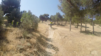
Photos of Azerbaijan Mountain Bike

Activity Type Stats
| activitytype | trails | distance | descent | descent distance | total vertical | rating | global rank | state rank | photos | reports | routes | ridelogs |
|---|---|---|---|---|---|---|---|---|---|---|---|---|
| Mountain Bike | 7 | 8 miles | 2,247 ft | 5 miles | 755 ft | #99 | 46 | 18 | 1 | 1,819 | ||
| E-Bike | 3 | 8 miles | 1,716 ft | 5 miles | 755 ft | #103 | 18 | 6 | ||||
| Hike | 5 | 2 miles | 1,316 ft | 2 miles | 755 ft | #129 | 17 | 303 | ||||
| Trail Running | 5 | 2 miles | 1,316 ft | 2 miles | 755 ft | #127 | 17 | 8 |
Activities
Trails
Points of Interest
- By Aimant & contributors
- Admins: Aydin, DrewDewil
- #3264 - 8,389 views
- azerbaijan activity log | embed map of Azerbaijan mountain bike trails |
Downloading of trail gps tracks in kml & gpx formats is enabled for Azerbaijan.
You must login to download files.