close
-
Layers w
- Weather Layers
- Pro
- Pro
- Pro
- Pro
- Pro
- Pro
- More Layers
- Pro
- Pro
- Pro
- Pro
-
Upgrade to

3D
Trail Conditions
- Unknown
- Snow Groomed
- Snow Packed
- Snow Covered
- Snow Cover Partial
- Freeze/thaw Cycle
- Icy
- Prevalent Mud
- Wet
- Variable
- Ideal
- Dry
- Very Dry
Trail Flow (Ridden Direction)
Trailforks scans users ridelogs to determine the most popular direction each trail is ridden. A good flowing trail network will have most trails flowing in a single direction according to their intension.
The colour categories are based on what percentage of riders are riding a trail in its intended direction.
The colour categories are based on what percentage of riders are riding a trail in its intended direction.
- > 96%
- > 90%
- > 80%
- > 70%
- > 50%
- < 50%
- bi-directional trail
- no data
Trail Last Ridden
Trailforks scans ridelogs to determine the last time a trail was ridden.
- < 2 days
- < 1 week
- < 2 weeks
- < 1 month
- < 6 months
- > 6 months
Trail Ridden Direction
The intended direction a trail should be ridden.
- Downhill Only
- Downhill Primary
- Both Directions
- Uphill Primary
- Uphill Only
- One Direction
Contribute Details
Colors indicate trail is missing specified detail.
- Description
- Photos
- Description & Photos
- Videos
Trail Popularity ?
Trailforks scans ridelogs to determine which trails are ridden the most in the last 9 months.
Trails are compared with nearby trails in the same city region with a possible 25 colour shades.
Think of this as a heatmap, more rides = more kinetic energy = warmer colors.
- most popular
- popular
- less popular
- not popular
ATV/ORV/OHV Filter
Max Vehicle Width
inches
US Cell Coverage
Legend

Radar Time
Activity Recordings
Trailforks uses anonymized public activity data.
?
Activity Recordings
Trailforks uses anonymized public activity data.
?
Personal Heatmap
▶
Activity Types
all
/
none
▶
Options
2
Date range
month
–
Winter Trails
Warning
A routing network for winter maps does not exist. Selecting trails using the winter trails layer has been disabled.
Missing Trails
Most Popular
Least Popular
Trails are colored based on popularity. The more popular a trail is, the more red. Less popular trails trend towards green.
Jump Magnitude Heatmap
Heatmap of where riders jump on trails. Zoom in to see individual jumps, click circles to view jump details.
BC Backroad Status
![map legend]()
Service Road Atlas is a free to use, community-driven service for viewing and creating reports on the numerous back-country service roads around B.C. and Alberta.

Slope Aspect
Direction the slope faces
Trails Deemphasized
Trails are shown in grey.
Only show trails with no bike usage.
Suggested Layers
Based on selected activity type
Save the current map location and zoom level as your default home location whenever this page is loaded.
Save
No description for Azpeitia has been added yet!
Login or register to submit one.
This region uses the Uk/Euro style trail grading system.
Activities Click to view
- Mountain Bike
33 trails
- E-Bike
24 trails
- Hike
19 trails
- Trail Running
18 trails
Region Details
- 12
- 1
- 3
- 3
- 3
- 2
Region Status
Open as of Jun 11, 2026Stats
- Avg Trail Rating
- Trails (view details)
- 24
- Trails Mountain Bike
- 34
- Trails E-Bike
- 24
- Trails Horse
- 1
- Trails Hike
- 19
- Trails Trail Running
- 18
- Trails Dirtbike/Moto
- 1
- Trails Observed Trials
- 1
- Reports
- 71
- Photos
- 46
- Ridden Counter
- 860
Sub Regions
-
Azpeiti - YK Riders
- 2
- 5
- 3
- 2
Popular Azpeitia Mountain Biking Trails
• 100 ★ 5.0 • 2 miles • 0 ft • 63 •
Jeitsiera luze eta dibertigarria Bajada larga y divertida
• 90 ★ 3.8 • 2,500 ft • 6 ft • 51 •
Jatxiera tekniko eta aldapatxua. Bajada tecnica y con pendiente.
• 95 ★ 4.4 • 2,388 ft • 0 ft • 50 •
Aldapa haundidun jatxiera. Sendero con tramos de mucha pendiente.
• 70 ★ 0.0 • 594 ft • 0 ft • 24 •
Popular black difficulty singletrack. This mountain bike primary trail can be used downhill primary. It features berm, jump and skinny.
• 50 ★ 4.5 • 2,211 ft • 0 ft • 20 •
Sendero plagado de saltos dobles y un final con curvas enlazadas muy fluido.
• ★ 0.0 • 1,729 ft • 0 ft • 11 •
Blue difficulty singletrack. This multi-use trail can be used downhill primary. It features berm.
Azpeitia Mountain Bike Routes
20 miles • 5,083 ft • 8 • Loop •
La ruta sigue el recorrido de la martxa que hicieron el año pasado, evento que repetirán el 11 de...
Photos of Azpeitia Mountain Bike
Videos of Azpeitia Mountain Bike
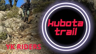
trail: Kubota
5:00 |
72 |
Nov 22, 2025 , Azpeitia
Current Trail Warnings
| status | trail | date | condition | user | info |
|---|---|---|---|---|---|
| Exkerretei | May 31, 2026 @ 12:17am (Pacific/Midway) May 31, 2026 | Dry | zigor-ark |
Recent Trail Reports
| status | trail | date | condition | info | user |
|---|---|---|---|---|---|
| Kubota | May 31, 2026 @ 12:17am (Pacific/Midway) May 31, 2026 | Dry | zigor-ark | ||
| Kubota igoera | May 31, 2026 @ 12:17am (Pacific/Midway) May 31, 2026 | Ideal | zigor-ark | ||
| Errekazulo Chicken Line 1 | May 31, 2026 @ 12:17am (Pacific/Midway) May 31, 2026 | Ideal | zigor-ark | ||
| Erreka zulo | May 31, 2026 @ 12:17am (Pacific/Midway) May 31, 2026 | Ideal | zigor-ark | ||
| Kanteratik Igoera | May 31, 2026 @ 12:17am (Pacific/Midway) May 31, 2026 | Ideal | zigor-ark | ||
| Xistiyako beltza | May 31, 2026 @ 12:17am (Pacific/Midway) May 31, 2026 | Ideal | zigor-ark | ||
| Xixtiya | May 31, 2026 @ 12:17am (Pacific/Midway) May 31, 2026 | Dry | zigor-ark | ||
| Esteka | May 31, 2026 @ 12:17am (Pacific/Midway) May 31, 2026 | Ideal | zigor-ark | ||
| Txernohill Red | Mar 22, 2026 @ 10:16am (Europe/Andorra) Mar 22, 2026 | Dry | northernbraaap Eremua | ||
| Kubata | Mar 22, 2026 @ 10:16am (Europe/Andorra) Mar 22, 2026 | Ideal | northernbraaap Eremua |
Activity Feed
| username | action | type | title | date |
|---|---|---|---|---|
| Alexisd16r6f | wishlist | trail | activity #96585599 and 1 more | Jun 8, 2026 @ 10:19pm Jun 8, 2026 |
| zigor-ark | add | report | activity #95998844 and 8 more | May 31, 2026 @ 9:52pm May 31, 2026 |
| Jxroussel | add | report | activity #94996191 and 1 more | May 18, 2026 @ 1:10pm May 18, 2026 |
| Canilopezcediel | wishlist | route | activity #94795919 | May 16, 2026 @ 2:08am May 16, 2026 |
| Zabaleta21 | ridden | trail | activity #94422397 | May 10, 2026 @ 6:54am May 10, 2026 |
Recent Comments
| username | type | title | comment | date |
|---|---|---|---|---|
| trail | Esta variante existe? | Sep 4, 2025 @ 1:12pm Sep 4, 2025 | ||
| trail | Bajada con muy buenos apoyos, tiene tramos... | Sep 4, 2025 @ 12:59pm Sep 4, 2025 |
Local Badges
-

Epic Mountain Bike Climb 2k2 awarded -

Climbing 10k Badge2 awarded -

Mountain Biking 100k Badge0 awarded -

Epic Ride Descent 2k2 awarded -

Descent 10k Badge2 awarded -

Descent 100k Badge0 awarded
Bike & Skill Parks
| name | type | city | rating |
|---|---|---|---|
| Azpeitia Jump Park | skill park | Azpeitia |
Activity Type Stats
| activitytype | trails | distance | descent | descent distance | total vertical | rating | global rank | state rank | photos | reports | routes | ridelogs |
|---|---|---|---|---|---|---|---|---|---|---|---|---|
| Mountain Bike | 33 | #5,774 | #319 | 35 | 105 | 1 | 617 | |||||
| E-Bike | 24 | #7,183 | #498 | 1 | 98 | 1 | 358 | |||||
| Horse | 1 | |||||||||||
| Hike | 19 | #12,541 | #524 | 96 | 34 | |||||||
| Trail Running | 18 | #12,160 | #523 | 96 | 27 | |||||||
| Dirtbike/Moto | 1 |
Frequently Asked Questions About Azpeitia
▼
What are the best places to ride in Azpeitia?
Azpeitia has 1 areas to explore for mountain biking. The top rated areas are:
▼
What are the highest rated mountain biking trails in Azpeitia?
The highest rated mountain biking trails in Azpeitia are:
- Kubota (4.4/5)
- Kubata (4.1/5)
- Exkerretei (4.1/5)
- Txernohill Red (4.1/5)
- Erreka zulo (4.1/5)
▼
Where can I park to ride in Azpeitia?
There are 1 parking locations listed in Azpeitia. The most popular parking spots are:
▼
What is the longest trail in Azpeitia?
The longest trail in Azpeitia is Kubota at 1.8 miles. View all trails sorted by distance.
Activities
- By krasty1002
 TMD TFSPAIN & contributors
 - Admins: Altavoz, krasty1002, Altavoz, krasty1002
- #62824 - 1,165 views
- azpeitia activity log | embed map of Azpeitia mountain bike trails | azpeitia mountain biking points of interest
Downloading of trail gps tracks in kml & gpx formats is enabled for Azpeitia.
You must login to download files.