close
-
Layers w
- Weather Layers
- Pro
- Pro
- Pro
- Pro
- Pro
- Pro
- More Layers
- Pro
- Pro
- Pro
- Pro
-
Upgrade to

3D
Trail Conditions
- Unknown
- Snow Groomed
- Snow Packed
- Snow Covered
- Snow Cover Partial
- Freeze/thaw Cycle
- Icy
- Prevalent Mud
- Wet
- Variable
- Ideal
- Dry
- Very Dry
Trail Flow (Ridden Direction)
Trailforks scans users ridelogs to determine the most popular direction each trail is ridden. A good flowing trail network will have most trails flowing in a single direction according to their intension.
The colour categories are based on what percentage of riders are riding a trail in its intended direction.
The colour categories are based on what percentage of riders are riding a trail in its intended direction.
- > 96%
- > 90%
- > 80%
- > 70%
- > 50%
- < 50%
- bi-directional trail
- no data
Trail Last Ridden
Trailforks scans ridelogs to determine the last time a trail was ridden.
- < 2 days
- < 1 week
- < 2 weeks
- < 1 month
- < 6 months
- > 6 months
Trail Ridden Direction
The intended direction a trail should be ridden.
- Downhill Only
- Downhill Primary
- Both Directions
- Uphill Primary
- Uphill Only
- One Direction
Contribute Details
Colors indicate trail is missing specified detail.
- Description
- Photos
- Description & Photos
- Videos
Trail Popularity ?
Trailforks scans ridelogs to determine which trails are ridden the most in the last 9 months.
Trails are compared with nearby trails in the same city region with a possible 25 colour shades.
Think of this as a heatmap, more rides = more kinetic energy = warmer colors.
- most popular
- popular
- less popular
- not popular
ATV/ORV/OHV Filter
Max Vehicle Width
inches
US Cell Coverage
Legend

Radar Time
Activity Recordings
Trailforks uses anonymized public activity data.
?
Activity Recordings
Trailforks uses anonymized public activity data.
?
Personal Heatmap
▶
Activity Types
all
/
none
▶
Options
2
Date range
month
–
Winter Trails
Warning
A routing network for winter maps does not exist. Selecting trails using the winter trails layer has been disabled.
Missing Trails
Most Popular
Least Popular
Trails are colored based on popularity. The more popular a trail is, the more red. Less popular trails trend towards green.
Jump Magnitude Heatmap
Heatmap of where riders jump on trails. Zoom in to see individual jumps, click circles to view jump details.
BC Backroad Status
![map legend]()
Service Road Atlas is a free to use, community-driven service for viewing and creating reports on the numerous back-country service roads around B.C. and Alberta.

Slope Aspect
Direction the slope faces
Trails Deemphasized
Trails are shown in grey.
Only show trails with no bike usage.
Suggested Layers
Based on selected activity type
Save the current map location and zoom level as your default home location whenever this page is loaded.
SaveMost popular riding area on the Sunshine Coast. Lots of climbing with great descents. Trails of all types: flow, jump, stunts, steeps this area has it all.
eBikes Allowed:
Yes
Shuttleable: YES
 google parking directions
 Access Info:
Most common meeting point is the Power Lines at the bottom. Second common spot is the Mattresses about 1 km up the road.
Activities Click to view
- Mountain Bike
206 trails
- E-Bike
207 trails
- Horse
29 trails
- Hike
166 trails
- Trail Running
166 trails
- Dirtbike/Moto
58 trails
- Observed Trials
66 trails
- ATV/ORV/OHV
35 trails
Region Details
- 41
- 37
- 104
- 16
- 3
Region Status
Caution as of Jun 18, 2026Stats
- Avg Trail Rating
- Trails (view details)
- 206
- Trails Mountain Bike
- 208
- Trails E-Bike
- 207
- Trails Horse
- 29
- Trails Hike
- 166
- Trails Trail Running
- 166
- Trails Dirtbike/Moto
- 58
- Trails Observed Trials
- 66
- Trails ATV/ORV/OHV
- 35
- Total Distance
- 142 miles
- Total Descent
- 35,832 ft
- Total Vertical
- 4,009 ft
- Highest Trailhead
- 4,141 ft
- Reports
- 3,487
- Photos
- 1,355
- Ridden Counter
- 70,571
Popular B&K Mountain Biking Trails
• 100 ★ 4.6 • 1 mile • 0 ft • 3,530 •
Fast, fun, flowy with well built at the top, moving into bigger, faster sections through the trees. A couple of big /drops that are well signed, and even with padded trees, just in case. If you're planning on riding anything in this...
• 100 ★ 4.4 • 3,127 ft • 0 ft • 2,856 •
Nice flowy . When connecting over to , avoid the muddy double track by exiting before reaching the bottom of the downhill section and go right on .
• 100 ★ 4.3 • 1,864 ft • 0 ft • 2,278 •
A Sunshine Coast favourite. Classic B&K jump built by one of the Roberts Creek OG builders DY. Big rolls, woodwork, big tabletops and a lot of flow make this a great ride all around.
• 100 ★ 3.6 • 3,389 ft • 67 ft • 1,694 •
Nice single track that is used to connect from to and . Has some nice fast down hill sections.
• 100 ★ 3.9 • 2,437 ft • 0 ft • 1,662 •
Starts loamy and rooty with some fun small , then becomes rougher and looser lower down.
• 95 ★ 4.0 • 1 mile • 0 ft • 1,296 •
Fun down hill run. Also, good for climbing up to avoid the dust road in the summer.
B&K Mountain Bike Routes
★ 4.0 • 8 miles • 1,607 ft • 47 • Loop •
A great loop staring from the power lines. A fair amount of climbing that is spread out over the loop.
★ 3.5 • 11 miles • 2,107 ft • 64 • Loop •
Larger BnK loop that ties in many of the best trails in the area.
6 miles • 511 ft • 14 • Shuttled •
A run down the super fast is pretty much mandatory on a SSC visit. The connector trail named to access...
6 miles • 773 ft • 19 • Shuttled •
This is always my goto for a first shuttle lap at Roberts Creek. Pedal up from shuttle park up the steep...
5 miles • 1,400 ft • 6 • Point to Point •
A nice technical climb route that keeps you off the FSR and takes you up to the Yellow 15 access trail. If...
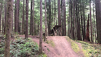
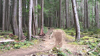
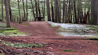
Photos of B&K Mountain Bike
Videos of B&K Mountain Bike
trail: Mach Chicken
0:16 |
150 |
Jan 5, 2023

trail: DNZ
0:08 |
25 |
Feb 19, 2022
trail: DNZ
0:08 |
9 |
Feb 19, 2022
trail: Mach Chicken
0:22 |
234 |
Jul 9, 2021
trail: Jumps
0:11 |
549 |
May 7, 2021
trail: Jumps
0:11 |
|
May 7, 2021
trail: DNZ
0:16 |
130 |
Apr 3, 2021
trail: Hand Solo
0:14 |
|
Feb 11, 2021
Current Trail Warnings
| status | trail | date | condition | user | info |
|---|---|---|---|---|---|
| New High Logging Road | Jun 10, 2026 @ 10:28am (America/Vancouver) Jun 10, 2026 | Unknown | nodignoridemtb CMBTA | Closed due to active logging operations. | |
| 1st Step | Jun 2, 2026 @ 12:05pm (America/Vancouver) Jun 2, 2026 | Ideal | 421coast | Rough ride down |
Recent Trail Reports
| status | trail | date | condition | info | user |
|---|---|---|---|---|---|
| Wild Turkey | Jun 18, 2026 @ 5:09pm (America/Vancouver) Jun 18, 2026 | Ideal | enki | ||
| Twisted Sista's | Jun 18, 2026 @ 5:09pm (America/Vancouver) Jun 18, 2026 | Ideal | enki | ||
| DNZ | Jun 18, 2026 @ 5:09pm (America/Vancouver) Jun 18, 2026 | Ideal | enki | ||
| BTS Connector | Jun 18, 2026 @ 5:09pm (America/Vancouver) Jun 18, 2026 | Dry | enki | ||
| Guy's Gulch | Jun 19, 2026 @ 5:04pm (America/Vancouver) Jun 19, 2026 | Dry | andybikehike | ||
| Hwy 102 | Jun 14, 2026 @ 10:04am (America/Vancouver) Jun 14, 2026 | Dry | messajane | ||
| Hand Solo | Jun 13, 2026 @ 4:50pm (America/Vancouver) Jun 13, 2026 | Dry | TheLongMan | ||
| Up n Around | Jun 13, 2026 @ 4:50pm (America/Vancouver) Jun 13, 2026 | Dry | TheLongMan | ||
| JB Connector | Jun 13, 2026 @ 4:50pm (America/Vancouver) Jun 13, 2026 | Very Dry | TheLongMan | ||
| Joe's | Jun 13, 2026 @ 4:50pm (America/Vancouver) Jun 13, 2026 | Ideal | TheLongMan |
Activity Feed
| username | action | type | title | date |
|---|---|---|---|---|
| dagne | ridden | trail | activity #97645898 | Jun 23, 2026 @ 12:33pm 38 mins |
| Basmek | wishlist | trail | activity #97606345 and 4 more | Jun 22, 2026 @ 10:42pm 14 hours |
| caspiankai | wishlist | trail | activity #97599626 | Jun 22, 2026 @ 7:22pm 18 hours |
| Roscoedoggg | wishlist | region | activity #97526261 | Jun 21, 2026 @ 3:38pm 2 days |
| frenchy-p | wishlist | region | activity #97487592 | Jun 21, 2026 @ 8:27am 2 days |
Recent Comments
| username | type | title | comment | date |
|---|---|---|---|---|
| trail | a lot of work to put this trail together,... | Jun 19, 2026 @ 5:13pm Jun 19, 2026 | ||
| trail | The trail is not closed. Must have been... | Jun 18, 2026 @ 8:01pm Jun 18, 2026 | ||
| trail | Closed 6/16/26 😩 | Jun 16, 2026 @ 8:30am Jun 16, 2026 | ||
| trail | So much fun!!! Highly recommend | Jun 15, 2026 @ 9:34am Jun 15, 2026 | ||
| trail | I used my jeep on the FSR to reach Peter’s... | Jun 7, 2026 @ 3:00pm Jun 7, 2026 |
Nearby Areas
| name | distance | ||||
|---|---|---|---|---|---|
| Coast Gravity Park | 1 | 5 | 1 | 5 km | |
| Sprockids | 11 | 24 | 10 | 5.9 km | |
| Porpoise Bay | 2 | 8 | 5 | 4 | 6 km |
| Kinnikinnick Park | 15 | 1 | 7.3 km | ||
| Keats Island | 8.7 km |
Local Badges
-

Completionist0 awarded
Bike & Skill Parks
| name | type | city | rating |
|---|---|---|---|
| jump line | skill park | Roberts Creek |
Local Trail Supporters
- Wednesday Night Club
- Dylan Broeke
![]()
Activity Type Stats
| activitytype | trails | distance | descent | descent distance | total vertical | rating | global rank | state rank | photos | reports | routes | ridelogs |
|---|---|---|---|---|---|---|---|---|---|---|---|---|
| Mountain Bike | 206 | 139 miles | 34,774 ft | 66 miles | 4,009 ft | #114 | #17 | 1,322 | 3,488 | 12 | 20,749 | |
| E-Bike | 207 | 139 miles | 35,003 ft | 66 miles | 4,009 ft | #71 | #18 | 16 | 3,407 | 2 | 1,090 | |
| Horse | 29 | 33 miles | 4,931 ft | 13 miles | 3,337 ft | #255 | #7 | 1 | 782 | 59 | ||
| Hike | 166 | 121 miles | 23,091 ft | 50 miles | 4,009 ft | #462 | #32 | 16 | 3,052 | 1 | 1,233 | |
| Trail Running | 166 | 121 miles | 23,091 ft | 50 miles | 4,009 ft | #463 | #26 | 3,049 | 1 | 630 | ||
| Dirtbike/Moto | 58 | 66 miles | 8,711 ft | 24 miles | 3,337 ft | #76 | #26 | 807 | 106 | |||
| Observed Trials | 66 | 70 miles | 8,980 ft | 24 miles | 3,337 ft | #10 | #6 | 102 | 12 | |||
| ATV/ORV/OHV | 35 | 49 miles | 6,171 ft | 17 miles | 3,337 ft | #38 | #5 | 751 | 8 |
Frequently Asked Questions About B&K
▼
What are the highest rated mountain biking trails in B&K?
The highest rated mountain biking trails in B&K are:
- Twisted Sista's (4.7/5)
- Hand Solo (4.6/5)
- Mach Chicken (4.6/5)
- Built To Spill (4.5/5)
- JRX (4.4/5)
▼
What is the best time of the year to ride in B&K?
Based on ride log data, the most popular months to ride in B&K are:
- July (486 activities)
- August (380 activities)
- June (365 activities)
▼
Where can I park to ride in B&K?
There are 1 parking locations listed in B&K. The most popular parking spots are:
▼
What is the longest trail in B&K?
The longest trail in B&K is Trailfest Wagonroad at 4.9 km. View all trails sorted by distance.
Activities
Trails
- By nodignoridemtb
 CMBTA & contributors
 - Admins: CMBTA, SCDBA
- #10349 - 44,963 views
- b&k activity log | embed map of B&K mountain bike trails | b&k mountain biking points of interest polygons
Downloading of trail gps tracks in kml & gpx formats is enabled for B&K.
You must login to download files.