close
-
Layers w
- Weather Layers
- Pro
- Pro
- Pro
- Pro
- Pro
- Pro
- More Layers
- Pro
- Pro
- Pro
- Pro
-
Upgrade to

3D
Trail Conditions
- Unknown
- Snow Groomed
- Snow Packed
- Snow Covered
- Snow Cover Partial
- Freeze/thaw Cycle
- Icy
- Prevalent Mud
- Wet
- Variable
- Ideal
- Dry
- Very Dry
Trail Flow (Ridden Direction)
Trailforks scans users ridelogs to determine the most popular direction each trail is ridden. A good flowing trail network will have most trails flowing in a single direction according to their intension.
The colour categories are based on what percentage of riders are riding a trail in its intended direction.
The colour categories are based on what percentage of riders are riding a trail in its intended direction.
- > 96%
- > 90%
- > 80%
- > 70%
- > 50%
- < 50%
- bi-directional trail
- no data
Trail Last Ridden
Trailforks scans ridelogs to determine the last time a trail was ridden.
- < 2 days
- < 1 week
- < 2 weeks
- < 1 month
- < 6 months
- > 6 months
Trail Ridden Direction
The intended direction a trail should be ridden.
- Downhill Only
- Downhill Primary
- Both Directions
- Uphill Primary
- Uphill Only
- One Direction
Contribute Details
Colors indicate trail is missing specified detail.
- Description
- Photos
- Description & Photos
- Videos
Trail Popularity ?
Trailforks scans ridelogs to determine which trails are ridden the most in the last 9 months.
Trails are compared with nearby trails in the same city region with a possible 25 colour shades.
Think of this as a heatmap, more rides = more kinetic energy = warmer colors.
- most popular
- popular
- less popular
- not popular
ATV/ORV/OHV Filter
Max Vehicle Width
inches
US Cell Coverage
Legend

Radar Time
Activity Recordings
Trailforks uses anonymized public activity data.
?
Activity Recordings
Trailforks uses anonymized public activity data.
?
Personal Heatmap
▶
Activity Types
all
/
none
▶
Options
2
Date range
month
–
Winter Trails
Warning
A routing network for winter maps does not exist. Selecting trails using the winter trails layer has been disabled.
Missing Trails
Most Popular
Least Popular
Trails are colored based on popularity. The more popular a trail is, the more red. Less popular trails trend towards green.
Jump Magnitude Heatmap
Heatmap of where riders jump on trails. Zoom in to see individual jumps, click circles to view jump details.
BC Backroad Status
![map legend]()
Service Road Atlas is a free to use, community-driven service for viewing and creating reports on the numerous back-country service roads around B.C. and Alberta.

Slope Aspect
Direction the slope faces
Trails Deemphasized
Trails are shown in grey.
Only show trails with no bike usage.
Suggested Layers
Based on selected activity type
Save the current map location and zoom level as your default home location whenever this page is loaded.
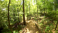
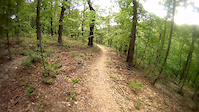
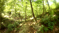
SaveThe Back 40 Trails in Bella Vista, Arkansas, are a purpose-built network of singletrack that winds through dense Ozark forest, blending fast berms, rolling climbs, and scenic creekside riding into one of the most accessible and enjoyable mountain biking systems in the region.
Primary Trail Type: Cross-Country
Shuttleable: YES
 google parking directions
 Access Info:
Numerous trailheads, easy access from Lake Ann, or from the trailhead at Blowing Springs
IMBA Ride Center

Bentonville
Activities Click to view
- Mountain Bike
32 trails
- E-Bike
32 trails
- Horse
0 trails
- Hike
33 trails
- Trail Running
33 trails
Region Details
- 1
- 3
- 23
- 5
Region Status
Open as of 1 dayStats
- Avg Trail Rating
- Trails (view details)
- 33
- Trails Mountain Bike
- 32
- Trails E-Bike
- 32
- Trails Hike
- 33
- Trails Trail Running
- 33
- Total Distance
- 41 miles
- Total Descent Distance
- 16 miles
- Total Descent
- 4,913 ft
- Total Vertical
- 401 ft
- Highest Trailhead
- 1,394 ft
- Reports
- 1,169
- Photos
- 637
- Ridden Counter
- 29,588
Popular Back 40 Mountain Biking Trails
• 95 ★ 4.8 • 1,348 ft • 13 ft • 3,149 •
This trail is multidirectional. It best flows North to South and is a great connector from the Vietnam Veteran Memorial Parking Lot to the Wonderland Trails above Lake Bella Vista. This trail access Rabit Hole Loop, which allows some...
• 65 ★ 4.5 • 3 miles • 194 ft • 2,443 •
A black diamond trail that will take you across a series of tight rock ledges high above a dry creek bed. The trail has a variety of black features include high speed ares with double and tabletop jumps, berms, rock gardens and small...
• 95 ★ 5.0 • 1,483 ft • 30 ft • 2,371 •
Popular black diamond difficulty singletrack. This multi-use trail can be used both directions. On average it takes 1 minutes to complete this trail.
• 80 ★ 3.8 • 1 mile • 189 ft • 2,127 •
A fun connector with either a long climbs and steep descent, or a steep climb and longer descent with features both ways.
• 55 ★ 4.1 • 3 miles • 314 ft • 1,700 •
This flow trail consists of rollers, berms, and small rock gardens. The trail winds its way down a series of steep slops and has some significant exposure in sections. The trail has a number of road crossings, so ensure you slow down...
• 90 ★ 4.4 • 453 ft • 3 ft • 1,593 •
A small advanced level trail that follows the rock ledges along the river bed.
• 65 ★ 4.7 • 2 miles • 253 ft • 1,368 •
This intermediate level trails follows a series of valleys through the heart of the Back 40 trail system. Berms, rollers, jumps and high speed sections can all be found along this trail. The climbs are sustained, but low grade if you...
Back 40 Mountain Bike Routes
★ 3.7 • 7 miles • 707 ft • 0 • Loop •
This route is best started at the Bear Hollow Trailhead, which offers immediately access to the Loop....
★ 3.7 • 18 miles • 1,919 ft • 3 •
Hit the best downhills in the Back 40 with this loop. It covers , Taylor's Homestead, and . But there's...
7 miles • 771 ft • 1 • Loop •
You could either start on the high side parking and ride down, and ride up and out, Or you could start on...
14 miles • 1,354 ft • 3 • Loop •
Enjoy some of Back 40 and stop for lunch at the Gear Garden along the way!
★ 1.0 • 44 miles • 4,937 ft • 13 • Loop •
This route rides 99% of the Back 40 system with limited repeating. The route Hits all of the proper Jump...
Photos of Back 40 Mountain Bike
Videos of Back 40 Mountain Bike

trail: Go Ride
2:59 |
46 |
Aug 19, 2025
trail: The Ledges
4:07 |
553 |
Nov 7, 2017
trail: The Back 40 (Zone 4)
5:17 |
189 |
Jun 16, 2017
trail: The Back 40 (Zone 4)
0:35 |
149 |
Jun 16, 2017
trail: The Back 40 (Zone 4)
2:02 |
81 |
Jun 16, 2017
trail: Flo Ride
5:31 |
1249 |
Jun 14, 2017
trail: The Ledges
21:42 |
232 |
Jun 13, 2017

trail: The Back 40 (Zone 4)
0:50 |
284 |
Dec 3, 2016
Recent Trail Reports
| status | trail | date | condition | info | user |
|---|---|---|---|---|---|
| The Back 40 (Zone 2) | Jun 28, 2026 @ 10:26am (America/Chicago) 1 day | Unknown | chrisjennings | ||
| Snowbird | Jun 25, 2026 @ 6:15am (America/Indiana/Vincennes) Jun 25, 2026 | Ideal | rmtrailhawk | ||
| Snowbird Back 40 Connector | Jun 20, 2026 @ 10:39am (America/Indiana/Vincennes) Jun 20, 2026 | Ideal | Plockridge | ||
| Rago | Jun 18, 2026 @ 5:25pm (America/Chicago) Jun 18, 2026 | Unknown | SeanMcCullar | ||
| Taylor Homestead | Jun 17, 2026 @ 4:54pm (America/Chicago) Jun 17, 2026 | Unknown | sslikesnake FAST | ||
| Lookout | Jun 17, 2026 @ 11:17am (America/Chicago) Jun 17, 2026 | Dry | Clmorga1 | ||
| Summit School | Jun 16, 2026 @ 1:53pm (America/Chicago) Jun 16, 2026 | Unknown | NonDotJon | ||
| Pinyon Creek | Jun 14, 2026 @ 10:27am (America/Indiana/Vincennes) Jun 14, 2026 | Wet | Plockridge | ||
| Sally Trail (North) | Jun 13, 2026 @ 2:54pm (America/Indiana/Vincennes) Jun 13, 2026 | Ideal | rmtrailhawk | ||
| Buckingham | Apr 26, 2026 @ 11:27am (America/Indiana/Vincennes) Apr 26, 2026 | Ideal | thomcerny NGMBA |
Activity Feed
| username | action | type | title | date |
|---|---|---|---|---|
| thomcerny | vote | trail | activity #98069434 | Jun 29, 2026 @ 9:31am 3 hours |
| DRkC8wpn | comment | report | activity #98062601 | Jun 29, 2026 @ 7:38am 5 hours |
| SteveLeary | vote | trail | activity #97997111 | Jun 28, 2026 @ 9:18am 1 day |
| chrisjennings | add | report | activity #97992369 | Jun 28, 2026 @ 8:26am 1 day |
| Mkelbert | wishlist | route | activity #97956802 | Jun 27, 2026 @ 7:33pm 2 days |
Recent Comments
| username | type | title | comment | date |
|---|---|---|---|---|
| report | Thanks for the report this has been cut.... | Jun 29, 2026 @ 7:38am 5 hours | ||
| report | It’s been cut. | Jun 19, 2026 @ 10:08am Jun 19, 2026 | ||
| report | This has been cut. | Jun 18, 2026 @ 7:50am Jun 18, 2026 | ||
| report | Thanks for the report this has been cut.... | Jun 18, 2026 @ 6:57am Jun 18, 2026 | ||
| report | Thos had been cut Woodsman Crew. | Jun 18, 2026 @ 6:26am Jun 18, 2026 |
Nearby Areas
| name | distance | ||||
|---|---|---|---|---|---|
| Blowing Springs | 12 | 18 | 8 | 2 | 2.3 km |
| Little Sugar | 6 | 35 | 14 | 3.2 km | |
| Oz Trails Bike Park | 5 | 19 | 9 | 4 | 3.2 km |
| Wonderland | 2 | 4.1 km | |||
| Slaughter Pen Trails | 42 | 63 | 20 | 3 | 5.2 km |
Activity Type Stats
| activitytype | trails | distance | descent | descent distance | total vertical | rating | global rank | state rank | photos | reports | routes | ridelogs |
|---|---|---|---|---|---|---|---|---|---|---|---|---|
| Mountain Bike | 32 | 20 miles | 2,434 ft | 8 miles | 400 ft | #1,303 | #443 | 570 | 1,168 | 8 | 14,098 | |
| E-Bike | 32 | 20 miles | 2,434 ft | 8 miles | 400 ft | #1,410 | #675 | 25 | 1,071 | 5 | 2,506 | |
| Hike | 33 | 20 miles | 2,434 ft | 8 miles | 400 ft | #3,055 | #1,057 | 23 | 1,167 | 2 | 1,107 | |
| Trail Running | 33 | 20 miles | 2,434 ft | 8 miles | 400 ft | #2,435 | #591 | 19 | 1,167 | 3 | 246 |
Frequently Asked Questions About Back 40
▼
What are the highest rated mountain biking trails in Back 40?
The highest rated mountain biking trails in Back 40 are:
- Taylor Homestead (4.4/5)
- Sally Trail (North) (4.4/5)
- Go Ride (4.3/5)
- The Ledges (4.3/5)
- Lookout (4.2/5)
▼
What is the best time of the year to ride in Back 40?
Based on ride log data, the most popular months to ride in Back 40 are:
- May (125 activities)
- October (117 activities)
- April (114 activities)
▼
Where can I park to ride in Back 40?
There are 8 parking locations listed in Back 40. The most popular parking spots are: View all parking and trailhead locations on the map to plan your visit.
▼
What is the longest trail in Back 40?
The longest trail in Back 40 is The Back 40 (Zone 2) at 6.1 miles. View all trails sorted by distance.
Activities
Trails
Points of Interest
- By slabhardcheese & contributors
- Admins: Trailblazers, Rock Solid, FAST, Trailblazers, FAST
- #16843 - 29,586 views
- back 40 activity log | embed map of Back 40 mountain bike trails | back 40 mountain biking points of interest
Downloading of trail gps tracks in kml & gpx formats is enabled for Back 40.
You must login to download files.