close
-
Layers w
- Weather Layers
- Pro
- Pro
- Pro
- Pro
- Pro
- Pro
- More Layers
- Pro
- Pro
- Pro
- Pro
-
Upgrade to

3D
Trail Conditions
- Unknown
- Snow Groomed
- Snow Packed
- Snow Covered
- Snow Cover Partial
- Freeze/thaw Cycle
- Icy
- Prevalent Mud
- Wet
- Variable
- Ideal
- Dry
- Very Dry
Trail Flow (Ridden Direction)
Trailforks scans users ridelogs to determine the most popular direction each trail is ridden. A good flowing trail network will have most trails flowing in a single direction according to their intension.
The colour categories are based on what percentage of riders are riding a trail in its intended direction.
The colour categories are based on what percentage of riders are riding a trail in its intended direction.
- > 96%
- > 90%
- > 80%
- > 70%
- > 50%
- < 50%
- bi-directional trail
- no data
Trail Last Ridden
Trailforks scans ridelogs to determine the last time a trail was ridden.
- < 2 days
- < 1 week
- < 2 weeks
- < 1 month
- < 6 months
- > 6 months
Trail Ridden Direction
The intended direction a trail should be ridden.
- Downhill Only
- Downhill Primary
- Both Directions
- Uphill Primary
- Uphill Only
- One Direction
Contribute Details
Colors indicate trail is missing specified detail.
- Description
- Photos
- Description & Photos
- Videos
Trail Popularity ?
Trailforks scans ridelogs to determine which trails are ridden the most in the last 9 months.
Trails are compared with nearby trails in the same city region with a possible 25 colour shades.
Think of this as a heatmap, more rides = more kinetic energy = warmer colors.
- most popular
- popular
- less popular
- not popular
ATV/ORV/OHV Filter
Max Vehicle Width
inches
US Cell Coverage
Legend

Radar Time
Activity Recordings
Trailforks uses anonymized public activity data.
?
Activity Recordings
Trailforks uses anonymized public activity data.
?
Personal Heatmap
▶
Activity Types
all
/
none
▶
Options
2
Date range
month
–
Winter Trails
Warning
A routing network for winter maps does not exist. Selecting trails using the winter trails layer has been disabled.
Missing Trails
Most Popular
Least Popular
Trails are colored based on popularity. The more popular a trail is, the more red. Less popular trails trend towards green.
Jump Magnitude Heatmap
Heatmap of where riders jump on trails. Zoom in to see individual jumps, click circles to view jump details.
BC Backroad Status
![map legend]()
Service Road Atlas is a free to use, community-driven service for viewing and creating reports on the numerous back-country service roads around B.C. and Alberta.

Slope Aspect
Direction the slope faces
Trails Deemphasized
Trails are shown in grey.
Only show trails with no bike usage.
Suggested Layers
Based on selected activity type
Save the current map location and zoom level as your default home location whenever this page is loaded.
Save
No description for Bad Aibling has been added yet!
Login or register to submit one.
This region uses the Uk/Euro style trail grading system.
Activities Click to view
- Mountain Bike
61 trails
- E-Bike
61 trails
- Adaptive Bike
- Winter Fat Bike
0 trails
- Hike
59 trails
- Trail Running
59 trails
Region Details
- 16
- 16
- 16
- 5
- 8
Region Status
Open as of 2 daysStats
- Avg Trail Rating
- Trails (view details)
- 64
- Trails Mountain Bike
- 61
- Trails E-Bike
- 61
- Trails Hike
- 59
- Trails Trail Running
- 59
- Trails Backcountry Ski
- 2
- Total Distance
- 71 miles
- Total Descent
- 26,721 ft
- Total Vertical
- 4,087 ft
- Highest Trailhead
- 5,669 ft
- Reports
- 306
- Photos
- 174
- Ridden Counter
- 775
Popular Bad Aibling Mountain Biking Trails
• 100 ★ 4.0 • 971 ft • 0 ft • 50 •
Really short, but fun trail, starting at the Rohnberg summit. It’s quite narrow and starts to the right of . It becomes a bit steeper and even has a small jump, before ending at a fire road that takes you to the .
• 85 ★ 3.9 • 2,257 ft • 0 ft • 47 •
Short trail in the middle of the woods. Some roots and steps.
• 100 ★ 4.5 • 705 ft • 0 ft • 46 •
Popular blue difficulty singletrack. This mountain bike primary trail can be used both directions. On average it takes minutes to complete this trail.
• 95 ★ 3.8 • 3,009 ft • 0 ft • 46 •
Popular blue difficulty singletrack. This mountain bike primary trail can be used downhill primary. On average it takes 7 minutes to complete this trail.
• 80 ★ 3.2 • 1 mile • 0 ft • 45 •
Trail Alternative from Rohnberg down towards Schliersee. Some rooty parts and some old, hand built jumps. Take a close look at the condition before using any of the built features since they are not maintained and degrade over time.
• 40 ★ 3.9 • 1 mile • 0 ft • 37 •
From the Bushäusl this trail generally flows down back towards Hausham. It is broken up into three sections broken up by each time it crosses the road. If you are paying attention when climbing to the top you will see where the trail...
• 95 ★ 4.8 • 3,606 ft • 0 ft • 36 •
Highly rated popular black difficulty singletrack. This mountain bike primary trail can be used both directions. On average it takes 15 minutes to complete this trail.
• 75 ★ 3.0 • 553 ft • 0 ft • 35 •
Popular green difficulty singletrack. This mountain bike primary trail can be used downhill primary and has a easy overall physical rating with a 0 ft green climb. On average it takes minutes to complete this trail.
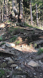
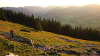
Photos of Bad Aibling Mountain Bike
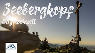
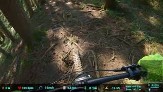
Videos of Bad Aibling Mountain Bike
trail: Sulzberg Northwest Ridge
0:17 |
203 |
Aug 2, 2021
trail: Breitenstein Upper
0:13 |
631 |
Nov 14, 2020
10:15 |
167 |
Aug 21, 2024 , Bad Aibling

trail: Schlierbergalm Trail
33:42 |
388 |
Sep 9, 2023 , Bad Aibling
trail: Little Rohnberg West Part 2
33:42 |
110 |
Sep 9, 2023 , Bad Aibling

trail: Little Rohnberg West
33:42 |
237 |
Sep 9, 2023 , Bad Aibling
trail: Elkofen Trail
6:26 |
141 |
Feb 23, 2023 , Bad Aibling

trail: Eberberg-Down
4:05 |
167 |
Aug 6, 2022 , Bad Aibling
Recent Trail Reports
| status | trail | date | condition | info | user |
|---|---|---|---|---|---|
| Fehleiten Trail | Jun 25, 2026 @ 5:43pm (Europe/Berlin) 2 days | Ideal | andi-frede | ||
| Faltertrail | Jun 25, 2026 @ 5:43pm (Europe/Berlin) 2 days | Ideal | andi-frede | ||
| Buchfeld trail | Jun 25, 2026 @ 5:43pm (Europe/Berlin) 2 days | Ideal | andi-frede | ||
| Waschbrunn Trail 1 | Jun 25, 2026 @ 7:22am (Europe/Berlin) 3 days | Variable | andi-frede | ||
| Schlierbergalm Trail | Jun 4, 2026 @ 10:00am (Europe/Berlin) Jun 4, 2026 | Ideal | nako7 | ||
| L'il Thang | Jun 4, 2026 @ 10:00am (Europe/Berlin) Jun 4, 2026 | Ideal | nako7 | ||
| Little Rohnberg West Part 2 | Jun 4, 2026 @ 10:00am (Europe/Berlin) Jun 4, 2026 | Variable | nako7 | ||
| Little Rohnberg West | Jun 4, 2026 @ 10:00am (Europe/Berlin) Jun 4, 2026 | Ideal | nako7 | ||
| Rohnberg South Alt Return | May 24, 2026 @ 11:17am (Europe/Berlin) May 24, 2026 | Ideal | nako7 | ||
| Auracher Köpferl | May 10, 2026 @ 10:22am (Europe/Vaduz) May 10, 2026 | Dry | wolfiwolf |
Activity Feed
| username | action | type | title | date |
|---|---|---|---|---|
| andi-frede | add | report | activity #97819074 and 2 more | Jun 26, 2026 @ 12:16am 2 days |
| andi-frede | add | report | activity #97758760 | Jun 25, 2026 @ 4:24am 3 days |
| andi-frede | add | report | activity #97753303 | Jun 25, 2026 @ 12:56am 3 days |
| Di447 | ridden | trail | activity #97479652 and 1 more | Jun 21, 2026 @ 6:48am Jun 21, 2026 |
| Di447 | comment | trail | activity #97479498 and 1 more | Jun 21, 2026 @ 6:46am Jun 21, 2026 |
Recent Comments
| username | type | title | comment | date |
|---|---|---|---|---|
| trail | Ist oookay. Nicht wirklich spaßig zu fahren... | Jun 21, 2026 @ 6:47am Jun 21, 2026 | ||
| trail | Definitiv nicht zu empfehlen. Viele kleine... | Jun 21, 2026 @ 6:46am Jun 21, 2026 | ||
| trail | hallo, gibt es dort auch downhill sektionen? | Jun 11, 2026 @ 5:59am Jun 11, 2026 | ||
| trail | Hallo, der trail ist ganz gut, aber etwas... | Jun 5, 2026 @ 6:34am Jun 5, 2026 | ||
| trail | Nice techy trail. Excellent training spot for... | Oct 6, 2025 @ 3:32am Oct 6, 2025 |
Local Badges
-

Epic Mountain Bike Climb 2k0 awarded -

Climbing 10k Badge0 awarded -

Mountain Biking 100k Badge0 awarded -

Epic Ride Descent 2k0 awarded -

Descent 10k Badge0 awarded -

Descent 100k Badge0 awarded
Activity Type Stats
| activitytype | trails | distance | descent | descent distance | total vertical | rating | global rank | state rank | photos | reports | routes | ridelogs |
|---|---|---|---|---|---|---|---|---|---|---|---|---|
| Mountain Bike | 61 | 64 miles | 24,797 ft | 31 miles | 4,088 ft | #3,108 | #35 | 173 | 305 | 4,077 | ||
| E-Bike | 61 | 64 miles | 24,797 ft | 31 miles | 4,088 ft | #2,395 | #41 | 255 | 162 | |||
| Hike | 59 | 64 miles | 24,731 ft | 31 miles | 4,088 ft | #3,791 | #29 | 289 | 480 | |||
| Trail Running | 59 | 64 miles | 24,731 ft | 31 miles | 4,088 ft | #3,300 | #26 | 289 | 44 | |||
| Backcountry Ski | 2 | 5 miles | 154 ft | 2,146 ft | 2,680 ft | 1 | 388 |
Frequently Asked Questions About Bad Aibling
▼
What are the highest rated mountain biking trails in Bad Aibling?
The highest rated mountain biking trails in Bad Aibling are:
- Auracher Köpferl (4.5/5)
- Little Rohnberg West Part 2 (4.2/5)
- Faltertrail (4.1/5)
- Jägerkamp (4.1/5)
- Fehleiten Trail (4.1/5)
▼
What is the best time of the year to ride in Bad Aibling?
Based on ride log data, the most popular months to ride in Bad Aibling are:
- February (19 activities)
- June (18 activities)
- April (17 activities)
▼
Where can I park to ride in Bad Aibling?
There are 2 parking locations listed in Bad Aibling. The most popular parking spots are:
▼
What is the longest trail in Bad Aibling?
The longest trail in Bad Aibling is Rotwandhaus to Pfanngraben Lower at 3.1 km. View all trails sorted by distance.
Activities
- By mountaindude84 & contributors
- Admins: larry81541
- #63616 - 1,254 views
- bad aibling activity log | embed map of Bad Aibling mountain bike trails | bad aibling mountain biking points of interest
Downloading of trail gps tracks in kml & gpx formats is enabled for Bad Aibling.
You must login to download files.