close
-
Layers w
- Weather Layers
- Pro
- Pro
- Pro
- Pro
- Pro
- Pro
- More Layers
- Pro
- Pro
- Pro
- Pro
-
Upgrade to

3D
Trail Conditions
- Unknown
- Snow Groomed
- Snow Packed
- Snow Covered
- Snow Cover Partial
- Freeze/thaw Cycle
- Icy
- Prevalent Mud
- Wet
- Variable
- Ideal
- Dry
- Very Dry
Trail Flow (Ridden Direction)
Trailforks scans users ridelogs to determine the most popular direction each trail is ridden. A good flowing trail network will have most trails flowing in a single direction according to their intension.
The colour categories are based on what percentage of riders are riding a trail in its intended direction.
The colour categories are based on what percentage of riders are riding a trail in its intended direction.
- > 96%
- > 90%
- > 80%
- > 70%
- > 50%
- < 50%
- bi-directional trail
- no data
Trail Last Ridden
Trailforks scans ridelogs to determine the last time a trail was ridden.
- < 2 days
- < 1 week
- < 2 weeks
- < 1 month
- < 6 months
- > 6 months
Trail Ridden Direction
The intended direction a trail should be ridden.
- Downhill Only
- Downhill Primary
- Both Directions
- Uphill Primary
- Uphill Only
- One Direction
Contribute Details
Colors indicate trail is missing specified detail.
- Description
- Photos
- Description & Photos
- Videos
Trail Popularity ?
Trailforks scans ridelogs to determine which trails are ridden the most in the last 9 months.
Trails are compared with nearby trails in the same city region with a possible 25 colour shades.
Think of this as a heatmap, more rides = more kinetic energy = warmer colors.
- most popular
- popular
- less popular
- not popular
ATV/ORV/OHV Filter
Max Vehicle Width
inches
US Cell Coverage
Legend

Radar Time
Activity Recordings
Trailforks uses anonymized public activity data.
?
Activity Recordings
Trailforks uses anonymized public activity data.
?
Personal Heatmap
▶
Activity Types
all
/
none
▶
Options
2
Date range
month
–
Winter Trails
Warning
A routing network for winter maps does not exist. Selecting trails using the winter trails layer has been disabled.
Missing Trails
Most Popular
Least Popular
Trails are colored based on popularity. The more popular a trail is, the more red. Less popular trails trend towards green.
Jump Magnitude Heatmap
Heatmap of where riders jump on trails. Zoom in to see individual jumps, click circles to view jump details.
BC Backroad Status
![map legend]()
Service Road Atlas is a free to use, community-driven service for viewing and creating reports on the numerous back-country service roads around B.C. and Alberta.

Slope Aspect
Direction the slope faces
Trails Deemphasized
Trails are shown in grey.
Only show trails with no bike usage.
Suggested Layers
Based on selected activity type
Save the current map location and zoom level as your default home location whenever this page is loaded.
Save
No description for Bad Wildbad has been added yet!
Login or register to submit one.
This region uses the Uk/Euro style trail grading system.
Activities Click to view
- Mountain Bike
13 trails
- E-Bike
4 trails
- Hike
7 trails
- Trail Running
7 trails
Region Details
- 2
- 6
- 2
- 1
Region Status
Caution as of Jan 4, 2026Stats
- Avg Trail Rating
- Trails (view details)
- 13
- Trails Mountain Bike
- 13
- Trails E-Bike
- 4
- Trails Hike
- 7
- Trails Trail Running
- 7
- Total Distance
- 5 miles
- Total Descent
- 3,476 ft
- Total Vertical
- 1,049 ft
- Highest Trailhead
- 2,706 ft
- Reports
- 27
- Photos
- 16
- Ridden Counter
- 431
Sub Regions
-
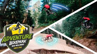
Bikepark Bad Wildbad
- 2
- 1
- 1
Popular Bad Wildbad Mountain Biking Trails
• 100 ★ 4.0 • 4,961 ft • 0 ft • 119 •
Popular black difficulty singletrack. This mountain bike primary trail can be used downhill only and has a hard overall physical rating. It features bridge, drop, jump and rock face. On average it takes 17 minutes to complete this trail.
• 25 ★ 2.6 • 4,725 ft • 0 ft • 117 •
Less popular blue difficulty machine groomed. This mountain bike primary trail can be used downhill only and has a moderate overall physical rating. It features drop, jump and skinny. On average it takes 4 minutes to complete this trail.
• 75 ★ 2.4 • 1 mile • 13 ft • 84 •
Popular blue difficulty singletrack. This mountain bike primary trail can be used downhill only. It features jump and pump track. On average it takes 7 minutes to complete this trail.
• 50 ★ 4.8 • 4,170 ft • 0 ft • 57 •
Moderately popular proline difficulty singletrack. This mountain bike primary trail can be used downhill only. It features bridge, drop, jump, gap jump, ladder bridge, rock face, rock garden, wallride and other. Trail visibility is always easy to follow. On average it takes 10 minutes to complete this trail.
• 70 ★ 1.0 • 3,468 ft • 373 ft • 9 •
Popular blue difficulty singletrack. This mountain bike primary trail can be used downhill primary and has a hard overall physical rating with a 373 ft black diamond climb. On average it takes 9 minutes to complete this trail.
• 100 ★ 0.0 • 830 ft • 115 ft • 8 •
Popular green difficulty singletrack. This mountain bike primary trail can be used both directions and has a moderate overall physical rating with a 115 ft blue climb. On average it takes 3 minutes to complete this trail.
• 5 ★ 0.0 • 1,358 ft • 0 ft • 7 •
Less popular blue difficulty singletrack. This mountain bike primary trail can be used downhill primary. On average it takes 2 minutes to complete this trail.
• 85 ★ 0.0 • 2,621 ft • 392 ft • 5 •
Popular blue difficulty singletrack. This mountain bike primary trail can be used both directions and has a hard overall physical rating with a 392 ft blue climb. Trail visibility is always easy to follow.
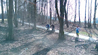
Photos of Bad Wildbad Mountain Bike
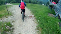
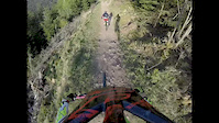
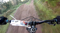
Videos of Bad Wildbad Mountain Bike
trail: Dual Slalom
0:18 |
203 |
Mar 21, 2015
trail: Dual Slalom
0:58 |
111 |
Jan 31, 2015
trail: Bikepark Freeride
0:42 |
1043 |
Apr 19, 2014
trail: Kärcher Freeride
0:17 |
269 |
Nov 20, 2013
youtuber
![Most INSANE Moments of 2023! (Pt. 2) - 'The...]()
trail: Downhill 1
8:34 |
223 |
Dec 21, 2023 , Bad Wildbad
youtuber
![Most INSANE Unseen Moments of 2022! (Pt. 2) -...]()
trail: Downhill 1
19:59 |
240 |
Feb 28, 2023 , Bad Wildbad
trail: Kärcher Freeride
13:02 |
546 |
Jan 2, 2023 , Bad Wildbad

trail: Bikepark Freeride
13:02 |
335 |
Jan 2, 2023 , Bad Wildbad
Recent Trail Reports
| status | trail | date | condition | info | user |
|---|---|---|---|---|---|
| Enduro Trail / DH 2 | May 18, 2025 @ 11:36am May 18, 2025 | Dry | montogeek | ||
| Kärcher Freeride | Sep 8, 2024 @ 10:31am Sep 8, 2024 | Ideal | rpenman | ||
| Bikepark Freeride | Sep 8, 2024 @ 10:31am Sep 8, 2024 | Ideal | rpenman | ||
| Downhill 1 | Apr 6, 2024 @ 1:33am Apr 6, 2024 | Ideal | Bikeboerny | ||
| Rennbachsteige Upper | Feb 8, 2020 @ 1:41am Feb 8, 2020 | Wet | sholzner |
Activity Feed
| username | action | type | title | date |
|---|---|---|---|---|
| HMan79 | add | photo | activity #96393453 and 1 more | Jun 6, 2026 @ 11:51am Jun 6, 2026 |
| HMan79 | comment | trail | activity #96393416 | Jun 6, 2026 @ 11:50am Jun 6, 2026 |
| marco_rothfusz | wishlist | region | activity #95232265 | May 22, 2026 @ 4:16am May 22, 2026 |
| Kf898c | difficultyvote | trail | activity #86636895 | Jan 4, 2026 @ 8:26am Jan 4, 2026 |
| zGianni | ridden | trail | activity #72533002 | May 27, 2025 @ 1:50pm May 27, 2025 |
Recent Comments
| username | type | title | comment | date |
|---|---|---|---|---|
| trail | Der gesamte Bike Park ist gesperrt, wird auch... | Jun 6, 2026 @ 11:50am Jun 6, 2026 | ||
| trail | Sind ein paar ziemlich technische Stellen... | Jun 11, 2022 @ 8:46am Jun 11, 2022 | ||
| trail | Really cool trail, many line options. Would... | May 28, 2022 @ 5:57am May 28, 2022 | ||
| trail | dem Stimme ich zu...rot bis schwarz | Oct 30, 2021 @ 11:34am Oct 30, 2021 | ||
| trail | Sehe es eher als mindestens rote eher la... | Oct 24, 2020 @ 6:03am Oct 24, 2020 |
Local Badges
-

Epic Mountain Bike Climb 2k1 awarded -

Climbing 10k Badge0 awarded -

Mountain Biking 100k Badge0 awarded -

Epic Ride Descent 2k1 awarded -

Descent 10k Badge0 awarded -

Descent 100k Badge0 awarded
Bike & Skill Parks
| name | type | city | rating |
|---|---|---|---|
| Bikepark Bad Wildbad | bike park | Bad Wildbad |
Activity Type Stats
| activitytype | trails | distance | descent | descent distance | total vertical | rating | global rank | state rank | photos | reports | routes | ridelogs |
|---|---|---|---|---|---|---|---|---|---|---|---|---|
| Mountain Bike | 13 | 5 miles | 3,478 ft | 4 miles | 1,050 ft | #7,332 | #275 | 16 | 27 | 944 | ||
| E-Bike | 4 | #5,997 | #232 | 22 | 92 | |||||||
| Hike | 7 | 1 mile | 226 ft | 1,791 ft | 663 ft | #8,793 | #180 | 26 | 166 | |||
| Trail Running | 7 | 1 mile | 226 ft | 1,791 ft | 663 ft | #8,315 | #174 | 26 |
Frequently Asked Questions About Bad Wildbad
▼
What are the best places to ride in Bad Wildbad?
Bad Wildbad has 1 areas to explore for mountain biking. The top rated areas are:
▼
What are the highest rated mountain biking trails in Bad Wildbad?
The highest rated mountain biking trails in Bad Wildbad are:
- Downhill 1 (4.3/5)
- Enduro Trail / DH 2 (4/5)
- Rennbachsteige Upper (3.6/5)
- Kärcher Freeride (3.4/5)
- Bikepark Freeride (3.1/5)
▼
What is the best time of the year to ride in Bad Wildbad?
Based on ride log data, the most popular months to ride in Bad Wildbad are:
- August (5 activities)
- September (5 activities)
- November (4 activities)
▼
Where can I park to ride in Bad Wildbad?
There are 2 parking locations listed in Bad Wildbad. The most popular parking spots are:
Activities
Trails
Points of Interest
- By e-van & contributors
- Admins: HDRiders, Sasse82, sp00n82, martywis
- #5262 - 4,543 views
- bad wildbad activity log | embed map of Bad Wildbad mountain bike trails | bad wildbad mountain biking points of interest
Downloading of trail gps tracks in kml & gpx formats is enabled for Bad Wildbad.
You must login to download files.