close
-
Layers w
- Weather Layers
- Pro
- Pro
- Pro
- Pro
- Pro
- Pro
- More Layers
- Pro
- Pro
- Pro
- Pro
-
Upgrade to

3D
Trail Conditions
- Unknown
- Snow Groomed
- Snow Packed
- Snow Covered
- Snow Cover Partial
- Freeze/thaw Cycle
- Icy
- Prevalent Mud
- Wet
- Variable
- Ideal
- Dry
- Very Dry
Trail Flow (Ridden Direction)
Trailforks scans users ridelogs to determine the most popular direction each trail is ridden. A good flowing trail network will have most trails flowing in a single direction according to their intension.
The colour categories are based on what percentage of riders are riding a trail in its intended direction.
The colour categories are based on what percentage of riders are riding a trail in its intended direction.
- > 96%
- > 90%
- > 80%
- > 70%
- > 50%
- < 50%
- bi-directional trail
- no data
Trail Last Ridden
Trailforks scans ridelogs to determine the last time a trail was ridden.
- < 2 days
- < 1 week
- < 2 weeks
- < 1 month
- < 6 months
- > 6 months
Trail Ridden Direction
The intended direction a trail should be ridden.
- Downhill Only
- Downhill Primary
- Both Directions
- Uphill Primary
- Uphill Only
- One Direction
Contribute Details
Colors indicate trail is missing specified detail.
- Description
- Photos
- Description & Photos
- Videos
Trail Popularity ?
Trailforks scans ridelogs to determine which trails are ridden the most in the last 9 months.
Trails are compared with nearby trails in the same city region with a possible 25 colour shades.
Think of this as a heatmap, more rides = more kinetic energy = warmer colors.
- most popular
- popular
- less popular
- not popular
ATV/ORV/OHV Filter
Max Vehicle Width
inches
US Cell Coverage
Legend

Radar Time
Activity Recordings
Trailforks uses anonymized public activity data.
?
Activity Recordings
Trailforks uses anonymized public activity data.
?
Personal Heatmap
▶
Activity Types
all
/
none
▶
Options
2
Date range
month
–
Winter Trails
Warning
A routing network for winter maps does not exist. Selecting trails using the winter trails layer has been disabled.
Missing Trails
Most Popular
Least Popular
Trails are colored based on popularity. The more popular a trail is, the more red. Less popular trails trend towards green.
Jump Magnitude Heatmap
Heatmap of where riders jump on trails. Zoom in to see individual jumps, click circles to view jump details.
BC Backroad Status
![map legend]()
Service Road Atlas is a free to use, community-driven service for viewing and creating reports on the numerous back-country service roads around B.C. and Alberta.

Slope Aspect
Direction the slope faces
Trails Deemphasized
Trails are shown in grey.
Only show trails with no bike usage.
Suggested Layers
Based on selected activity type
Save the current map location and zoom level as your default home location whenever this page is loaded.
Save
No description for Baden has been added yet!
Login or register to submit one.
This region uses the Uk/Euro style trail grading system.
Activities Click to view
- Mountain Bike
100 trails
- E-Bike
100 trails
- Adaptive Bike
1 trails
- Hike
88 trails
- Trail Running
88 trails
Region Details
- 7
- 47
- 38
- 6
- 1
Region Status
Caution as of May 17, 2026Stats
- Avg Trail Rating
- Trails (view details)
- 99
- Trails Mountain Bike
- 101
- Trails E-Bike
- 100
- Trails Gravel Bike
- 1
- Trails Adaptive Bike
- 1
- Trails Horse
- 3
- Trails Hike
- 88
- Trails Trail Running
- 88
- Total Distance
- 46 miles
- Total Descent
- 12,054 ft
- Total Vertical
- 1,224 ft
- Highest Trailhead
- 2,309 ft
- Reports
- 1,336
- Photos
- 123
- Ridden Counter
- 6,373
Sub Regions
-
Baregg Rüsler
- 14
- 17
- 1
-
Obersiggenthal
- 6
- 2
- 1
-
Wasserschloss Baldegg
- 25
- 19
- 4
- 1
Popular Baden Mountain Biking Trails
• 85 ★ 4.0 • 4,964 ft • 0 ft • 160 •
Sandy downhill Trail with some wheel ruts. May be difficult when wet.
• 90 ★ 3.7 • 2,923 ft • 28 ft • 136 •
Popular green difficulty singletrack. This multi-use trail can be used both directions and has a easy overall physical rating. On average it takes 3 minutes to complete this trail.
• 70 ★ 4.2 • 3,619 ft • 4 ft • 123 •
Decent DH trail. No features, other than a few small jumps over fallen trees. If you're brave, take the very steep section at the bottom, otherwise there is bypass.
• 85 ★ 3.8 • 4,583 ft • 0 ft • 122 •
One of the most ridden Trail in Region Baden. The Trail contains several nice elements and every one of them is ridable or has a chicken-line! Look out for hikers crossing the Trail!
• 95 ★ 4.0 • 2,608 ft • 39 ft • 121 •
Flat Trail from Herzoghütte through Teufelskeller to Baden.
• 100 ★ 3.8 • 2,454 ft • 0 ft • 119 •
Trail to Schwabenberg. This awesome Trail is good for training the Condition. Access Road from
Baden Mountain Bike Routes
★ 3.0 • 11 miles • 1,365 ft • 8 • Loop •
A easy route with a steady ascent to , following to Rüsler and ends with a descent from Baregg to Baden....
4 miles • 257 ft • 7 • Point to Point •
best way to reach Gebenstorf / Brugg from
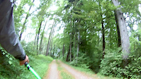
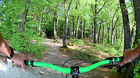
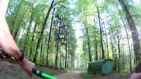
Photos of Baden Mountain Bike
Videos of Baden Mountain Bike
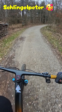
trail: Schlingelpeter
0:55 |
5 |
Mar 2, 2026
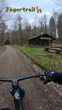
trail: Jägertrail
0:04 |
4 |
Mar 2, 2026
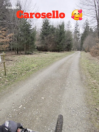
trail: Carosello di Giuseppe
2:00 |
14 |
Mar 1, 2026

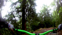
trail: Wasserturm DH
8:36 |
559 |
Apr 1, 2019
trail: Hundsbuck
0:30 |
8 |
May 14, 2018
trail: Unterwilerberg Trail
3:18 |
19 |
May 13, 2018
trail: Staldenflow 1
2:10 |
33 |
Apr 26, 2018
trail: Carosello di Giuseppe
2:12 |
27 |
Apr 26, 2018
Recent Trail Reports
| status | trail | date | condition | info | user |
|---|---|---|---|---|---|
| Isolation Trail | May 17, 2026 @ 12:44pm (Europe/Zurich) May 17, 2026 | Variable | 7mjtRQ | ||
| Heizirüti | Apr 26, 2026 @ 4:31pm (Europe/Zurich) Apr 26, 2026 | Variable | Winters3 | ||
| Slippery Stone Trail | Apr 26, 2026 @ 4:27pm (Europe/Zurich) Apr 26, 2026 | Ideal | Winters3 | ||
| Wasserturm DH | Apr 18, 2026 @ 11:12pm (Europe/Zurich) Apr 18, 2026 | Ideal | Winters3 | ||
| Unterwilerberg Trail | Apr 18, 2026 @ 10:45pm (Europe/Zurich) Apr 18, 2026 | Variable | Winters3 | ||
| Kappeler | Apr 18, 2026 @ 10:44pm (Europe/Zurich) Apr 18, 2026 | Variable | Winters3 | ||
| Hägeler DH | Apr 18, 2026 @ 10:31pm (Europe/Zurich) Apr 18, 2026 | Unknown | Winters3 | ||
| Münzlihausen DH | Apr 15, 2026 @ 6:13pm (Europe/Zurich) Apr 15, 2026 | Wet | Winters3 | ||
| Hägeler Access | Apr 15, 2026 @ 6:13pm (Europe/Zurich) Apr 15, 2026 | Ideal | Winters3 | ||
| Allmend Connector | Apr 15, 2026 @ 6:13pm (Europe/Zurich) Apr 15, 2026 | Wet | Winters3 |
Activity Feed
| username | action | type | title | date |
|---|---|---|---|---|
| Cuno67 | ridden | trail | activity #97254282 and 1 more | Jun 18, 2026 @ 8:32am 2 days |
| BroccoliAG | ridden | trail | activity #97239559 and 1 more | Jun 18, 2026 @ 2:39am 2 days |
| Miguellol | add | photo | activity #96497904 and 7 more | Jun 7, 2026 @ 2:28pm Jun 7, 2026 |
| Christine2mUq6I | wishlist | trail | activity #96011311 and 2 more | Jun 1, 2026 @ 5:42am Jun 1, 2026 |
| GillesdezShJw8 | wishlist | trail | activity #95558010 and 1 more | May 26, 2026 @ 5:34am May 26, 2026 |
Recent Comments
| username | type | title | comment | date |
|---|---|---|---|---|
| trail | Top section good, Bottom section nearly... | Aug 8, 2025 @ 3:26am Aug 8, 2025 | ||
| trail | Topsection overgrown, Bottom section nearly... | May 16, 2025 @ 7:10pm May 16, 2025 | ||
| trail | tree at the middle section | May 10, 2025 @ 8:58am May 10, 2025 | ||
| report | Bottom part rideable but only for experienced... | Aug 29, 2024 @ 1:50pm Aug 29, 2024 | ||
| report | Fact & true. Time to remove this entry... | Jul 2, 2023 @ 2:09am Jul 2, 2023 |
Local Badges
-

Completionist0 awarded -

Big Ride 30k2,155 awarded -

Epic Ride 50k670 awarded -

Top 10 Trails7 awarded -

Descent 100k Badge7 awarded -
Completionist0 awarded
Activity Type Stats
| activitytype | trails | distance | descent | descent distance | total vertical | rating | global rank | state rank | photos | reports | routes | ridelogs |
|---|---|---|---|---|---|---|---|---|---|---|---|---|
| Mountain Bike | 100 | 46 miles | 12,054 ft | 25 miles | 1,224 ft | #2,096 | #25 | 105 | 1,343 | 4 | 12,700 | |
| E-Bike | 100 | 46 miles | 12,054 ft | 25 miles | 1,224 ft | #1,697 | #77 | 10 | 1,293 | 5 | 1,827 | |
| Gravel Bike | 1 | #1,217 | #9 | 4 | 59 | |||||||
| Adaptive Bike | 1 | #205 | #94 | 2 | ||||||||
| Horse | 3 | 1 mile | 75 ft | 2,598 ft | 653 ft | 207 | ||||||
| Hike | 88 | 43 miles | 10,797 ft | 23 miles | 1,224 ft | #3,302 | #58 | 8 | 1,292 | 476 | ||
| Trail Running | 88 | 43 miles | 10,797 ft | 23 miles | 1,224 ft | #2,789 | #46 | 1,292 | 1,328 |
Frequently Asked Questions About Baden
▼
What are the best places to ride in Baden?
Baden has 3 areas to explore for mountain biking. The top rated areas are:
▼
What are the highest rated mountain biking trails in Baden?
The highest rated mountain biking trails in Baden are:
- Carosello di Giuseppe (4.2/5)
- Baldegg Playground (4.2/5)
- Häxehöhli DH (4.2/5)
- Shroomer Trail (4.2/5)
- Unterwilerberg Trail (4.2/5)
▼
What is the best time of the year to ride in Baden?
Based on ride log data, the most popular months to ride in Baden are:
- August (75 activities)
- April (73 activities)
- September (63 activities)
▼
Where can I park to ride in Baden?
There are 3 parking locations listed in Baden. The most popular parking spots are: View all parking and trailhead locations on the map to plan your visit.
Activities
Trails
Points of Interest
- By CHsurfer & contributors
- Admins: Baden Brugg
- #18675 - 7,761 views
- baden activity log | embed map of Baden mountain bike trails | baden mountain biking points of interest
Downloading of trail gps tracks in kml & gpx formats is enabled for Baden.
You must login to download files.