close
-
Layers w
- Weather Layers
- Pro
- Pro
- Pro
- Pro
- Pro
- Pro
- More Layers
- Pro
- Pro
- Pro
- Pro
-
Upgrade to

3D
Trail Conditions
- Unknown
- Snow Groomed
- Snow Packed
- Snow Covered
- Snow Cover Partial
- Freeze/thaw Cycle
- Icy
- Prevalent Mud
- Wet
- Variable
- Ideal
- Dry
- Very Dry
Trail Flow (Ridden Direction)
Trailforks scans users ridelogs to determine the most popular direction each trail is ridden. A good flowing trail network will have most trails flowing in a single direction according to their intension.
The colour categories are based on what percentage of riders are riding a trail in its intended direction.
The colour categories are based on what percentage of riders are riding a trail in its intended direction.
- > 96%
- > 90%
- > 80%
- > 70%
- > 50%
- < 50%
- bi-directional trail
- no data
Trail Last Ridden
Trailforks scans ridelogs to determine the last time a trail was ridden.
- < 2 days
- < 1 week
- < 2 weeks
- < 1 month
- < 6 months
- > 6 months
Trail Ridden Direction
The intended direction a trail should be ridden.
- Downhill Only
- Downhill Primary
- Both Directions
- Uphill Primary
- Uphill Only
- One Direction
Contribute Details
Colors indicate trail is missing specified detail.
- Description
- Photos
- Description & Photos
- Videos
Trail Popularity ?
Trailforks scans ridelogs to determine which trails are ridden the most in the last 9 months.
Trails are compared with nearby trails in the same city region with a possible 25 colour shades.
Think of this as a heatmap, more rides = more kinetic energy = warmer colors.
- most popular
- popular
- less popular
- not popular
ATV/ORV/OHV Filter
Max Vehicle Width
inches
US Cell Coverage
Legend

Radar Time
Activity Recordings
Trailforks uses anonymized public activity data.
?
Activity Recordings
Trailforks uses anonymized public activity data.
?
Personal Heatmap
▶
Activity Types
all
/
none
▶
Options
2
Date range
month
–
Winter Trails
Warning
A routing network for winter maps does not exist. Selecting trails using the winter trails layer has been disabled.
Missing Trails
Most Popular
Least Popular
Trails are colored based on popularity. The more popular a trail is, the more red. Less popular trails trend towards green.
Jump Magnitude Heatmap
Heatmap of where riders jump on trails. Zoom in to see individual jumps, click circles to view jump details.
BC Backroad Status
![map legend]()
Service Road Atlas is a free to use, community-driven service for viewing and creating reports on the numerous back-country service roads around B.C. and Alberta.

Slope Aspect
Direction the slope faces
Trails Deemphasized
Trails are shown in grey.
Only show trails with no bike usage.
Suggested Layers
Based on selected activity type
Save the current map location and zoom level as your default home location whenever this page is loaded.
Save
No description for Bagno di Romagna has been added yet!
Login or register to submit one.
Primary Trail Type: All-Mountain & Downhill
This region uses the Uk/Euro style trail grading system.
Activities Click to view
- Mountain Bike
46 trails
- E-Bike
44 trails
- Gravel Bike
0 trails
- Adaptive Bike
0 trails
- Winter Fat Bike
0 trails
- Horse
16 trails
- Hike
42 trails
- Trail Running
41 trails
Region Details
- 11
- 3
- 17
Region Status
Caution as of Jun 13, 2026Stats
- Avg Trail Rating
- Trails (view details)
- 38
- Trails Mountain Bike
- 46
- Trails E-Bike
- 44
- Trails Horse
- 16
- Trails Hike
- 42
- Trails Trail Running
- 41
- Trails Dirtbike/Moto
- 1
- Total Distance
- 73 miles
- Total Descent
- 28,662 ft
- Total Vertical
- 3,063 ft
- Highest Trailhead
- 4,075 ft
- Reports
- 389
- Photos
- 44
- Ridden Counter
- 2,203
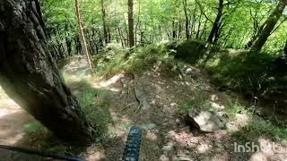
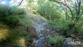
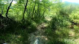
Popular Bagno di Romagna Mountain Biking Trails
• 75 ★ 4.8 • 3 miles • 156 ft • 128 •
Arrivatio al Passo Serre inizia la discesa, prima in bosco ripido, poi un fantastico scrinale scoperto di roccia, esposto, infine parte finale in single track molto ripido, passaggi su lastre di roccia memorabili.
• 100 ★ 4.6 • 2 miles • 91 ft • 101 •
Highly rated popular red difficulty singletrack. This mountain bike primary trail can be used downhill only and has a hard overall physical rating. It features rock garden. Trail visibility is always easy to follow. On average it takes 21 minutes to complete this trail.
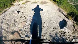
• 80 ★ 4.0 • 2 miles • 326 ft • 72 •
Highly rated popular blue difficulty singletrack. This mountain bike primary trail can be used downhill only and has a hard overall physical rating. It features rock face. Trail visibility is always easy to follow. On average it takes 21 minutes to complete this trail.
• 65 ★ 4.0 • 3 miles • 31 ft • 55 •
Moderately popular blue difficulty singletrack. This mountain bike primary trail can be used downhill only and has a hard overall physical rating. It features rock face. Adaptive MTB rating: amtb blue. Trail visibility is always easy to follow. On average it takes 22 minutes to complete this trail.
• 60 ★ 4.2 • 2 miles • 206 ft • 52 •
Moderately popular red difficulty singletrack. This mountain bike primary trail can be used downhill only and has a hard overall physical rating. It features rock face. Trail visibility is always easy to follow. On average it takes 23 minutes to complete this trail.
• 45 ★ 4.2 • 2 miles • 75 ft • 49 •
Trail molto tecnico ed esposto con una vista Eccezzionale! Attenzione al punto in cui c'è la occorre scendere e condurre a mano la bici. Occorre moderare la velocità in quanto ci sono punti stretti e pericolosi.Alla fine del trail si...
• 55 ★ 4.2 • 2 miles • 7 ft • 41 •
Uno dei percorsi in stile "freeride" più iconici nei dintorni di Bagno di Romagna. La prima parte ha diversi ripidi in mezzo al bosco per poi proseguire sempre su roccia fino in fondo , non mancano le parti esposte e ripidoni di...
Bagno di Romagna Mountain Bike Routes
★ 4.0 • 18 miles • 3,759 ft • 0 • Loop •
Giro panoramico, alcuni tratti di salita su asfalto, saliscendi nel bosco e discesa da Zuccherodante su...
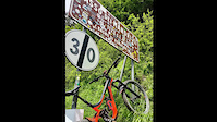
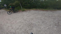
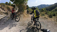
Photos of Bagno di Romagna Mountain Bike
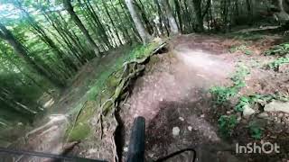
Videos of Bagno di Romagna Mountain Bike
trail: Zucchero Dante
14:37 |
85 |
Jun 20, 2023
trail: Farniole
4:22 |
81 |
Mar 30, 2023
trail: Siepe dell'orso
13:03 |
72 |
Oct 18, 2022
trail: L'Eremo Nuovo
2:43 |
66 |
Sep 9, 2025 , Bagno di Romagna
trail: Becca Freeride
4:45 |
80 |
Sep 9, 2025 , Bagno di Romagna
trail: Carabina Trail
8:50 |
97 |
Sep 9, 2025 , Bagno di Romagna
trail: Chiardovo Freeride
5:30 |
91 |
Sep 5, 2025 , Bagno di Romagna
trail: Il trogo
4:59 |
65 |
Aug 3, 2025 , Bagno di Romagna
Recent Trail Reports
| status | trail | date | condition | info | user |
|---|---|---|---|---|---|
| Zucchero Dante | Jun 13, 2026 @ 1:20pm (Europe/Rome) Jun 13, 2026 | Unknown | massimomilani | ||
| Rio Salso MTB | Apr 26, 2026 @ 9:43am (Europe/San_Marino) Apr 26, 2026 | Variable | meliobike | ||
| Risalita da Pietrapazza | Apr 26, 2026 @ 9:43am (Europe/San_Marino) Apr 26, 2026 | Ideal | meliobike | ||
| Siepe dell'orso | Apr 26, 2026 @ 9:43am (Europe/San_Marino) Apr 26, 2026 | Ideal | meliobike | ||
| Farniole | Apr 11, 2026 @ 2:29pm (Europe/Rome) Apr 11, 2026 | Unknown | ErikCalis | ||
| Pratalino | Mar 21, 2026 @ 3:10pm (Europe/San_Marino) Mar 21, 2026 | Wet | MassimoFussi | ||
| Salita al passo Serra | Mar 7, 2026 @ 10:09am (Europe/San_Marino) Mar 7, 2026 | Prevalent Mud | Garru | ||
| Carabina Trail | Mar 7, 2026 @ 10:09am (Europe/San_Marino) Mar 7, 2026 | Variable | Garru | ||
| Monte Piano | Mar 7, 2026 @ 10:09am (Europe/San_Marino) Mar 7, 2026 | Dry | Garru | ||
| Trails Connector #1 | Mar 7, 2026 @ 10:09am (Europe/San_Marino) Mar 7, 2026 | Dry | Garru |
Activity Feed
| username | action | type | title | date |
|---|---|---|---|---|
| massimomilani | add | report | activity #96861813 | Jun 13, 2026 @ 4:20am Jun 13, 2026 |
| Pedromptorres | wishlist | region | activity #96167592 | Jun 3, 2026 @ 10:57am Jun 3, 2026 |
| Pedromptorres | wishlist | trail | activity #96167578 | Jun 3, 2026 @ 10:57am Jun 3, 2026 |
| LeonardoPoli | wishlist | route | activity #95964739 | May 31, 2026 @ 11:55am May 31, 2026 |
| Baccone85 | ridden | trail | activity #95429562 | May 24, 2026 @ 11:23am May 24, 2026 |
Recent Comments
| username | type | title | comment | date |
|---|---|---|---|---|
| report | .. | Mar 23, 2026 @ 2:08am Mar 23, 2026 | ||
| trail | Parte finale molto impegnativa, tra gradoni e... | Oct 18, 2025 @ 11:03am Oct 18, 2025 | ||
| trail | Condizioni perfette. Top | Oct 11, 2025 @ 4:15am Oct 11, 2025 | ||
| trail | [becca freeride] traccia ancora acerba seguire... | Sep 21, 2025 @ 11:42am Sep 21, 2025 | ||
| trail | Molto guidato, fondo prevanetemente flow ma... | Sep 9, 2025 @ 8:17am Sep 9, 2025 |
Local Badges
-

Epic Mountain Bike Climb 2k254 awarded -

Climbing 10k Badge24 awarded -

Mountain Biking 100k Badge1 awarded -

Epic Ride Descent 2k254 awarded -

Descent 10k Badge25 awarded -

Descent 100k Badge1 awarded
Activity Type Stats
| activitytype | trails | distance | descent | descent distance | total vertical | rating | global rank | state rank | photos | reports | routes | ridelogs |
|---|---|---|---|---|---|---|---|---|---|---|---|---|
| Mountain Bike | 46 | 73 miles | 28,661 ft | 41 miles | 3,064 ft | #2,728 | #129 | 33 | 389 | 2 | 2,003 | |
| E-Bike | 44 | 65 miles | 26,896 ft | 38 miles | 3,064 ft | #553 | #53 | 4 | 378 | 1 | 1,005 | |
| Horse | 16 | 32 miles | 9,193 ft | 15 miles | 2,661 ft | #862 | #25 | 14 | ||||
| Hike | 42 | 72 miles | 27,766 ft | 40 miles | 3,064 ft | #3,386 | #109 | 7 | 387 | 227 | ||
| Trail Running | 41 | 71 miles | 27,146 ft | 39 miles | 2,933 ft | #2,926 | #95 | 387 | 42 | |||
| Dirtbike/Moto | 1 | 2 miles | 512 ft | 1 mile | 335 ft | 4 |
Frequently Asked Questions About Bagno di Romagna
▼
What are the highest rated mountain biking trails in Bagno di Romagna?
The highest rated mountain biking trails in Bagno di Romagna are:
- Zucchero Dante (4.5/5)
- Corzano (4.3/5)
- Farniole (4.3/5)
- Carabina Trail (4.1/5)
- Frana trail (4.1/5)
▼
What is the best time of the year to ride in Bagno di Romagna?
Based on ride log data, the most popular months to ride in Bagno di Romagna are:
- October (14 activities)
- September (6 activities)
- November (5 activities)
▼
Where can I park to ride in Bagno di Romagna?
Check the Bagno di Romagna trail map for trailhead and parking information. Community members regularly update access and parking details for trails in the area.
▼
What is the longest trail in Bagno di Romagna?
The longest trail in Bagno di Romagna is Rio Salso MTB at 8.4 km. View all trails sorted by distance.
Activities
Trails
Points of Interest
- By Gullo & contributors
- Admins: apply
- #11926 - 9,343 views
- bagno di romagna activity log | embed map of Bagno di Romagna mountain bike trails | bagno di romagna mountain biking points of interest
Downloading of trail gps tracks in kml & gpx formats is enabled for Bagno di Romagna.
You must login to download files.