close
-
Layers w
- Weather Layers
- Pro
- Pro
- Pro
- Pro
- Pro
- Pro
- More Layers
- Pro
- Pro
- Pro
- Pro
-
Upgrade to

3D
Trail Conditions
- Unknown
- Snow Groomed
- Snow Packed
- Snow Covered
- Snow Cover Partial
- Freeze/thaw Cycle
- Icy
- Prevalent Mud
- Wet
- Variable
- Ideal
- Dry
- Very Dry
Trail Flow (Ridden Direction)
Trailforks scans users ridelogs to determine the most popular direction each trail is ridden. A good flowing trail network will have most trails flowing in a single direction according to their intension.
The colour categories are based on what percentage of riders are riding a trail in its intended direction.
The colour categories are based on what percentage of riders are riding a trail in its intended direction.
- > 96%
- > 90%
- > 80%
- > 70%
- > 50%
- < 50%
- bi-directional trail
- no data
Trail Last Ridden
Trailforks scans ridelogs to determine the last time a trail was ridden.
- < 2 days
- < 1 week
- < 2 weeks
- < 1 month
- < 6 months
- > 6 months
Trail Ridden Direction
The intended direction a trail should be ridden.
- Downhill Only
- Downhill Primary
- Both Directions
- Uphill Primary
- Uphill Only
- One Direction
Contribute Details
Colors indicate trail is missing specified detail.
- Description
- Photos
- Description & Photos
- Videos
Trail Popularity ?
Trailforks scans ridelogs to determine which trails are ridden the most in the last 9 months.
Trails are compared with nearby trails in the same city region with a possible 25 colour shades.
Think of this as a heatmap, more rides = more kinetic energy = warmer colors.
- most popular
- popular
- less popular
- not popular
ATV/ORV/OHV Filter
Max Vehicle Width
inches
US Cell Coverage
Legend

Radar Time
Activity Recordings
Trailforks uses anonymized public activity data.
?
Activity Recordings
Trailforks uses anonymized public activity data.
?
Personal Heatmap
▶
Activity Types
all
/
none
▶
Options
2
Date range
month
–
Winter Trails
Warning
A routing network for winter maps does not exist. Selecting trails using the winter trails layer has been disabled.
Missing Trails
Most Popular
Least Popular
Trails are colored based on popularity. The more popular a trail is, the more red. Less popular trails trend towards green.
Jump Magnitude Heatmap
Heatmap of where riders jump on trails. Zoom in to see individual jumps, click circles to view jump details.
BC Backroad Status
![map legend]()
Service Road Atlas is a free to use, community-driven service for viewing and creating reports on the numerous back-country service roads around B.C. and Alberta.

Slope Aspect
Direction the slope faces
Trails Deemphasized
Trails are shown in grey.
Only show trails with no bike usage.
Suggested Layers
Based on selected activity type
Save the current map location and zoom level as your default home location whenever this page is loaded.
Save
No description for Bagolino has been added yet!
Login or register to submit one.
This region uses the Uk/Euro style trail grading system.
Activities Click to view
- Mountain Bike
12 trails
- E-Bike
12 trails
- Hike
13 trails
- Trail Running
13 trails
- Downhill Ski
9 trails
- Backcountry Ski
6 trails
Region Details
- 1
- 1
- 1
Region Status
Caution as of Jul 14, 2025Stats
- Avg Trail Rating
- Trails (view details)
- 14
- Trails Mountain Bike
- 12
- Trails E-Bike
- 12
- Trails Hike
- 13
- Trails Trail Running
- 13
- Trails Downhill Ski
- 9
- Trails Backcountry Ski
- 6
- Total Distance
- 14 miles
- Total Descent
- 6,788 ft
- Total Vertical
- 2,892 ft
- Highest Trailhead
- 7,255 ft
- Reports
- 23
- Ridden Counter
- 144
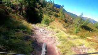
Popular Bagolino Mountain Biking Trails
• 100 ★ 4.0 • 3 miles • 43 ft • 24 •
Popular red difficulty singletrack. This mountain bike primary trail can be used downhill primary and has a hard overall physical rating with a 43 ft blue climb. Trail visibility is always easy to follow. On average it takes 1 hour24 minutes to complete this trail.
• 35 ★ 0.0 • 2 miles • 81 ft • 12 •
Less popular black difficulty singletrack. This mountain bike primary trail can be used downhill only and has a hard overall physical rating. It features rock face, rock garden and skinny. Trail visibility is always easy to follow. On average it takes 38 minutes to complete this trail.
• ★ 0.0 • 5 miles • 2,120 ft • 2 •
Sentiero in ambiente fantastico che collega Berzana con il rifugio Tita Secchi In mtb con una buona gamba si percorre quasi completamente anche in salita, in Emtb si percorre facilmente. In discesa è un S1 medio con qualche passaggio S2.
• ★ 0.0 • 2 miles • 1,242 ft • 1 •
Sentiero Tita Secchi - Laione Dal rifugio si sale su vecchia mulattiera troppo distrutta per poter essere percorsa anche in Emtb (quindi tutta a spinta), poi sempre a spinta non estrema si prosegue fino al Laione Dalla cima del Laione,...
• ★ 0.0 • 2,933 ft • 612 ft •
Sentiero che sale al Frerone dalla Cresta, è un canale a volte molto scavato, in salita non presenta particolari difficoltà ed è tutto a spinta. In discesa è un S4 con tratti S5 che necessita di estrema attenzione vista l'espositione
• ★ 0.0 • 1,529 ft • 326 ft •
Sentiero con prima parte S4 prosegue su un S3 medio, in salita è tutto a spinta
• ★ 0.0 • 1 mile • 19 ft •
Sentiero spettacolare che scende dal Monte Frerone, Inizialmente presenta qualche passaggio S4 poi porsegue con S2/S3 eccetto per i tornantini che potrebbero essere gradabili S4 l'ultimo tratto percorre un sentiero con brevi tratti...
Bagolino Mountain Bike Routes
12 miles • 879 ft • 0 •
Percorso per chi ama divertirsi in discesa, mai estremamente tecnico, ma che richiede comunque buone...
15 miles • 3,973 ft • 0 •
Percorso cross country medio/difficile che richiede un buon allenamento e una buona tecnica di guida del...
Recent Trail Reports
| status | trail | date | condition | info | user |
|---|---|---|---|---|---|
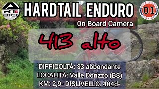
| 413 basso | Jul 12, 2025 @ 8:29am Jul 12, 2025 | Ideal | Berttom | ||
| 413 alto | Jul 12, 2025 @ 8:29am Jul 12, 2025 | Ideal | Berttom | ||
| Bruffione lungo | Sep 2, 2023 @ 12:02am Sep 2, 2023 | Variable | aalgisi |
Activity Feed
| username | action | type | title | date |
|---|---|---|---|---|
| FabioGoby | ridden | trail | activity #85246247 | Dec 8, 2025 @ 5:46am Dec 8, 2025 |
| mtbbresciafederico | ridden | trail | activity #84185060 and 2 more | Nov 15, 2025 @ 9:48am Nov 15, 2025 |
| alpinebrothers | add | poi | activity #81990266 | Oct 9, 2025 @ 12:02am Oct 9, 2025 |
| orobictrails-valebg | add | trail | activity #81115325 and 3 more | Sep 25, 2025 @ 11:12pm Sep 25, 2025 |
| raffganz | add | video | activity #80968848 | Sep 23, 2025 @ 12:18pm Sep 23, 2025 |
Recent Comments
| username | type | title | comment | date |
|---|---|---|---|---|
| trail | Sentiero naturale livello S3/S4 con qualche... | Jul 10, 2025 @ 2:22am Jul 10, 2025 |
Activity Type Stats
| activitytype | trails | distance | descent | descent distance | total vertical | rating | global rank | state rank | photos | reports | routes | ridelogs |
|---|---|---|---|---|---|---|---|---|---|---|---|---|
| Mountain Bike | 12 | 9 miles | 5,256 ft | 6 miles | 2,890 ft | #9,305 | #904 | 10 | 2 | 521 | ||
| E-Bike | 12 | 9 miles | 5,256 ft | 6 miles | 2,890 ft | #6,547 | #684 | 10 | 2 | 91 | ||
| Hike | 13 | 9 miles | 5,256 ft | 6 miles | 2,890 ft | #9,850 | #678 | 10 | 169 | |||
| Trail Running | 13 | 9 miles | 5,256 ft | 6 miles | 2,890 ft | #9,505 | #672 | 10 | 2 | |||
| Downhill Ski | 9 | #585 | #48 | 13 | 46 | |||||||
| Backcountry Ski | 6 | 5 miles | 1,532 ft | 3 miles | 2,119 ft | #358 | #26 | 99 |
Frequently Asked Questions About Bagolino
▼
What are the best places to ride in Bagolino?
Bagolino has 1 areas to explore for mountain biking.
▼
What are the highest rated mountain biking trails in Bagolino?
The highest rated mountain biking trails in Bagolino are:
- Bruffione lungo (4/5)
- 413 basso (0/5)
- 413 alto (0/5)
- Frerone Cresta Est (0/5)
- Berzana - Rig. Tita Secchi (0/5)
▼
What is the best time of the year to ride in Bagolino?
Based on ride log data, the most popular months to ride in Bagolino are:
- August (4 activities)
- July (3 activities)
- September (1 activities)
▼
Where can I park to ride in Bagolino?
Check the Bagolino trail map for trailhead and parking information. Community members regularly update access and parking details for trails in the area.
Activities
Trails
- By erripotter & contributors
- Admins: marcoangeletti, adessoomaipiu, micheletraversi
- #28431 - 909 views
- bagolino activity log | embed map of Bagolino mountain bike trails | bagolino mountain biking points of interest
Downloading of trail gps tracks in kml & gpx formats is enabled for Bagolino.
You must login to download files.