close
-
Layers w
- Weather Layers
- Pro
- Pro
- Pro
- Pro
- Pro
- Pro
- More Layers
- Pro
- Pro
- Pro
- Pro
-
Upgrade to

3D
Trail Conditions
- Unknown
- Snow Groomed
- Snow Packed
- Snow Covered
- Snow Cover Partial
- Freeze/thaw Cycle
- Icy
- Prevalent Mud
- Wet
- Variable
- Ideal
- Dry
- Very Dry
Trail Flow (Ridden Direction)
Trailforks scans users ridelogs to determine the most popular direction each trail is ridden. A good flowing trail network will have most trails flowing in a single direction according to their intension.
The colour categories are based on what percentage of riders are riding a trail in its intended direction.
The colour categories are based on what percentage of riders are riding a trail in its intended direction.
- > 96%
- > 90%
- > 80%
- > 70%
- > 50%
- < 50%
- bi-directional trail
- no data
Trail Last Ridden
Trailforks scans ridelogs to determine the last time a trail was ridden.
- < 2 days
- < 1 week
- < 2 weeks
- < 1 month
- < 6 months
- > 6 months
Trail Ridden Direction
The intended direction a trail should be ridden.
- Downhill Only
- Downhill Primary
- Both Directions
- Uphill Primary
- Uphill Only
- One Direction
Contribute Details
Colors indicate trail is missing specified detail.
- Description
- Photos
- Description & Photos
- Videos
Trail Popularity ?
Trailforks scans ridelogs to determine which trails are ridden the most in the last 9 months.
Trails are compared with nearby trails in the same city region with a possible 25 colour shades.
Think of this as a heatmap, more rides = more kinetic energy = warmer colors.
- most popular
- popular
- less popular
- not popular
ATV/ORV/OHV Filter
Max Vehicle Width
inches
US Cell Coverage
Legend

Radar Time
Activity Recordings
Trailforks uses anonymized public activity data.
?
Activity Recordings
Trailforks uses anonymized public activity data.
?
Personal Heatmap
▶
Activity Types
all
/
none
▶
Options
2
Date range
month
–
Winter Trails
Warning
A routing network for winter maps does not exist. Selecting trails using the winter trails layer has been disabled.
Missing Trails
Most Popular
Least Popular
Trails are colored based on popularity. The more popular a trail is, the more red. Less popular trails trend towards green.
Jump Magnitude Heatmap
Heatmap of where riders jump on trails. Zoom in to see individual jumps, click circles to view jump details.
BC Backroad Status
![map legend]()
Service Road Atlas is a free to use, community-driven service for viewing and creating reports on the numerous back-country service roads around B.C. and Alberta.

Slope Aspect
Direction the slope faces
Trails Deemphasized
Trails are shown in grey.
Only show trails with no bike usage.
Suggested Layers
Based on selected activity type
Save the current map location and zoom level as your default home location whenever this page is loaded.
Save
No description for Bakersfield has been added yet!
Login or register to submit one.
Activities Click to view
- Mountain Bike
9 trails
- E-Bike
7 trails
- Gravel Bike
0 trails
- Adaptive Bike
0 trails
- Hike
8 trails
- Trail Running
8 trails
Region Details
- 1
- 1
- 5
- 2
Region Status
Caution as of May 17, 2026Stats
- Avg Trail Rating
- Trails (view details)
- 9
- Trails Mountain Bike
- 9
- Trails E-Bike
- 7
- Trails Hike
- 8
- Trails Trail Running
- 8
- Total Distance
- 26 miles
- Total Descent Distance
- 4 miles
- Total Descent
- 1,739 ft
- Total Vertical
- 624 ft
- Highest Trailhead
- 947 ft
- Reports
- 34
- Photos
- 40
- Ridden Counter
- 431
Sub Regions
-
Hart Memorial Park
- 1
- 5
- 1
Popular Bakersfield Mountain Biking Trails
• 60 ★ 4.7 • 4,177 ft • 106 ft • 243 •
Highly rated moderately popular green difficulty singletrack. This multi-use trail can be used both directions and has a easy overall physical rating with a 106 ft blue climb. It features roller coaster. Trail visibility is always easy to follow. On average it takes 8 minutes to complete this trail.
• 80 ★ 4.3 • 1,434 ft • 0 ft • 109 •
Popular blue difficulty singletrack. This mountain bike primary trail can be used downhill primary and has a moderate overall physical rating. It features drop, jump, roller coaster and skinny. On average it takes 1 minutes to complete this trail.
• 90 ★ 4.0 • 1,381 ft • 0 ft • 39 •
Popular black diamond difficulty singletrack. This mountain bike primary trail can be used both directions. On average it takes 2 minutes to complete this trail.
• 70 ★ 0.0 • 3 miles • 422 ft • 37 •
Popular blue difficulty singletrack. This mountain bike primary trail can be used both directions with a 422 ft green climb.
• 100 ★ 0.0 • 2,402 ft • 14 ft • 36 •
Popular blue difficulty singletrack. This multi-use trail can be used one direction and has a moderate overall physical rating with a 14 ft black diamond climb. It features berm and jump. Adaptive MTB rating: amtb blue. Trail visibility is always easy to follow.
• 45 ★ 0.0 • 2,776 ft • 330 ft • 13 •
Moderately popular blue difficulty singletrack. This multi-use trail can be used both directions and has a moderate overall physical rating with a 330 ft blue climb.
• 15 ★ 2.0 • 5,269 ft • 33 ft • 8 •
Less popular blue difficulty singletrack. This multi-use trail can be used both directions and has a moderate overall physical rating with a 33 ft blue climb.
• 25 ★ 0.0 • 1,955 ft • 0 ft • 7 •
Less popular black diamond difficulty singletrack. This mountain bike primary trail can be used both directions.
Bakersfield Mountain Bike Routes
★ 5.0 • 8 miles • 812 ft • 1 • Loop •
There are not many recognized or mapped trails in this area. This includes the Cactus and trails into an 8...
59 miles • 7,455 ft • 1 •
Section 13 of the California to Canada trail, a long distance bikepacking route from Southern California...
• 21 miles • 51 ft • 0 •
• 30 miles • 100 ft • 1 •
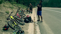
Photos of Bakersfield Mountain Bike
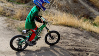
Videos of Bakersfield Mountain Bike
trail: Mr. Toads Wild Ride
5:35 |
237 |
Aug 22, 2016
trail: Mr. Toads Wild Ride
0:16 |
196 |
Oct 25, 2015

trail: Mr. Toads Wild Ride
2:22 |
621 |
Nov 13, 2018 , Bakersfield

trail: Mr. Toads Wild Ride
3:18 |
439 |
Jul 20, 2018 , Bakersfield
Recent Trail Reports
| status | trail | date | condition | info | user |
|---|---|---|---|---|---|
| Hart's Drop | May 17, 2026 @ 8:37am (America/Los_Angeles) May 17, 2026 | Very Dry | Levelo | ||
| Sidewinder | May 13, 2026 @ 9:00am (America/Los_Angeles) May 13, 2026 | Dry | Piper7717 | ||
| Hart Park Trail | Apr 28, 2025 @ 3:33pm Apr 28, 2025 | Dry | nicolecopti | ||
| Mr. Toads Wild Ride | Apr 28, 2025 @ 3:32pm Apr 28, 2025 | Dry | nicolecopti | ||
| Boat Drop Trail | Dec 10, 2024 @ 6:13pm Dec 10, 2024 | Dry | jacobsklaver | ||
| Kern River Parkway | Aug 28, 2024 @ 9:25pm Aug 28, 2024 | Unknown | MatthewLn5x8YJ | ||
| Dutchman Trail | Dec 24, 2023 @ 12:52am Dec 24, 2023 | Ideal | BMVW |
Activity Feed
| username | action | type | title | date |
|---|---|---|---|---|
| Levelo | add | report | activity #94928407 | May 17, 2026 @ 12:06pm May 17, 2026 |
| Piper7717 | add | report | activity #94636524 | May 13, 2026 @ 10:29am May 13, 2026 |
| shootymcface | wishlist | trail | activity #94589609 | May 12, 2026 @ 3:54pm May 12, 2026 |
| JanellJones | wishlist | trail | activity #90250037 | Mar 8, 2026 @ 8:52pm Mar 8, 2026 |
| havi32 | wishlist | trail | activity #89536631 | Feb 25, 2026 @ 12:56pm Feb 25, 2026 |
Recent Comments
| username | type | title | comment | date |
|---|---|---|---|---|
| trail | After all the rain we had there is a big rut... | Mar 6, 2023 @ 10:34am Mar 6, 2023 | ||
| trail | Very fun canyon ride. Short but with all kinds... | Apr 5, 2021 @ 7:30pm Apr 5, 2021 | ||
| trail | Mellow trail great for first timers and... | May 20, 2018 @ 3:39pm May 20, 2018 |
Bike & Skill Parks
| name | type | city | rating |
|---|---|---|---|
| Kern Raceway | skill park | Bakersfield |
Activity Type Stats
| activitytype | trails | distance | descent | descent distance | total vertical | rating | global rank | state rank | photos | reports | routes | ridelogs |
|---|---|---|---|---|---|---|---|---|---|---|---|---|
| Mountain Bike | 9 | 26 miles | 1,739 ft | 4 miles | 623 ft | #5,791 | #1,952 | 40 | 34 | 2 | 12,922 | |
| E-Bike | 7 | 5 miles | 1,585 ft | 3 miles | 367 ft | #6,697 | #2,015 | 28 | 1 | 551 | ||
| Hike | 8 | 26 miles | 1,598 ft | 4 miles | 623 ft | #7,293 | #2,580 | 33 | 172 | |||
| Trail Running | 8 | 26 miles | 1,598 ft | 4 miles | 623 ft | #6,810 | #2,229 | 33 | 23 |
Frequently Asked Questions About Bakersfield
▼
What are the best places to ride in Bakersfield?
Bakersfield has 1 areas to explore for mountain biking. The top rated areas are:
▼
What are the highest rated mountain biking trails in Bakersfield?
The highest rated mountain biking trails in Bakersfield are:
- Mr. Toads Wild Ride (4.3/5)
- Dutchman Trail (4.1/5)
- Boat Drop Trail (4/5)
- Sidewinder (0/5)
- Spanky's Loop (0/5)
▼
What is the best time of the year to ride in Bakersfield?
Based on ride log data, the most popular months to ride in Bakersfield are:
- May (16 activities)
- September (15 activities)
- April (14 activities)
▼
Where can I park to ride in Bakersfield?
There are 1 parking locations listed in Bakersfield. The most popular parking spots are:
Activities
Trails
Points of Interest
- By sbrdude1 & contributors
- Admins: apply
- #3415 - 8,401 views
- bakersfield activity log | embed map of Bakersfield mountain bike trails | bakersfield mountain biking points of interest
Downloading of trail gps tracks in kml & gpx formats is enabled for Bakersfield.
You must login to download files.