close
-
Layers w
- Weather Layers
- Pro
- Pro
- Pro
- Pro
- Pro
- Pro
- More Layers
- Pro
- Pro
- Pro
- Pro
-
Upgrade to

3D
Trail Conditions
- Unknown
- Snow Groomed
- Snow Packed
- Snow Covered
- Snow Cover Partial
- Freeze/thaw Cycle
- Icy
- Prevalent Mud
- Wet
- Variable
- Ideal
- Dry
- Very Dry
Trail Flow (Ridden Direction)
Trailforks scans users ridelogs to determine the most popular direction each trail is ridden. A good flowing trail network will have most trails flowing in a single direction according to their intension.
The colour categories are based on what percentage of riders are riding a trail in its intended direction.
The colour categories are based on what percentage of riders are riding a trail in its intended direction.
- > 96%
- > 90%
- > 80%
- > 70%
- > 50%
- < 50%
- bi-directional trail
- no data
Trail Last Ridden
Trailforks scans ridelogs to determine the last time a trail was ridden.
- < 2 days
- < 1 week
- < 2 weeks
- < 1 month
- < 6 months
- > 6 months
Trail Ridden Direction
The intended direction a trail should be ridden.
- Downhill Only
- Downhill Primary
- Both Directions
- Uphill Primary
- Uphill Only
- One Direction
Contribute Details
Colors indicate trail is missing specified detail.
- Description
- Photos
- Description & Photos
- Videos
Trail Popularity ?
Trailforks scans ridelogs to determine which trails are ridden the most in the last 9 months.
Trails are compared with nearby trails in the same city region with a possible 25 colour shades.
Think of this as a heatmap, more rides = more kinetic energy = warmer colors.
- most popular
- popular
- less popular
- not popular
ATV/ORV/OHV Filter
Max Vehicle Width
inches
US Cell Coverage
Legend

Radar Time
Activity Recordings
Trailforks uses anonymized public activity data.
?
Activity Recordings
Trailforks uses anonymized public activity data.
?
Personal Heatmap
▶
Activity Types
all
/
none
▶
Options
2
Date range
month
–
Winter Trails
Warning
A routing network for winter maps does not exist. Selecting trails using the winter trails layer has been disabled.
Missing Trails
Most Popular
Least Popular
Trails are colored based on popularity. The more popular a trail is, the more red. Less popular trails trend towards green.
Jump Magnitude Heatmap
Heatmap of where riders jump on trails. Zoom in to see individual jumps, click circles to view jump details.
BC Backroad Status
![map legend]()
Service Road Atlas is a free to use, community-driven service for viewing and creating reports on the numerous back-country service roads around B.C. and Alberta.

Slope Aspect
Direction the slope faces
Trails Deemphasized
Trails are shown in grey.
Only show trails with no bike usage.
Suggested Layers
Based on selected activity type
Save the current map location and zoom level as your default home location whenever this page is loaded.
Save
No description for Ballarat has been added yet!
Login or register to submit one.
Activities Click to view
- Mountain Bike
52 trails
- E-Bike
12 trails
- Adaptive Bike
0 trails
- Hike
48 trails
- Trail Running
48 trails
Region Details
- 2
- 2
- 10
- 21
- 8
- 3
Region Status
Caution as of Jun 15, 2026Stats
- Avg Trail Rating
- Trails (view details)
- 47
- Trails Mountain Bike
- 52
- Trails E-Bike
- 12
- Trails Hike
- 48
- Trails Trail Running
- 48
- Total Distance
- 75 miles
- Total Descent
- 5,548 ft
- Total Vertical
- 1,527 ft
- Highest Trailhead
- 2,473 ft
- Reports
- 1,112
- Photos
- 182
- Ridden Counter
- 6,680
Sub Regions
-
Black Hill Bike Park
- 2
- 3
- 2
- 2
- 3
-
Nerrina Trails
- 1
- 2
- 6
-
Woowookarung Regional Park
- 5
- 11
Popular Ballarat Mountain Biking Trails
• 95 ★ 4.4 • 1,873 ft • 9 ft • 340 •
Popular double black diamond difficulty singletrack. This mountain bike primary trail can be used downhill only and has a hard overall physical rating. It features berm, jump, gap jump and rock garden. Trail visibility is sometimes hard to follow. On average it takes 6 minutes to complete this trail.
• 90 ★ 4.4 • 1,266 ft • 4 ft • 333 •
Black Hill being only minutes from the centre of Ballarat, is the spot for downhill in town. The tracks vary in level, and with so many sections, you can put together your own run to suit your abilities. All the tracks at Black Hill are...
• 85 ★ 4.7 • 4,692 ft • 240 ft • 298 •
Popular blue difficulty singletrack. This mountain bike primary trail can be used one direction. On average it takes 8 minutes to complete this trail.
• 95 ★ 4.5 • 4,841 ft • 152 ft • 293 •
Popular blue difficulty singletrack. This mountain bike primary trail can be used one direction. On average it takes 9 minutes to complete this trail.
• 85 ★ 3.3 • 3,967 ft • 83 ft • 275 •
Popular green difficulty singletrack. This mountain bike primary trail can be used one direction. On average it takes 5 minutes to complete this trail.
• 85 ★ 4.3 • 1,487 ft • 42 ft • 261 •
Popular black diamond difficulty singletrack. This mountain bike primary trail can be used downhill only. It features berm and jump. On average it takes 4 minutes to complete this trail.
• 55 ★ 4.7 • 1,549 ft • 0 ft • 236 •
Moderately popular double black diamond difficulty singletrack. This mountain bike primary trail can be used downhill only and has a extreme overall physical rating. It features berm, drop, jump, gap jump and rock garden. Trail visibility is sometimes hard to follow. On average it takes 7 minutes to complete this trail.
Ballarat Mountain Bike Routes
★ 4.5 • 3 miles • 375 ft • 3 • Point to Point •
Old school natural XC/Trail riding, mostly Blue Square with a few challenging Black Diamond sections. Flat...
15 miles • 1,210 ft • 6 •
Swagmen used to talk about “taking to the wallaby track” and swamp wallabies are common in the...
★ 1.0 • 126 miles • 9,115 ft • 13 •
Duel suspension mtn bike recommended. The trail can be hard to follow at times.
28 miles • 2,028 ft • 9 •
40km Mountain bike loop, Ballarat Cycle Classic, Cancer Research Fundraiser
32 miles • 2,780 ft • 13 • Out & Back •
Ballarat Cycle Classic 50km route
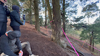
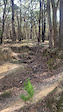
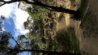
Photos of Ballarat Mountain Bike
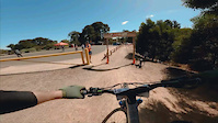
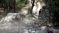
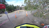
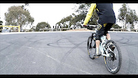
Videos of Ballarat Mountain Bike

trail: Alluvial
0:30 |
86 |
Aug 18, 2024
trail: Alluvial
0:30 |
37 |
Aug 18, 2024
trail: Nerrina - Yarrowee Link
0:06 |
104 |
May 3, 2023
trail: Alluvial
0:53 |
|
Feb 19, 2023
trail: Open Cut
0:08 |
964 |
Mar 21, 2020
trail: Open Cut
0:11 |
|
Nov 15, 2019
trail: Claim Jumper
0:12 |
1120 |
Jul 28, 2019
trail: Open Cut
0:00 |
473 |
Sep 5, 2018
Recent Trail Reports
| status | trail | date | condition | info | user |
|---|---|---|---|---|---|
| Kids Play | Sep 13, 2025 @ 1:53pm (Australia/Melbourne) Sep 12, 2025 | Ideal | dean6500 | ||
| Nuggety Dam | Nov 30, 2024 @ 10:31am Nov 30, 2024 | Wet | Squizza75 | ||
| Moto SW | Nov 16, 2024 @ 9:31am Nov 16, 2024 | Dry | Squizza75 | ||
| Gap Track | Nov 13, 2024 @ 6:25pm Nov 13, 2024 | Ideal | Squizza75 | ||
| Rock Track | Nov 13, 2024 @ 6:25pm Nov 13, 2024 | Ideal | Squizza75 | ||
| Big Kids Play | Nov 13, 2024 @ 6:25pm Nov 13, 2024 | Dry | Squizza75 | ||
| The Golden Mile | Nov 13, 2024 @ 6:25pm Nov 13, 2024 | Very Dry | Squizza75 | ||
| Off to Church | Nov 9, 2024 @ 1:32pm Nov 9, 2024 | Dry | Squizza75 | ||
| Eastside XC Loop | Dec 22, 2023 @ 8:14am Dec 22, 2023 | Dry | Bam4130 | ||
| Claim Jumper | Dec 2, 2023 @ 8:21am Dec 2, 2023 | Variable | dean6500 |
Activity Feed
| username | action | type | title | date |
|---|---|---|---|---|
| ak0047 | ridden | trail | activity #96592080 | Jun 9, 2026 @ 2:16am Jun 9, 2026 |
| justinL5A3JS | wishlist | route | activity #93010221 | Apr 20, 2026 @ 4:35am Apr 20, 2026 |
| Seaston | wishlist | route | activity #91811637 | Apr 3, 2026 @ 4:19am Apr 3, 2026 |
| GetWarren | wishlist | route | activity #88397465 | Feb 5, 2026 @ 2:04pm Feb 5, 2026 |
| markholloway | update | route | activity #88323123 | Feb 4, 2026 @ 7:13am Feb 4, 2026 |
Recent Comments
| username | type | title | comment | date |
|---|---|---|---|---|
| trail | This trail is now permanently closed by ParksVic | Nov 20, 2023 @ 11:33am Nov 20, 2023 | ||
| report | Dry and dusty | Feb 27, 2021 @ 11:51pm Feb 27, 2021 | ||
| trail | Climb is a bit steep, make sure to warm up. :) | Dec 26, 2020 @ 12:27am Dec 26, 2020 | ||
| report | A few muddy sections | Nov 29, 2020 @ 10:10pm Nov 29, 2020 | ||
| trail | A Great trail to introduce new comers to the... | Oct 17, 2020 @ 8:13pm Oct 17, 2020 |
Local Badges
-

10 Blue Trails76 awarded -

Epic Ride Climb 2k60 awarded -

Climbing 10k Badge68 awarded -

Climbing 100k Badge8 awarded -

Epic Ride Descent 2k62 awarded -

Descent 10k Badge68 awarded
Bike & Skill Parks
| name | type | city | rating |
|---|---|---|---|
| Bottom Pump Track | skill park | Ballarat | |
| Top Pump Track | skill park | Ballarat |
Activity Type Stats
| activitytype | trails | distance | descent | descent distance | total vertical | rating | global rank | state rank | photos | reports | routes | ridelogs |
|---|---|---|---|---|---|---|---|---|---|---|---|---|
| Mountain Bike | 52 | 73 miles | 5,364 ft | 41 miles | 1,529 ft | #1,479 | #77 | 182 | 1,112 | 18 | 17,854 | |
| E-Bike | 12 | 40 miles | 1,414 ft | 26 miles | 1,529 ft | #2,291 | #111 | 1,014 | 1 | 1,079 | ||
| Hike | 48 | 75 miles | 5,364 ft | 42 miles | 1,529 ft | #2,325 | #67 | 1,105 | 3 | 501 | ||
| Trail Running | 48 | 75 miles | 5,364 ft | 42 miles | 1,529 ft | #1,735 | #49 | 1,102 | 3 | 1,053 |
Frequently Asked Questions About Ballarat
▼
What are the best places to ride in Ballarat?
Ballarat has 3 areas to explore for mountain biking. The top rated areas are:
▼
What are the highest rated mountain biking trails in Ballarat?
The highest rated mountain biking trails in Ballarat are:
- Crit Loop Extension (4.3/5)
- Eastside XC Loop (4.2/5)
- Open Cut (4.2/5)
- Westside Blue XC Loop (4.2/5)
- Alluvial (4.1/5)
▼
What is the best time of the year to ride in Ballarat?
Based on ride log data, the most popular months to ride in Ballarat are:
- February (69 activities)
- March (56 activities)
- August (53 activities)
▼
Where can I park to ride in Ballarat?
Activities
Trails
- By SouthCoastMedia & contributors
- Admins: Victoria
- #5778 - 19,876 views
- ballarat activity log | embed map of Ballarat mountain bike trails | ballarat mountain biking points of interest
Downloading of trail gps tracks in kml & gpx formats is enabled for Ballarat.
You must login to download files.