close
-
Layers w
- Weather Layers
- Pro
- Pro
- Pro
- Pro
- Pro
- Pro
- More Layers
- Pro
- Pro
- Pro
- Pro
-
Upgrade to

3D
Trail Conditions
- Unknown
- Snow Groomed
- Snow Packed
- Snow Covered
- Snow Cover Partial
- Freeze/thaw Cycle
- Icy
- Prevalent Mud
- Wet
- Variable
- Ideal
- Dry
- Very Dry
Trail Flow (Ridden Direction)
Trailforks scans users ridelogs to determine the most popular direction each trail is ridden. A good flowing trail network will have most trails flowing in a single direction according to their intension.
The colour categories are based on what percentage of riders are riding a trail in its intended direction.
The colour categories are based on what percentage of riders are riding a trail in its intended direction.
- > 96%
- > 90%
- > 80%
- > 70%
- > 50%
- < 50%
- bi-directional trail
- no data
Trail Last Ridden
Trailforks scans ridelogs to determine the last time a trail was ridden.
- < 2 days
- < 1 week
- < 2 weeks
- < 1 month
- < 6 months
- > 6 months
Trail Ridden Direction
The intended direction a trail should be ridden.
- Downhill Only
- Downhill Primary
- Both Directions
- Uphill Primary
- Uphill Only
- One Direction
Contribute Details
Colors indicate trail is missing specified detail.
- Description
- Photos
- Description & Photos
- Videos
Trail Popularity ?
Trailforks scans ridelogs to determine which trails are ridden the most in the last 9 months.
Trails are compared with nearby trails in the same city region with a possible 25 colour shades.
Think of this as a heatmap, more rides = more kinetic energy = warmer colors.
- most popular
- popular
- less popular
- not popular
ATV/ORV/OHV Filter
Max Vehicle Width
inches
US Cell Coverage
Legend

Radar Time
Activity Recordings
Trailforks uses anonymized public activity data.
?
Activity Recordings
Trailforks uses anonymized public activity data.
?
Personal Heatmap
▶
Activity Types
all
/
none
▶
Options
2
Date range
month
–
Winter Trails
Warning
A routing network for winter maps does not exist. Selecting trails using the winter trails layer has been disabled.
Missing Trails
Most Popular
Least Popular
Trails are colored based on popularity. The more popular a trail is, the more red. Less popular trails trend towards green.
Jump Magnitude Heatmap
Heatmap of where riders jump on trails. Zoom in to see individual jumps, click circles to view jump details.
BC Backroad Status
![map legend]()
Service Road Atlas is a free to use, community-driven service for viewing and creating reports on the numerous back-country service roads around B.C. and Alberta.

Slope Aspect
Direction the slope faces
Trails Deemphasized
Trails are shown in grey.
Only show trails with no bike usage.
Suggested Layers
Based on selected activity type
Save the current map location and zoom level as your default home location whenever this page is loaded.
Save
No description for Ballingry has been added yet!
Login or register to submit one.
This region uses the Uk/Euro style trail grading system.
Activities Click to view
- Mountain Bike
66 trails
- E-Bike
61 trails
- Adaptive Bike
0 trails
- Hike
47 trails
- Trail Running
47 trails
Region Details
- 13
- 24
- 16
- 5
- 6
Region Status
Open as of Dec 21, 2025Stats
- Avg Trail Rating
- Trails (view details)
- 64
- Trails Mountain Bike
- 66
- Trails E-Bike
- 61
- Trails Horse
- 1
- Trails Hike
- 47
- Trails Trail Running
- 47
- Trails Nordic Ski
- 1
- Total Distance
- 19 miles
- Total Descent Distance
- 9 miles
- Total Descent
- 3,690 ft
- Total Vertical
- 847 ft
- Highest Trailhead
- 1,148 ft
- Reports
- 124
- Photos
- 19
- Ridden Counter
- 4,869
Sub Regions
-
Benarty Hill
- 4
- 4
- 6
-
Lochore Meadows
- 21
- 12
Popular Ballingry Mountain Biking Trails
• 100 ★ 0.0 • 955 ft • 0 ft • 173 •
Popular blue difficulty singletrack. This multi-use trail can be used one direction. Trail visibility is always easy to follow. On average it takes 1 minutes to complete this trail.
• 90 ★ 0.0 • 951 ft • 10 ft • 150 •
Popular blue difficulty singletrack. This mountain bike primary trail can be used one direction. Trail visibility is always easy to follow. On average it takes 1 minutes to complete this trail.
• 90 ★ 0.0 • 1,171 ft • 2 ft • 141 •
Popular blue difficulty singletrack. This mountain bike primary trail can be used both directions. Trail visibility is always easy to follow. On average it takes 1 minutes to complete this trail.
• 85 ★ 0.0 • 797 ft • 0 ft • 138 • • hike
Popular green difficulty singletrack. This hike primary trail can be used both directions. On average it takes 3 minutes to complete this trail.
• 90 ★ 2.0 • 1,178 ft • 65 ft • 137 • • hike
Popular green difficulty family friendly gravel path. This hike primary trail can be used both directions and has a easy overall physical rating with a 65 ft green climb. Trail visibility is always easy to follow. On average it takes 1 minutes to complete this trail.
• 85 ★ 0.0 • 1,047 ft • 0 ft • 125 •
Popular blue difficulty singletrack. This mountain bike primary trail can be used one direction. Trail visibility is always easy to follow. On average it takes 1 minutes to complete this trail.
• 60 ★ 0.0 • 804 ft • 6 ft • 124 • • hike
Moderately popular green difficulty gravel path. This hike primary trail can be used both directions. Trail visibility is always easy to follow. On average it takes 1 minutes to complete this trail.
Photos of Ballingry Mountain Bike
Videos of Ballingry Mountain Bike
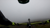
trail: Benarty DH
2:55 |
687 |
Apr 7, 2019

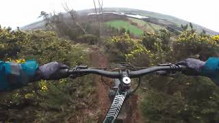
trail: Benarty DH
4:06 |
2914 |
Jun 23, 2018
youtuber
![Benarty]()

trail: Benarty DH
5:58 |
62 |
Apr 21, 2026 , Ballingry
youtuber
![Back At Benarty Hill. Benarty Hill mtb. Fife...]()
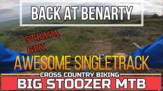
trail: Harran Hill Path
20:12 |
137 |
Jun 9, 2023 , Ballingry

youtuber
![Back At Benarty Hill. Benarty Hill mtb. Fife...]()

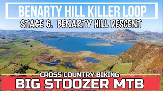
trail: Trig Point Path
20:12 |
159 |
Jun 9, 2023 , Ballingry
Recent Trail Reports
| status | trail | date | condition | info | user |
|---|---|---|---|---|---|
| All Ability Trail | Dec 21, 2025 @ 4:08pm (Europe/London) Dec 21, 2025 | Wet | ddd333hhh | ||
| All Ability Trail | Dec 21, 2025 @ 11:22am (Europe/London) Dec 21, 2025 | Wet | ddd333hhh | ||
| Trail | Dec 21, 2025 @ 11:22am (Europe/London) Dec 21, 2025 | Wet | ddd333hhh | ||
| Trail | Dec 21, 2025 @ 11:22am (Europe/London) Dec 21, 2025 | Wet | ddd333hhh | ||
| Access Road | Dec 21, 2025 @ 11:22am (Europe/London) Dec 21, 2025 | Wet | ddd333hhh | ||
| Access Road | Dec 21, 2025 @ 11:22am (Europe/London) Dec 21, 2025 | Wet | ddd333hhh | ||
| Harran Hill Path | Dec 21, 2025 @ 11:22am (Europe/London) Dec 21, 2025 | Ideal | ddd333hhh | ||
| Trail | Dec 21, 2025 @ 11:22am (Europe/London) Dec 21, 2025 | Wet | ddd333hhh | ||
| Access Road | Dec 21, 2025 @ 11:22am (Europe/London) Dec 21, 2025 | Wet | ddd333hhh | ||
| Trail | Oct 26, 2025 @ 5:54pm (Europe/London) Oct 26, 2025 | Variable | jp1 |
Activity Feed
| username | action | type | title | date |
|---|---|---|---|---|
| mOjiFf | ridden | trail | activity #97202289 | Jun 17, 2026 @ 12:17pm 1 day |
| mOjiFf | ridden | trail | activity #97202127 and 8 more | Jun 17, 2026 @ 12:15pm 1 day |
| mav3rik | add | video | activity #93067830 and 1 more | Apr 21, 2026 @ 2:03am Apr 21, 2026 |
| sw-mtb | wishlist | trail | activity #91760014 | Apr 2, 2026 @ 7:16am Apr 2, 2026 |
| jp1 | add | trail | activity #89686962 | Feb 28, 2026 @ 6:14am Feb 28, 2026 |
Recent Comments
| username | type | title | comment | date |
|---|---|---|---|---|
| report | Trails on this part of the hill normally best... | Aug 24, 2025 @ 12:40am Aug 24, 2025 | ||
| report | Second this, tried to follow this route but... | Aug 23, 2025 @ 5:18pm Aug 23, 2025 | ||
| report | Rocky, Rooty, Muddy and yet more Dog Walkers | Oct 5, 2023 @ 3:36am Oct 5, 2023 | ||
| trail | Rooty, Rocky, Muddy | Oct 3, 2023 @ 6:36am Oct 3, 2023 | ||
| trail | In the video entitled 'Back At Benarty' the... | Jun 9, 2023 @ 8:55am Jun 9, 2023 |
Local Badges
-

Completionist0 awarded -

Epic Mountain Bike Climb 2k1 awarded -

Climbing 10k Badge5 awarded -

Mountain Biking 100k Badge0 awarded -

Epic Ride Descent 2k1 awarded -

Descent 10k Badge5 awarded
Bike & Skill Parks
| name | type | city | rating |
|---|---|---|---|
| White Wood Bike Park | skill park | Ballingry | |
| Bike Skills Loop | skill park | Ballingry |
Activity Type Stats
| activitytype | trails | distance | descent | descent distance | total vertical | rating | global rank | state rank | photos | reports | routes | ridelogs |
|---|---|---|---|---|---|---|---|---|---|---|---|---|
| Mountain Bike | 66 | 19 miles | 3,691 ft | 9 miles | 846 ft | #4,691 | #164 | 19 | 124 | 2,119 | ||
| E-Bike | 61 | 18 miles | 3,179 ft | 8 miles | 846 ft | #3,355 | #117 | 101 | 508 | |||
| Horse | 1 | 1 mile | 13 ft | 381 ft | 135 ft | 4 | ||||||
| Hike | 47 | 16 miles | 2,559 ft | 7 miles | 846 ft | #5,230 | #118 | 96 | 112 | |||
| Trail Running | 47 | 16 miles | 2,559 ft | 7 miles | 846 ft | #5,692 | #143 | 96 | 372 | |||
| Nordic Ski | 1 | 14 |
Frequently Asked Questions About Ballingry
▼
What are the best places to ride in Ballingry?
Ballingry has 2 areas to explore for mountain biking. The top rated areas are:
▼
What are the highest rated mountain biking trails in Ballingry?
The highest rated mountain biking trails in Ballingry are:
- Steps DH (4.1/5)
- Connect 4 (4/5)
- Benarty Brae (4/5)
- Benarty DH (4/5)
- The Walking Dead (4/5)
▼
What is the best time of the year to ride in Ballingry?
Based on ride log data, the most popular months to ride in Ballingry are:
- October (12 activities)
- July (10 activities)
- June (8 activities)
▼
Where can I park to ride in Ballingry?
There are 4 parking locations listed in Ballingry. The most popular parking spots are: View all parking and trailhead locations on the map to plan your visit.
Activities
Trails
Points of Interest
- By gav-s
 & contributors
 - Admins: DMBinS, FLS
- #37795 - 1,152 views
- ballingry activity log | embed map of Ballingry mountain bike trails | ballingry mountain biking points of interest polygons
Downloading of trail gps tracks in kml & gpx formats is enabled for Ballingry.
You must login to download files.