close
-
Layers w
- Weather Layers
- Pro
- Pro
- Pro
- Pro
- Pro
- Pro
- More Layers
- Pro
- Pro
- Pro
- Pro
-
Upgrade to

3D
Trail Conditions
- Unknown
- Snow Groomed
- Snow Packed
- Snow Covered
- Snow Cover Partial
- Freeze/thaw Cycle
- Icy
- Prevalent Mud
- Wet
- Variable
- Ideal
- Dry
- Very Dry
Trail Flow (Ridden Direction)
Trailforks scans users ridelogs to determine the most popular direction each trail is ridden. A good flowing trail network will have most trails flowing in a single direction according to their intension.
The colour categories are based on what percentage of riders are riding a trail in its intended direction.
The colour categories are based on what percentage of riders are riding a trail in its intended direction.
- > 96%
- > 90%
- > 80%
- > 70%
- > 50%
- < 50%
- bi-directional trail
- no data
Trail Last Ridden
Trailforks scans ridelogs to determine the last time a trail was ridden.
- < 2 days
- < 1 week
- < 2 weeks
- < 1 month
- < 6 months
- > 6 months
Trail Ridden Direction
The intended direction a trail should be ridden.
- Downhill Only
- Downhill Primary
- Both Directions
- Uphill Primary
- Uphill Only
- One Direction
Contribute Details
Colors indicate trail is missing specified detail.
- Description
- Photos
- Description & Photos
- Videos
Trail Popularity ?
Trailforks scans ridelogs to determine which trails are ridden the most in the last 9 months.
Trails are compared with nearby trails in the same city region with a possible 25 colour shades.
Think of this as a heatmap, more rides = more kinetic energy = warmer colors.
- most popular
- popular
- less popular
- not popular
ATV/ORV/OHV Filter
Max Vehicle Width
inches
US Cell Coverage
Legend

Radar Time
Activity Recordings
Trailforks uses anonymized public activity data.
?
Activity Recordings
Trailforks uses anonymized public activity data.
?
Personal Heatmap
▶
Activity Types
all
/
none
▶
Options
2
Date range
month
–
Winter Trails
Warning
A routing network for winter maps does not exist. Selecting trails using the winter trails layer has been disabled.
Missing Trails
Most Popular
Least Popular
Trails are colored based on popularity. The more popular a trail is, the more red. Less popular trails trend towards green.
Jump Magnitude Heatmap
Heatmap of where riders jump on trails. Zoom in to see individual jumps, click circles to view jump details.
BC Backroad Status
![map legend]()
Service Road Atlas is a free to use, community-driven service for viewing and creating reports on the numerous back-country service roads around B.C. and Alberta.

Slope Aspect
Direction the slope faces
Trails Deemphasized
Trails are shown in grey.
Only show trails with no bike usage.
Suggested Layers
Based on selected activity type
Save the current map location and zoom level as your default home location whenever this page is loaded.
Save
No description for Bandera has been added yet!
Login or register to submit one.
Activities Click to view
- Mountain Bike
40 trails
- Adaptive Bike
0 trails
- Horse
34 trails
- Hike
39 trails
- Trail Running
39 trails
Region Details
- 8
- 8
- 13
- 9
- 2
Region Status
Open as of Nov 9, 2024Stats
- Avg Trail Rating
- Trails (view details)
- 40
- Trails Mountain Bike
- 40
- Trails Horse
- 34
- Trails Hike
- 39
- Trails Trail Running
- 39
- Total Distance
- 44 miles
- Total Descent
- 4,832 ft
- Total Vertical
- 555 ft
- Highest Trailhead
- 1,942 ft
- Reports
- 29
- Photos
- 66
- Ridden Counter
- 1,375
Sub Regions
-
Hill Country State Natural Area
- 7
- 11
- 8
- 2
Popular Bandera Mountain Biking Trails
• 90 ★ 0.0 • 1 mile • 0 ft • 44 •
Popular blue difficulty singletrack. This multi-use trail can be used both directions. On average it takes 7 minutes to complete this trail.
• 95 ★ 4.0 • 2 miles • 187 ft • 26 •
Popular blue difficulty singletrack. This multi-use trail can be used both directions. On average it takes 8 minutes to complete this trail.
• 100 ★ 0.0 • 689 ft • 0 ft • 25 •
Popular black diamond difficulty singletrack. This multi-use trail can be used both directions. On average it takes minutes to complete this trail.
• 60 ★ 0.0 • 2 miles • 360 ft • 24 •
Moderately popular black diamond difficulty singletrack. This multi-use trail can be used both directions. On average it takes 21 minutes to complete this trail.
• 5 ★ 0.0 • 2 miles • 252 ft • 24 •
Less popular black diamond difficulty singletrack. This multi-use trail can be used both directions. On average it takes 30 minutes to complete this trail.
• 85 ★ 0.0 • 965 ft • 7 ft • 23 •
Popular blue difficulty singletrack. This multi-use trail can be used both directions. On average it takes minutes to complete this trail.
• 80 ★ 3.0 • 3 miles • 282 ft • 23 •
Popular black diamond difficulty mixed. This multi-use trail can be used both directions. On average it takes 23 minutes to complete this trail.
• 95 ★ 0.0 • 466 ft • 0 ft • 21 •
Popular green difficulty singletrack. This multi-use trail can be used both directions. On average it takes minutes to complete this trail.
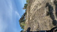
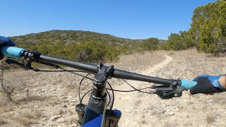
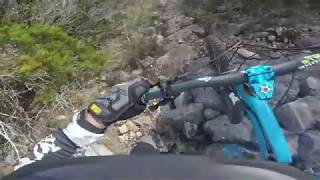
Bandera Mountain Bike Routes
Videos of Bandera Mountain Bike
trail: Bandera Creek
0:15 |
|
Nov 18, 2019
trail: Vista Ridge
20:05 |
241 |
Apr 1, 2022 , Bandera

trail: Bandera Creek
20:05 |
236 |
Apr 1, 2022 , Bandera

20:05 |
373 |
Apr 1, 2022
trail: Madrone
15:39 |
837 |
Jul 12, 2019 , Bandera
youtuber
![Bandera Bike Park is Getting Rad!]()

6:01 |
441 |
Jul 4, 2019
youtuber
![Bandera Bike Park!]()

6:39 |
529 |
Mar 22, 2019
Recent Trail Reports
| status | trail | date | condition | info | user |
|---|---|---|---|---|---|
| Bandera Connect | Nov 9, 2024 @ 12:12pm Nov 9, 2024 | Dry | Renakendall | ||
| Side Track | Mar 1, 2023 @ 6:18am Mar 1, 2023 | Dry | bgil | ||
| West Peak Wilderness Connect | Feb 11, 2023 @ 5:03pm Feb 11, 2023 | Very Dry | Kellyp1886 | ||
| Ice Cream Hill | Feb 12, 2023 @ 1:03am Feb 12, 2023 | Very Dry | Kellyp1886 | ||
| Creek Bottom | Jan 29, 2023 @ 3:41pm Jan 29, 2023 | Variable | AxelThomsen | ||
| Madrone | Jan 29, 2023 @ 11:41pm Jan 29, 2023 | Variable | AxelThomsen | ||
| Bandera Creek | Oct 8, 2022 @ 10:19pm Oct 8, 2022 | Ideal | AxelThomsen | ||
| Wilderness Trail | Oct 9, 2022 @ 5:19am Oct 9, 2022 | Ideal | AxelThomsen | ||
| Vista Ridge | Oct 7, 2022 @ 10:40pm Oct 7, 2022 | Ideal | AxelThomsen | ||
| Hermits | Oct 8, 2022 @ 5:40am Oct 8, 2022 | Ideal | AxelThomsen |
Activity Feed
| username | action | type | title | date |
|---|---|---|---|---|
| LukasA | wishlist | region | activity #90509808 | Mar 13, 2026 @ 1:45pm Mar 13, 2026 |
| TMagg | wishlist | region | activity #89666842 | Feb 27, 2026 @ 8:09pm Feb 27, 2026 |
| jakins | wishlist | region | activity #88765190 | Feb 11, 2026 @ 9:47pm Feb 11, 2026 |
| MattxCyrIU | wishlist | trail | activity #87993980 | Jan 29, 2026 @ 9:52am Jan 29, 2026 |
| j79Wl3 | wishlist | region | activity #87411096 | Jan 18, 2026 @ 7:45am Jan 18, 2026 |
Recent Comments
| username | type | title | comment | date |
|---|---|---|---|---|
| trail | Test | Nov 27, 2024 @ 8:03am Nov 27, 2024 | ||
| trail | Hike-a-bike for me on many parts. Not for... | Oct 9, 2023 @ 7:24pm Oct 9, 2023 | ||
| trail | Aptly named. I rode it backwards. Walked quite... | Nov 1, 2020 @ 4:33pm Nov 1, 2020 | ||
| trail | Rode backwards and it seems like that... | Jul 4, 2020 @ 11:27am Jul 4, 2020 | ||
| trail | Why are all the trails in Hill Country State... | May 13, 2018 @ 5:33am May 13, 2018 |
Local Badges
-

10 Blue Trails1 awarded -

Epic Mountain Bike Climb 2k2 awarded -

Climbing 10k Badge1 awarded -

Mountain Biking 100k Badge0 awarded -

Epic Ride Descent 2k2 awarded -

Descent 10k Badge1 awarded
Activity Type Stats
| activitytype | trails | distance | descent | descent distance | total vertical | rating | global rank | state rank | photos | reports | routes | ridelogs |
|---|---|---|---|---|---|---|---|---|---|---|---|---|
| Mountain Bike | 40 | 44 miles | 4,833 ft | 18 miles | 554 ft | #4,381 | #1,480 | 58 | 29 | 1 | 454 | |
| Horse | 34 | #2,589 | #1,434 | 11 | ||||||||
| Hike | 39 | 43 miles | 4,560 ft | 18 miles | 554 ft | #5,662 | #1,992 | 8 | 29 | 132 | ||
| Trail Running | 39 | 43 miles | 4,560 ft | 18 miles | 554 ft | #5,067 | #1,586 | 29 | 2 | 58 |
Frequently Asked Questions About Bandera
▼
What are the best places to ride in Bandera?
Bandera has 1 areas to explore for mountain biking. The top rated areas are:
▼
What are the highest rated mountain biking trails in Bandera?
The highest rated mountain biking trails in Bandera are:
- Good Luck (4.1/5)
- Bandera Creek (4/5)
- Prairie Loop (4/5)
- Madrone (4/5)
- Medina Loop (3.8/5)
▼
What is the best time of the year to ride in Bandera?
Based on ride log data, the most popular months to ride in Bandera are:
- November (19 activities)
- December (7 activities)
- October (5 activities)
▼
Where can I park to ride in Bandera?
There are 1 parking locations listed in Bandera. The most popular parking spots are:
Activities
Trails
Points of Interest
- By Larsacus
 TRAILFORKS & contributors
 - Admins: ARR
- #29774 - 3,211 views
- bandera activity log | embed map of Bandera mountain bike trails | bandera mountain biking points of interest
Downloading of trail gps tracks in kml & gpx formats is enabled for Bandera.
You must login to download files.