close
-
Layers w
- Weather Layers
- Pro
- Pro
- Pro
- Pro
- Pro
- Pro
- More Layers
- Pro
- Pro
- Pro
- Pro
-
Upgrade to

3D
Trail Conditions
- Unknown
- Snow Groomed
- Snow Packed
- Snow Covered
- Snow Cover Partial
- Freeze/thaw Cycle
- Icy
- Prevalent Mud
- Wet
- Variable
- Ideal
- Dry
- Very Dry
Trail Flow (Ridden Direction)
Trailforks scans users ridelogs to determine the most popular direction each trail is ridden. A good flowing trail network will have most trails flowing in a single direction according to their intension.
The colour categories are based on what percentage of riders are riding a trail in its intended direction.
The colour categories are based on what percentage of riders are riding a trail in its intended direction.
- > 96%
- > 90%
- > 80%
- > 70%
- > 50%
- < 50%
- bi-directional trail
- no data
Trail Last Ridden
Trailforks scans ridelogs to determine the last time a trail was ridden.
- < 2 days
- < 1 week
- < 2 weeks
- < 1 month
- < 6 months
- > 6 months
Trail Ridden Direction
The intended direction a trail should be ridden.
- Downhill Only
- Downhill Primary
- Both Directions
- Uphill Primary
- Uphill Only
- One Direction
Contribute Details
Colors indicate trail is missing specified detail.
- Description
- Photos
- Description & Photos
- Videos
Trail Popularity ?
Trailforks scans ridelogs to determine which trails are ridden the most in the last 9 months.
Trails are compared with nearby trails in the same city region with a possible 25 colour shades.
Think of this as a heatmap, more rides = more kinetic energy = warmer colors.
- most popular
- popular
- less popular
- not popular
ATV/ORV/OHV Filter
Max Vehicle Width
inches
US Cell Coverage
Legend

Radar Time
Activity Recordings
Trailforks uses anonymized public activity data.
?
Activity Recordings
Trailforks uses anonymized public activity data.
?
Personal Heatmap
▶
Activity Types
all
/
none
▶
Options
2
Date range
month
–
Winter Trails
Warning
A routing network for winter maps does not exist. Selecting trails using the winter trails layer has been disabled.
Missing Trails
Most Popular
Least Popular
Trails are colored based on popularity. The more popular a trail is, the more red. Less popular trails trend towards green.
Jump Magnitude Heatmap
Heatmap of where riders jump on trails. Zoom in to see individual jumps, click circles to view jump details.
BC Backroad Status
![map legend]()
Service Road Atlas is a free to use, community-driven service for viewing and creating reports on the numerous back-country service roads around B.C. and Alberta.

Slope Aspect
Direction the slope faces
Trails Deemphasized
Trails are shown in grey.
Only show trails with no bike usage.
Suggested Layers
Based on selected activity type
Save the current map location and zoom level as your default home location whenever this page is loaded.
Save
No description for Bandung has been added yet!
Login or register to submit one.
Activities Click to view
- Mountain Bike
15 trails
- Adaptive Bike
0 trails
- Winter Fat Bike
0 trails
- Hike
12 trails
- Trail Running
13 trails
Region Details
- 1
- 4
- 9
- 1
Region Status
Open as of Dec 5, 2025Local Trail Association
Stats
- Avg Trail Rating
- Trails (view details)
- 15
- Trails Mountain Bike
- 15
- Trails E-Bike
- 2
- Trails Horse
- 1
- Trails Hike
- 12
- Trails Trail Running
- 13
- Trails Dirtbike/Moto
- 1
- Trails ATV/ORV/OHV
- 1
- Total Distance
- 43 miles
- Total Descent
- 15,310 ft
- Total Vertical
- 4,700 ft
- Highest Trailhead
- 5,929 ft
- Reports
- 29
- Photos
- 64
- Ridden Counter
- 123
Sub Regions
-
Trek 11 Sukawana Bike Park
- 2
Popular Bandung Mountain Biking Trails
• 5 ★ 5.0 • 1 mile • 7 ft • 17 •
Less popular blue difficulty singletrack. This mountain bike primary trail can be used downhill primary. It features drop, jump and pump track. On average it takes 3 minutes to complete this trail.
• 5 ★ 5.0 • 1 mile • 13 ft • 13 •
Less popular blue difficulty singletrack. This mountain bike primary trail can be used downhill primary and has a easy overall physical rating. It features drop and jump. On average it takes 17 minutes to complete this trail.
• 5 ★ 0.0 • 4,031 ft • 140 ft • 9 •
Rocks and roots. Perfect place to hone your technical skill.
• 95 ★ 0.0 • 1 mile • 7 ft • 8 •
Singletrack SS3 merupakan bagian dari Trek 11 Sukawana.
• 5 ★ 0.0 • 2,668 ft • 32 ft • 6 •
Less popular green difficulty singletrack. This mountain bike primary trail can be used downhill primary and has a easy overall physical rating with a 32 ft green climb. On average it takes 3 minutes to complete this trail.
• 5 ★ 0.0 • 5 miles • 1,044 ft • 6 •
Less popular blue difficulty singletrack. This mountain bike primary trail can be used both directions and has a hard overall physical rating with a 1,044 ft blue climb. On average it takes 2 hours2 minutes to complete this trail.
• 75 ★ 0.0 • 5,036 ft • 3 ft • 3 •
Popular blue difficulty singletrack. This mountain bike primary trail can be used downhill only and has a moderate overall physical rating with a 3 ft blue climb. It features berm, drop and jump. Trail visibility is always easy to follow. On average it takes 26 minutes to complete this trail.
Bandung Mountain Bike Routes
Panglejar - Cirata Featured
8 miles • 102 ft • 0 • Point to Point •
Starts with a mellow climb and double track descending which then turn into flowy singletracks in the...
★ 3.0 • 12 miles • 1,092 ft • 0 • Point to Point •
Starting from the western slopes of Mt. Burangrang. Ends at interprovince main road near Purwakarta.
1 mile • 45 ft • 0 • Shuttled •
Adjacent to the Village of Arts & Culture Jelekong. The location is easily accessible to lovers Bike...
12 miles • 2,389 ft • 0 • Loop •
Steady and easy uphill route through Pasir Impun to access the scenic Firdaus trail and the flowy Tamiya...
5 miles • 1,104 ft • 0 •
Tetap hati hati karena dibeberapa sections terdapat track licin dan curam
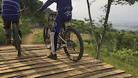
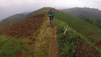
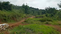
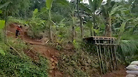
Photos of Bandung Mountain Bike
Videos of Bandung Mountain Bike
3:22 |
121 |
Apr 9, 2017
trail: Firdaus
3:47 |
297 |
Jan 1, 2017
0:19 |
31 |
Dec 26, 2016
0:07 |
58 |
Dec 26, 2016
0:07 |
24 |
Dec 26, 2016
trail: Sekejolang
0:59 |
189 |
Aug 3, 2016
trail: Firdaus
10:13 |
105 |
Sep 10, 2015
Recent Trail Reports
| status | trail | date | condition | info | user |
|---|---|---|---|---|---|
| SS3 Trek 11 Sukawana | Jun 4, 2022 @ 6:01pm Jun 4, 2022 | Variable | ianshori | ||
| Sukawana Access Road | Jun 4, 2022 @ 6:01pm Jun 4, 2022 | Wet | ianshori | ||
| KSG (Kampung Sapedah Gentong) | Jun 14, 2021 @ 7:40pm Jun 14, 2021 | Dry | wansbud | ||
| Firdaus | Apr 24, 2021 @ 2:45am Apr 24, 2021 | Ideal | ianshori | ||
| New Kanhay Alternative | Feb 11, 2021 @ 7:31pm Feb 11, 2021 | Ideal | ianshori | ||
| Lower Tamiya | Dec 28, 2020 @ 4:58pm Dec 28, 2020 | Ideal | ianshori | ||
| Upper Tamiya | Aug 31, 2019 @ 6:42pm Aug 31, 2019 | Dry | zulki-fly |
Activity Feed
| username | action | type | title | date |
|---|---|---|---|---|
| herubee | vote | trail | activity #37566444 | Feb 19, 2023 @ 1:44am Feb 19, 2023 |
| herubee | vote | trail | activity #37566440 and 1 more | Feb 19, 2023 @ 1:44am Feb 19, 2023 |
| ianshori | add | report | activity #30082836 and 1 more | Jun 5, 2022 @ 10:59pm Jun 5, 2022 |
| wansbud | add | report | activity #20164890 | Jun 14, 2021 @ 7:41pm Jun 14, 2021 |
| asepwahyudy | wishlist | trail | activity #18812196 | May 5, 2021 @ 8:32am May 5, 2021 |
Recent Comments
| username | type | title | comment | date |
|---|---|---|---|---|
| trail | Contact person? | Dec 15, 2019 @ 6:59pm Dec 15, 2019 | ||
| trail | thanks | Jan 29, 2018 @ 3:19pm Jan 29, 2018 | ||
| trail | Awesome track with the unique obstacles. | Mar 10, 2017 @ 7:24pm Mar 10, 2017 | ||
| trail | new trail @bandung | Dec 27, 2016 @ 12:03am Dec 27, 2016 |
Local Badges
-

Epic Ride Climb 2k30 awarded -

Climbing 10k Badge13 awarded -

Climbing 100k Badge4 awarded -

Epic Ride Descent 2k32 awarded -

Descent 10k Badge13 awarded -

Descent 100k Badge4 awarded
Activity Type Stats
| activitytype | trails | distance | descent | descent distance | total vertical | rating | global rank | state rank | photos | reports | routes | ridelogs |
|---|---|---|---|---|---|---|---|---|---|---|---|---|
| Mountain Bike | 15 | 43 miles | 15,312 ft | 26 miles | 4,701 ft | #1,664 | #3 | 64 | 29 | 5 | 3,381 | |
| E-Bike | 2 | 8 miles | 1,932 ft | 4 miles | 1,621 ft | 23 | 1 | 5 | ||||
| Horse | 1 | 2 miles | 10 ft | 407 ft | 817 ft | 4 | ||||||
| Hike | 12 | 35 miles | 11,709 ft | 20 miles | 4,147 ft | #1,934 | #7 | 26 | 57 | |||
| Trail Running | 13 | 41 miles | 13,635 ft | 24 miles | 4,154 ft | #1,373 | #7 | 26 | 1 | 75 | ||
| Dirtbike/Moto | 1 | 2 miles | 10 ft | 407 ft | 817 ft | 4 | ||||||
| ATV/ORV/OHV | 1 | 2 miles | 10 ft | 407 ft | 817 ft | 4 | 1 |
Frequently Asked Questions About Bandung
▼
What are the best places to ride in Bandung?
Bandung has 1 areas to explore for mountain biking. The top rated areas are:
▼
What are the highest rated mountain biking trails in Bandung?
The highest rated mountain biking trails in Bandung are:
- Lower Tamiya (4.1/5)
- Upper Tamiya (4.1/5)
- KSG (Kampung Sapedah Gentong) (4.1/5)
- Firdaus (4/5)
- SS3 Trek 11 Sukawana (0/5)
▼
What is the best time of the year to ride in Bandung?
Based on ride log data, the most popular months to ride in Bandung are:
- July (3 activities)
- October (2 activities)
- September (2 activities)
▼
Where can I park to ride in Bandung?
There are 1 parking locations listed in Bandung. The most popular parking spots are:
Trails
Points of Interest
- By rifu
 & contributors
 - Admins: jack-jacobs, rifu, Funtasteam
- #9866 - 8,249 views
- bandung activity log | embed map of Bandung mountain bike trails | bandung mountain biking points of interest
Downloading of trail gps tracks in kml & gpx formats is enabled for Bandung.
You must login to download files.