close
-
Layers w
- Weather Layers
- Pro
- Pro
- Pro
- Pro
- Pro
- Pro
- More Layers
- Pro
- Pro
- Pro
- Pro
-
Upgrade to

3D
Trail Conditions
- Unknown
- Snow Groomed
- Snow Packed
- Snow Covered
- Snow Cover Partial
- Freeze/thaw Cycle
- Icy
- Prevalent Mud
- Wet
- Variable
- Ideal
- Dry
- Very Dry
Trail Flow (Ridden Direction)
Trailforks scans users ridelogs to determine the most popular direction each trail is ridden. A good flowing trail network will have most trails flowing in a single direction according to their intension.
The colour categories are based on what percentage of riders are riding a trail in its intended direction.
The colour categories are based on what percentage of riders are riding a trail in its intended direction.
- > 96%
- > 90%
- > 80%
- > 70%
- > 50%
- < 50%
- bi-directional trail
- no data
Trail Last Ridden
Trailforks scans ridelogs to determine the last time a trail was ridden.
- < 2 days
- < 1 week
- < 2 weeks
- < 1 month
- < 6 months
- > 6 months
Trail Ridden Direction
The intended direction a trail should be ridden.
- Downhill Only
- Downhill Primary
- Both Directions
- Uphill Primary
- Uphill Only
- One Direction
Contribute Details
Colors indicate trail is missing specified detail.
- Description
- Photos
- Description & Photos
- Videos
Trail Popularity ?
Trailforks scans ridelogs to determine which trails are ridden the most in the last 9 months.
Trails are compared with nearby trails in the same city region with a possible 25 colour shades.
Think of this as a heatmap, more rides = more kinetic energy = warmer colors.
- most popular
- popular
- less popular
- not popular
ATV/ORV/OHV Filter
Max Vehicle Width
inches
US Cell Coverage
Legend

Radar Time
Activity Recordings
Trailforks uses anonymized public activity data.
?
Activity Recordings
Trailforks uses anonymized public activity data.
?
Personal Heatmap
▶
Activity Types
all
/
none
▶
Options
2
Date range
month
–
Winter Trails
Warning
A routing network for winter maps does not exist. Selecting trails using the winter trails layer has been disabled.
Missing Trails
Most Popular
Least Popular
Trails are colored based on popularity. The more popular a trail is, the more red. Less popular trails trend towards green.
Jump Magnitude Heatmap
Heatmap of where riders jump on trails. Zoom in to see individual jumps, click circles to view jump details.
BC Backroad Status
![map legend]()
Service Road Atlas is a free to use, community-driven service for viewing and creating reports on the numerous back-country service roads around B.C. and Alberta.

Slope Aspect
Direction the slope faces
Trails Deemphasized
Trails are shown in grey.
Only show trails with no bike usage.
Suggested Layers
Based on selected activity type
Save the current map location and zoom level as your default home location whenever this page is loaded.
Save
No description for Bangtail Mountains has been added yet!
Login or register to submit one.
 google parking directions
google parking directions Region Supporters & Maintainers
![]()
Southwest Montana Mountain Bike Association
since 2013Maintainer
Activities Click to view
- Mountain Bike
9 trails
- E-Bike
4 trails
- Horse
5 trails
- Hike
9 trails
- Trail Running
9 trails
- Dirtbike/Moto
5 trails
- ATV/ORV/OHV
3 trails
Region Details
- 3
- 6
Region Status
Caution as of Jun 15, 2026Stats
- Avg Trail Rating
- Trails (view details)
- 9
- Trails Mountain Bike
- 9
- Trails E-Bike
- 4
- Trails Horse
- 5
- Trails Hike
- 9
- Trails Trail Running
- 9
- Trails Dirtbike/Moto
- 5
- Trails ATV/ORV/OHV
- 3
- Total Distance
- 41 miles
- Total Descent
- 4,029 ft
- Total Vertical
- 2,456 ft
- Highest Trailhead
- 7,922 ft
- Reports
- 219
- Photos
- 131
- Ridden Counter
- 2,877
Popular Bangtail Mountains Mountain Biking Trails
• 90 ★ 4.5 • 9 miles • 2,352 ft • 806 •
This IMBA Epic is one of the most famous rides around Bozeman for a reason, stunning views of the Bridger and Crazy Mountains and mile after mile of glorious singletrack. Trail can be ridden in either direction although most people ride...
• 85 ★ 4.3 • 7 miles • 547 ft • 706 •
Opens to dirt bikes 6/16
• 80 ★ 4.0 • 3,904 ft • 103 ft • 607 •
This IMBA Epic is one of the most famous rides around Bozeman for a reason, stunning views of the Bridger and Crazy Mountains and mile after mile of glorious singletrack. Trail can be ridden in either direction although most people ride...
• 60 ★ 0.0 • 1,955 ft • 0 ft • 40 •
Moderately popular blue difficulty singletrack. This mountain bike primary trail.
• 5 ★ 0.0 • 3 miles • 1,231 ft • • atv
See MVUM. Motorized trail from Jackson Ck Trailhead to the Bangail Divide.
Bangtail Mountains Mountain Bike Routes
★ 4.3 • 22 miles • 3,493 ft • 6 •
Photos of Bangtail Mountains Mountain Bike
Videos of Bangtail Mountains Mountain Bike

20:35 |
367 |
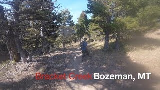
May 30, 2023 , Bozeman

13:14 |
365 |
May 30, 2023 , Bozeman

12:06 |
436 |
May 30, 2023 , Bozeman
1059 |
Aug 28, 2017 , Bozeman
Current Trail Warnings
| status | trail | date | condition | user | info |
|---|---|---|---|---|---|
| Bangtail Guard Station - Bangtail Divide Central (IMBA Epic) | Jun 15, 2026 @ 3:06pm (America/Denver) Jun 15, 2026 | Ideal | Bwyoung Trailblazers | Large tree fall still present. 30-60 mins... |
Recent Trail Reports
| status | trail | date | condition | info | user |
|---|---|---|---|---|---|
| Stone Creek - Bangtail Divide South (IMBA Epic) | Jun 14, 2026 @ 11:12am (America/Denver) Jun 14, 2026 | Variable | jhanson927 | ||
| Grassy Mountain - Bangtail Divide North (IMBA Epic) | Jun 14, 2026 @ 10:58am (America/Boise) Jun 14, 2026 | Ideal | Bwyoung Trailblazers | ||
| Olsen Creek Road (FS-6944) | May 3, 2026 @ 5:26am (America/Denver) May 3, 2026 | Variable | ElliotHayhurst | ||
| Guard Station Cutoff | May 3, 2026 @ 5:20am (America/Denver) May 3, 2026 | Prevalent Mud | ElliotHayhurst | ||
| Bangtail Divide Connector (IMBA Epic) | Aug 14, 2025 @ 4:19pm Aug 14, 2025 | Very Dry | dadbod420 | ||
| Skunk Creek Road | Mar 24, 2025 @ 10:28am Mar 24, 2025 | Snow Cover Partial | DinsmoreBailey SWMMBA | ||
| Access Road | Mar 24, 2025 @ 10:26am Mar 24, 2025 | Snow Cover Partial | DinsmoreBailey SWMMBA |
Activity Feed
| username | action | type | title | date |
|---|---|---|---|---|
| Mdunn409 | wishlist | route | activity #97215049 | Jun 17, 2026 @ 4:08pm Jun 17, 2026 |
| djibolster | wishlist | route | activity #97204931 | Jun 17, 2026 @ 12:59pm Jun 17, 2026 |
| Bwyoung | add | report | activity #97064553 | Jun 15, 2026 @ 2:06pm Jun 15, 2026 |
| jhanson927 | add | report | activity #97059198 | Jun 15, 2026 @ 12:27pm Jun 15, 2026 |
| Bwyoung | add | report | activity #97015484 | Jun 14, 2026 @ 5:36pm Jun 14, 2026 |
Recent Comments
| username | type | title | comment | date |
|---|---|---|---|---|
| trail | 5/20/2026 TLDR: Still Practically Impassable... | May 21, 2026 @ 2:05pm May 21, 2026 | ||
| trail | 5/2/26 Snow covered after the first summit at... | May 3, 2026 @ 4:19am May 3, 2026 | ||
| report | And the rocks are great | Oct 8, 2024 @ 9:46pm Oct 8, 2024 | ||
| report | Dry but very rocky | Oct 6, 2024 @ 5:29pm Oct 6, 2024 | ||
| report | Came over from Msla to do Bangtail after... | Jul 14, 2024 @ 5:27pm Jul 14, 2024 |
Nearby Areas
| name | distance | ||||
|---|---|---|---|---|---|
| Crosscut Trail System | 11 | 6 | 2 | 3.5 km | |
| Bridger Range | 14 | 12 | 4 | 6.2 km | |
| Glen Lake Rotary Park | 11.7 km | ||||
| Highland Glen | 9 | 12.6 km | |||
| Triangle Trail System | 17 | 5 | 13.7 km |
Local Products
Activity Type Stats
| activitytype | trails | distance | descent | descent distance | total vertical | rating | global rank | state rank | photos | reports | routes | ridelogs |
|---|---|---|---|---|---|---|---|---|---|---|---|---|
| Mountain Bike | 9 | 41 miles | 4,029 ft | 15 miles | 2,457 ft | #5,016 | #1,809 | 131 | 219 | 1 | 2,396 | |
| E-Bike | 4 | 21 miles | 1,345 ft | 6 miles | 2,457 ft | #5,213 | #1,441 | 164 | 50 | |||
| Horse | 5 | 21 miles | 1,345 ft | 6 miles | 2,457 ft | #1,777 | #934 | 98 | ||||
| Hike | 9 | 41 miles | 4,029 ft | 15 miles | 2,457 ft | #5,957 | #2,152 | 219 | 91 | |||
| Trail Running | 9 | 41 miles | 4,029 ft | 15 miles | 2,457 ft | #5,083 | #1,526 | 219 | 33 | |||
| Dirtbike/Moto | 5 | 28 miles | 3,209 ft | 10 miles | 2,457 ft | #733 | #273 | 108 | 17 | |||
| ATV/ORV/OHV | 3 | 16 miles | 344 ft | 3 miles | 1,946 ft | #577 | #249 | 57 | 2 |
Frequently Asked Questions About Bangtail Mountains
▼
What are the highest rated mountain biking trails in Bangtail Mountains?
The highest rated mountain biking trails in Bangtail Mountains are:
- Stone Creek - Bangtail Divide South (IMBA Epic) (4.3/5)
- Grassy Mountain - Bangtail Divide North (IMBA Epic) (4.2/5)
- Bangtail Divide Connector (IMBA Epic) (4/5)
- Bangtail Guard Station - Bangtail Divide Central (IMBA Epic) (3.8/5)
- Guard Station Cutoff (0/5)
▼
What is the best time of the year to ride in Bangtail Mountains?
Based on ride log data, the most popular months to ride in Bangtail Mountains are:
- July (72 activities)
- June (50 activities)
- August (49 activities)
▼
Where can I park to ride in Bangtail Mountains?
There are 2 parking locations listed in Bangtail Mountains. The most popular parking spots are:
▼
What is the longest trail in Bangtail Mountains?
The longest trail in Bangtail Mountains is Stone Creek - Bangtail Divide South (IMBA Epic) at 9.0 miles. View all trails sorted by distance.
Activities
- By brenthillier
 NSMBA TRAILFORKS & contributors
 - Admins: SWMMBA, SWMMBA-TDC
- #22256 - 10,297 views
- bangtail mountains activity log | embed map of Bangtail Mountains mountain bike trails | bangtail mountains mountain biking points of interest
Downloading of trail gps tracks in kml & gpx formats is enabled for Bangtail Mountains.
You must login to download files.