close
-
Layers w
- Weather Layers
- Pro
- Pro
- Pro
- Pro
- Pro
- Pro
- More Layers
- Pro
- Pro
- Pro
- Pro
-
Upgrade to

3D
Trail Conditions
- Unknown
- Snow Groomed
- Snow Packed
- Snow Covered
- Snow Cover Partial
- Freeze/thaw Cycle
- Icy
- Prevalent Mud
- Wet
- Variable
- Ideal
- Dry
- Very Dry
Trail Flow (Ridden Direction)
Trailforks scans users ridelogs to determine the most popular direction each trail is ridden. A good flowing trail network will have most trails flowing in a single direction according to their intension.
The colour categories are based on what percentage of riders are riding a trail in its intended direction.
The colour categories are based on what percentage of riders are riding a trail in its intended direction.
- > 96%
- > 90%
- > 80%
- > 70%
- > 50%
- < 50%
- bi-directional trail
- no data
Trail Last Ridden
Trailforks scans ridelogs to determine the last time a trail was ridden.
- < 2 days
- < 1 week
- < 2 weeks
- < 1 month
- < 6 months
- > 6 months
Trail Ridden Direction
The intended direction a trail should be ridden.
- Downhill Only
- Downhill Primary
- Both Directions
- Uphill Primary
- Uphill Only
- One Direction
Contribute Details
Colors indicate trail is missing specified detail.
- Description
- Photos
- Description & Photos
- Videos
Trail Popularity ?
Trailforks scans ridelogs to determine which trails are ridden the most in the last 9 months.
Trails are compared with nearby trails in the same city region with a possible 25 colour shades.
Think of this as a heatmap, more rides = more kinetic energy = warmer colors.
- most popular
- popular
- less popular
- not popular
ATV/ORV/OHV Filter
Max Vehicle Width
inches
US Cell Coverage
Legend

Radar Time
Activity Recordings
Trailforks uses anonymized public activity data.
?
Activity Recordings
Trailforks uses anonymized public activity data.
?
Personal Heatmap
▶
Activity Types
all
/
none
▶
Options
2
Date range
month
–
Winter Trails
Warning
A routing network for winter maps does not exist. Selecting trails using the winter trails layer has been disabled.
Missing Trails
Most Popular
Least Popular
Trails are colored based on popularity. The more popular a trail is, the more red. Less popular trails trend towards green.
Jump Magnitude Heatmap
Heatmap of where riders jump on trails. Zoom in to see individual jumps, click circles to view jump details.
BC Backroad Status
![map legend]()
Service Road Atlas is a free to use, community-driven service for viewing and creating reports on the numerous back-country service roads around B.C. and Alberta.

Slope Aspect
Direction the slope faces
Trails Deemphasized
Trails are shown in grey.
Only show trails with no bike usage.
Suggested Layers
Based on selected activity type
Save the current map location and zoom level as your default home location whenever this page is loaded.
Save
No description for Barcelona has been added yet!
Login or register to submit one.
This region uses the Uk/Euro style trail grading system.
Activities Click to view
- Mountain Bike
1,524 trails
- E-Bike
1,468 trails
- Gravel Bike
1 trails
- Adaptive Bike
58 trails
- Horse
183 trails
- Hike
1,492 trails
- Trail Running
1,473 trails
- Dirtbike/Moto
1 trails
- ATV/ORV/OHV
1 trails
- Snowmobile
1 trails
- Snowshoe
1 trails
- Downhill Ski
1 trails
- Backcountry Ski
1 trails
- Nordic Ski
1 trails
Region Details
- 431
- 1
- 376
- 428
- 199
- 56
Region Status
Open as of 52 minsStats
- Avg Trail Rating
- Trails (view details)
- 1,515
- Trails Mountain Bike
- 1,524
- Trails E-Bike
- 1,468
- Trails Gravel Bike
- 1
- Trails Adaptive Bike
- 58
- Trails Horse
- 183
- Trails Hike
- 1,492
- Trails Trail Running
- 1,473
- Trails Dirtbike/Moto
- 1
- Trails Observed Trials
- 2
- Trails ATV/ORV/OHV
- 1
- Trails Snowmobile
- 1
- Trails Snowshoe
- 1
- Trails Downhill Ski
- 1
- Trails Backcountry Ski
- 1
- Trails Nordic Ski
- 1
- Total Distance
- 537 miles
- Total Descent
- 156,920 ft
- Total Vertical
- 1,897 ft
- Highest Trailhead
- 1,898 ft
- Reports
- 16,812
- Photos
- 1,403
- Ridden Counter
- 280,455
Articles
Video: How César Rojo Built Unno - The Story Behind Barcelona’s Most Obsessive Brand
Feb 2, 2026 from pinkbike.com
César Rojo opens the doors to the obsession, risks, and 'All on Red' mindset that defined the birth of Unno.
Video: Gregoire Bachmann Chases Sun & Dirt at La Poma
Apr 22, 2025 from pinkbike.com
Some stylish combos in this dirt jump shredit.

Video: Adrien Loron Takes on Urban Riding in Barcelona in "Salsa Brava"
Jan 24, 2025 from pinkbike.com
The 2-time king of Crankworx champion trades the race track in for the streets and keeps the pace.

Video: Loic Bruni has Another World Cup Podium... in XC Eliminator
Nov 16, 2020 from pinkbike.com
Loic Bruni earned his 28th World Cup podium this weekend except this time it wasn't in downhill.
Sub Regions
-
Castellbisbal
- 6
- 9
- 11
- 3
-
Collserola
- 9
- 298
- 356
- 161
- 47
-
Els Tres Turons
- 11
- 10
- 4
-
Montjuic
- 1
- 32
- 25
- 5
-
Sant Fost De Campsentelles
- 10
- 10
- 7
- 1
-
Vallromanes
- 5
- 18
- 4
- 3
Popular Barcelona Mountain Biking Trails
• 100 ★ 4.1 • 1,821 ft • 34 ft • 1,063 •
“Forapistas” is an easy trail right next to “Camí de Can Borni” Is the perfect trail for riders of all levels, especially beginners. The trail is nice and clean. Is not skinny and you have a good view of what do you have in the...
• 100 ★ 3.2 • 1,079 ft • 17 ft • 1,018 •
A trail starting just next to Casa Juanco. It starts as a narrow singletrack and just after the tower it becomes open and with few easy rock garden and loose rocks. Few brave people does it also uphill.
• 100 ★ 3.0 • 666 ft • 0 ft • 966 •
Pequeña alternativa a la . Asequible para todo el mundo
• 100 ★ 2.0 • 528 ft • 75 ft • 902 •
Este trail se usa tanto de subida como bajada. Ideal para conectar con el resto de bajadas y subidas. This trail is used in uphill and downhill direction. Be careful
• 100 ★ 3.0 • 699 ft • 0 ft • 887 •
Popular green difficulty singletrack. This multi-use trail can be used both directions and has a easy overall physical rating with a 0 ft blue climb. Trail visibility is always easy to follow. On average it takes minutes to complete this trail.
• 100 ★ 4.2 • 584 ft • 0 ft • 838 •
There are two drops in the middle but you don't have todo if you don't want
• 100 ★ 3.5 • 679 ft • 0 ft • 831 •
Popular green difficulty singletrack. This multi-use trail can be used both directions with a 0 ft blue climb. Trail visibility is always easy to follow. On average it takes minutes to complete this trail.
• 100 ★ 3.5 • 1 mile • 13 ft • 792 •
Popular green difficulty singletrack. This multi-use trail can be used both directions and has a moderate overall physical rating with a 13 ft blue climb. Trail visibility is always easy to follow. On average it takes 6 minutes to complete this trail.
Barcelona Mountain Bike Routes
★ 5.0 • 20 miles • 4,021 ft • 20 • Point to Point •
Enduro ride on some of the trails around Barcelona. Focus on technical descents and your own climbing.
17 miles • 2,528 ft • 1 • Loop •
From the Velodrome we will head towards the Horta cemetery, on Calle escala Dei we will find Alta de...
42 miles • 6,854 ft • 13 • Loop •
We will begin the itinerary circulating very smoothly, warming legs on the Aigües road in the direction...
★ 1.0 • 64 miles • 11,446 ft • 44 • Loop •
Epic 100 km / 3300m loop that will keep you busy for hours! For a 75 km variant, leave out the eastern...
42 miles • 6,854 ft • 13 • Loop •
We will begin the itinerary circulating very smoothly, warming legs on the Aigües road in the direction...
9 miles • 1,774 ft • 3 •
The itinerary begins at the sports complex La Bonaigua that we will find at the end of the Paseo del Monte...
Photos of Barcelona Mountain Bike
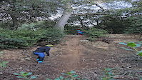
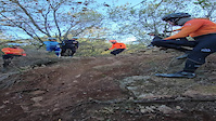
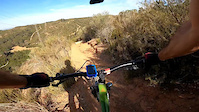
Videos of Barcelona Mountain Bike
2:55 |
35 |
Oct 12, 2025
trail: El Barranco
0:38 |
21 |
Jul 14, 2025

trail: Charco Pestoso
2:17 |
25 |
Jan 19, 2025

trail: Cazadores
2:17 |
27 |
Jan 19, 2025
trail: Kamikaze Can Ribes
0:10 |
|
Jan 8, 2024
trail: Kamikaze Can Ribes
0:15 |
|
Jan 8, 2024
trail: Costurer
0:01 |
|
Apr 30, 2023

trail: Cruza Pistas
2:26 |
27 |
Mar 28, 2023
Current Trail Warnings
| status | trail | date | condition | user | info |
|---|---|---|---|---|---|
| Santa Margarida / Torre del Bisbe - upper | Jun 3, 2026 @ 2:31am (America/Vancouver) Jun 3, 2026 | Ideal | josepbt | me comentan que está quedando muy muy... | |
| Virolai | Jun 2, 2026 @ 6:34pm (Europe/Andorra) Jun 2, 2026 | Dry | svives | ||
| El Segmento Que Aun Se Puede | May 29, 2026 @ 12:27am (Europe/Madrid) May 28, 2026 | Dry | sergiorgdh | árbol caído. Después, flow y... |
Recent Trail Reports
| status | trail | date | condition | info | user |
|---|---|---|---|---|---|
| Mirador Migdia | Jun 19, 2026 @ 10:22am (Europe/Madrid) 52 mins | Dry | hZQNHc | ||
| Salamandra | Jun 15, 2026 @ 7:51pm (Europe/Madrid) Jun 15, 2026 | Ideal | stax999 | ||
| Rauxa | Jun 10, 2026 @ 12:59am (Europe/Madrid) Jun 9, 2026 | Dry | PLFamiliesOG91 | ||
| Chuck Norris | Jun 8, 2026 @ 2:25pm (Europe/Madrid) Jun 8, 2026 | Unknown | Eskate | ||
| Caçafantasmes | Jun 7, 2026 @ 12:10am (Europe/Madrid) Jun 6, 2026 | Unknown | Albertn2bMUo | ||
| Arrabassada Esquerra | Jun 5, 2026 @ 11:20am (Europe/Madrid) Jun 5, 2026 | Unknown | Fancelli | ||
| Masriera a Torrent Can Cerdà | Jun 3, 2026 @ 2:23pm (Europe/Madrid) Jun 3, 2026 | Unknown | jum4l0 | ||
| Pipican | Jun 2, 2026 @ 6:34pm (Europe/Andorra) Jun 2, 2026 | Dry | svives | ||
| Sant Salvador | Jun 2, 2026 @ 6:34pm (Europe/Andorra) Jun 2, 2026 | Dry | svives | ||
| Santuaris Rockgarden | Jun 2, 2026 @ 6:34pm (Europe/Andorra) Jun 2, 2026 | Dry | svives |
Activity Feed
| username | action | type | title | date |
|---|---|---|---|---|
| hZQNHc | add | report | activity #97302555 | Jun 19, 2026 @ 1:22am 52 mins |
| MikelAkira | ridden | trail | activity #97263283 | Jun 18, 2026 @ 10:55am 15 hours |
| Raine94 | wishlist | trail | activity #97128327 | Jun 16, 2026 @ 11:51am 3 days |
| Chadburdyshaw | wishlist | region | activity #97117567 | Jun 16, 2026 @ 9:41am 3 days |
| stax999 | add | report | activity #97052738 | Jun 15, 2026 @ 10:51am Jun 15, 2026 |
Recent Comments
| username | type | title | comment | date |
|---|---|---|---|---|
| trail | Hemos subido por ella para llegar a las... | Jun 6, 2026 @ 9:12am Jun 6, 2026 | ||
| trail | Heavy metal empinada y corta. La pondría roja | May 28, 2026 @ 3:33pm May 28, 2026 | ||
| trail | divertida, medio-suave-fuerte. En buen estado | May 28, 2026 @ 3:31pm May 28, 2026 | ||
| trail | Camino para trailrunners. Por la entrada sur... | May 28, 2026 @ 3:31pm May 28, 2026 | ||
| trail | De las bajadas más divertidas de la zona.... | May 28, 2026 @ 3:16pm May 28, 2026 |
Local Badges
-

Completionist0 awarded -

Epic Ride 50k11,793 awarded -

Top 10 Trails4 awarded -
Completionist0 awarded -

10 Expert Trails0 awarded -
Completionist0 awarded
Activity Type Stats
| activitytype | trails | distance | descent | descent distance | total vertical | rating | global rank | state rank | photos | reports | routes | ridelogs |
|---|---|---|---|---|---|---|---|---|---|---|---|---|
| Mountain Bike | 1,524 | 529 miles | 154,783 ft | 305 miles | 1,896 ft | #17 | #2 | 1,314 | 16,809 | 39 | 158,285 | |
| E-Bike | 1,468 | 504 miles | 150,528 ft | 292 miles | 1,896 ft | #12 | #13 | 65 | 16,357 | 23 | 19,034 | |
| Gravel Bike | 1 | #71 | #37 | 257 | 3 | 1,798 | ||||||
| Adaptive Bike | 58 | #98 | #86 | 1 | ||||||||
| Horse | 183 | 62 miles | 10,912 ft | 29 miles | 1,371 ft | #136 | #12 | 939 | 1 | |||
| Hike | 1,492 | 529 miles | 150,791 ft | 302 miles | 1,896 ft | #25 | #12 | 13 | 16,451 | 2 | 4,679 | |
| Trail Running | 1,473 | 522 miles | 149,035 ft | 298 miles | 1,896 ft | #15 | #12 | 12 | 16,354 | 17,706 | ||
| Dirtbike/Moto | 1 | #504 | #21 | 759 | 3 | |||||||
| Observed Trials | 2 | 47 | ||||||||||
| ATV/ORV/OHV | 1 | #332 | #13 | 760 | 2 | |||||||
| Snowmobile | 1 | #146 | #2 | 1 | ||||||||
| Snowshoe | 1 | #205 | #5 | 3 | ||||||||
| Downhill Ski | 1 | #348 | #15 | 16 | ||||||||
| Backcountry Ski | 1 | #234 | #11 | 81 | ||||||||
| Nordic Ski | 1 | #265 | #5 | 29 |
Frequently Asked Questions About Barcelona
▼
What are the best places to ride in Barcelona?
Barcelona has 6 areas to explore for mountain biking. The top rated areas are:
▼
What are the highest rated mountain biking trails in Barcelona?
The highest rated mountain biking trails in Barcelona are:
- Instituto - Corriol Vall de Sorgues (4.6/5)
- Dragon Kahn / Camí de Can Pasqual (4.6/5)
- Cuerpo en Llamas (4.5/5)
- Les Planes 2 (4.5/5)
- Trialera Park (4.5/5)
▼
What is the best time of the year to ride in Barcelona?
Based on ride log data, the most popular months to ride in Barcelona are:
- May (642 activities)
- October (579 activities)
- July (517 activities)
▼
Where can I park to ride in Barcelona?
There are 14 parking locations listed in Barcelona. The most popular parking spots are:
- Parking Tibidabo 2
- Parking Can Cuiàs
- Parking Pla dels Maduixers
- Parking Can Coll
- Parking del Turó d'en Cors
Activities
Trails
- By AllridersAgency & contributors
- Admins: snaker4, kai-bcn, henrikenduro, Galis
- #6695 - 62,609 views
- barcelona activity log | embed map of Barcelona mountain bike trails | barcelona mountain biking points of interest polygons
Downloading of trail gps tracks in kml & gpx formats is enabled for Barcelona.
You must login to download files.