close
-
Layers w
- Weather Layers
- Pro
- Pro
- Pro
- Pro
- Pro
- Pro
- More Layers
- Pro
- Pro
- Pro
- Pro
-
Upgrade to

3D
Trail Conditions
- Unknown
- Snow Groomed
- Snow Packed
- Snow Covered
- Snow Cover Partial
- Freeze/thaw Cycle
- Icy
- Prevalent Mud
- Wet
- Variable
- Ideal
- Dry
- Very Dry
Trail Flow (Ridden Direction)
Trailforks scans users ridelogs to determine the most popular direction each trail is ridden. A good flowing trail network will have most trails flowing in a single direction according to their intension.
The colour categories are based on what percentage of riders are riding a trail in its intended direction.
The colour categories are based on what percentage of riders are riding a trail in its intended direction.
- > 96%
- > 90%
- > 80%
- > 70%
- > 50%
- < 50%
- bi-directional trail
- no data
Trail Last Ridden
Trailforks scans ridelogs to determine the last time a trail was ridden.
- < 2 days
- < 1 week
- < 2 weeks
- < 1 month
- < 6 months
- > 6 months
Trail Ridden Direction
The intended direction a trail should be ridden.
- Downhill Only
- Downhill Primary
- Both Directions
- Uphill Primary
- Uphill Only
- One Direction
Contribute Details
Colors indicate trail is missing specified detail.
- Description
- Photos
- Description & Photos
- Videos
Trail Popularity ?
Trailforks scans ridelogs to determine which trails are ridden the most in the last 9 months.
Trails are compared with nearby trails in the same city region with a possible 25 colour shades.
Think of this as a heatmap, more rides = more kinetic energy = warmer colors.
- most popular
- popular
- less popular
- not popular
ATV/ORV/OHV Filter
Max Vehicle Width
inches
US Cell Coverage
Legend

Radar Time
Activity Recordings
Trailforks uses anonymized public activity data.
?
Activity Recordings
Trailforks uses anonymized public activity data.
?
Personal Heatmap
▶
Activity Types
all
/
none
▶
Options
2
Date range
month
–
Winter Trails
Warning
A routing network for winter maps does not exist. Selecting trails using the winter trails layer has been disabled.
Missing Trails
Most Popular
Least Popular
Trails are colored based on popularity. The more popular a trail is, the more red. Less popular trails trend towards green.
Jump Magnitude Heatmap
Heatmap of where riders jump on trails. Zoom in to see individual jumps, click circles to view jump details.
BC Backroad Status
![map legend]()
Service Road Atlas is a free to use, community-driven service for viewing and creating reports on the numerous back-country service roads around B.C. and Alberta.

Slope Aspect
Direction the slope faces
Trails Deemphasized
Trails are shown in grey.
Only show trails with no bike usage.
Suggested Layers
Based on selected activity type
Save the current map location and zoom level as your default home location whenever this page is loaded.
Save
No description for Bardineto has been added yet!
Login or register to submit one.
This region uses the Uk/Euro style trail grading system.
Activities Click to view
- Mountain Bike
26 trails
- E-Bike
20 trails
- Gravel Bike
0 trails
- Adaptive Bike
0 trails
- Winter Fat Bike
0 trails
- Horse
4 trails
- Hike
20 trails
- Trail Running
22 trails
Region Details
- 11
- 1
- 4
- 9
Region Status
Open as of Jun 3, 2026Stats
- Avg Trail Rating
- Trails (view details)
- 25
- Trails Mountain Bike
- 26
- Trails E-Bike
- 20
- Trails Horse
- 4
- Trails Hike
- 20
- Trails Trail Running
- 22
- Total Distance
- 32 miles
- Total Descent
- 9,739 ft
- Total Vertical
- 2,857 ft
- Highest Trailhead
- 4,192 ft
- Reports
- 457
- Photos
- 42
- Ridden Counter
- 9,897
Popular Bardineto Mountain Biking Trails
• 100 ★ 4.4 • 1,079 ft • 0 ft • 1,277 •
Highly rated popular green difficulty singletrack. This mountain bike primary trail can be used downhill primary. On average it takes minutes to complete this trail.
• 85 ★ 4.4 • 1 mile • 0 ft • 1,195 •
Highly rated popular blue difficulty singletrack. This mountain bike primary trail can be used downhill primary with a 0 ft blue climb. On average it takes 7 minutes to complete this trail.
• 80 ★ 4.1 • 1 mile • 95 ft • 1,185 •
Highly rated popular blue difficulty singletrack. This mountain bike primary trail can be used downhill primary. On average it takes 7 minutes to complete this trail.
• 50 ★ 4.0 • 2 miles • 4 ft • 345 •
Moderately popular blue difficulty singletrack. This mountain bike primary trail. On average it takes 12 minutes to complete this trail.
• 75 ★ 4.7 • 1 mile • 91 ft • 332 •
Highly rated popular blue difficulty singletrack. This mountain bike primary trail can be used downhill primary with a 91 ft blue climb. On average it takes 12 minutes to complete this trail.
• 75 ★ 5.0 • 3,953 ft • 516 ft • 277 •
Popular green difficulty doubletrack. This multi-use trail can be used both directions and has a hard overall physical rating with a 516 ft black diamond climb. On average it takes 9 minutes to complete this trail.
• 5 ★ 5.0 • 1 mile • 7 ft • 89 •
Highest part flow, at the end of first part , the trail and a fire road are the same track for 100 meters more or less. Take the right direction of the fire road, cross a little river and after 20 meters turn on the left side. Flow...
Bardineto Mountain Bike Routes
★ 4.0 • 16 miles • 4,283 ft • 7 •
Giro enduro nei pressi del Monte Carmo con partenza e ritorno da Bardineto, utilizzando alcuni tra i...
4 miles • 911 ft • 0 • Point to Point •
ITA La partenza si effettua al Giogo di Toirano dove la via forestale si addentra nel bosco. Le varie...
★ 2.5 • 5 miles • 1,448 ft • 0 •
--------------------------------------------------
• 2 miles • 237 ft • 0 •
• 5 miles • 400 ft • 1 •
• 3 miles • 346 ft • 1 •
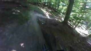
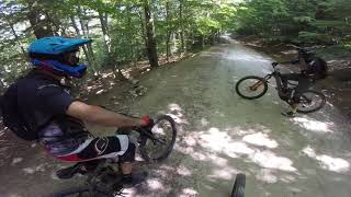
Photos of Bardineto Mountain Bike
Videos of Bardineto Mountain Bike
trail: Dondella
0:52 |
34 |
Oct 26, 2023
trail: Mulino
0:10 |
231 |
Jun 29, 2014
trail: Dondella climb offroad
2:26 |
279 |
Aug 27, 2013


trail: Dondella
8:29 |
264 |
Nov 30, 2023 , bardineto
trail: Dondella
8:07 |
129 |
Jul 2, 2023 , bardineto
trail: Pian Fieno upper part
8:26 |
264 |
Jul 1, 2023 , bardineto
Current Trail Warnings
| status | trail | date | condition | user | info |
|---|---|---|---|---|---|
| Dondella | May 19, 2026 @ 4:56pm (Europe/Rome) May 19, 2026 | Unknown | alealegazza | ITA Il sentiero DONDELLA è da... |
Recent Trail Reports
| status | trail | date | condition | info | user |
|---|---|---|---|---|---|
| Short Trail | Jun 3, 2026 @ 3:38pm (Europe/Monaco) Jun 3, 2026 | Ideal | pufalot TRAILFORKS | ||
| il collegamento | May 31, 2026 @ 9:46am (Europe/Monaco) May 31, 2026 | Ideal | Pambry | ||
| Pian fieno | May 29, 2026 @ 11:48am (Europe/Rome) May 29, 2026 | Unknown | alealegazza | ||
| Dondella climb offroad | May 21, 2026 @ 9:47am (Europe/Monaco) May 21, 2026 | Ideal | weridemtbskillscoaching | ||
| Pian Fieno upper part | May 8, 2026 @ 8:27am (Europe/Rome) May 7, 2026 | Ideal | nobrain | ||
| Green River | May 4, 2026 @ 8:48am (Europe/Rome) May 3, 2026 | Ideal | damientheflow | ||
| Bardineto / Rio secco / Cascina Cormore | May 1, 2026 @ 3:14pm (Europe/Rome) May 1, 2026 | Unknown | Pistolero79 | ||
| Mulino climb (moderate) | May 1, 2026 @ 10:30am (Europe/Monaco) May 1, 2026 | Ideal | Pistolero79 | ||
| Mulino | Apr 30, 2026 @ 9:14am (Europe/Rome) Apr 30, 2026 | Ideal | FLO89 TSR | ||
| Mulino climb (hard) | Apr 30, 2026 @ 9:14am (Europe/Rome) Apr 30, 2026 | Dry | FLO89 TSR |
Activity Feed
| username | action | type | title | date |
|---|---|---|---|---|
| teunvandenbrink | ridden | trail | activity #97171412 and 3 more | Jun 17, 2026 @ 3:27am 1 day |
| spezies8472 | wishlist | trail | activity #97104630 | Jun 16, 2026 @ 6:19am 2 days |
| stagolee | wishlist | trail | activity #97035766 | Jun 15, 2026 @ 6:01am 3 days |
| Herbaliza | ridden | trail | activity #96859589 | Jun 13, 2026 @ 3:39am Jun 13, 2026 |
| Cuno67 | ridden | trail | activity #96724765 | Jun 11, 2026 @ 2:20am Jun 11, 2026 |
Recent Comments
| username | type | title | comment | date |
|---|---|---|---|---|
| trail | Warning!!!! Undoable at the moment because of... | Feb 20, 2026 @ 11:11am Feb 20, 2026 | ||
| trail | trail fantastico in ottime condizioni. ottima... | Nov 10, 2025 @ 4:56am Nov 10, 2025 | ||
| trail | Muy divertido con largos tubos en la parte... | Oct 3, 2025 @ 10:29am Oct 3, 2025 | ||
| report | Se cerchi un sentiero pulito in zona... | Jan 5, 2025 @ 11:32am Jan 5, 2025 | ||
| report | Grazie. Mi hai risparmiato di arrivare fin lì... | Jan 3, 2025 @ 11:52am Jan 3, 2025 |
Local Badges
-

Epic Ride Climb 2k982 awarded -

Climbing 10k Badge84 awarded -

Climbing 100k Badge2 awarded -

Epic Ride Descent 2k1,632 awarded -

Descent 10k Badge123 awarded -

Descent 100k Badge3 awarded
Activity Type Stats
| activitytype | trails | distance | descent | descent distance | total vertical | rating | global rank | state rank | photos | reports | routes | ridelogs |
|---|---|---|---|---|---|---|---|---|---|---|---|---|
| Mountain Bike | 26 | 32 miles | 9,741 ft | 15 miles | 2,858 ft | #3,177 | #163 | 42 | 457 | 3 | 5,091 | |
| E-Bike | 20 | 24 miles | 6,555 ft | 11 miles | 2,858 ft | #3,505 | #325 | 381 | 2 | 1,250 | ||
| Horse | 4 | 3 miles | 646 ft | 1 mile | 413 ft | #1,522 | #60 | 22 | ||||
| Hike | 20 | 26 miles | 5,174 ft | 10 miles | 2,858 ft | #5,964 | #292 | 395 | 53 | |||
| Trail Running | 22 | 28 miles | 6,066 ft | 11 miles | 2,858 ft | #5,246 | #254 | 404 | 9 |
Frequently Asked Questions About Bardineto
▼
What are the highest rated mountain biking trails in Bardineto?
The highest rated mountain biking trails in Bardineto are:
- Dondella (4.5/5)
- Mulino (4.4/5)
- il collegamento (4.3/5)
- Pian fieno (4.3/5)
- Short Trail (4.2/5)
▼
What is the best time of the year to ride in Bardineto?
Based on ride log data, the most popular months to ride in Bardineto are:
- October (31 activities)
- September (18 activities)
- July (17 activities)
▼
Where can I park to ride in Bardineto?
Check the Bardineto trail map for trailhead and parking information. Community members regularly update access and parking details for trails in the area.
▼
What is the longest trail in Bardineto?
The longest trail in Bardineto is Alta Via Monte Carmo - Giogo di Toirano at 3.0 km. View all trails sorted by distance.
Activities
Trails
Points of Interest
- By denitopia
 TRAILFORKS VTA & contributors
 - Admins: denitopia
- #8631 - 7,178 views
- bardineto activity log | embed map of Bardineto mountain bike trails | bardineto mountain biking points of interest
Downloading of trail gps tracks in kml & gpx formats is enabled for Bardineto.
You must login to download files.