close
-
Layers w
- Weather Layers
- Pro
- Pro
- Pro
- Pro
- Pro
- Pro
- More Layers
- Pro
- Pro
- Pro
- Pro
-
Upgrade to

3D
Trail Conditions
- Unknown
- Snow Groomed
- Snow Packed
- Snow Covered
- Snow Cover Partial
- Freeze/thaw Cycle
- Icy
- Prevalent Mud
- Wet
- Variable
- Ideal
- Dry
- Very Dry
Trail Flow (Ridden Direction)
Trailforks scans users ridelogs to determine the most popular direction each trail is ridden. A good flowing trail network will have most trails flowing in a single direction according to their intension.
The colour categories are based on what percentage of riders are riding a trail in its intended direction.
The colour categories are based on what percentage of riders are riding a trail in its intended direction.
- > 96%
- > 90%
- > 80%
- > 70%
- > 50%
- < 50%
- bi-directional trail
- no data
Trail Last Ridden
Trailforks scans ridelogs to determine the last time a trail was ridden.
- < 2 days
- < 1 week
- < 2 weeks
- < 1 month
- < 6 months
- > 6 months
Trail Ridden Direction
The intended direction a trail should be ridden.
- Downhill Only
- Downhill Primary
- Both Directions
- Uphill Primary
- Uphill Only
- One Direction
Contribute Details
Colors indicate trail is missing specified detail.
- Description
- Photos
- Description & Photos
- Videos
Trail Popularity ?
Trailforks scans ridelogs to determine which trails are ridden the most in the last 9 months.
Trails are compared with nearby trails in the same city region with a possible 25 colour shades.
Think of this as a heatmap, more rides = more kinetic energy = warmer colors.
- most popular
- popular
- less popular
- not popular
ATV/ORV/OHV Filter
Max Vehicle Width
inches
US Cell Coverage
Legend

Radar Time
Activity Recordings
Trailforks uses anonymized public activity data.
?
Activity Recordings
Trailforks uses anonymized public activity data.
?
Personal Heatmap
▶
Activity Types
all
/
none
▶
Options
2
Date range
month
–
Winter Trails
Warning
A routing network for winter maps does not exist. Selecting trails using the winter trails layer has been disabled.
Missing Trails
Most Popular
Least Popular
Trails are colored based on popularity. The more popular a trail is, the more red. Less popular trails trend towards green.
Jump Magnitude Heatmap
Heatmap of where riders jump on trails. Zoom in to see individual jumps, click circles to view jump details.
BC Backroad Status
![map legend]()
Service Road Atlas is a free to use, community-driven service for viewing and creating reports on the numerous back-country service roads around B.C. and Alberta.

Slope Aspect
Direction the slope faces
Trails Deemphasized
Trails are shown in grey.
Only show trails with no bike usage.
Suggested Layers
Based on selected activity type
Save the current map location and zoom level as your default home location whenever this page is loaded.
Save
No description for Bardo has been added yet!
Login or register to submit one.
This region uses the Uk/Euro style trail grading system.
Activities Click to view
- Mountain Bike
27 trails
- E-Bike
25 trails
- Adaptive Bike
0 trails
- Horse
2 trails
- Hike
27 trails
- Trail Running
26 trails
- Nordic Ski
2 trails
Region Details
- 12
- 4
- 8
- 2
- 1
Region Status
Open as of Jun 4, 2026Stats
- Avg Trail Rating
- Trails (view details)
- 27
- Trails Mountain Bike
- 27
- Trails E-Bike
- 25
- Trails Horse
- 2
- Trails Hike
- 27
- Trails Trail Running
- 26
- Trails Dirtbike/Moto
- 3
- Trails Nordic Ski
- 2
- Total Distance
- 50 miles
- Total Descent
- 8,693 ft
- Total Vertical
- 1,530 ft
- Highest Trailhead
- 2,459 ft
- Reports
- 317
- Photos
- 144
- Ridden Counter
- 4,261
Sub Regions
-
9 Buków
- 2
-
Glacensis Bardo
- 2
- 5
-
Góry Bardzkie
- 3
- 2
- 1
Popular Bardo Mountain Biking Trails
• 100 ★ 4.1 • 5 miles • 395 ft • 592 •
Ścieżka przygotowana maszynowo, jedna z najstarszych wchodzących w skład projektu . Ciekawa turystycznie, w bezpośrednim pobliżu mija taras widokowy na oraz ze źródełkiem wody pitnej. Niewielkie odstępstwo od trasy pozwala...
• 95 ★ 4.0 • 3 miles • 1,030 ft • 554 •
Jednokierunkowa, monotoniczna ścieżka przygotowana maszynowo, jedna z pierwszych, które powstały w ramach projektu . Prowadzi głównie przez las, czasami przez łąki.
• 70 ★ 3.7 • 2 miles • 387 ft • 225 •
Popular blue difficulty machine groomed. This mountain bike primary trail can be used one direction and has a moderate overall physical rating with a 387 ft blue climb. It features berm and pump track. Trail visibility is always easy to follow. On average it takes 24 minutes to complete this trail.
• 90 ★ 3.8 • 2 miles • 194 ft • 209 •
Jedna z pierwszych ścieżek systemu Singletrack Glacensis, przygotowana w sposób maszynowy. Łatwa, zatacza pętlę, zaczyna się i kończy obok parkingu. Jej nazwa pochodzi od tzw. Miejsca Hrabiowskiego, ciekawego punktu widokowego....
• 60 ★ 3.9 • 2 miles • 103 ft • 191 •
Moderately popular blue difficulty machine groomed. This mountain bike primary trail can be used one direction and has a moderate overall physical rating with a 103 ft blue climb. It features berm and pump track. Trail visibility is always easy to follow. On average it takes 16 minutes to complete this trail.
• 85 ★ 4.7 • 2 miles • 182 ft • 147 •
Popular green difficulty machine groomed. This mountain bike primary trail can be used one direction. Trail visibility is always easy to follow. On average it takes 14 minutes to complete this trail.
• 55 ★ 3.7 • 2,090 ft • 6 ft • 130 •
Moderately popular blue difficulty machine groomed. This mountain bike primary trail can be used downhill only. Trail visibility is always easy to follow. On average it takes 2 minutes to complete this trail.
• 70 ★ 0.0 • 4 miles • 240 ft • 94 •
Ta ścieżka to jednocześnie: - część trasy narciarstwa biegowego , wchodzącego w skład grupy , - część trasy , wchodzącej w skład , - sugerowana trasa łącząca (pętla Wilcza) i .
Bardo Mountain Bike Routes
★ 4.7 • 8 miles • 1,449 ft • 2 • Loop •
Singletrack Glacensis - pełna Pętla Łaszczowa. Prowadzi z Barda na Przełęcz Łaszczową i z powrotem.
★ 3.5 • 19 miles • 2,488 ft • 11 • Loop •
Singletrack Glacensis - pełna pętla Wilcza. Jedynie kilka kilometrów prowadzi po ścieżkach typu...
27 miles • 3,142 ft • 1 • Loop •
Jest to najdłuższa z oficjalnych tras. Taki dystans po płaskim szutrze zajmuje dobrym rowerzystom...
85 miles • 11,258 ft • 31 • Loop •
Szereg połączonych pętli Singletrack Glacensis, z Barda do Stronia i z powrotem: - pętla Łaszczowa, -...
34 miles • 4,631 ft • 12 • Loop •
Cztery pętle Singletrack Glacensis z Barda: - Łaszczowa, - Kłodzka, - Chwalisław, - Złota.
8 miles • 1,207 ft • 1 • Point to Point •
Trasa prowadzi przez zróżnicowany teren, w zasadzie pokrywa się z Glacensis Wilcza Niebieska.
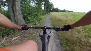
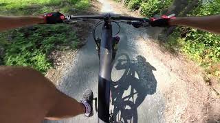
Photos of Bardo Mountain Bike
Videos of Bardo Mountain Bike
4:03 |
67 |
Apr 28, 2025
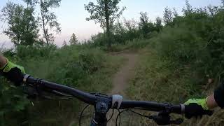
trail: Pętla Różańcowa
2:43 |
213 |
Jun 27, 2023 , Bardo
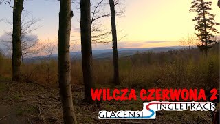
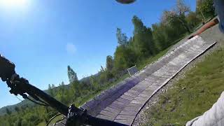
trail: Wilcza Czerwona 2
271 |
May 16, 2021 , Bardo
32:30 |
827 |
Jun 2, 2020

trail: Pętla Hrabiowska
16:14 |
790 |
Nov 27, 2019 , Bardo
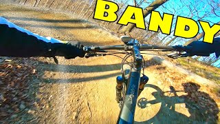
trail: Łaszczowa Czerwona
28:49 |
1314 |
Nov 27, 2019 , Bardo
trail: Pętla Różańcowa
8:15 |
1044 |
Nov 24, 2019 , Bardo
Recent Trail Reports
| status | trail | date | condition | info | user |
|---|---|---|---|---|---|
| Łaszczowa Niebieska | Jun 4, 2026 @ 10:29pm (Europe/Warsaw) Jun 4, 2026 | Ideal | majatravels | ||
| Łaszczowa Czerwona | Jun 4, 2026 @ 10:29pm (Europe/Warsaw) Jun 4, 2026 | Ideal | majatravels | ||
| Access Road | May 11, 2026 @ 9:40am (Europe/Prague) May 11, 2026 | Dry | MarekRS | ||
| Pętla Hrabiowska | May 3, 2026 @ 12:27pm (Europe/Prague) May 3, 2026 | Ideal | 65qKUv | ||
| Podzamecka Kopa | Feb 16, 2026 @ 2:23pm (Europe/Prague) Feb 16, 2026 | Icy | kocbar | ||
| Droga Krzyżowa Lower | Dec 31, 2025 @ 12:08am (Europe/Warsaw) Dec 30, 2025 | Freeze/thaw Cycle | Slavco85 | ||
| Ostra Góra | Dec 30, 2025 @ 11:57pm (Europe/Warsaw) Dec 30, 2025 | Snow Covered | Slavco85 | ||
| Wilcza Czerwona 2 | Sep 28, 2025 @ 1:00pm (Europe/Warsaw) Sep 28, 2025 | Unknown | Hitech | ||
| Bardo - Przełęcz Łaszczowa | Aug 18, 2025 @ 4:32pm Aug 18, 2025 | Dry | kyrtap | ||
| Access Road | Aug 18, 2025 @ 4:32pm Aug 18, 2025 | Dry | kyrtap |
Activity Feed
| username | action | type | title | date |
|---|---|---|---|---|
| Valheru81 | wishlist | route | activity #97372522 | Jun 20, 2026 @ 1:35am Jun 20, 2026 |
| radhar | wishlist | region | activity #97306714 | Jun 19, 2026 @ 4:04am Jun 19, 2026 |
| Kirsa | wishlist | route | activity #97047113 | Jun 15, 2026 @ 9:31am Jun 15, 2026 |
| majatravels | add | report | activity #96249213 and 1 more | Jun 4, 2026 @ 1:29pm Jun 4, 2026 |
| Valheru81 | wishlist | route | activity #96002473 | Jun 1, 2026 @ 12:28am Jun 1, 2026 |
Recent Comments
| username | type | title | comment | date |
|---|---|---|---|---|
| trail | Few broken trees | Jul 1, 2025 @ 9:52am Jul 1, 2025 | ||
| trail | Pierwsza moja wizyta w tym miejscu. Po... | Sep 3, 2023 @ 3:22pm Sep 3, 2023 | ||
| trail | Pełna zgoda z poprzednimi wpisami. Zakręty i... | Sep 3, 2023 @ 3:09pm Sep 3, 2023 | ||
| trail | Na starcie trochę błota rozjeżdżonego... | Oct 7, 2022 @ 6:38am Oct 7, 2022 | ||
| trail | Przy drugim przejeździe dają trochę frajdy... | Sep 19, 2022 @ 11:28am Sep 19, 2022 |
Local Badges
-

Epic Mountain Bike Climb 2k90 awarded -

Climbing 10k Badge15 awarded -

Mountain Biking 100k Badge0 awarded -

Epic Ride Descent 2k90 awarded -

Descent 10k Badge15 awarded -

Descent 100k Badge0 awarded
Bike & Skill Parks
| name | type | city | rating |
|---|---|---|---|
| Rowerowy Park Umiejętności w Bardzie | skill park | Bardo |
Activity Type Stats
| activitytype | trails | distance | descent | descent distance | total vertical | rating | global rank | state rank | photos | reports | routes | ridelogs |
|---|---|---|---|---|---|---|---|---|---|---|---|---|
| Mountain Bike | 27 | 50 miles | 8,694 ft | 22 miles | 1,529 ft | #3,125 | #61 | 147 | 317 | 11 | 3,532 | |
| E-Bike | 25 | 41 miles | 7,425 ft | 19 miles | 1,529 ft | #2,460 | #290 | 3 | 281 | 7 | 191 | |
| Horse | 2 | 1 mile | 59 ft | 1,001 ft | 367 ft | #665 | #264 | 2 | ||||
| Hike | 27 | 50 miles | 8,694 ft | 22 miles | 1,529 ft | #3,631 | #64 | 289 | 264 | |||
| Trail Running | 26 | 50 miles | 8,537 ft | 22 miles | 1,529 ft | #3,229 | #54 | 289 | 15 | |||
| Dirtbike/Moto | 3 | 1 mile | 213 ft | 1,581 ft | 371 ft | 2 | 2 | |||||
| Nordic Ski | 2 | 6 miles | 692 ft | 3 miles | 367 ft | #356 | #34 | 5 |
Frequently Asked Questions About Bardo
▼
What are the best places to ride in Bardo?
Bardo has 3 areas to explore for mountain biking. The top rated areas are:
▼
What are the highest rated mountain biking trails in Bardo?
The highest rated mountain biking trails in Bardo are:
- Pętla Różańcowa (4.2/5)
- Łaszczowa Niebieska (4/5)
- Łaszczowa Czerwona (4/5)
- Wilcza Czerwona 2 (3.9/5)
- Wilcza Czerwona 3 (3.9/5)
▼
What is the best time of the year to ride in Bardo?
Based on ride log data, the most popular months to ride in Bardo are:
- July (67 activities)
- September (50 activities)
- May (46 activities)
▼
Where can I park to ride in Bardo?
There are 4 parking locations listed in Bardo. The most popular parking spots are: View all parking and trailhead locations on the map to plan your visit.
Activities
Trails
- By kjaer
 & contributors
 - Admins: xaoo
- #27550 - 6,351 views
- bardo activity log | embed map of Bardo mountain bike trails | bardo mountain biking points of interest
Downloading of trail gps tracks in kml & gpx formats is enabled for Bardo.
You must login to download files.