close
-
Layers w
- Weather Layers
- Pro
- Pro
- Pro
- Pro
- Pro
- Pro
- More Layers
- Pro
- Pro
- Pro
- Pro
-
Upgrade to

3D
Trail Conditions
- Unknown
- Snow Groomed
- Snow Packed
- Snow Covered
- Snow Cover Partial
- Freeze/thaw Cycle
- Icy
- Prevalent Mud
- Wet
- Variable
- Ideal
- Dry
- Very Dry
Trail Flow (Ridden Direction)
Trailforks scans users ridelogs to determine the most popular direction each trail is ridden. A good flowing trail network will have most trails flowing in a single direction according to their intension.
The colour categories are based on what percentage of riders are riding a trail in its intended direction.
The colour categories are based on what percentage of riders are riding a trail in its intended direction.
- > 96%
- > 90%
- > 80%
- > 70%
- > 50%
- < 50%
- bi-directional trail
- no data
Trail Last Ridden
Trailforks scans ridelogs to determine the last time a trail was ridden.
- < 2 days
- < 1 week
- < 2 weeks
- < 1 month
- < 6 months
- > 6 months
Trail Ridden Direction
The intended direction a trail should be ridden.
- Downhill Only
- Downhill Primary
- Both Directions
- Uphill Primary
- Uphill Only
- One Direction
Contribute Details
Colors indicate trail is missing specified detail.
- Description
- Photos
- Description & Photos
- Videos
Trail Popularity ?
Trailforks scans ridelogs to determine which trails are ridden the most in the last 9 months.
Trails are compared with nearby trails in the same city region with a possible 25 colour shades.
Think of this as a heatmap, more rides = more kinetic energy = warmer colors.
- most popular
- popular
- less popular
- not popular
ATV/ORV/OHV Filter
Max Vehicle Width
inches
US Cell Coverage
Legend

Radar Time
Activity Recordings
Trailforks uses anonymized public activity data.
?
Activity Recordings
Trailforks uses anonymized public activity data.
?
Personal Heatmap
▶
Activity Types
all
/
none
▶
Options
2
Date range
month
–
Winter Trails
Warning
A routing network for winter maps does not exist. Selecting trails using the winter trails layer has been disabled.
Missing Trails
Most Popular
Least Popular
Trails are colored based on popularity. The more popular a trail is, the more red. Less popular trails trend towards green.
Jump Magnitude Heatmap
Heatmap of where riders jump on trails. Zoom in to see individual jumps, click circles to view jump details.
BC Backroad Status
![map legend]()
Service Road Atlas is a free to use, community-driven service for viewing and creating reports on the numerous back-country service roads around B.C. and Alberta.

Slope Aspect
Direction the slope faces
Trails Deemphasized
Trails are shown in grey.
Only show trails with no bike usage.
Suggested Layers
Based on selected activity type
Save the current map location and zoom level as your default home location whenever this page is loaded.
Save
No description for Barnstaple has been added yet!
Login or register to submit one.
This region uses the Uk/Euro style trail grading system.
Activities Click to view
- Mountain Bike
2 trails
- E-Bike
1 trails
- Gravel Bike
0 trails
- Adaptive Bike
0 trails
- Hike
3 trails
- Trail Running
4 trails
Region Details
- 1
- 1
Region Status
Open as of Sep 27, 2025Stats
- Avg Trail Rating
- Trails (view details)
- 2
- Trails Mountain Bike
- 2
- Trails E-Bike
- 1
- Trails Hike
- 4
- Trails Trail Running
- 4
- Total Distance
- 4,589 ft
- Total Descent
- 382 ft
- Total Vertical
- 369 ft
- Highest Trailhead
- 598 ft
- Reports
- 11
- Photos
- 130
- Ridden Counter
- 34
Sub Regions
-
Fremington Woods
Popular Barnstaple Mountain Biking Trails
• ★ 2.5 • 4,589 ft • 13 ft • 25 •
Starting at the Monument on the top of the hill going all the way down to the road near the garage. ride or walk to the top of the hill then ride down.
Barnstaple Mountain Bike Routes
30 miles • 828 ft • 0 • Point to Point •
Day 1 C2C for a three day 100 Miles Coast to Coast trip
41 miles • 2,297 ft • 0 • Point to Point •
Devon C2C Day 2 of a three day Coast to Coast 100 mile trip
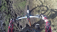
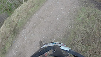
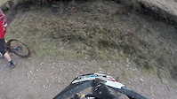
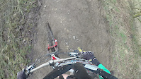
Photos of Barnstaple Mountain Bike
Videos of Barnstaple Mountain Bike
trail: Codden Hill
0:12 |
555 |
Feb 18, 2016
trail: Codden Hill
0:42 |
222 |
Feb 15, 2016
trail: Codden Hill
0:27 |
216 |
Feb 14, 2016
trail: Codden Hill
0:15 |
173 |
Feb 14, 2016
Recent Trail Reports
no previous reports, add one now!
Activity Feed
| username | action | type | title | date |
|---|---|---|---|---|
| nellybrewster | wishlist | trail | activity #93105681 | Apr 21, 2026 @ 2:23pm Apr 21, 2026 |
| jodyreynolds81 | add | photo | activity #88963959 and 5 more | Feb 15, 2026 @ 8:50am Feb 15, 2026 |
| tomhQcq2G | wishlist | trail | activity #84036579 | Nov 12, 2025 @ 12:48pm Nov 12, 2025 |
| GBDevon | wishlist | route | activity #31464199 | Jul 16, 2022 @ 11:54am Jul 16, 2022 |
| Kiwiconna | ridden | trail | activity #14560262 | Nov 11, 2020 @ 4:39am Nov 11, 2020 |
Local Mountain Biking Directory
-
Bike-itBike Shop
Activity Type Stats
| activitytype | trails | distance | descent | descent distance | total vertical | rating | global rank | state rank | photos | reports | routes | ridelogs |
|---|---|---|---|---|---|---|---|---|---|---|---|---|
| Mountain Bike | 2 | 4,590 ft | 381 ft | 4,360 ft | 367 ft | #9,170 | #362 | 130 | 11 | 2 | 6,150 | |
| E-Bike | 1 | #6,340 | #284 | 9 | 2 | 267 | ||||||
| Hike | 3 | #10,112 | #324 | 11 | 408 | |||||||
| Trail Running | 4 | #9,779 | #318 | 11 | 28 |
- By canadaka
 Trailforks & contributors
 - Admins: wisey, MathieuC, cemoorelife
- #7662 - 7,320 views
- barnstaple activity log | embed map of Barnstaple mountain bike trails | barnstaple mountain biking points of interest
Downloading of trail gps tracks in kml & gpx formats is enabled for Barnstaple.
You must login to download files.