close
-
Layers w
- Weather Layers
- Pro
- Pro
- Pro
- Pro
- Pro
- Pro
- More Layers
- Pro
- Pro
- Pro
- Pro
-
Upgrade to

3D
Trail Conditions
- Unknown
- Snow Groomed
- Snow Packed
- Snow Covered
- Snow Cover Partial
- Freeze/thaw Cycle
- Icy
- Prevalent Mud
- Wet
- Variable
- Ideal
- Dry
- Very Dry
Trail Flow (Ridden Direction)
Trailforks scans users ridelogs to determine the most popular direction each trail is ridden. A good flowing trail network will have most trails flowing in a single direction according to their intension.
The colour categories are based on what percentage of riders are riding a trail in its intended direction.
The colour categories are based on what percentage of riders are riding a trail in its intended direction.
- > 96%
- > 90%
- > 80%
- > 70%
- > 50%
- < 50%
- bi-directional trail
- no data
Trail Last Ridden
Trailforks scans ridelogs to determine the last time a trail was ridden.
- < 2 days
- < 1 week
- < 2 weeks
- < 1 month
- < 6 months
- > 6 months
Trail Ridden Direction
The intended direction a trail should be ridden.
- Downhill Only
- Downhill Primary
- Both Directions
- Uphill Primary
- Uphill Only
- One Direction
Contribute Details
Colors indicate trail is missing specified detail.
- Description
- Photos
- Description & Photos
- Videos
Trail Popularity ?
Trailforks scans ridelogs to determine which trails are ridden the most in the last 9 months.
Trails are compared with nearby trails in the same city region with a possible 25 colour shades.
Think of this as a heatmap, more rides = more kinetic energy = warmer colors.
- most popular
- popular
- less popular
- not popular
ATV/ORV/OHV Filter
Max Vehicle Width
inches
US Cell Coverage
Legend

Radar Time
Activity Recordings
Trailforks uses anonymized public activity data.
?
Activity Recordings
Trailforks uses anonymized public activity data.
?
Personal Heatmap
▶
Activity Types
all
/
none
▶
Options
2
Date range
month
–
Winter Trails
Warning
A routing network for winter maps does not exist. Selecting trails using the winter trails layer has been disabled.
Missing Trails
Most Popular
Least Popular
Trails are colored based on popularity. The more popular a trail is, the more red. Less popular trails trend towards green.
Jump Magnitude Heatmap
Heatmap of where riders jump on trails. Zoom in to see individual jumps, click circles to view jump details.
BC Backroad Status
![map legend]()
Service Road Atlas is a free to use, community-driven service for viewing and creating reports on the numerous back-country service roads around B.C. and Alberta.

Slope Aspect
Direction the slope faces
Trails Deemphasized
Trails are shown in grey.
Only show trails with no bike usage.
Suggested Layers
Based on selected activity type
Save the current map location and zoom level as your default home location whenever this page is loaded.
Save
No description for Barranquilla has been added yet!
Login or register to submit one.
Activities Click to view
- Mountain Bike
6 trails
- E-Bike
6 trails
- Adaptive Bike
- Horse
0 trails
- Hike
1 trails
- Trail Running
1 trails
Region Details
- 2
- 4
Region Status
Caution as of Apr 23, 2026Stats
- Trails (view details)
- 6
- Trails Mountain Bike
- 6
- Trails E-Bike
- 6
- Trails Hike
- 1
- Trails Trail Running
- 1
- Total Distance
- 4 miles
- Total Descent Distance
- 2 miles
- Total Descent
- 696 ft
- Total Vertical
- 311 ft
- Highest Trailhead
- 388 ft
- Reports
- 15
- Photos
- 29
- Ridden Counter
- 68
Popular Barranquilla Mountain Biking Trails
• 100 ★ 0.0 • 1,903 ft • 19 ft • 12 •
Popular green difficulty singletrack. This mountain bike primary trail can be used both directions and has a easy overall physical rating with a 19 ft green climb. It features berm. Trail visibility is always easy to follow. On average it takes 8 minutes to complete this trail.
• 90 ★ 0.0 • 1,427 ft • 28 ft • 11 •
Popular green difficulty singletrack. This mountain bike primary trail can be used both directions and has a easy overall physical rating with a 28 ft green climb. Trail visibility is always easy to follow. On average it takes 2 minutes to complete this trail.
• 30 ★ 0.0 • 4,925 ft • 174 ft • 7 •
Desde la entrada, siguiendo la cerca por todo el perimetro. Pasa por Purgatorio, frente a Yisus, Pokemon, Peralte Sakura, Como Varón y spider hasta hasta las bancas en el aire.
• 15 ★ 0.0 • 2 miles • 286 ft • 7 •
Una de las más largas y técnicas dentro de Pelícano.
• 45 ★ 0.0 • 2,989 ft • 95 ft • 5 •
Punto más alto de Pelícano. Pasa por una de las torres eléctricas.
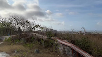
Photos of Barranquilla Mountain Bike
Videos of Barranquilla Mountain Bike
0:10 |
21 |
Mar 31, 2022
Recent Trail Reports
| status | trail | date | condition | info | user |
|---|---|---|---|---|---|
| Maizal - Mirador Piro Reloaded | Nov 16, 2022 @ 10:07am Nov 16, 2022 | Snow Groomed | GordBurg |
Activity Feed
| username | action | type | title | date |
|---|---|---|---|---|
| AlfredoA | add | trail | activity #40481857 and 1 more | May 31, 2023 @ 10:28am May 31, 2023 |
| AlfredoA | add | photo | activity #39591032 and 17 more | May 2, 2023 @ 10:54am May 2, 2023 |
| AlfredoA | add | trail | activity #39589215 and 1 more | May 2, 2023 @ 9:51am May 2, 2023 |
| AlfredoA | add | photo | activity #39062217 | Apr 15, 2023 @ 1:16pm Apr 15, 2023 |
| AlfredoA | add | photo | activity #38758557 and 7 more | Apr 5, 2023 @ 7:06pm Apr 5, 2023 |
Activity Type Stats
| activitytype | trails | distance | descent | descent distance | total vertical | rating | global rank | state rank | photos | reports | routes | ridelogs |
|---|---|---|---|---|---|---|---|---|---|---|---|---|
| Mountain Bike | 6 | 4 miles | 696 ft | 2 miles | 312 ft | #8,909 | #20 | 29 | 15 | 4,627 | ||
| E-Bike | 6 | 4 miles | 696 ft | 2 miles | 312 ft | #1,840 | #11 | 15 | 75 | |||
| Hike | 1 | 1,903 ft | 52 ft | 1,027 ft | 56 ft | #3,175 | #14 | 15 | 83 | |||
| Trail Running | 1 | 1,903 ft | 52 ft | 1,027 ft | 56 ft | #2,652 | #14 | 15 | 24 |
Frequently Asked Questions About Barranquilla
▼
What are the highest rated mountain biking trails in Barranquilla?
The highest rated mountain biking trails in Barranquilla are:
- Maizal - Mirador Piro Reloaded (0/5)
- Vía Láctea - Maizal (0/5)
- El Tornillo - Camilo Jose (0/5)
- Torrecita (0/5)
- Tourmalet Pelicano (0/5)
▼
What is the best time of the year to ride in Barranquilla?
Based on ride log data, the most popular months to ride in Barranquilla are:
- May (47 activities)
- April (42 activities)
- December (20 activities)
▼
Where can I park to ride in Barranquilla?
Check the Barranquilla trail map for trailhead and parking information. Community members regularly update access and parking details for trails in the area.
▼
What is the longest trail in Barranquilla?
The longest trail in Barranquilla is Tourmalet Pelicano at 1.7 miles. View all trails sorted by distance.
Trails
Points of Interest
- By Fabiomontoyac & contributors
- Admins: apply
- #39065 - 1,368 views
- barranquilla activity log | embed map of Barranquilla mountain bike trails |
Downloading of trail gps tracks in kml & gpx formats is enabled for Barranquilla.
You must login to download files.