close
-
Layers w
- Weather Layers
- Pro
- Pro
- Pro
- Pro
- Pro
- Pro
- More Layers
- Pro
- Pro
- Pro
- Pro
-
Upgrade to

3D
Trail Conditions
- Unknown
- Snow Groomed
- Snow Packed
- Snow Covered
- Snow Cover Partial
- Freeze/thaw Cycle
- Icy
- Prevalent Mud
- Wet
- Variable
- Ideal
- Dry
- Very Dry
Trail Flow (Ridden Direction)
Trailforks scans users ridelogs to determine the most popular direction each trail is ridden. A good flowing trail network will have most trails flowing in a single direction according to their intension.
The colour categories are based on what percentage of riders are riding a trail in its intended direction.
The colour categories are based on what percentage of riders are riding a trail in its intended direction.
- > 96%
- > 90%
- > 80%
- > 70%
- > 50%
- < 50%
- bi-directional trail
- no data
Trail Last Ridden
Trailforks scans ridelogs to determine the last time a trail was ridden.
- < 2 days
- < 1 week
- < 2 weeks
- < 1 month
- < 6 months
- > 6 months
Trail Ridden Direction
The intended direction a trail should be ridden.
- Downhill Only
- Downhill Primary
- Both Directions
- Uphill Primary
- Uphill Only
- One Direction
Contribute Details
Colors indicate trail is missing specified detail.
- Description
- Photos
- Description & Photos
- Videos
Trail Popularity ?
Trailforks scans ridelogs to determine which trails are ridden the most in the last 9 months.
Trails are compared with nearby trails in the same city region with a possible 25 colour shades.
Think of this as a heatmap, more rides = more kinetic energy = warmer colors.
- most popular
- popular
- less popular
- not popular
ATV/ORV/OHV Filter
Max Vehicle Width
inches
US Cell Coverage
Legend

Radar Time
Activity Recordings
Trailforks uses anonymized public activity data.
?
Activity Recordings
Trailforks uses anonymized public activity data.
?
Personal Heatmap
▶
Activity Types
all
/
none
▶
Options
2
Date range
month
–
Winter Trails
Warning
A routing network for winter maps does not exist. Selecting trails using the winter trails layer has been disabled.
Missing Trails
Most Popular
Least Popular
Trails are colored based on popularity. The more popular a trail is, the more red. Less popular trails trend towards green.
Jump Magnitude Heatmap
Heatmap of where riders jump on trails. Zoom in to see individual jumps, click circles to view jump details.
BC Backroad Status
![map legend]()
Service Road Atlas is a free to use, community-driven service for viewing and creating reports on the numerous back-country service roads around B.C. and Alberta.

Slope Aspect
Direction the slope faces
Trails Deemphasized
Trails are shown in grey.
Only show trails with no bike usage.
Suggested Layers
Based on selected activity type
Save the current map location and zoom level as your default home location whenever this page is loaded.
Save
No description for Barrie has been added yet!
Login or register to submit one.
Activities Click to view
- Mountain Bike
164 trails
- E-Bike
8 trails
- Adaptive Bike
1 trails
- Horse
16 trails
- Hike
164 trails
- Trail Running
164 trails
- Snowmobile
0 trails
- Snowshoe
154 trails
- Nordic Ski
46 trails
Region Details
- 27
- 19
- 66
- 28
Region Status
Open as of May 25, 2026Stats
- Avg Trail Rating
- Trails (view details)
- 141
- Trails Mountain Bike
- 164
- Trails E-Bike
- 8
- Trails Gravel Bike
- 5
- Trails Adaptive Bike
- 1
- Trails Winter Fat Bike
- 5
- Trails Horse
- 16
- Trails Hike
- 164
- Trails Trail Running
- 164
- Trails Snowshoe
- 154
- Trails Downhill Ski
- 3
- Trails Nordic Ski
- 46
- Total Distance
- 35 miles
- Total Descent
- 3,040 ft
- Total Vertical
- 330 ft
- Highest Trailhead
- 1,048 ft
- Reports
- 131
- Photos
- 19
- Ridden Counter
- 14,943
Sub Regions
-
Ardagh Bluffs
- 2
- 32
- 16
-
Barrie Lakefront Park
- 2
- 2
-
Beacon Glen Trails
- 6
-
Hewitt's Creek
- 9
- 3
-
Sandy Hollow
- 2
-
Simcoe County Forest - Bloxham Tract
-
Simcoe County Forest - Dyer Tract
- 1
- 20
- 9
-
Sunnidale Park
- 3
Popular Barrie Mountain Biking Trails
• 100 ★ 0.0 • 2 miles • 15 ft • 255 •
Popular white difficulty family friendly gravel path. This multi-use trail can be used both directions and has a easy overall physical rating with a 15 ft green climb. Trail visibility is always easy to follow. On average it takes 9 minutes to complete this trail.
• 50 ★ 0.0 • 1 mile • 233 ft • 217 •
Moderately popular green difficulty mixed. This multi-use trail can be used both directions. On average it takes 2 minutes to complete this trail.
• 80 ★ 0.0 • 492 ft • 42 ft • 70 •
Popular green difficulty doubletrack. This multi-use trail can be used both directions. On average it takes minutes to complete this trail.
• 95 ★ 0.0 • 909 ft • 0 ft • 65 •
Popular green difficulty mixed. This multi-use trail can be used both directions. On average it takes minutes to complete this trail.
• 70 ★ 0.0 • 695 ft • 94 ft • 61 •
Popular green difficulty singletrack. This multi-use trail can be used both directions. On average it takes 1 minutes to complete this trail.
• 85 ★ 0.0 • 1,808 ft • 51 ft • 57 •
A fun trail with moderate climbs, bumps, jumps & a little exposure. Fast flowy exit to the south end.
• 75 ★ 0.0 • 1,276 ft • 120 ft • 50 •
Popular green difficulty singletrack. This multi-use trail can be used both directions. On average it takes 2 minutes to complete this trail.
• 60 ★ 0.0 • 397 ft • 3 ft • 48 •
Moderately popular green difficulty singletrack. This multi-use trail can be used both directions. On average it takes minutes to complete this trail.
Barrie Mountain Bike Routes
★ 3.2 • 13 miles • 1,349 ft • 95 • Out & Back •
A good 20km route through Copeland, showcasing some of the 'key' trails in the forest. A good variety of...
6 miles • 809 ft • 34 •
Hi, I need 20 something characters to submit this so I am just going to type this.
8 miles • 761 ft • 42 • Loop •
This trail is to improve your riding from the basics and really push your comfort zone.
11 miles • 1,191 ft • 49 • Loop •
This course takes you out to the furthest points of the trail system and back.
Photos of Barrie Mountain Bike
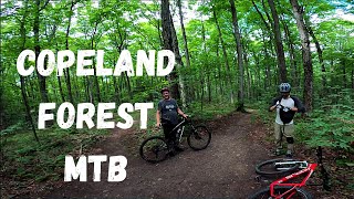
Videos of Barrie Mountain Bike
trail: Pioneer Trail
0:30 |
|
Aug 21, 2022
21:57 |
857 |
Feb 6, 2021
Recent Trail Reports
| status | trail | date | condition | info | user |
|---|---|---|---|---|---|
| Minet's Connector | May 25, 2026 @ 5:51pm (America/Toronto) May 25, 2026 | Ideal | Gibby2 | ||
| North Shore Trail | May 25, 2026 @ 5:51pm (America/Toronto) May 25, 2026 | Ideal | Gibby2 | ||
| Connector | Oct 3, 2025 @ 5:16pm (America/Toronto) Oct 3, 2025 | Ideal | Relaxingmeat13 | ||
| Wilkins Walk | Oct 3, 2025 @ 5:16pm (America/Toronto) Oct 3, 2025 | Ideal | Relaxingmeat13 | ||
| Path | Oct 3, 2025 @ 5:16pm (America/Toronto) Oct 3, 2025 | Ideal | Relaxingmeat13 | ||
| Holly Meadow | Sep 16, 2025 @ 7:42pm (America/Toronto) Sep 16, 2025 | Ideal | duey01 | ||
| Wiggin's Wiggle | Sep 16, 2025 @ 7:41pm (America/Toronto) Sep 16, 2025 | Ideal | duey01 | ||
| Rilynn & Reece | Sep 16, 2025 @ 7:40pm (America/Toronto) Sep 16, 2025 | Ideal | duey01 | ||
| Fiona's Sidepiece | Sep 16, 2025 @ 7:39pm (America/Toronto) Sep 16, 2025 | Ideal | duey01 | ||
| King Louie | Sep 16, 2025 @ 7:33pm (America/Toronto) Sep 16, 2025 | Dry | duey01 |
Activity Feed
| username | action | type | title | date |
|---|---|---|---|---|
| Canadmos | update | region | activity #97104149 | Jun 16, 2026 @ 6:09am 2 days |
| Canadmos | add | trail | activity #97104002 and 5 more | Jun 16, 2026 @ 6:07am 2 days |
| Krisf | wishlist | route | activity #96990897 | Jun 14, 2026 @ 11:38am Jun 14, 2026 |
| Gibby2 | add | report | activity #95534386 and 2 more | May 25, 2026 @ 5:19pm May 25, 2026 |
| Mottzy69 | wishlist | route | activity #95252367 | May 22, 2026 @ 10:21am May 22, 2026 |
Recent Comments
| username | type | title | comment | date |
|---|---|---|---|---|
| trail | Super fun trail to descend! | Sep 15, 2025 @ 7:21pm Sep 15, 2025 | ||
| trail | Pretty serious hill at the end | Sep 9, 2025 @ 6:50pm Sep 9, 2025 | ||
| trail | Turns into a beach amount of sand | Jul 16, 2025 @ 2:08pm Jul 16, 2025 |
Local Badges
-

10 Green Trails97 awarded -

Epic Ride Climb 2k15 awarded -

Climbing 10k Badge20 awarded -

Climbing 100k Badge0 awarded -

Epic Ride Descent 2k57 awarded -

Descent 10k Badge26 awarded
Local Mountain Biking Directory
-
Pedal to the People
-
Bike Stuff Plus
![Bike Stuff Plus]()
-
The Bike Zone - BarrieBike Shop
![The Bike Zone - Barrie]()
-
BikelandBike Shop
![Bikeland]()
-
Trek Bicycle Store BarrieBike Shop
![Trek Bicycle Store Barrie]()
-
MEC (Mountain Equipment Co-op) BarrieBike Shop
Activity Type Stats
| activitytype | trails | distance | descent | descent distance | total vertical | rating | global rank | state rank | photos | reports | routes | ridelogs |
|---|---|---|---|---|---|---|---|---|---|---|---|---|
| Mountain Bike | 164 | 34 miles | 3,028 ft | 13 miles | 328 ft | #2,944 | #57 | 19 | 131 | 7 | 7,258 | |
| E-Bike | 8 | 4 miles | 89 ft | 3,898 ft | 75 ft | #6,221 | #98 | 94 | 310 | |||
| Gravel Bike | 5 | #6,552 | #101 | 3 | 69 | |||||||
| Adaptive Bike | 1 | #6,565 | #74 | 2 | ||||||||
| Winter Fat Bike | 5 | #6,552 | #101 | 3 | ||||||||
| Horse | 16 | 5 miles | 318 ft | 2 miles | 200 ft | #1,919 | #27 | 5 | ||||
| Hike | 164 | 34 miles | 3,005 ft | 13 miles | 331 ft | #3,684 | #71 | 131 | 1,365 | |||
| Trail Running | 164 | 34 miles | 3,005 ft | 13 miles | 331 ft | #3,157 | #52 | 131 | 1,257 | |||
| Snowshoe | 154 | 33 miles | 2,966 ft | 13 miles | 331 ft | #288 | #27 | 11 | 83 | |||
| Downhill Ski | 3 | 1,010 ft | 62 ft | 1,010 ft | 66 ft | #15 | 69 | |||||
| Nordic Ski | 46 | 15 miles | 853 ft | 5 miles | 308 ft | #756 | #52 | 5 | 60 |
Frequently Asked Questions About Barrie
▼
What are the best places to ride in Barrie?
Barrie has 8 areas to explore for mountain biking. The top rated areas are:
▼
What are the highest rated mountain biking trails in Barrie?
The highest rated mountain biking trails in Barrie are:
- Ardagh Ring Trail - East (3.9/5)
- North Shore Trail (0/5)
- Rilynn & Reece (0/5)
- Road Runner (0/5)
- Pink Panther (0/5)
▼
What is the best time of the year to ride in Barrie?
Based on ride log data, the most popular months to ride in Barrie are:
- July (108 activities)
- September (58 activities)
- June (54 activities)
▼
Where can I park to ride in Barrie?
There are 3 parking locations listed in Barrie. The most popular parking spots are: View all parking and trailhead locations on the map to plan your visit.
Activities
- By Snake10927 & contributors
- Admins: apply
- #4243 - 22,648 views
- barrie activity log | embed map of Barrie mountain bike trails | barrie mountain biking points of interest
Downloading of trail gps tracks in kml & gpx formats is enabled for Barrie.
You must login to download files.