close
-
Layers w
- Weather Layers
- Pro
- Pro
- Pro
- Pro
- Pro
- Pro
- More Layers
- Pro
- Pro
- Pro
- Pro
-
Upgrade to

3D
Trail Conditions
- Unknown
- Snow Groomed
- Snow Packed
- Snow Covered
- Snow Cover Partial
- Freeze/thaw Cycle
- Icy
- Prevalent Mud
- Wet
- Variable
- Ideal
- Dry
- Very Dry
Trail Flow (Ridden Direction)
Trailforks scans users ridelogs to determine the most popular direction each trail is ridden. A good flowing trail network will have most trails flowing in a single direction according to their intension.
The colour categories are based on what percentage of riders are riding a trail in its intended direction.
The colour categories are based on what percentage of riders are riding a trail in its intended direction.
- > 96%
- > 90%
- > 80%
- > 70%
- > 50%
- < 50%
- bi-directional trail
- no data
Trail Last Ridden
Trailforks scans ridelogs to determine the last time a trail was ridden.
- < 2 days
- < 1 week
- < 2 weeks
- < 1 month
- < 6 months
- > 6 months
Trail Ridden Direction
The intended direction a trail should be ridden.
- Downhill Only
- Downhill Primary
- Both Directions
- Uphill Primary
- Uphill Only
- One Direction
Contribute Details
Colors indicate trail is missing specified detail.
- Description
- Photos
- Description & Photos
- Videos
Trail Popularity ?
Trailforks scans ridelogs to determine which trails are ridden the most in the last 9 months.
Trails are compared with nearby trails in the same city region with a possible 25 colour shades.
Think of this as a heatmap, more rides = more kinetic energy = warmer colors.
- most popular
- popular
- less popular
- not popular
ATV/ORV/OHV Filter
Max Vehicle Width
inches
US Cell Coverage
Legend

Radar Time
Activity Recordings
Trailforks uses anonymized public activity data.
?
Activity Recordings
Trailforks uses anonymized public activity data.
?
Personal Heatmap
▶
Activity Types
all
/
none
▶
Options
2
Date range
month
–
Winter Trails
Warning
A routing network for winter maps does not exist. Selecting trails using the winter trails layer has been disabled.
Missing Trails
Most Popular
Least Popular
Trails are colored based on popularity. The more popular a trail is, the more red. Less popular trails trend towards green.
Jump Magnitude Heatmap
Heatmap of where riders jump on trails. Zoom in to see individual jumps, click circles to view jump details.
BC Backroad Status
![map legend]()
Service Road Atlas is a free to use, community-driven service for viewing and creating reports on the numerous back-country service roads around B.C. and Alberta.

Slope Aspect
Direction the slope faces
Trails Deemphasized
Trails are shown in grey.
Only show trails with no bike usage.
Suggested Layers
Based on selected activity type
Save the current map location and zoom level as your default home location whenever this page is loaded.
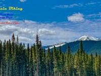
SavePublic land east of the Barrier Lake PRA / Hwy 40 along the Hwy 68 corridor around Lusk Ridge and Mount Baldy.
Primary Trail Type: Cross-Country
AKA: Barrier Dam, Lusk Ridge
 google parking directions
 Activities Click to view
- Mountain Bike
16 trails
- E-Bike
4 trails
- Horse
1 trails
- Hike
35 trails
- Trail Running
35 trails
- Snowshoe
11 trails
Region Details
- 1
- 5
- 6
Region Status
Open as of Jun 15, 2026Stats
- Avg Trail Rating
- Trails (view details)
- 13
- Trails Mountain Bike
- 16
- Trails E-Bike
- 4
- Trails Horse
- 1
- Trails Hike
- 35
- Trails Trail Running
- 35
- Trails Snowshoe
- 11
- Trails Backcountry Ski
- 2
- Total Distance
- 28 miles
- Total Descent
- 3,895 ft
- Total Vertical
- 3,155 ft
- Highest Trailhead
- 7,488 ft
- Reports
- 134
- Photos
- 99
- Ridden Counter
- 3,652
Popular Barrier Lake Mountain Biking Trails
• 25 ★ 0.0 • 2 miles • 107 ft • 54 •
This trail runs along the powerline beside Barrier Lake. South of the junction it is signed as a hiking trail , it provides a nice alternative to StoneyTrail [which gets lots of horse traffic].
• 55 ★ 4.0 • 3 miles • 741 ft • 27 •
Moderately popular blue difficulty singletrack. This multi-use trail can be used both directions.
• 50 ★ 0.0 • 4,777 ft • 9 ft • 23 •
Moderately popular blue difficulty singletrack. This multi-use trail can be used both directions.
• 40 ★ 0.0 • 1,742 ft • 250 ft • 16 • • hike
Moderately popular blue difficulty singletrack. This hike primary trail can be used both directions.
• 45 ★ 0.0 • 682 ft • 55 ft • 11 • • hike
Moderately popular green difficulty singletrack. This hike primary trail can be used both directions.
• 45 ★ 0.0 • 2,726 ft • 51 ft • 5 •
Moderately popular green difficulty singletrack. This multi-use trail can be used both directions.
• 25 ★ 0.0 • 1,483 ft • 0 ft • 4 •
Less popular blue difficulty singletrack. This multi-use trail can be used both directions.
• 5 ★ 0.0 • 997 ft • 44 ft • 1 •
Less popular green difficulty singletrack. This multi-use trail can be used both directions.
Barrier Lake Mountain Bike Routes
Prairie View to Jewell Pass Loop Featured
★ 4.4 • 10 miles • 2,053 ft • 2 • Loop •
An oldie but a goodie! The PV-JP Loop has been a mainstay of the local riding scene since the '90s. This...
★ 4.0 • 9 miles • 1,721 ft • 5 • Loop •
Park at east entrance of Barrier Lake. Take . Connect and go down . At the bottom/end of , connect with...
★ 4.0 • 9 miles • 1,534 ft • 7 • Loop •
Probably the most pleasant way to get around . CCH is a great descent, but the ride back to Barrier Dam...
13 miles • 2,155 ft • 1 • Loop •
A twist on the classic - route. This version starts at the northeast end of Trails which creates a...
9 miles • 1,936 ft • 2 • Loop •
An oldie but a goodie! The PV-JP Loop has been a mainstay of the local riding scene since the '90s. This...
15 miles • 3,086 ft • 7 • Loop •
Park at Barrier Lake. Bike up Prairie View; down Razors Edge; back up Quaite Creek; down and back to the...
Photos of Barrier Lake Mountain Bike
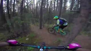
Videos of Barrier Lake Mountain Bike
trail: Lusk Pass Trail
10:50 |
5 |
Jun 16, 2026 , Exshaw
826 |
Aug 18, 2017 , Exshaw
Recent Trail Reports
| status | trail | date | condition | info | user |
|---|---|---|---|---|---|
| Lusk Pass Trail | Jun 15, 2026 @ 12:48pm (America/Edmonton) Jun 15, 2026 | Unknown | Zemu | ||
| Lusk Pass | Jun 15, 2026 @ 12:48pm (America/Edmonton) Jun 15, 2026 | Unknown | Zemu | ||
| Lusk Pass Cutoff Trail | Jun 15, 2026 @ 12:48pm (America/Edmonton) Jun 15, 2026 | Unknown | Zemu | ||
| Marmot Falls Trail | Jan 17, 2026 @ 12:40pm (America/Edmonton) Jan 17, 2026 | Icy | hamiltonspiderman | ||
| Troll Falls Trail | Jan 17, 2026 @ 12:40pm (America/Edmonton) Jan 17, 2026 | Icy | hamiltonspiderman | ||
| Troll Falls - Marmot Falls Connector | Jul 5, 2025 @ 9:55am Jul 5, 2025 | Dry | conanf | ||
| Barrier Powerline | Aug 4, 2023 @ 11:04am Aug 4, 2023 | Variable | zorp |
Activity Feed
| username | action | type | title | date |
|---|---|---|---|---|
| ryang | wishlist | route | activity #97230095 | Jun 17, 2026 @ 8:44pm 2 days |
| Zemu | add | video | activity #97127262 | Jun 16, 2026 @ 11:38am Jun 16, 2026 |
| Zemu | add | report | activity #97078454 and 2 more | Jun 15, 2026 @ 5:56pm Jun 15, 2026 |
| jillianphilpott | wishlist | trail | activity #96651611 and 1 more | Jun 9, 2026 @ 8:47pm Jun 9, 2026 |
| sebas515 | wishlist | route | activity #89051535 | Feb 16, 2026 @ 5:18pm Feb 16, 2026 |
Recent Comments
| username | type | title | comment | date |
|---|---|---|---|---|
| trail | almost the entire descent section is on public... | Oct 10, 2023 @ 11:18am Oct 10, 2023 | ||
| trail | This trail is closed | May 17, 2023 @ 8:32pm May 17, 2023 | ||
| trail | Unsure if built yet? Proposed? | Aug 11, 2017 @ 7:50pm Aug 11, 2017 |
Nearby Areas
| name | distance | ||||
|---|---|---|---|---|---|
| Bow Valley Provincial Park | 14 | 3.9 km | |||
| Exshaw Mountain | 1 | 3 | 9 | 6.1 km | |
| Jumpingpound Ridge | 1 | 7 | 6 | 6.2 km | |
| Sibbald Lake | 1 | 5 | 7.1 km | ||
| Bow Valley Wildland Provincial Park | 19 | 10 | 3 | 1 | 10.1 km |
Activity Type Stats
| activitytype | trails | distance | descent | descent distance | total vertical | rating | global rank | state rank | photos | reports | routes | ridelogs |
|---|---|---|---|---|---|---|---|---|---|---|---|---|
| Mountain Bike | 16 | 26 miles | 3,881 ft | 12 miles | 1,781 ft | #7,227 | #90 | 99 | 134 | 10 | 3,315 | |
| E-Bike | 4 | #9,081 | #103 | 92 | 1 | 95 | ||||||
| Horse | 1 | 12 miles | 1,201 ft | 6 miles | 509 ft | #1,512 | #19 | 59 | 2 | |||
| Hike | 35 | 28 miles | 3,894 ft | 12 miles | 3,156 ft | #4,986 | #35 | 134 | 757 | |||
| Trail Running | 35 | 28 miles | 3,894 ft | 12 miles | 3,156 ft | #5,266 | #50 | 134 | 108 | |||
| Snowshoe | 11 | #1,596 | #50 | 4 | ||||||||
| Backcountry Ski | 2 |
Frequently Asked Questions About Barrier Lake
▼
What are the highest rated mountain biking trails in Barrier Lake?
The highest rated mountain biking trails in Barrier Lake are:
- Lusk Pass Trail (4/5)
- Marmot Falls Trail (0/5)
- Troll Falls Trail (0/5)
- Lusk Pass Cutoff Trail (0/5)
- Barrier Powerline (0/5)
▼
What is the best time of the year to ride in Barrier Lake?
Based on ride log data, the most popular months to ride in Barrier Lake are:
- July (70 activities)
- August (69 activities)
- June (68 activities)
▼
Where can I park to ride in Barrier Lake?
There are 3 parking locations listed in Barrier Lake. The most popular parking spots are: View all parking and trailhead locations on the map to plan your visit.
▼
What is the longest trail in Barrier Lake?
The longest trail in Barrier Lake is Lusk Pass Trail at 3.2 miles. View all trails sorted by distance.
Activities
Trails
- By pinkrobe & contributors
- Admins: BVMBA, CAMBA, ETA, jdeolive, AlbertaParks
- #8518 - 14,395 views
- barrier lake activity log | embed map of Barrier Lake mountain bike trails | barrier lake mountain biking points of interest polygons
Downloading of trail gps tracks in kml & gpx formats is enabled for Barrier Lake.
You must login to download files.