close
-
Layers w
- Weather Layers
- Pro
- Pro
- Pro
- Pro
- Pro
- Pro
- More Layers
- Pro
- Pro
- Pro
- Pro
-
Upgrade to

3D
Trail Conditions
- Unknown
- Snow Groomed
- Snow Packed
- Snow Covered
- Snow Cover Partial
- Freeze/thaw Cycle
- Icy
- Prevalent Mud
- Wet
- Variable
- Ideal
- Dry
- Very Dry
Trail Flow (Ridden Direction)
Trailforks scans users ridelogs to determine the most popular direction each trail is ridden. A good flowing trail network will have most trails flowing in a single direction according to their intension.
The colour categories are based on what percentage of riders are riding a trail in its intended direction.
The colour categories are based on what percentage of riders are riding a trail in its intended direction.
- > 96%
- > 90%
- > 80%
- > 70%
- > 50%
- < 50%
- bi-directional trail
- no data
Trail Last Ridden
Trailforks scans ridelogs to determine the last time a trail was ridden.
- < 2 days
- < 1 week
- < 2 weeks
- < 1 month
- < 6 months
- > 6 months
Trail Ridden Direction
The intended direction a trail should be ridden.
- Downhill Only
- Downhill Primary
- Both Directions
- Uphill Primary
- Uphill Only
- One Direction
Contribute Details
Colors indicate trail is missing specified detail.
- Description
- Photos
- Description & Photos
- Videos
Trail Popularity ?
Trailforks scans ridelogs to determine which trails are ridden the most in the last 9 months.
Trails are compared with nearby trails in the same city region with a possible 25 colour shades.
Think of this as a heatmap, more rides = more kinetic energy = warmer colors.
- most popular
- popular
- less popular
- not popular
ATV/ORV/OHV Filter
Max Vehicle Width
inches
US Cell Coverage
Legend

Radar Time
Activity Recordings
Trailforks uses anonymized public activity data.
?
Activity Recordings
Trailforks uses anonymized public activity data.
?
Personal Heatmap
▶
Activity Types
all
/
none
▶
Options
2
Date range
month
–
Winter Trails
Warning
A routing network for winter maps does not exist. Selecting trails using the winter trails layer has been disabled.
Missing Trails
Most Popular
Least Popular
Trails are colored based on popularity. The more popular a trail is, the more red. Less popular trails trend towards green.
Jump Magnitude Heatmap
Heatmap of where riders jump on trails. Zoom in to see individual jumps, click circles to view jump details.
BC Backroad Status
![map legend]()
Service Road Atlas is a free to use, community-driven service for viewing and creating reports on the numerous back-country service roads around B.C. and Alberta.

Slope Aspect
Direction the slope faces
Trails Deemphasized
Trails are shown in grey.
Only show trails with no bike usage.
Suggested Layers
Based on selected activity type
Save the current map location and zoom level as your default home location whenever this page is loaded.
Savecomune italiano di 1.291 abitanti, della Valsassina, della provincia di Lecco, in Lombardia. Sorge in posizione privilegiata sul cosiddetto Altopiano Valsassinese, immersa nel verde e di fronte alle Grigne, anticamente era anche conosciuto coi nomi di Barzo, Barso, Barsio.
source: Wikipedia
This region uses the Uk/Euro style trail grading system.
Activities Click to view
- Hike
33 trails
- Mountain Bike
22 trails
- E-Bike
23 trails
- Adaptive Bike
0 trails
- Winter Fat Bike
0 trails
- Horse
5 trails
- Trail Running
28 trails
- Snowshoe
5 trails
- Backcountry Ski
4 trails
Region Details
- 3
- 5
- 3
- 2
- 1
Region Status
Open as of Jun 1, 2026Stats
- Avg Trail Rating
- Trails (view details)
- 32
- Trails Mountain Bike
- 23
- Trails E-Bike
- 23
- Trails Horse
- 5
- Trails Hike
- 33
- Trails Trail Running
- 28
- Trails Snowshoe
- 5
- Trails Downhill Ski
- 1
- Trails Backcountry Ski
- 4
- Total Distance
- 38 miles
- Total Descent Distance
- 23 miles
- Total Descent
- 21,243 ft
- Total Vertical
- 5,105 ft
- Highest Trailhead
- 7,160 ft
- Reports
- 72
- Photos
- 69
- Ridden Counter
- 886
Sub Regions
-
Piani di Bobbio
- 4
- 2
- 2
- 1
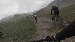
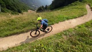
Popular Barzio Mountain Biking Trails
• 80 ★ 4.2 • 2 miles • 72 ft • 28 •
IN MTB: nella parte alta (partendo dai piani di Bobbio) e fino alla baita Pesciola bassa il sentiero si sviluppa lungo un single track molto roccioso e pendente. Il sentiero entra poi nel bosco e diventa molto più guidato mantenendo...
• 65 ★ 3.8 • 3 miles • 137 ft • 27 •
singletrack to Livello tecnico: AM, Enduro Tipo di Terreno: Sentiero, Sterrato, Asfalto Fontane: Alla partenza e molteplici lungo il percorso Giunti alla cabinovia la salita non termina, continueremo a salire seguendo la cementata che...
• 90 ★ 3.0 • 5,174 ft • 118 ft • 16 •
fun single track from Piani di Bobbio to Passo del Cedrino, Bergamo province
• 70 ★ 3.0 • 1 mile • 13 ft • 15 •
Strada Agro Silvo Pastorale che conduce fino all'arrivo dell'impianto
• 75 ★ 2.7 • 3,684 ft • 0 ft • 13 •
Passo del Gandazzo 1660m to Baite Ceresola - Valtorta /Bergamo Pronto per una sfida? Prova questo segmento! https://strava.app.link/n8sJFJUgmkb
• 60 ★ 3.5 • 4,682 ft • 0 ft • 11 •
Downhill from Baite di Nava, Barzio to Introbio
• 85 ★ 5.0 • 4 miles • 2,576 ft • 10 •
Dal passo di Grandazzo salendo verso il passo del toro il sentiero è molto scassato, in salita è tutto a spalla, in discesa è un S3 Dal passo del toro verso il rif. Grassi sono presenti alcuni passaggi S4 esposti, poi prosegue su un...
• 60 ★ 3.7 • 4 miles • 146 ft • 9 •
Starting point - RIFUGIO GRASSI mountain hut - downhill to località COSTA, (Provincia di Bergamo) Alpine single track very scenic, down green fields and Casere - dairy cabins
Barzio Mountain Bike Routes
★ 3.0 • 9 miles • 185 ft • 1 • Point to Point •
Nella splendida cornice della Valsassina si snoda questo percorso ciclopedonale lungo il fondo valle
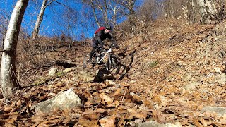
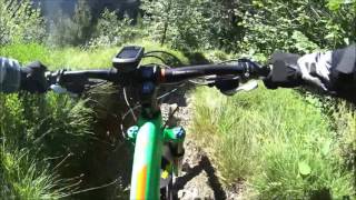
Photos of Barzio Mountain Bike
Videos of Barzio Mountain Bike

trail: Rifugio Buzzoni
32:45 |
213 |
May 29, 2023 , Barzio
trail: Chiavello
32:45 |
88 |
May 29, 2023 , Barzio

trail: Cedrino - Gandazzo
32:45 |
111 |
May 29, 2023 , Barzio
trail: Gandasso 'nDuro
12:01 |
325 |
May 18, 2023 , Barzio
trail: Rifugio Buzzoni
10:48 |
392 |
May 18, 2023 , Barzio
18:25 |
218 |
Apr 18, 2023 , Barzio
trail: Rifugio Buzzoni
10:03 |
306 |
Sep 23, 2022 , Barzio
Current Trail Warnings
| status | trail | date | condition | user | info |
|---|---|---|---|---|---|
| Cabinovia Barzio-Piani di Bobbio | Jun 1, 2026 @ 3:04pm (Europe/Rome) Jun 1, 2026 | Unknown | adessoomaipiu | Hike Chiusa tutta l'estate 2026 per... |
Recent Trail Reports
| status | trail | date | condition | info | user |
|---|---|---|---|---|---|
| Via Natività | May 16, 2026 @ 10:37am (Europe/Rome) May 16, 2026 | Ideal | Pambry | ||
| Biancolina | Feb 7, 2026 @ 4:03pm (Europe/Vaduz) Feb 7, 2026 | Variable | Guret NORTHNLINE | ||
| Pequeno DH | Dec 13, 2025 @ 1:40pm (Europe/Vaduz) Dec 13, 2025 | Snow Cover Partial | Guret NORTHNLINE | ||
| GRASSI - COSTA DH | Sep 8, 2025 @ 12:21pm Sep 8, 2025 | Unknown | dantio | ||
| Rifugio Buzzoni | Aug 17, 2025 @ 7:17am Aug 17, 2025 | Ideal | lucas-91 | ||
| BOBBIO DH | Jul 19, 2025 @ 10:39am Jul 19, 2025 | Variable | Guret NORTHNLINE | ||
| Barzio - Piani di Bobbio | May 24, 2025 @ 12:48pm May 24, 2025 | Dry | marionide | ||
| Cedrino - Gandazzo | May 24, 2025 @ 12:47pm May 24, 2025 | Dry | marionide | ||
| Gandasso 'nDuro | May 24, 2025 @ 12:45pm May 24, 2025 | Dry | marionide | ||
| Sentiero delle Creste | Dec 15, 2024 @ 12:01pm Dec 15, 2024 | Snow Covered | Guret NORTHNLINE |
Activity Feed
| username | action | type | title | date |
|---|---|---|---|---|
| MonesTrail | comment | trail | activity #96284284 | Jun 5, 2026 @ 3:44am Jun 5, 2026 |
| adessoomaipiu | add | report | activity #96012188 | Jun 1, 2026 @ 6:04am Jun 1, 2026 |
| maooosnow | update | event | activity #95620861 | May 27, 2026 @ 2:17am May 27, 2026 |
| Pambry | add | report | activity #94878262 | May 17, 2026 @ 1:31am May 17, 2026 |
| Guret | add | report | activity #93891397 and 1 more | May 2, 2026 @ 1:41pm May 2, 2026 |
Recent Comments
| username | type | title | comment | date |
|---|---|---|---|---|
| trail | E' fattibile in salita? | Jun 5, 2026 @ 3:44am Jun 5, 2026 | ||
| trail | OK....May as well remove Bobbio DH as a trail... | Jul 19, 2025 @ 12:35pm Jul 19, 2025 | ||
| trail | I add this notes to "trail report": that is... | Jul 19, 2025 @ 10:42am Jul 19, 2025 | ||
| trail | Trails in Bobbio stopped being maintained 3... | Jul 19, 2025 @ 10:10am Jul 19, 2025 | ||
| trail | nice flow trails with some technical points... | Sep 21, 2024 @ 8:52am Sep 21, 2024 |
Local Badges
-

Completionist0 awarded -

Epic Mountain Bike Climb 2k5 awarded -

Climbing 10k Badge0 awarded -

Mountain Biking 100k Badge0 awarded -

Epic Ride Descent 2k5 awarded -

Descent 10k Badge0 awarded
Bike & Skill Parks
| name | type | city | rating |
|---|---|---|---|
| Pumptruck Barzio | skill park | Barzio |
Activity Type Stats
| activitytype | trails | distance | descent | descent distance | total vertical | rating | global rank | state rank | photos | reports | routes | ridelogs |
|---|---|---|---|---|---|---|---|---|---|---|---|---|
| Mountain Bike | 22 | 33 miles | 19,183 ft | 22 miles | 5,105 ft | #5,137 | #376 | 64 | 71 | 2 | 185 | |
| E-Bike | 23 | 33 miles | 19,183 ft | 22 miles | 5,105 ft | #909 | #116 | 71 | 3 | 115 | ||
| Horse | 5 | 8 miles | 4,016 ft | 5 miles | 4,236 ft | #1,875 | #108 | 6 | 1 | |||
| Hike | 33 | 38 miles | 21,243 ft | 23 miles | 5,105 ft | #1,319 | #41 | 5 | 72 | 1 | 165 | |
| Trail Running | 28 | 37 miles | 20,266 ft | 23 miles | 5,105 ft | #3,981 | #172 | 72 | 1 | 17 | ||
| Snowshoe | 5 | 7 miles | 5,705 ft | 6 miles | 4,449 ft | #378 | #22 | 8 | ||||
| Downhill Ski | 1 | 2,543 ft | 423 ft | 3 | 207 | |||||||
| Backcountry Ski | 4 | 3 miles | 2,162 ft | 2 miles | 3,484 ft | #325 | #21 | 7 | 11 |
Frequently Asked Questions About Barzio
▼
What are the best places to ride in Barzio?
Barzio has 1 areas to explore for mountain biking. The top rated areas are:
▼
What are the highest rated mountain biking trails in Barzio?
The highest rated mountain biking trails in Barzio are:
- Bocchetta di Pesciola - Baite di Faggio (4.1/5)
- Rifugio Buzzoni (3.9/5)
- PASSO NAVA - INTROBIO DH (3.9/5)
- Strada ASP Zucco Oscellera (3.8/5)
- Chiavello (3.8/5)
▼
What is the best time of the year to ride in Barzio?
Based on ride log data, the most popular months to ride in Barzio are:
- August (3 activities)
- July (2 activities)
- June (1 activities)
▼
Where can I park to ride in Barzio?
There are 6 parking locations listed in Barzio. The most popular parking spots are: View all parking and trailhead locations on the map to plan your visit.
Activities
Trails
Points of Interest
- Ex Albergo Pequeno Viewpoint
- Zucco Oscellera (1858 m) Viewpoint
- [Mountain retreat] Rifugio Lecco Other
- Zuccone dei Campelli (2159 m) Summit
- Cristo degli Alpini Viewpoint
- Rifugio Grassi Lodge
- Rifugio Buzzoni Lodge
- Water Fountain/Source Sight
- Corna Grande (6,831 ft)
- Cima di Piazzo (6,686 ft)
- La Cornetta (6,444 ft)
- By marcoangeletti
 TRAILFORKS & contributors
 - Admins: marcoangeletti, adessoomaipiu, micheletraversi, NORTHNLINE
- #39520 - 1,589 views
- barzio activity log | embed map of Barzio mountain bike trails | barzio mountain biking points of interest
Downloading of trail gps tracks in kml & gpx formats is enabled for Barzio.
You must login to download files.