close
-
Layers w
- Weather Layers
- Pro
- Pro
- Pro
- Pro
- Pro
- Pro
- More Layers
- Pro
- Pro
- Pro
- Pro
-
Upgrade to

3D
Trail Conditions
- Unknown
- Snow Groomed
- Snow Packed
- Snow Covered
- Snow Cover Partial
- Freeze/thaw Cycle
- Icy
- Prevalent Mud
- Wet
- Variable
- Ideal
- Dry
- Very Dry
Trail Flow (Ridden Direction)
Trailforks scans users ridelogs to determine the most popular direction each trail is ridden. A good flowing trail network will have most trails flowing in a single direction according to their intension.
The colour categories are based on what percentage of riders are riding a trail in its intended direction.
The colour categories are based on what percentage of riders are riding a trail in its intended direction.
- > 96%
- > 90%
- > 80%
- > 70%
- > 50%
- < 50%
- bi-directional trail
- no data
Trail Last Ridden
Trailforks scans ridelogs to determine the last time a trail was ridden.
- < 2 days
- < 1 week
- < 2 weeks
- < 1 month
- < 6 months
- > 6 months
Trail Ridden Direction
The intended direction a trail should be ridden.
- Downhill Only
- Downhill Primary
- Both Directions
- Uphill Primary
- Uphill Only
- One Direction
Contribute Details
Colors indicate trail is missing specified detail.
- Description
- Photos
- Description & Photos
- Videos
Trail Popularity ?
Trailforks scans ridelogs to determine which trails are ridden the most in the last 9 months.
Trails are compared with nearby trails in the same city region with a possible 25 colour shades.
Think of this as a heatmap, more rides = more kinetic energy = warmer colors.
- most popular
- popular
- less popular
- not popular
ATV/ORV/OHV Filter
Max Vehicle Width
inches
US Cell Coverage
Legend

Radar Time
Activity Recordings
Trailforks uses anonymized public activity data.
?
Activity Recordings
Trailforks uses anonymized public activity data.
?
Personal Heatmap
▶
Activity Types
all
/
none
▶
Options
2
Date range
month
–
Winter Trails
Warning
A routing network for winter maps does not exist. Selecting trails using the winter trails layer has been disabled.
Missing Trails
Most Popular
Least Popular
Trails are colored based on popularity. The more popular a trail is, the more red. Less popular trails trend towards green.
Jump Magnitude Heatmap
Heatmap of where riders jump on trails. Zoom in to see individual jumps, click circles to view jump details.
BC Backroad Status
![map legend]()
Service Road Atlas is a free to use, community-driven service for viewing and creating reports on the numerous back-country service roads around B.C. and Alberta.

Slope Aspect
Direction the slope faces
Trails Deemphasized
Trails are shown in grey.
Only show trails with no bike usage.
Suggested Layers
Based on selected activity type
Save the current map location and zoom level as your default home location whenever this page is loaded.
SavePopular Trail Networks
view all areas »
No description for Bayern has been added yet!
Login or register to submit one.
AKA: Bavaria
This region uses the Uk/Euro style trail grading system.
Region Details
- 713
- 1
- 1,322
- 942
- 216
- 216
- 100
Stats
- Avg Trail Rating
- Trails (view details)
- 3,707
- Trails Mountain Bike
- 3,536
- Trails E-Bike
- 3,464
- Trails Gravel Bike
- 208
- Trails Adaptive Bike
- 528
- Trails Winter Fat Bike
- 308
- Trails Horse
- 28
- Trails Hike
- 3,043
- Trails Trail Running
- 3,039
- Trails Dirtbike/Moto
- 2
- Trails Snowshoe
- 9
- Trails Downhill Ski
- 6
- Trails Backcountry Ski
- 73
- Trails Nordic Ski
- 32
- Total Distance
- 2,889 miles
- Total Descent
- 934,088 ft
- Total Vertical
- 9,200 ft
- Highest Trailhead
- 9,648 ft
- Reports
- 15,748
- Photos
- 5,255
- Ridden Counter
- 123,494
Articles
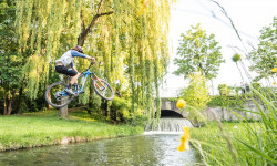
Video: City Sends with Wyn Masters in 'Munich Gaps Volume Two'
Jul 17, 2020 from pinkbike.com
Wyn Masters sends it around the city.
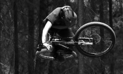
Video: Solo Jumps & Flow Somewhere Deep in the Woods of Bavaria
Mar 23, 2020 from pinkbike.com
A freeride paradise in the middle of nowhere in Germany.
Sub Regions
- Amberg (Stadtkreis) (13)
- Amberg (13)
- Amberg (13)
- Ansbach (Stadtkreis) (1)
- Aschaffenburg (Stadtkreis) (7)
- Aschaffenburg (7)
- Augsburg (Stadtkreis) (38)
- Augsburg (17)
- Augsburg (17)
- Bamberg (Stadtkreis) (5)
- Bamberg (4)
- Bamberg (4)
- Bayreuth (Stadtkreis) (5)
- Bayreuth (5)
- Bayreuth (5)
- Coburg (Stadtkreis) (1)
- Coburg (1)
- Coburg (1)
- Erlangen (Stadtkreis) (10)
- Erlangen (10)
- Birkenbuehl (0)
- Meilwald (8)
- Erlangen (10)
- Fürth (Stadtkreis) (37)
- Fürth (37)
- Fürther Stadtwald (13)
- Fürth (37)
- Ingolstadt (Stadtkreis) (7)
- Ingolstadt (7)
- Ingolstadt (7)
- Kaufbeuren (Stadtkreis) (4)
- Kaufbeuren (4)
- Kaufbeuren (4)
- Kempten (Stadtkreis) (13)
- Kempten (12)
- Kempten (12)
- Landkreis Aichach-Friedberg (3)
- Landkreis Amberg-Sulzbach (6)
- Schnaittenbach (1)
- Sulzbach-Rosenberg (3)
- Lauterach Tal (6)
- Schnaittenbach (1)
- Landkreis Ansbach (5)
- Landkreis Aschaffenburg (40)
- Alzenau (34)
- Hahnenkamm (32)
- Heimbuchenthal (4)
- Heinrichsthal (2)
- Karlstein Am Main (2)
- LA Trails (10)
- Alzenau (34)
- Landkreis Augsburg (54)
- Stadtbergen (15)
- Stadtbergen (15)
- Landkreis Bad Kissingen (1)
- Bad Kissingen (1)
- Bad Kissingen (1)
- Landkreis Bad Tölz-Wolfratshausen (160)
- Landkreis Bamberg (41)
- Hirschaid (18)
- Oberhaid (11)
- Strullendorf (1)
- Landkreis Bayreuth (20)
- Bischofsgrün (0)
- Fichtelberg (4)
- Pegnitz (4)
- Warmensteinach (7)
- Bischofsgrün (0)
- Landkreis Berchtesgadener Land (191)
- Landkreis Cham (73)
- Cham (3)
- Furth Im Wald (3)
- Lam (13)
- Wald (6)
- Waldmünchen (0)
- Waldmünchen (0)
- Lamer Winkel (53)
- Cham (3)
- Landkreis Coburg (2)
- Landkreis Dachau (3)
- Dachau (3)
- Dachau (3)
- Landkreis Deggendorf (2)
- Deggendorf (1)
- Deggendorf (1)
- Landkreis Donau-Ries (11)
- Nördlingen (11)
- Nördlinger Ries (15)
- Nördlingen (11)
- Landkreis Ebersberg (5)
- Landkreis Eichstätt (12)
- Eichstätt (2)
- Gaimersheim (0)
- Reisberg (4)
- Kipfenberg (5)
- Walting (1)
- Eichstätt (2)
- Landkreis Erding (1)
- Landkreis Erlangen-Höchstadt (34)
- Dormitzer Forst (18)
- Erlenstegener Forst (1)
- DH Reuth (4)
- Markwald (0)
- Dormitzer Forst (18)
- Landkreis Forchheim (39)
- Ebermannstadt (11)
- Forchheim (4)
- Staatswald (2)
- Landkreis Freising (5)
- Freising (1)
- Freising (1)
- Landkreis Fürstenfeldbruck (23)
- Fürstenfeldbruck (21)
- Amperschlucht (3)
- Landkreis Fürth (4)
- Landkreis Garmisch-Partenkirchen (236)
- Garmisch (132)
- Garmisch Area (121)
- Ammergauer Alpen Area (49)
- Bikepark Oberammergau (18)
- Eschenlohe/Ohlstadt Area (27)
- Mittenwald/Wallgau Area (31)
- Garmisch (132)
- Landkreis Günzburg (3)
- Landkreis Haßberge (30)
- Königsberg In Bayern (12)
- Hassberge (0)
- Königsberg In Bayern (12)
- Landkreis Hof (12)
- Landkreis Kelheim (328)
- Essing (9)
- Ihrlerstein (53)
- Kelheim (185)
- Painten (37)
- Essing (9)
- Landkreis Kitzingen (29)
- Iphofen (7)
- Markt Einersheim (4)
- Rödelsee (14)
- Iphofen (7)
- Landkreis Kronach (1)
- Kronach (1)
- Kronach (1)
- Landkreis Kulmbach (19)
- Kulmbach (9)
- Kulmbach (9)
- Landkreis Landsberg am Lech (5)
- Geltendorf (2)
- Landsberg am Lech (1)
- Geltendorf (2)
- Landkreis Landshut (3)
- Landkreis Lichtenfels (17)
- Bad Staffelstein (1)
- Lichtenfels (6)
- Bad Staffelstein (1)
- Landkreis Lindau (8)
- Stiefenhofen (2)
- Weiler-Simmerberg (2)
- Stiefenhofen (2)
- Landkreis Main-Spessart (23)
- Burgsinn (1)
- Frammersbach (4)
- Zellingen (1)
- Landkreis Miesbach (214)
- Landkreis Miltenberg (87)
- Amorbach (18)
- Bürgstadt (5)
- Großheubach (10)
- Großostheim (5)
- Miltenberg (11)
- Mömlingen (24)
- Niedernberg (1)
- Obernburg am Main (5)
- Schneeberg (Unterfranken) (2)
- Sulzbach am Main (1)
- Weilbach (1)
- Amorbach (18)
- Landkreis Mühldorf am Inn (4)
- Landkreis München (2)
- Schäftlarn (1)
- Landkreis Neuburg-Schrobenhausen (2)
- Neuburg an der Donau (2)
- Schrobenhausen (2)
- Neuburg an der Donau (2)
- Landkreis Neumarkt in der Oberpfalz (163)
- Berg bei Neumarkt (27)
- Dietfurt (36)
- Dietfurt (12)
- Hohenfels (25)
- Neumarkt in der Oberpfalz (36)
- Jura Trails Neumarkt (23)
- Parsberg (31)
- *Jura* (0)
- Velburg (2)
- Berg bei Neumarkt (27)
- Landkreis Neustadt an der Aisch (5)
- Diespeck (2)
- Diespeck (2)
- Landkreis Neustadt an der Waldnaab (17)
- Weiherhammer (15)
- Weiherhammer (15)
- Landkreis Nürnberger Land (28)
- Altdorf bei Nürnberg (4)
- Neunkirchen am Sand (1)
- Schnaittach (15)
- Schwarzenbruck (2)
- Bikepark Osternohe (3)
- Altdorf bei Nürnberg (4)
- Landkreis Oberallgäu (49)
- Bad Hindelang (8)
- Buchenberg (1)
- Immenstadt im Allgäu (10)
- Missen-Wilhams (2)
- Oberstaufen (1)
- Oberstdorf (8)
- Ofterschwang (2)
- Sonthofen (2)
- Waltenhofen (4)
- Wertach (2)
- Landkreis Ostallgäu (73)
- Füssen (20)
- Marktoberdorf (5)
- Nesselwang (9)
- Pfronten (37)
- Pfronten-Nesselwang (13)
- Schwangau (2)
- Füssen (20)
- Landkreis Passau (54)
- Bad Griesbach (3)
- Hauzenberg (17)
- Vilshofen (1)
- Bad Griesbach (3)
- Landkreis Pfaffenhofen an der Ilm (19)
- Pfaffenhofen (19)
- Stadtwald (12)
- Pfaffenhofen (19)
- Landkreis Regen (65)
- Bischofsmais (30)
- Bodenmais (6)
- Regen (10)
- Zwiesel (3)
- Bikepark Arber (13)
- Landkreis Regensburg (341)
- Beratzhausen (5)
- Donaustauf (33)
- Kallmünz (7)
- Laaber (18)
- Nittendorf (12)
- Regenstauf (51)
- Wörth an der Donau (13)
- Zeitlarn (6)
- Beratzhausen (5)
- Landkreis Rhön-Grabfeld (12)
- Landkreis Rosenheim (160)
- Aschau (37)
- Kampenwand (35)
- Bad Aibling (61)
- Brannenburg (1)
- Samerberg (42)
- Bikepark Samerberg (8)
- Samerberg (16)
- Aschau (37)
- Landkreis Roth (38)
- Büchenbach (9)
- Heidenberg (5)
- Kammerstein (5)
- Büchenbach (9)
- Landkreis Rottal-Inn (9)
- Simbach am Inn (9)
- Simbach am Inn (9)
- Landkreis Schwandorf (132)
- Burglengenfeld (7)
- Maxhütte-Haidhof (23)
- Nabburg (13)
- Neunburg (2)
- Schwandorf (31)
- Teublitz (4)
- Wackersdorf (3)
- Burglengenfeld (7)
- Landkreis Schweinfurt (13)
- Landkreis Starnberg (92)
- Andechs (9)
- Berg (1)
- Herrsching (12)
- Inning (18)
- Seefeld (12)
- Starnberg (18)
- Tutzing (4)
- Wörthsee (19)
- Würmtal Trails (16)
- Andechs (9)
- Landkreis Straubing-Bogen (25)
- Sankt Englmar (24)
- Sankt Englmar (24)
- Landkreis Tirschenreuth (15)
- Waldershof (5)
- Steinwald (9)
- WASA Trails (1)
- Waldershof (5)
- Landkreis Traunstein (56)
- Inzell (22)
- Ruhpolding (9)
- Siegsdorf (18)
- Inzell (22)
- Landkreis Unterallgäu (1)
- Landkreis Weilheim-Schongau (20)
- Böbing (1)
- Peißenberg (7)
- Schongau (5)
- Böbing (1)
- Landkreis Weißenburg-Gunzenhausen (47)
- Pleinfeld (5)
- Treuchtlingen (29)
- Weißenburg (11)
- Pleinfeld (5)
- Landkreis Wunsiedel im Fichtelgebirge (21)
- Arzberg (8)
- Wunsiedel (4)
- Kösseine (4)
- Epprechtstein (4)
- Arzberg (8)
- Landkreis Würzburg (11)
- Thüngersheim (1)
- Unterpleichfeld (1)
- Hettstadter Steige (0)
- Thüngersheim (1)
- Landshut (Stadtkreis) (24)
- Landshut (24)
- Landshut (24)
- Memmingen (Stadtkreis) (4)
- München (Stadtkreis) (123)
- München (101)
- Freimann (0)
- Isartrails (63)
- Kiesgrube (1)
- München (101)
- Nürnberg (Stadtkreis) (54)
- Nürnberg (53)
- Schmausenbuck (30)
- Trail Paradise Woodstone (19)
- Nürnberg (53)
- Passau (Stadtkreis) (7)
- Passau (5)
- Passau (5)
- Regensburg (Stadtkreis) (422)
- Regensburg (359)
- Donau (67)
- Laber (29)
- Marienhöhe (2)
- Naabdelta (184)
- Regen (41)
- Tegernheim & Co. (51)
- Regensburg (359)
- Rosenheim (Stadtkreis) (1)
- Rosenheim (1)
- Mangfalltal (9)
- Rosenheim (1)
- Schwabach (Stadtkreis) (2)
- Schwabach (3)
- Schwabach (3)
- Schweinfurt (Stadtkreis) (5)
- Schweinfurt (4)
- Schweinfurt (4)
- Weiden in der Oberpfalz (Stadtkreis) (24)
- Weiden (23)
- Weiden (23)
- Würzburg (Stadtkreis) (19)
- Würzburg (19)
- Güntersleben (0)
- Würzburg (19)
- Hof (5)
Popular Bayern Mountain Biking Trails
• 100 ★ 4.7 • 2 miles • 0 ft • 1,033 •
English below! nie steil, nie gefährlich, nie extrem... Beginnt an der Bergstation und ist mit Sessel - oder Schlepplift erreichbar. Durch seine glatte und harte Oberfläche auch für Hardtail Biker geeignet und auch bei schlechter...
• 100 ★ 3.9 • 397 ft • 0 ft • 971 •
English below! Der mit einer 5-er Table-Line befindet sich oberhalb des Übungsparcours. Die Jumps sind sehr rythmisch und nicht zu steil geshaped. Die Sprünge sind gleichermaßen zum Üben und zum Tricksen geeignet. Unterhalb entstand...
• 65 ★ 4.4 • 4,478 ft • 0 ft • 875 •
English below! Hinter dem Gasthof der Bergstation beginnt die . Die Streckenlänge beträgt 2,2 km, der Höhenunterschied 260 m. Es befinden sich nur einige leicht zu umfahrende Sprünge in der Strecke. Im oberen Teil ist die Strecke...
• 95 ★ 4.8 • 1 mile • 5 ft • 810 •
Relatively easy trail with natural character. A few built small optional skinnies but otherwise like a natural, easy trail in the woods outside of a bikepark. Many parts are relatively flat where you will need to pedal to maintain any...
• 65 ★ 4.5 • 2,713 ft • 0 ft • 809 •
English below! Im Jahr 1999 wurde der erste „Evil Eye" Trail am Geisskopf feierlich eröffnet. Diddie Schneider und adidas eyewear legten damals den Grundstein für die Entwicklung von North Shore Trails in Europa. Im Jahr 2010 wurde...
• 70 ★ 4.6 • 1 mile • 2 ft • 770 •
Highly rated popular red difficulty singletrack. This mountain bike primary trail can be used downhill only and has a moderate overall physical rating. Trail visibility is always easy to follow. On average it takes 8 minutes to complete this trail.
• 90 ★ 4.8 • 1,506 ft • 0 ft • 750 •
New ending for as alternative to the connector road
Bayern Mountain Bike Routes
★ 4.7 • 147 miles • 15,944 ft • 5 • Loop •
Die Jura-Landschaft entstammt einem riesigen Meer, das die Region vor 200 Millionen Jahren bedeckte. Nach...
★ 5.0 • 9 miles • 1,652 ft • 16 • Point to Point •
Very demanding all-mountain route connecting some of the finest single track pieces of Marienhöhe,...
★ 5.0 • 232 miles • 39,037 ft • 7 •
AlpenX22 von Füssen nach Riva del Garda
★ 5.0 • 16 miles • 2,911 ft • 0 •
Erste ausgeschilderte Mountainbikestrecke Mil1 in Miltenberg / Main. Start und Ziel sind jeweils der...
★ 5.0 • 20 miles • 1,336 ft • 3 • Loop •
DAV Ausfahrt vom Stadtwald nach Cadolzburg und zurück. Trails: Canyon und Druidenstein
★ 5.0 • 15 miles • 1,870 ft • 8 • Loop •
Technical demanding but short route around the Naabdelta. There is no signage.
Photos of Bayern Mountain Bike
Videos of Bayern Mountain Bike
trail: Walzer Cup neu
2:18 |
83 |
Aug 18, 2025
trail: Merida Timber Coaster
6:27 |
6 |
Jul 19, 2025
trail: Merida Timber Coaster
3:22 |
9 |
Jul 17, 2025
trail: Flow Country Trail
5:41 |
16 |
Jul 17, 2025
trail: Merida Timber Coaster
5:16 |
4 |
Jul 17, 2025
trail: Flow Country Trail
5:26 |
6 |
Jul 17, 2025
trail: Flow Country Trail
5:45 |
3 |
Jul 17, 2025
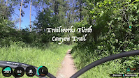
trail: Trailworks: Canyon-Trail
0:30 |
120 |
May 25, 2025
Current Trail Warnings
| status | trail | date | condition | user | info |
|---|---|---|---|---|---|
| Keltensteig Part 2 Miltenberg | Jun 22, 2026 @ 9:01am (Europe/Berlin) 19 hours | Variable | HAL2000 | Durch Forstarbeiten sind Teile vom Trail... | |
| Lucky! Regen | Jun 21, 2026 @ 8:21pm (Europe/Berlin) 1 day | Dry | FabianDeml | Im unteren Teil nach liegen Bäume quer.... | |
| Jumpline Tegernheim & Co. | Jun 19, 2026 @ 11:21am (America/Vancouver) Jun 19, 2026 | Dry | RatisBonanza | In der zweiten Linksanlegerkurve Bäume... |
Recent Trail Reports
Activity Feed
| username | action | type | title | date |
|---|---|---|---|---|
| fanbau | add | report | activity #97549059 | Jun 22, 2026 @ 1:53am 17 hours |
| kasif78 | wishlist | region | activity #97548806 | Jun 22, 2026 @ 1:40am 17 hours |
| nako7 | add | report | activity #97546478 and 2 more | Jun 22, 2026 @ 12:10am 19 hours |
| HAL2000 | add | report | activity #97546078 | Jun 21, 2026 @ 11:56pm 19 hours |
| HAL2000 | add | report | activity #97546034 and 6 more | Jun 21, 2026 @ 11:55pm 19 hours |
Recent Comments
| username | type | title | comment | date |
|---|---|---|---|---|
| trail | Ist oookay. Nicht wirklich spaßig zu fahren... | Jun 21, 2026 @ 6:47am 2 days | ||
| trail | Definitiv nicht zu empfehlen. Viele kleine... | Jun 21, 2026 @ 6:46am 2 days | ||
| trail | First quarter is nice and fun (S1). Last... | Jun 20, 2026 @ 1:43am 3 days | ||
| trail | Schöner Trail hat mehrere ausgewaschen... | Jun 18, 2026 @ 8:59am Jun 18, 2026 | ||
| trail | Liegen 20 Bäume drin, absolut unfahrbar | Jun 14, 2026 @ 6:24am Jun 14, 2026 |
Local Badges
-

10 Green Trails156 awarded -

Top 10 Trails0 awarded -

Climbing 10k Badge14 awarded -
Climbing 10k Badge182 awarded -

Climbing 100k Badge0 awarded -

Epic Ride Descent 2k164 awarded
Bike & Skill Parks
| name | type | city | rating |
|---|---|---|---|
| MTB Zone Bikepark Geisskopf | bike park | Bischofsmais | |
| Bikepark Samerberg | bike park | Samerberg | |
| Bikepark Ochsenkopf | bike park | Warmensteinach | |
| Bikepark Osternohe | bike park | ||
| Bikepark HINDELANG | bike park | Bad Hindelang |
Activity Type Stats
| activitytype | trails | distance | descent | descent distance | total vertical | rating | global rank | state rank | photos | reports | routes | ridelogs |
|---|---|---|---|---|---|---|---|---|---|---|---|---|
| Mountain Bike | 3,536 | 2,601 miles | 863,970 ft | 1,428 miles | 9,199 ft | 4,971 | 15,720 | 88 | 323,994 | |||
| E-Bike | 3,464 | 2,518 miles | 842,963 ft | 1,395 miles | 9,199 ft | 231 | 13,350 | 37 | 39,712 | |||
| Gravel Bike | 208 | 202 miles | 22,110 ft | 63 miles | 4,606 ft | 420 | 3 | 3,964 | ||||
| Adaptive Bike | 528 | 783 miles | 78,406 ft | 223 miles | 6,302 ft | 1,464 | 3 | |||||
| Winter Fat Bike | 308 | 189 miles | 50,620 ft | 92 miles | 4,528 ft | 939 | 5 | |||||
| Horse | 28 | 30 miles | 2,858 ft | 11 miles | 4,324 ft | 1 | 1,397 | 7 | ||||
| Hike | 3,043 | 2,466 miles | 782,448 ft | 1,286 miles | 9,199 ft | 6 | 14,560 | 6 | 23,528 | |||
| Trail Running | 3,039 | 2,462 miles | 781,736 ft | 1,284 miles | 9,199 ft | 1 | 14,602 | 5 | 8,136 | |||
| Dirtbike/Moto | 2 | 1,913 ft | 292 ft | 52 ft | 1,392 | 3 | ||||||
| Snowshoe | 9 | 18 miles | 1,814 ft | 3 miles | 5,128 ft | 19 | 146 | |||||
| Downhill Ski | 6 | 6 miles | 220 ft | 5,072 ft | 5,495 ft | 30 | 2,075 | |||||
| Backcountry Ski | 73 | 174 miles | 33,009 ft | 43 miles | 7,103 ft | 18 | 4,192 | |||||
| Nordic Ski | 32 | 18 miles | 1,516 ft | 7 miles | 3,094 ft | 19 | 3,234 |
Activities
- Bayern Mountain Biking Trails
- Bayern E-Biking Trails
- Bayern Gravel Biking Trails
- Bayern Adaptive Biking Trails
- Bayern Winter Fat Biking Trails
- Bayern Horseback Trails
- Bayern Hiking Trails
- Bayern Trail Running Trails
- Bayern Snowshoeing Trails
- Bayern Skiing Trails
- Bayern Backcountry Skiing Trails
- Bayern Nordic Skiing Trails
Trails
Points of Interest
- Viewpoint Rotofen
- Viewpoint Türmereck - Saalachseeblick
- Viewpoint Kastensteinhöhe
- Viewpoint Bad Reichenhall-Blick
- Viewpoint Reisenkaser / Scheibelkopf
- Viewpoint Chiemseeblick
- Lattenbergstoa Viewpoint
- Viewpoint Fürmann Alm
- Jochköpfl Viewpoint
- Viewpoint Stöhrweg Gatterl
- Zugspitze (2,863 m)
- Mittlere Höllentalspitze (2,709 m)
- Äußere Höllentalspitze (2,686 m)
- By Girgl10 & contributors
- Admins: Sasse82, elreyrules, cemoorelife, larry81541
- #4139 - 39,766 views
- bayern activity log | embed map of Bayern mountain bike trails | bayern mountain biking points of interest polygons
Downloading of trail gps tracks in kml & gpx formats is enabled for Bayern.
You must login to download files.