close
-
Layers w
- Weather Layers
- Pro
- Pro
- Pro
- Pro
- Pro
- Pro
- More Layers
- Pro
- Pro
- Pro
- Pro
-
Upgrade to

3D
Trail Conditions
- Unknown
- Snow Groomed
- Snow Packed
- Snow Covered
- Snow Cover Partial
- Freeze/thaw Cycle
- Icy
- Prevalent Mud
- Wet
- Variable
- Ideal
- Dry
- Very Dry
Trail Flow (Ridden Direction)
Trailforks scans users ridelogs to determine the most popular direction each trail is ridden. A good flowing trail network will have most trails flowing in a single direction according to their intension.
The colour categories are based on what percentage of riders are riding a trail in its intended direction.
The colour categories are based on what percentage of riders are riding a trail in its intended direction.
- > 96%
- > 90%
- > 80%
- > 70%
- > 50%
- < 50%
- bi-directional trail
- no data
Trail Last Ridden
Trailforks scans ridelogs to determine the last time a trail was ridden.
- < 2 days
- < 1 week
- < 2 weeks
- < 1 month
- < 6 months
- > 6 months
Trail Ridden Direction
The intended direction a trail should be ridden.
- Downhill Only
- Downhill Primary
- Both Directions
- Uphill Primary
- Uphill Only
- One Direction
Contribute Details
Colors indicate trail is missing specified detail.
- Description
- Photos
- Description & Photos
- Videos
Trail Popularity ?
Trailforks scans ridelogs to determine which trails are ridden the most in the last 9 months.
Trails are compared with nearby trails in the same city region with a possible 25 colour shades.
Think of this as a heatmap, more rides = more kinetic energy = warmer colors.
- most popular
- popular
- less popular
- not popular
ATV/ORV/OHV Filter
Max Vehicle Width
inches
US Cell Coverage
Legend

Radar Time
Activity Recordings
Trailforks uses anonymized public activity data.
?
Activity Recordings
Trailforks uses anonymized public activity data.
?
Personal Heatmap
▶
Activity Types
all
/
none
▶
Options
2
Date range
month
–
Winter Trails
Warning
A routing network for winter maps does not exist. Selecting trails using the winter trails layer has been disabled.
Missing Trails
Most Popular
Least Popular
Trails are colored based on popularity. The more popular a trail is, the more red. Less popular trails trend towards green.
Jump Magnitude Heatmap
Heatmap of where riders jump on trails. Zoom in to see individual jumps, click circles to view jump details.
BC Backroad Status
![map legend]()
Service Road Atlas is a free to use, community-driven service for viewing and creating reports on the numerous back-country service roads around B.C. and Alberta.

Slope Aspect
Direction the slope faces
Trails Deemphasized
Trails are shown in grey.
Only show trails with no bike usage.
Suggested Layers
Based on selected activity type
Save the current map location and zoom level as your default home location whenever this page is loaded.
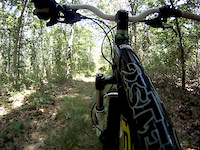
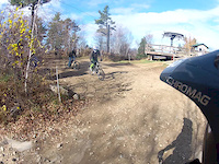
SaveThe riding here can accommodate all abilities. Trails consist of dirt roads, double track, single track as well as numerous natural features for extra fun. This is what makes Bear Brook a great time. You can ride easy on Podunk road or push yourself to the limit on Catamount Hill. Class 1 and Class 2 eMTB use is permitted.
Primary Trail Type: Cross-Country
eBikes Allowed:
Yes
Land Status: State Park
Land Manager: New Hampshire State Parks
 google parking directions
 Access Info:
90 Podunk Rd Allenstown, NH 03275, Parking Lot on the right through the toll booths
Links
Region Supporters & Maintainers
![]()
New Hampshire State ParksMaintainer
Activities Click to view
- Mountain Bike
58 trails
- E-Bike
57 trails
- Horse
12 trails
- Hike
57 trails
- Trail Running
57 trails
- Snowmobile
3 trails
- Snowshoe
16 trails
- Nordic Ski
11 trails
Region Details
- 7
- 24
- 21
- 6
Region Status
Caution as of 2 daysStats
- Avg Trail Rating
- Trails (view details)
- 58
- Trails Mountain Bike
- 58
- Trails E-Bike
- 57
- Trails Gravel Bike
- 20
- Trails Adaptive Bike
- 12
- Trails Winter Fat Bike
- 14
- Trails Horse
- 12
- Trails Hike
- 57
- Trails Trail Running
- 57
- Trails Snowmobile
- 3
- Trails Snowshoe
- 16
- Trails Nordic Ski
- 11
- Total Distance
- 66 miles
- Total Descent
- 6,835 ft
- Total Vertical
- 614 ft
- Highest Trailhead
- 922 ft
- Reports
- 1,115
- Photos
- 177
- Ridden Counter
- 41,601
Popular Bear Brook State Park Mountain Biking Trails
• 100 ★ 4.3 • 4,157 ft • 6 ft • 2,493 •
Smooth singletrack with a few switchbacks, rollers, bump jumps and turns. Keep it pinned to maximize the fun.
• 100 ★ 4.4 • 3 miles • 183 ft • 2,391 •
Has to be one of the funnest flowy narrow downhills in the northeast. Little bit of Kingdom Trails right here in NH. Link it with and you have a couple miles of superb riding. It has three segments, Hemlock1, Hemlock2 and Hemlock3. Most...
• 95 ★ 4.8 • 1 mile • 274 ft • 1,923 •
Start near the podunk rd/ intersection and go down towards the ranger station at the snowmobile parking lot starting at the Bobcat/Podunk Rd for an even better time. Renamed from Raptor to at the request of the State of NH.
• 95 ★ 4.4 • 1 mile • 113 ft • 1,864 •
This is a beautiful trail that follows the inspiration for the Park’s name, . The trail is well shaded and stays relatively cool even in the heat of the summer. If you enjoy the sounds of running water and the occasional brook trout,...
• 95 ★ 3.6 • 1 mile • 62 ft • 1,661 •
is a relatively easy, rooty doubletrack that links to . You can also access and from this trail.
• 95 ★ 4.5 • 981 ft • 13 ft • 1,385 •
Popular green difficulty singletrack. This mountain bike primary trail can be used both directions and has a easy overall physical rating with a 13 ft green climb. Trail visibility is always easy to follow. On average it takes 1 minutes to complete this trail.
• 90 ★ 4.6 • 2,723 ft • 13 ft • 1,261 •
is a sweet, short singletrack trail that pops off of and connects back to, . Most people descend the trail, using it to finish a ride down Trail. Alternatively, it can be a way to avoid some of the initial steep and grueling doubletrack...
Bear Brook State Park Mountain Bike Routes
2022+ Boogie Beginner Loop Featured
5 miles • 286 ft • 2 •
Boogie Beginner Loop Established 2022 Alternatively, you can start at Hiker/Biker and follow the same loop
2022+ Boogie Demo Loop Featured
3 miles • 156 ft • 3 •
Boogie Demo Loop Short loop that hits some of the newer, flowier trails, easily accessible from popular...
2022+ Boogie Advanced Loop #1 Featured
6 miles • 621 ft • 5 •
Boogie Advanced Loop #2 Established 2022
2022+ Boogie Advanced Loop #2 Featured
13 miles • 1,002 ft • 8 • Loop •
Boogie Advanced loop #1 Established 2022
2022+ Boogie Intermediate Loop #1 Featured
6 miles • 459 ft • 10 •
Boogie Intermediate Loop #2 Established 2022
2022+ Boogie Family/Kids Loop Featured
2 miles • 16 ft • 2 •
Boogie Family Kids Loop Super easy, super accessible, super short, super flat - perfect for the little...
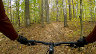
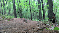
Photos of Bear Brook State Park Mountain Bike
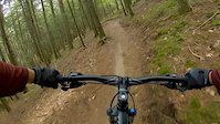
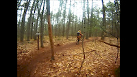
Videos of Bear Brook State Park Mountain Bike
trail: Big Bear
3:13 |
|
Jul 29, 2020
trail: Hemlock
2:07 |
487 |
Jul 29, 2020
trail: Bear Brook
0:05 |
385 |
Sep 30, 2017
trail: Big Bear
2:10 |
1024 |
May 2, 2016
trail: Lowland
0:38 |
496 |
Aug 17, 2014
trail: Lowland
2:41 |
730 |
Nov 3, 2013
trail: Lowland
0:27 |
601 |
Mar 3, 2013
trail: Lowland
2:46 |
171 |
Feb 4, 2013
Recent Trail Reports
| status | trail | date | condition | info | user |
|---|---|---|---|---|---|
| Big Bear | Jun 14, 2026 @ 12:31pm (America/New_York) Jun 14, 2026 | Ideal | Bill_Richards | ||
| Cub | Jun 14, 2026 @ 12:31pm (America/New_York) Jun 14, 2026 | Ideal | Bill_Richards | ||
| Porcupine | Jun 14, 2026 @ 12:31pm (America/New_York) Jun 14, 2026 | Ideal | Bill_Richards | ||
| Bear Brook | Jun 14, 2026 @ 12:31pm (America/New_York) Jun 14, 2026 | Ideal | Bill_Richards | ||
| Alp D' Huez | Jun 14, 2026 @ 12:31pm (America/New_York) Jun 14, 2026 | Ideal | Bill_Richards | ||
| Sentinel Pine | Jun 14, 2026 @ 12:31pm (America/New_York) Jun 14, 2026 | Ideal | Bill_Richards | ||
| Bobcat trail | Jun 14, 2026 @ 12:31pm (America/New_York) Jun 14, 2026 | Ideal | Bill_Richards | ||
| Hemlock | Jun 14, 2026 @ 12:31pm (America/New_York) Jun 14, 2026 | Ideal | Bill_Richards | ||
| Moose | Jun 5, 2026 @ 5:07pm (America/New_York) Jun 5, 2026 | Ideal | Oldbikersam | ||
| Squirrel | Jun 5, 2026 @ 5:07pm (America/New_York) Jun 5, 2026 | Ideal | Oldbikersam |
Activity Feed
| username | action | type | title | date |
|---|---|---|---|---|
| 1Pipepipe | wishlist | route | activity #97958779 | Jun 27, 2026 @ 8:28pm 2 hours |
| DylanTSrkyM | ridden | trail | activity #97829374 | Jun 26, 2026 @ 6:18am 2 days |
| sstatman17 | wishlist | region | activity #97518874 | Jun 21, 2026 @ 2:02pm Jun 21, 2026 |
| wiggeywackyo | ridden | trail | activity #97447970 | Jun 20, 2026 @ 6:23pm Jun 20, 2026 |
| VictoriaXv8Ef5 | vote | trail | activity #97443414 | Jun 20, 2026 @ 4:59pm Jun 20, 2026 |
Recent Comments
| username | type | title | comment | date |
|---|---|---|---|---|
| report | N no,3!!~~ dig. V a. M | May 10, 2026 @ 11:35am May 10, 2026 | ||
| trail | Highest praise to the trail builders. The... | Nov 7, 2025 @ 6:20pm Nov 7, 2025 | ||
| trail | Yes, Pitch Pine does travel through the middle... | Nov 4, 2025 @ 8:13am Nov 4, 2025 | ||
| trail | Would agree with others that this should be a... | Oct 5, 2025 @ 11:59am Oct 5, 2025 | ||
| report | 12..1.Wzwewew z a was,.x,... | Mar 22, 2025 @ 9:49am Mar 22, 2025 |
Nearby Areas
| name | distance | ||||
|---|---|---|---|---|---|
| Candy Land | 1 | 5 | 1 | 1.9 km | |
| Epsom Town Forest | 2 | 4.4 km | |||
| Tower Hill Loop | 7 km | ||||
| Knox and School Forests | 8 | 6 | 1 | 8.2 km | |
| Nottingcook Forest | 2 | 7 | 2 | 8.3 km |
Local Badges
-

Completionist0 awarded
Activity Type Stats
| activitytype | trails | distance | descent | descent distance | total vertical | rating | global rank | state rank | photos | reports | routes | ridelogs |
|---|---|---|---|---|---|---|---|---|---|---|---|---|
| Mountain Bike | 58 | 66 miles | 6,834 ft | 24 miles | 614 ft | #348 | #125 | 173 | 1,115 | 34 | 24,663 | |
| E-Bike | 57 | 66 miles | 6,834 ft | 24 miles | 614 ft | #1,943 | #715 | 890 | 3 | 715 | ||
| Gravel Bike | 20 | 31 miles | 2,405 ft | 10 miles | 604 ft | #214 | #88 | 3 | 133 | 33 | ||
| Adaptive Bike | 12 | 16 miles | 1,257 ft | 5 miles | 604 ft | #214 | #88 | 132 | ||||
| Winter Fat Bike | 14 | 11 miles | 827 ft | 3 miles | 433 ft | #214 | #88 | 108 | 3 | 9 | ||
| Horse | 12 | 8 miles | 1,060 ft | 4 miles | 374 ft | #1,380 | #700 | 112 | 6 | |||
| Hike | 57 | 65 miles | 6,709 ft | 23 miles | 614 ft | #3,397 | #1,183 | 1,101 | 1 | 348 | ||
| Trail Running | 57 | 65 miles | 6,709 ft | 23 miles | 614 ft | #2,622 | #646 | 1 | 1,101 | 1 | 289 | |
| Snowmobile | 3 | 3,209 ft | 7 ft | 210 ft | 59 ft | #19 | #6 | 1 | 4 | |||
| Snowshoe | 16 | 21 miles | 965 ft | 6 miles | 443 ft | #311 | #92 | 49 | 14 | |||
| Nordic Ski | 11 | 20 miles | 915 ft | 5 miles | 443 ft | #387 | #104 | 47 | 22 |
Frequently Asked Questions About Bear Brook State Park
▼
What are the highest rated mountain biking trails in Bear Brook State Park?
The highest rated mountain biking trails in Bear Brook State Park are:
- Moose (4.5/5)
- Squirrel (4.5/5)
- Carr Ridge (4.3/5)
- Hemlock (4.3/5)
- Bear Brook (4.3/5)
▼
What is the best time of the year to ride in Bear Brook State Park?
Based on ride log data, the most popular months to ride in Bear Brook State Park are:
- May (709 activities)
- July (708 activities)
- June (678 activities)
▼
Where can I park to ride in Bear Brook State Park?
There are 6 parking locations listed in Bear Brook State Park. The most popular parking spots are:
- Hiker/Biker Bear Brook Parking
- Hayes Field Parking
- Parking
- Fishing and Archery Parking
- Parking- Hall Mountain
▼
What is the longest trail in Bear Brook State Park?
The longest trail in Bear Brook State Park is Ferret at 3.7 miles. View all trails sorted by distance.
Activities
Trails
- Hard trails in Bear Brook State Park
- Easy trails in Bear Brook State Park
- Favorite trails in Bear Brook State Park
- Most ridden trails in Bear Brook State Park
- Singletrack in Bear Brook State Park
- Viewpoint trails in Bear Brook State Park
- Trails with technical features in Bear Brook State Park
- Race routes in Bear Brook State Park
Points of Interest
- By WillieJacobsz
 Trailforks SBP SWW & contributors
 - Admins: SNH NEMBA, SNH-BearBrook, SNH NEMBA, UWV
- #6011 - 69,806 views
- bear brook state park activity log | embed map of Bear Brook State Park mountain bike trails | bear brook state park mountain biking points of interest
Downloading of trail gps tracks in kml & gpx formats is enabled for Bear Brook State Park.
You must login to download files.