close
-
Layers w
- Weather Layers
- Pro
- Pro
- Pro
- Pro
- Pro
- Pro
- More Layers
- Pro
- Pro
- Pro
- Pro
-
Upgrade to

3D
Trail Conditions
- Unknown
- Snow Groomed
- Snow Packed
- Snow Covered
- Snow Cover Partial
- Freeze/thaw Cycle
- Icy
- Prevalent Mud
- Wet
- Variable
- Ideal
- Dry
- Very Dry
Trail Flow (Ridden Direction)
Trailforks scans users ridelogs to determine the most popular direction each trail is ridden. A good flowing trail network will have most trails flowing in a single direction according to their intension.
The colour categories are based on what percentage of riders are riding a trail in its intended direction.
The colour categories are based on what percentage of riders are riding a trail in its intended direction.
- > 96%
- > 90%
- > 80%
- > 70%
- > 50%
- < 50%
- bi-directional trail
- no data
Trail Last Ridden
Trailforks scans ridelogs to determine the last time a trail was ridden.
- < 2 days
- < 1 week
- < 2 weeks
- < 1 month
- < 6 months
- > 6 months
Trail Ridden Direction
The intended direction a trail should be ridden.
- Downhill Only
- Downhill Primary
- Both Directions
- Uphill Primary
- Uphill Only
- One Direction
Contribute Details
Colors indicate trail is missing specified detail.
- Description
- Photos
- Description & Photos
- Videos
Trail Popularity ?
Trailforks scans ridelogs to determine which trails are ridden the most in the last 9 months.
Trails are compared with nearby trails in the same city region with a possible 25 colour shades.
Think of this as a heatmap, more rides = more kinetic energy = warmer colors.
- most popular
- popular
- less popular
- not popular
ATV/ORV/OHV Filter
Max Vehicle Width
inches
US Cell Coverage
Legend

Radar Time
Activity Recordings
Trailforks uses anonymized public activity data.
?
Activity Recordings
Trailforks uses anonymized public activity data.
?
Personal Heatmap
▶
Activity Types
all
/
none
▶
Options
2
Date range
month
–
Winter Trails
Warning
A routing network for winter maps does not exist. Selecting trails using the winter trails layer has been disabled.
Missing Trails
Most Popular
Least Popular
Trails are colored based on popularity. The more popular a trail is, the more red. Less popular trails trend towards green.
Jump Magnitude Heatmap
Heatmap of where riders jump on trails. Zoom in to see individual jumps, click circles to view jump details.
BC Backroad Status
![map legend]()
Service Road Atlas is a free to use, community-driven service for viewing and creating reports on the numerous back-country service roads around B.C. and Alberta.

Slope Aspect
Direction the slope faces
Trails Deemphasized
Trails are shown in grey.
Only show trails with no bike usage.
Suggested Layers
Based on selected activity type
Save the current map location and zoom level as your default home location whenever this page is loaded.
Save
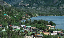
No description for Bear Lake has been added yet!
Login or register to submit one.
Activities Click to view
- Mountain Bike
5 trails
- Hike
5 trails
- Trail Running
5 trails
- Dirtbike/Moto
4 trails
- ATV/ORV/OHV
4 trails
Region Details
- 3
- 1
- 1
Region Status
Open as of Jun 7, 2026Local Trail Association
Stats
- Avg Trail Rating
- Trails (view details)
- 5
- Trails Mountain Bike
- 5
- Trails Hike
- 5
- Trails Trail Running
- 5
- Trails Dirtbike/Moto
- 4
- Trails ATV/ORV/OHV
- 4
- Total Distance
- 18 miles
- Total Descent
- 1,798 ft
- Total Vertical
- 2,568 ft
- Highest Trailhead
- 9,017 ft
- Reports
- 4
- Photos
- 11
- Ridden Counter
- 73
Articles
Lesser-Known Lake Escapes in the U.S.
May 22, 2025 from outsideonline.com
From turquoise gems in the Rockies to forest-fringed glacial lakes in New England, escape the crowds at these nine lakes in the U.S. where...
Popular Bear Lake Mountain Biking Trails
• 80 ★ 4.0 • 6 miles • 1,020 ft • 7 •
Collection of backcountry rarely used roads and cow trails. Take the coyote gap trail to access this loop. Human sightings are rare in this area.
• 5 ★ 0.0 • 5 miles • 2,684 ft • 4 •
Less popular black diamond difficulty doubletrack. This multi-use trail can be used both directions and has a hard overall physical rating with a 2,684 ft black diamond climb. It features rock garden.
Photos of Bear Lake Mountain Bike
Recent Trail Reports
| status | trail | date | condition | info | user |
|---|---|---|---|---|---|
| Guacamole Trail | Jun 7, 2026 @ 11:16pm (America/Boise) Jun 7, 2026 | Dry | dtshredzmtb | ||
| Ranger Dip | Jul 27, 2023 @ 8:15pm Jul 27, 2023 | Dry | birdrider | ||
| Red Sinks | Mar 28, 2021 @ 11:03am Mar 28, 2021 | Snow Groomed | radmande1 |
Activity Feed
| username | action | type | title | date |
|---|---|---|---|---|
| dtshredzmtb | checkin | trail | activity #96521186 | Jun 7, 2026 @ 10:18pm Jun 7, 2026 |
| dtshredzmtb | add | report | activity #96521165 | Jun 7, 2026 @ 10:16pm Jun 7, 2026 |
| thomastown | ridden | trail | activity #87247239 | Jan 15, 2026 @ 1:01pm Jan 15, 2026 |
| tjmotorbike | add | photo | activity #72722797 and 3 more | May 30, 2025 @ 12:57pm May 30, 2025 |
| tjmotorbike | ridden | trail | activity #72559758 | May 27, 2025 @ 11:32pm May 27, 2025 |
Nearby Areas
| name | distance | ||||
|---|---|---|---|---|---|
| St Charles Canyon | 11 | 5 | 23.5 km | ||
| Bailey Creek | 2 | 7 | 4 | 28.4 km | |
| Beaver Mountain | 2 | 4 | 2 | 29.6 km | |
| Soda Springs Bike Park | 32.1 km | ||||
| Kelly Park | 32.3 km |
Local Products
Activity Type Stats
| activitytype | trails | distance | descent | descent distance | total vertical | rating | global rank | state rank | photos | reports | routes | ridelogs |
|---|---|---|---|---|---|---|---|---|---|---|---|---|
| Mountain Bike | 5 | 18 miles | 1,798 ft | 5 miles | 2,569 ft | #7,563 | #2,906 | 11 | 3 | 255 | ||
| Hike | 5 | 18 miles | 1,798 ft | 5 miles | 2,569 ft | #9,786 | #3,800 | 3 | 15 | |||
| Trail Running | 5 | 18 miles | 1,798 ft | 5 miles | 2,569 ft | #8,872 | #3,153 | 3 | 3 | |||
| Dirtbike/Moto | 4 | 12 miles | 778 ft | 2 miles | 2,569 ft | #909 | #391 | 2 | 1 | |||
| ATV/ORV/OHV | 4 | 12 miles | 778 ft | 2 miles | 2,569 ft | #590 | #258 | 2 |
- By xrayj35
 & contributors
 - Admins: noplacefamous, jntidaho
- #6179 - 9,795 views
- bear lake activity log | embed map of Bear Lake mountain bike trails |
Downloading of trail gps tracks in kml & gpx formats is enabled for Bear Lake.
You must login to download files.