close
-
Layers w
- Weather Layers
- Pro
- Pro
- Pro
- Pro
- Pro
- Pro
- More Layers
- Pro
- Pro
- Pro
- Pro
-
Upgrade to

3D
Trail Conditions
- Unknown
- Snow Groomed
- Snow Packed
- Snow Covered
- Snow Cover Partial
- Freeze/thaw Cycle
- Icy
- Prevalent Mud
- Wet
- Variable
- Ideal
- Dry
- Very Dry
Trail Flow (Ridden Direction)
Trailforks scans users ridelogs to determine the most popular direction each trail is ridden. A good flowing trail network will have most trails flowing in a single direction according to their intension.
The colour categories are based on what percentage of riders are riding a trail in its intended direction.
The colour categories are based on what percentage of riders are riding a trail in its intended direction.
- > 96%
- > 90%
- > 80%
- > 70%
- > 50%
- < 50%
- bi-directional trail
- no data
Trail Last Ridden
Trailforks scans ridelogs to determine the last time a trail was ridden.
- < 2 days
- < 1 week
- < 2 weeks
- < 1 month
- < 6 months
- > 6 months
Trail Ridden Direction
The intended direction a trail should be ridden.
- Downhill Only
- Downhill Primary
- Both Directions
- Uphill Primary
- Uphill Only
- One Direction
Contribute Details
Colors indicate trail is missing specified detail.
- Description
- Photos
- Description & Photos
- Videos
Trail Popularity ?
Trailforks scans ridelogs to determine which trails are ridden the most in the last 9 months.
Trails are compared with nearby trails in the same city region with a possible 25 colour shades.
Think of this as a heatmap, more rides = more kinetic energy = warmer colors.
- most popular
- popular
- less popular
- not popular
ATV/ORV/OHV Filter
Max Vehicle Width
inches
US Cell Coverage
Legend

Radar Time
Activity Recordings
Trailforks uses anonymized public activity data.
?
Activity Recordings
Trailforks uses anonymized public activity data.
?
Personal Heatmap
▶
Activity Types
all
/
none
▶
Options
2
Date range
month
–
Winter Trails
Warning
A routing network for winter maps does not exist. Selecting trails using the winter trails layer has been disabled.
Missing Trails
Most Popular
Least Popular
Trails are colored based on popularity. The more popular a trail is, the more red. Less popular trails trend towards green.
Jump Magnitude Heatmap
Heatmap of where riders jump on trails. Zoom in to see individual jumps, click circles to view jump details.
BC Backroad Status
![map legend]()
Service Road Atlas is a free to use, community-driven service for viewing and creating reports on the numerous back-country service roads around B.C. and Alberta.

Slope Aspect
Direction the slope faces
Trails Deemphasized
Trails are shown in grey.
Only show trails with no bike usage.
Suggested Layers
Based on selected activity type
Save the current map location and zoom level as your default home location whenever this page is loaded.
Save
No description for Beaver has been added yet!
Login or register to submit one.
Activities Click to view
- Mountain Bike
127 trails
- E-Bike
42 trails
- Gravel Bike
7 trails
- Adaptive Bike
9 trails
- Winter Fat Bike
36 trails
- Horse
62 trails
- Hike
130 trails
- Trail Running
128 trails
- Dirtbike/Moto
30 trails
- ATV/ORV/OHV
28 trails
- Downhill Ski
43 trails
Region Details
- 32
- 1
- 20
- 54
- 19
- 1
Region Status
Open as of 3 hoursStats
- Avg Trail Rating
- Trails (view details)
- 173
- Trails Mountain Bike
- 127
- Trails E-Bike
- 42
- Trails Gravel Bike
- 7
- Trails Adaptive Bike
- 9
- Trails Winter Fat Bike
- 36
- Trails Horse
- 62
- Trails Hike
- 130
- Trails Trail Running
- 128
- Trails Dirtbike/Moto
- 30
- Trails ATV/ORV/OHV
- 28
- Trails Snowmobile
- 3
- Trails Snowshoe
- 2
- Trails Downhill Ski
- 43
- Total Distance
- 395 miles
- Total Descent
- 71,200 ft
- Total Vertical
- 6,134 ft
- Highest Trailhead
- 12,140 ft
- Reports
- 136
- Photos
- 528
- Ridden Counter
- 4,128
Sub Regions
-
Beaver Bench
-
Beaver Bench Trail System
- 1
- 7
- 4
-
Beaver North Creek
- 10
- 1
-
Eagle Point Resort
- 1
- 5
-
Southern Tushar Mountains
- 4
- 11
- 5
-
Tushar Peaks
- 5
- 11
- 9
Popular Beaver Mountain Biking Trails
• 100 ★ 4.5 • 6 miles • 351 ft • 297 •
This is a great easy, non technical trail that weaves in and out of the Table Grounds with amazing views of the Tushar Mountains.
• 65 ★ 2.8 • 4,734 ft • 180 ft • 84 •
The can be ridden in both directions, but is generally ridden clockwise starting with this trail heading up. This is a nice and easy climb through the trees. There is one little bit of rocky section near the top but it is barely gaining...
• 90 ★ 0.0 • 1 mile • 17 ft • 82 •
Popular green difficulty singletrack. This mountain bike primary trail can be used both directions. On average it takes 9 minutes to complete this trail.
• 100 ★ 5.0 • 1 mile • 0 ft • 77 •
This trail is generally ridden down, but is bi-directional. I would not say it is better up or down, but to get to the bottom of it, you would have to ride down a mix of dirt access road and washed out tight single track. Riding down it...
• 100 ★ 0.0 • 3,068 ft • 91 ft • 64 •
Climbing (or easy downhill) trail from the bottom of the downhill trails back up to .
• 90 ★ 4.0 • 3,182 ft • 0 ft • 63 •
This trail is considered the more advanced of the other beginner to intermediate trails. The trail has some steep sweeping berms that can be a bit loose, and there is one rocky section a the top that is a bit off camber in spots. The...
• 85 ★ 0.0 • 4,484 ft • 276 ft • 61 •
Popular blue difficulty singletrack. This mountain bike primary trail can be used both directions and has a moderate overall physical rating with a 276 ft blue climb. On average it takes 11 minutes to complete this trail.
• 85 ★ 0.0 • 1,266 ft • 5 ft • 60 •
This is the lower section of Crater Lakes #116 that can be used to connect to the Lakeshore Trail. This trail continues up to crater lake, but is more geared to hikers
Beaver Mountain Bike Routes
★ 2.0 • 17 miles • 1,763 ft • 14 • Loop •
A scenic loop around Fish Lake, which can be hiked or biked in either direction or in sections.
40 miles • 7,066 ft • 5 • Shuttled •
Starting at Eagle Point Ski resport peddle up into the heart of the Tushars, then turn south across the...
27 miles • 6,431 ft • 5 • Loop •
A tour around the Tushars from Eagle Point. See the pocket, bullion and other stunning views
19 miles • 4,673 ft • 2 • Loop •
Loop of the Western Tushar including Blue Lake.
3 miles • 278 ft • 0 • Loop •
Sage Advice is the first of many trails in the Beaver Bench Trail System. It will lead you to the top of...
22 miles • 2,568 ft • 0 • Shuttled •
Take a Shuttle up to eagle point and from there head west along the skyline before dropping into blue lake...
Photos of Beaver Mountain Bike
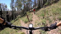
Videos of Beaver Mountain Bike
trail: Tushar Ridge (Upper)
2:00 |
50 |
Sep 1, 2019
trail: Puffer Lake - Skyline
3:40 |
101 |
Sep 1, 2019
trail: Endor
2:39 |
80 |
Sep 1, 2019
trail: Swoop Flow
2:38 |
250 |
Sep 1, 2019
youtuber
![Warm winter fat biking at Fish Lake! |...]()

trail: Bowery Bypass
31:12 |
35 |
Jan 2, 2026 , Beaver
youtuber
![Warm winter fat biking at Fish Lake! |...]()
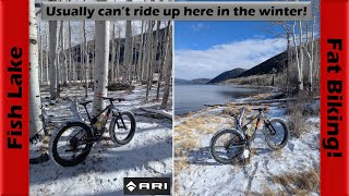
trail: Fish Lake Perimeter
31:12 |
39 |
Jan 2, 2026 , Beaver
youtuber
![All-Time Fall Time on Tanner Hollow Trail! |...]()
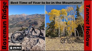
trail: Tanner Hollow - Big John
59:00 |
65 |
Oct 28, 2025 , Beaver
youtuber
![All-Time Fall Time on Tanner Hollow Trail! |...]()

59:00 |
58 |
Oct 28, 2025 , Beaver
Current Trail Warnings
| status | trail | date | condition | user | info |
|---|---|---|---|---|---|
| Fish Lake Perimeter | Jun 21, 2026 @ 11:52am (America/Denver) 3 hours | Dry | scottmorris | Lots of trees down. Both on the flat... | |
| Lake View Trail | Jun 21, 2026 @ 11:47am (America/Denver) 3 hours | Unknown | scottmorris | Still *so* many downed trees, on the... | |
| Fish Lake Perimeter | Jun 21, 2026 @ 11:47am (America/Denver) 3 hours | Unknown | scottmorris | Still *so* many downed trees, on the... |
Recent Trail Reports
National Scenic Trails & Official Routes
-
Great Western Trail
- Mountain Bike
- E-Bike
- Horse
- Hike
- Trail Running
- Dirtbike/Moto
- ATV/ORV/OHV

Activity Feed
| username | action | type | title | date |
|---|---|---|---|---|
| scottmorris | add | report | activity #97501257 and 2 more | Jun 21, 2026 @ 10:50am 3 hours |
| Trailmaven | comment | trail | activity #97006963 and 1 more | Jun 14, 2026 @ 2:57pm Jun 14, 2026 |
| RandallVGbhCH | wishlist | trail | activity #96267710 | Jun 4, 2026 @ 6:23pm Jun 4, 2026 |
| BoriszL1D1C | wishlist | region | activity #95996181 | May 31, 2026 @ 8:05pm May 31, 2026 |
| theN8 | add | report | activity #95318320 and 4 more | May 23, 2026 @ 7:56am May 23, 2026 |
Recent Comments
| username | type | title | comment | date |
|---|---|---|---|---|
| trail | Nice trail still has several downed trees.... | Jun 14, 2026 @ 2:59pm Jun 14, 2026 | ||
| trail | Could be good with several reroutes and a lot... | Jun 14, 2026 @ 2:57pm Jun 14, 2026 | ||
| trail | Stopped here (Mammoth TH) on April 15 to ride... | Apr 16, 2026 @ 11:41am Apr 16, 2026 | ||
| trail | The trail above the falls is super steep. ... | Nov 13, 2025 @ 4:41pm Nov 13, 2025 | ||
| trail | Note that the bottom is on private property. ... | Nov 13, 2025 @ 4:28pm Nov 13, 2025 |
Local Badges
-

Completionist0 awarded -

Big Ride 30k487 awarded -

Epic Ride 50k313 awarded -

Top 10 Trails0 awarded -

Descent 100k Badge0 awarded -
Completionist0 awarded
Bike & Skill Parks
| name | type | city | rating |
|---|---|---|---|
| Eagle Point Resort | bike park | Beaver |
Activity Type Stats
| activitytype | trails | distance | descent | descent distance | total vertical | rating | global rank | state rank | photos | reports | routes | ridelogs |
|---|---|---|---|---|---|---|---|---|---|---|---|---|
| Mountain Bike | 127 | 378 miles | 59,137 ft | 144 miles | 6,135 ft | #685 | #258 | 469 | 136 | 8 | 2,950 | |
| E-Bike | 42 | 120 miles | 14,888 ft | 41 miles | 5,266 ft | #1,386 | #858 | 90 | 4 | 86 | ||
| Gravel Bike | 7 | 41 miles | 5,387 ft | 17 miles | 4,222 ft | #333 | #939 | 3 | 1 | 38 | ||
| Adaptive Bike | 9 | 38 miles | 5,279 ft | 17 miles | 4,324 ft | #310 | #1,644 | 4 | ||||
| Winter Fat Bike | 36 | 125 miles | 15,466 ft | 40 miles | 5,299 ft | #55 | #863 | 2 | ||||
| Horse | 62 | 202 miles | 35,381 ft | 72 miles | 5,899 ft | #132 | #387 | 3 | 27 | 1 | 1 | |
| Hike | 130 | 380 miles | 59,213 ft | 144 miles | 6,135 ft | #307 | #150 | 49 | 133 | 6 | 367 | |
| Trail Running | 128 | 378 miles | 59,193 ft | 144 miles | 6,135 ft | #323 | #127 | 133 | 6 | 100 | ||
| Dirtbike/Moto | 30 | 115 miles | 12,657 ft | 37 miles | 5,066 ft | #288 | #138 | 13 | 11 | |||
| ATV/ORV/OHV | 28 | 111 miles | 11,893 ft | 34 miles | 5,066 ft | #157 | #68 | 3 | 13 | 15 | ||
| Snowmobile | 3 | 21 miles | 3,757 ft | 9 miles | 3,691 ft | 2 | ||||||
| Snowshoe | 2 | 15 miles | 2,090 ft | 4 miles | 3,967 ft | 2 | 13 | |||||
| Downhill Ski | 43 | 15 miles | 11,988 ft | 14 miles | 1,342 ft | #426 | #163 | 221 |
Frequently Asked Questions About Beaver
▼
What are the best places to ride in Beaver?
Beaver has 6 areas to explore for mountain biking. The top rated areas are:
▼
What are the highest rated mountain biking trails in Beaver?
The highest rated mountain biking trails in Beaver are:
- Copper Belt Peak (4.1/5)
- Monarch Loop (4.1/5)
- Hightop Trail (North) (4.1/5)
- Paiute Trail: Betenson Pass (4.1/5)
- Ramblers (NICA Course) (4.1/5)
▼
What is the best time of the year to ride in Beaver?
Based on ride log data, the most popular months to ride in Beaver are:
- July (47 activities)
- June (26 activities)
- August (16 activities)
▼
Where can I park to ride in Beaver?
There are 20 parking locations listed in Beaver. The most popular parking spots are:
- Mammoth Crossing Trailhead
- Elk Meadows
- Big John Flat Trailhead
- Parking (Lake Stream Trailhead)
- Bullion Falls Trailhead
Activities
Trails
Points of Interest
- Big John CUA Dispersed Camping
- Kents Lake Campground Camping
- Anderson Meadow Campground Camping
- Timid Springs Dispersed Camping
- Big John Flat Camping
- Wood Sender TTF
- Old Line Shack Sight
- Bullion Falls [waterfall] Other
- Delano Peak Summit
- Copper Belt Peak Summit
- Delano Peak (12,172 ft)
- Mount Baldy (12,090 ft)
- Mount Holly (11,962 ft)
- By canadaka
 Trailforks & contributors
 - Admins: jkwilliamz, UtahJohn, jpmcghee, jasonmalczyk
- #4827 - 9,998 views
- beaver activity log | embed map of Beaver mountain bike trails | beaver mountain biking points of interest
Downloading of trail gps tracks in kml & gpx formats is enabled for Beaver.
You must login to download files.