close
-
Layers w
- Weather Layers
- Pro
- Pro
- Pro
- Pro
- Pro
- Pro
- More Layers
- Pro
- Pro
- Pro
- Pro
-
Upgrade to

3D
Trail Conditions
- Unknown
- Snow Groomed
- Snow Packed
- Snow Covered
- Snow Cover Partial
- Freeze/thaw Cycle
- Icy
- Prevalent Mud
- Wet
- Variable
- Ideal
- Dry
- Very Dry
Trail Flow (Ridden Direction)
Trailforks scans users ridelogs to determine the most popular direction each trail is ridden. A good flowing trail network will have most trails flowing in a single direction according to their intension.
The colour categories are based on what percentage of riders are riding a trail in its intended direction.
The colour categories are based on what percentage of riders are riding a trail in its intended direction.
- > 96%
- > 90%
- > 80%
- > 70%
- > 50%
- < 50%
- bi-directional trail
- no data
Trail Last Ridden
Trailforks scans ridelogs to determine the last time a trail was ridden.
- < 2 days
- < 1 week
- < 2 weeks
- < 1 month
- < 6 months
- > 6 months
Trail Ridden Direction
The intended direction a trail should be ridden.
- Downhill Only
- Downhill Primary
- Both Directions
- Uphill Primary
- Uphill Only
- One Direction
Contribute Details
Colors indicate trail is missing specified detail.
- Description
- Photos
- Description & Photos
- Videos
Trail Popularity ?
Trailforks scans ridelogs to determine which trails are ridden the most in the last 9 months.
Trails are compared with nearby trails in the same city region with a possible 25 colour shades.
Think of this as a heatmap, more rides = more kinetic energy = warmer colors.
- most popular
- popular
- less popular
- not popular
ATV/ORV/OHV Filter
Max Vehicle Width
inches
US Cell Coverage
Legend

Radar Time
Activity Recordings
Trailforks uses anonymized public activity data.
?
Activity Recordings
Trailforks uses anonymized public activity data.
?
Personal Heatmap
▶
Activity Types
all
/
none
▶
Options
2
Date range
month
–
Winter Trails
Warning
A routing network for winter maps does not exist. Selecting trails using the winter trails layer has been disabled.
Missing Trails
Most Popular
Least Popular
Trails are colored based on popularity. The more popular a trail is, the more red. Less popular trails trend towards green.
Jump Magnitude Heatmap
Heatmap of where riders jump on trails. Zoom in to see individual jumps, click circles to view jump details.
BC Backroad Status
![map legend]()
Service Road Atlas is a free to use, community-driven service for viewing and creating reports on the numerous back-country service roads around B.C. and Alberta.

Slope Aspect
Direction the slope faces
Trails Deemphasized
Trails are shown in grey.
Only show trails with no bike usage.
Suggested Layers
Based on selected activity type
Save the current map location and zoom level as your default home location whenever this page is loaded.
Save
No description for Bedford has been added yet!
Login or register to submit one.
Activities Click to view
- Mountain Bike
98 trails
- E-Bike
12 trails
- Gravel Bike
0 trails
- Adaptive Bike
0 trails
- Winter Fat Bike
0 trails
- Horse
6 trails
- Hike
101 trails
- Trail Running
102 trails
- Dirtbike/Moto
12 trails
- ATV/ORV/OHV
6 trails
- Snowmobile
4 trails
- Snowshoe
60 trails
- Nordic Ski
21 trails
Region Details
- 9
- 24
- 21
- 40
- 3
Region Status
Caution as of Jun 11, 2026Local Trail Association
Stats
- Avg Trail Rating
- Trails (view details)
- 97
- Trails Mountain Bike
- 98
- Trails E-Bike
- 12
- Trails Horse
- 6
- Trails Hike
- 101
- Trails Trail Running
- 102
- Trails Dirtbike/Moto
- 12
- Trails ATV/ORV/OHV
- 6
- Trails Snowmobile
- 4
- Trails Snowshoe
- 60
- Trails Nordic Ski
- 21
- Total Distance
- 30 miles
- Total Descent
- 4,332 ft
- Total Vertical
- 339 ft
- Highest Trailhead
- 351 ft
- Reports
- 232
- Photos
- 33
- Ridden Counter
- 2,880
Sub Regions
-
Hemlock Ravine
- 1
- 8
-
Range Trails
- 3
- 12
-
Sandy Lake Park
- 1
- 5
- 23
- 3
Popular Bedford Mountain Biking Trails
• 50 ★ 3.5 • 1 mile • 146 ft • 62 •
Moderately popular blue difficulty singletrack. This mountain bike primary trail can be used downhill primary. On average it takes 9 minutes to complete this trail.
• 90 ★ 1.0 • 1,304 ft • 22 ft • 61 •
Popular blue difficulty doubletrack. This multi-use trail can be used both directions. On average it takes 4 minutes to complete this trail.
• 85 ★ 0.0 • 1,433 ft • 17 ft • 54 •
Popular white difficulty family friendly gravel path. This multi-use trail can be used both directions. On average it takes 4 minutes to complete this trail.
• 35 ★ 2.0 • 1,391 ft • 0 ft • 52 •
Less popular blue difficulty singletrack. This mountain bike primary trail can be used downhill primary. On average it takes 3 minutes to complete this trail.
• 95 ★ 0.0 • 925 ft • 0 ft • 47 •
This trail links from over to the double track Jacks Lake Trail, watch for the T in the trail and go left, the trail is marked with tape at the intersection and periodically along the route.
• 95 ★ 0.0 • 1,729 ft • 10 ft • 45 •
Steep loose rocky climb along the powerline into a wide singletrack with some roots and a few rocky sections. can be used to access some of the other trails.
• 30 ★ 2.0 • 689 ft • 3 ft • 41 •
Less popular blue difficulty singletrack. This mountain bike primary trail can be used downhill primary. On average it takes 2 minutes to complete this trail.
• 25 ★ 2.0 • 1,690 ft • 15 ft • 40 •
Less popular blue difficulty singletrack. This mountain bike primary trail can be used downhill primary. On average it takes minutes to complete this trail.
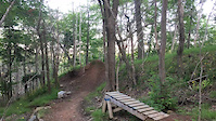
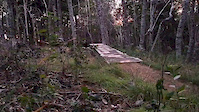
Photos of Bedford Mountain Bike
Videos of Bedford Mountain Bike
trail: Main Trail
0:10 |
533 |
May 18, 2018
trail: Main Trail
0:05 |
853 |
May 18, 2018
trail: Main Trail
0:05 |
528 |
May 18, 2018
trail: Main Trail
0:22 |
609 |
May 18, 2018
trail: Main Trail
4:18 |
627 |
Jun 8, 2012
626 |
Jul 26, 2016
Recent Trail Reports
| status | trail | date | condition | info | user |
|---|---|---|---|---|---|
| Mill Run Trail | Sep 2, 2025 @ 5:25pm Sep 2, 2025 | Variable | tonyth | ||
| Tower Trail to Sandy Lake | Sep 2, 2025 @ 5:25pm Sep 2, 2025 | Variable | tonyth | ||
| 2024-1 | Jan 16, 2025 @ 10:23am Jan 16, 2025 | Ideal | pmachan1 | ||
| Sandy Lake Service Road | Nov 20, 2024 @ 5:28pm Nov 20, 2024 | Variable | AlexanderGfTK4N | ||
| unnamed | Aug 27, 2024 @ 11:18am Aug 27, 2024 | Dry | johnt8 | ||
| Down and Out | Aug 27, 2024 @ 11:18am Aug 27, 2024 | Dry | johnt8 | ||
| 2024-2 | Aug 27, 2024 @ 11:18am Aug 27, 2024 | Dry | johnt8 | ||
| Mill Run Path | Aug 27, 2024 @ 11:18am Aug 27, 2024 | Dry | johnt8 | ||
| North Road | May 25, 2024 @ 9:40am May 25, 2024 | Variable | sumesh | ||
| Sandy Lake Park Road | Apr 21, 2024 @ 8:50am Apr 21, 2024 | Variable | AndyJoeNewby |
Activity Feed
| username | action | type | title | date |
|---|---|---|---|---|
| TtAYby | wishlist | trail | activity #97247844 | Jun 18, 2026 @ 6:33am 3 days |
| paullydca | wishlist | region | activity #96008325 | Jun 1, 2026 @ 4:22am Jun 1, 2026 |
| paullydca | wishlist | region | activity #96008317 | Jun 1, 2026 @ 4:22am Jun 1, 2026 |
| bent6543 | update | directory | activity #93639704 | Apr 29, 2026 @ 4:58am Apr 29, 2026 |
| Crutch007 | add | photo | activity #87210980 | Jan 14, 2026 @ 5:32pm Jan 14, 2026 |
Recent Comments
| username | type | title | comment | date |
|---|---|---|---|---|
| trail | Very challenging. Sections that need to be... | Sep 28, 2025 @ 3:41pm Sep 28, 2025 | ||
| trail | Trail is mostly complete, 75% raked. | Jan 16, 2025 @ 10:22am Jan 16, 2025 | ||
| trail | If you are considering coming here to bike.... | Apr 24, 2024 @ 3:28pm Apr 24, 2024 | ||
| trail | Very wet and muddy | Nov 14, 2020 @ 2:28pm Nov 14, 2020 | ||
| trail | Very wet and muddy. | Nov 14, 2020 @ 2:27pm Nov 14, 2020 |
Local Badges
-

10 Green Trails16 awarded -

10 Blue Trails27 awarded -

Epic Ride Climb 2k1 awarded -

Climbing 10k Badge10 awarded -

Climbing 100k Badge0 awarded -

Epic Ride Descent 2k1 awarded
Bike & Skill Parks
| name | type | city | rating |
|---|---|---|---|
| Brookline Drive Pump Track | skill park | Bedford |
Activity Type Stats
| activitytype | trails | distance | descent | descent distance | total vertical | rating | global rank | state rank | photos | reports | routes | ridelogs |
|---|---|---|---|---|---|---|---|---|---|---|---|---|
| Mountain Bike | 98 | 30 miles | 4,331 ft | 13 miles | 338 ft | #5,073 | #19 | 32 | 232 | 3,756 | ||
| E-Bike | 12 | 2 miles | 36 ft | 2,352 ft | 144 ft | #6,977 | #32 | 194 | 257 | |||
| Horse | 6 | 1 mile | 174 ft | 3,507 ft | 131 ft | #2,570 | #24 | 84 | ||||
| Hike | 101 | 30 miles | 4,295 ft | 13 miles | 338 ft | #4,361 | #16 | 231 | 1,622 | |||
| Trail Running | 102 | 30 miles | 4,301 ft | 13 miles | 338 ft | #4,140 | #13 | 231 | 557 | |||
| Dirtbike/Moto | 12 | 5 miles | 1,001 ft | 3 miles | 226 ft | #1,069 | #18 | 1 | 100 | 10 | ||
| ATV/ORV/OHV | 6 | 3 miles | 531 ft | 1 mile | 226 ft | #811 | #25 | 94 | 13 | |||
| Snowmobile | 4 | 2 miles | 151 ft | 3,642 ft | 161 ft | #350 | #21 | 72 | ||||
| Snowshoe | 60 | 21 miles | 3,337 ft | 9 miles | 279 ft | #679 | #18 | 97 | 11 | |||
| Nordic Ski | 21 | 9 miles | 1,224 ft | 3 miles | 279 ft | #1,098 | #23 | 94 | 1 |
Frequently Asked Questions About Bedford
▼
What are the best places to ride in Bedford?
Bedford has 4 areas to explore for mountain biking. The top rated areas are:
▼
What are the highest rated mountain biking trails in Bedford?
The highest rated mountain biking trails in Bedford are:
- Paper Mill Lake path (4.1/5)
- 49 Friesian (4.1/5)
- Mill Run Trail (4.1/5)
- Waterbury Park Path (4/5)
- Cascades Park Path (4/5)
▼
What is the best time of the year to ride in Bedford?
Based on ride log data, the most popular months to ride in Bedford are:
- July (31 activities)
- August (19 activities)
- September (18 activities)
▼
Where can I park to ride in Bedford?
There are 4 parking locations listed in Bedford. The most popular parking spots are: View all parking and trailhead locations on the map to plan your visit.
Activities
- By TheDaver
 & contributors
 - Admins: bent6543
- #5209 - 8,120 views
- bedford activity log | embed map of Bedford mountain bike trails | bedford mountain biking points of interest
Downloading of trail gps tracks in kml & gpx formats is enabled for Bedford.
You must login to download files.