close
-
Layers w
- Weather Layers
- Pro
- Pro
- Pro
- Pro
- Pro
- Pro
- More Layers
- Pro
- Pro
- Pro
- Pro
-
Upgrade to

3D
Trail Conditions
- Unknown
- Snow Groomed
- Snow Packed
- Snow Covered
- Snow Cover Partial
- Freeze/thaw Cycle
- Icy
- Prevalent Mud
- Wet
- Variable
- Ideal
- Dry
- Very Dry
Trail Flow (Ridden Direction)
Trailforks scans users ridelogs to determine the most popular direction each trail is ridden. A good flowing trail network will have most trails flowing in a single direction according to their intension.
The colour categories are based on what percentage of riders are riding a trail in its intended direction.
The colour categories are based on what percentage of riders are riding a trail in its intended direction.
- > 96%
- > 90%
- > 80%
- > 70%
- > 50%
- < 50%
- bi-directional trail
- no data
Trail Last Ridden
Trailforks scans ridelogs to determine the last time a trail was ridden.
- < 2 days
- < 1 week
- < 2 weeks
- < 1 month
- < 6 months
- > 6 months
Trail Ridden Direction
The intended direction a trail should be ridden.
- Downhill Only
- Downhill Primary
- Both Directions
- Uphill Primary
- Uphill Only
- One Direction
Contribute Details
Colors indicate trail is missing specified detail.
- Description
- Photos
- Description & Photos
- Videos
Trail Popularity ?
Trailforks scans ridelogs to determine which trails are ridden the most in the last 9 months.
Trails are compared with nearby trails in the same city region with a possible 25 colour shades.
Think of this as a heatmap, more rides = more kinetic energy = warmer colors.
- most popular
- popular
- less popular
- not popular
ATV/ORV/OHV Filter
Max Vehicle Width
inches
US Cell Coverage
Legend

Radar Time
Activity Recordings
Trailforks uses anonymized public activity data.
?
Activity Recordings
Trailforks uses anonymized public activity data.
?
Personal Heatmap
▶
Activity Types
all
/
none
▶
Options
2
Date range
month
–
Winter Trails
Warning
A routing network for winter maps does not exist. Selecting trails using the winter trails layer has been disabled.
Missing Trails
Most Popular
Least Popular
Trails are colored based on popularity. The more popular a trail is, the more red. Less popular trails trend towards green.
Jump Magnitude Heatmap
Heatmap of where riders jump on trails. Zoom in to see individual jumps, click circles to view jump details.
BC Backroad Status
![map legend]()
Service Road Atlas is a free to use, community-driven service for viewing and creating reports on the numerous back-country service roads around B.C. and Alberta.

Slope Aspect
Direction the slope faces
Trails Deemphasized
Trails are shown in grey.
Only show trails with no bike usage.
Suggested Layers
Based on selected activity type
Save the current map location and zoom level as your default home location whenever this page is loaded.
Save
No description for Belas has been added yet!
Login or register to submit one.
This region uses the Uk/Euro style trail grading system.
Activities Click to view
- Mountain Bike
17 trails
- Hike
10 trails
- Trail Running
10 trails
Region Details
- 1
- 7
- 8
- 1
Region Status
Caution as of Mar 23, 2026Stats
- Avg Trail Rating
- Trails (view details)
- 17
- Trails Mountain Bike
- 17
- Trails E-Bike
- 3
- Trails Hike
- 10
- Trails Trail Running
- 10
- Total Distance
- 12 miles
- Total Descent
- 2,867 ft
- Total Vertical
- 714 ft
- Highest Trailhead
- 1,256 ft
- Reports
- 148
- Photos
- 60
- Ridden Counter
- 1,045
Popular Belas Mountain Biking Trails
• 100 ★ 4.5 • 1,756 ft • 0 ft • 78 •
Popular blue difficulty singletrack. This mountain bike primary trail can be used downhill primary. It features drop, jump and rock face. On average it takes 4 minutes to complete this trail.
• 65 ★ 5.0 • 2,441 ft • 4 ft • 64 •
Moderately popular blue difficulty singletrack. This mountain bike primary trail can be used downhill primary. On average it takes 4 minutes to complete this trail.
• 80 ★ 4.5 • 2,325 ft • 19 ft • 59 •
Popular red difficulty singletrack. This mountain bike primary trail can be used downhill primary and has a hard overall physical rating. It features drop, jump and rock face. On average it takes 7 minutes to complete this trail.
• 55 ★ 5.0 • 3,072 ft • 11 ft • 53 •
Moderately popular blue difficulty singletrack. This mountain bike primary trail can be used downhill primary. On average it takes 6 minutes to complete this trail.
• 85 ★ 5.0 • 1,434 ft • 8 ft • 52 •
Popular blue difficulty singletrack. This mountain bike primary trail can be used downhill primary and has a moderate overall physical rating. It features drop, jump and rock face. On average it takes 3 minutes to complete this trail.
• 95 ★ 4.0 • 938 ft • 0 ft • 36 •
Popular green difficulty singletrack. This mountain bike primary trail can be used both directions. It features drop and jump. Trail visibility is always easy to follow. On average it takes minutes to complete this trail.
• 40 ★ 3.0 • 2,205 ft • 0 ft • 22 •
Moderately popular white difficulty doubletrack. This mountain bike primary trail. On average it takes 2 minutes to complete this trail.
• 70 ★ 4.5 • 4 miles • 278 ft • 21 •
Popular green difficulty singletrack. This mountain bike primary trail can be used both directions. On average it takes 1 hour5 minutes to complete this trail.
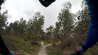
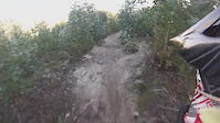
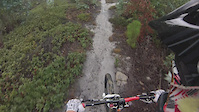
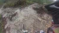
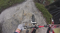
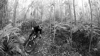
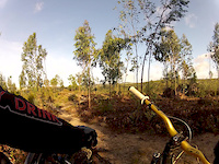
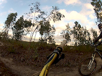
Photos of Belas Mountain Bike
Videos of Belas Mountain Bike
trail: Trilho dos Sobreiros
2:06 |
74 |
Mar 19, 2016
trail: Mini
3:45 |
104 |
Dec 6, 2015
trail: Mini
0:56 |
83 |
Oct 12, 2015
trail: Trilho do Marco Geodésico
2:52 |
181 |
Oct 12, 2015
trail: Trilho dos Sobreiros
0:59 |
59 |
Oct 12, 2015
trail: Snake
0:49 |
113 |
Oct 12, 2015
trail: Fetos
2:23 |
413 |
Mar 21, 2013
trail: Fetos
2:20 |
164 |
Dec 29, 2012
Recent Trail Reports
| status | trail | date | condition | info | user |
|---|---|---|---|---|---|
| Carregueira | Jan 15, 2025 @ 9:31am Jan 15, 2025 | Dry | Pedrolow | ||
| Sabugo-Alfouvar | Jan 15, 2025 @ 9:28am Jan 15, 2025 | Variable | Pedrolow | ||
| Muro | Jul 28, 2023 @ 9:26am Jul 28, 2023 | Dry | AntoniojoseAntunes | ||
| Trilho dos Sobreiros | Nov 5, 2022 @ 6:25pm Nov 5, 2022 | Ideal | Santinho | ||
| Fetos | Nov 5, 2022 @ 6:25pm Nov 5, 2022 | Ideal | Santinho | ||
| Snake | Sep 27, 2022 @ 9:51am Sep 27, 2022 | Dry | carlos-alves CDL-PFM | ||
| Single do Bom Jardim | Aug 4, 2022 @ 10:15am Aug 4, 2022 | Dry | gctano | ||
| Descida do Moka | May 28, 2022 @ 1:15am May 28, 2022 | Dry | gctano | ||
| Salamandra | Apr 3, 2022 @ 1:49am Apr 3, 2022 | Ideal | Santinho | ||
| Acacias | Apr 21, 2019 @ 1:13am Apr 21, 2019 | Dry | BrunoFigueiredo |
Activity Feed
| username | action | type | title | date |
|---|---|---|---|---|
| vQVT5A | ridden | trail | activity #88206612 | Feb 1, 2026 @ 11:56pm Feb 1, 2026 |
| Semich | add | report | activity #82230671 and 1 more | Oct 12, 2025 @ 12:01pm Oct 12, 2025 |
| Pedrolow | ridden | trail | activity #78367090 | Aug 17, 2025 @ 1:34pm Aug 17, 2025 |
| Pedrolow | add | report | activity #77522232 and 1 more | Aug 6, 2025 @ 6:26am Aug 6, 2025 |
| cWVsNd | ridden | trail | activity #73847761 | Jun 15, 2025 @ 9:58am Jun 15, 2025 |
Recent Comments
| username | type | title | comment | date |
|---|---|---|---|---|
| trail | Na parte junto ao tanque de agua ao lado da... | Apr 3, 2022 @ 4:11pm Apr 3, 2022 | ||
| trail | This trail does not exist anymore. Be careful... | Mar 13, 2021 @ 11:20am Mar 13, 2021 |
Nearby Areas
| name | distance | ||||
|---|---|---|---|---|---|
| Monsanto | 20 | 21 | 6.1 km | ||
| Jamor | 4 | 6.5 km | |||
| Mata de Alvalade | 4 | 1 | 7.4 km | ||
| Trancão Shore | 4 | 8.9 km | |||
| Parque Natural de Sintra-Cascais | 26 | 51 | 9.8 km |
Local Mountain Biking Directory
-
WERIDE.pt
-
Cycling Rentals
-
Rent4Trail
![Rent4Trail]()
-
2CyclingBike Shop
-
The Bike ShopBike Shop
Activity Type Stats
| activitytype | trails | distance | descent | descent distance | total vertical | rating | global rank | state rank | photos | reports | routes | ridelogs |
|---|---|---|---|---|---|---|---|---|---|---|---|---|
| Mountain Bike | 17 | 12 miles | 2,867 ft | 7 miles | 715 ft | #2,315 | #17 | 60 | 148 | 2,195 | ||
| E-Bike | 3 | 4 miles | 869 ft | 2 miles | 673 ft | 146 | 118 | |||||
| Hike | 10 | 10 miles | 2,123 ft | 6 miles | 715 ft | #3,113 | #21 | 141 | 53 | |||
| Trail Running | 10 | 10 miles | 2,123 ft | 6 miles | 715 ft | #2,347 | #21 | 141 | 255 |
Frequently Asked Questions About Belas
▼
What are the highest rated mountain biking trails in Belas?
The highest rated mountain biking trails in Belas are:
- Trilho dos Sobreiros (4.1/5)
- Snake (4.1/5)
- Carregueira (4.1/5)
- Salamandra (4.1/5)
- Fetos (4.1/5)
▼
What is the best time of the year to ride in Belas?
Based on ride log data, the most popular months to ride in Belas are:
- February (16 activities)
- September (6 activities)
- October (6 activities)
▼
Where can I park to ride in Belas?
Check the Belas trail map for trailhead and parking information. Community members regularly update access and parking details for trails in the area.
▼
What is the longest trail in Belas?
The longest trail in Belas is Sabugo-Alfouvar at 3.6 miles. View all trails sorted by distance.
- By nunovicente & contributors
- Admins: CDL-PFM
- #4356 - 4,191 views
- belas activity log | embed map of Belas mountain bike trails | belas mountain biking points of interest
Downloading of trail gps tracks in kml & gpx formats is enabled for Belas.
You must login to download files.