close
-
Layers w
- Weather Layers
- Pro
- Pro
- Pro
- Pro
- Pro
- Pro
- More Layers
- Pro
- Pro
- Pro
- Pro
-
Upgrade to

3D
Trail Conditions
- Unknown
- Snow Groomed
- Snow Packed
- Snow Covered
- Snow Cover Partial
- Freeze/thaw Cycle
- Icy
- Prevalent Mud
- Wet
- Variable
- Ideal
- Dry
- Very Dry
Trail Flow (Ridden Direction)
Trailforks scans users ridelogs to determine the most popular direction each trail is ridden. A good flowing trail network will have most trails flowing in a single direction according to their intension.
The colour categories are based on what percentage of riders are riding a trail in its intended direction.
The colour categories are based on what percentage of riders are riding a trail in its intended direction.
- > 96%
- > 90%
- > 80%
- > 70%
- > 50%
- < 50%
- bi-directional trail
- no data
Trail Last Ridden
Trailforks scans ridelogs to determine the last time a trail was ridden.
- < 2 days
- < 1 week
- < 2 weeks
- < 1 month
- < 6 months
- > 6 months
Trail Ridden Direction
The intended direction a trail should be ridden.
- Downhill Only
- Downhill Primary
- Both Directions
- Uphill Primary
- Uphill Only
- One Direction
Contribute Details
Colors indicate trail is missing specified detail.
- Description
- Photos
- Description & Photos
- Videos
Trail Popularity ?
Trailforks scans ridelogs to determine which trails are ridden the most in the last 9 months.
Trails are compared with nearby trails in the same city region with a possible 25 colour shades.
Think of this as a heatmap, more rides = more kinetic energy = warmer colors.
- most popular
- popular
- less popular
- not popular
ATV/ORV/OHV Filter
Max Vehicle Width
inches
US Cell Coverage
Legend

Radar Time
Activity Recordings
Trailforks uses anonymized public activity data.
?
Activity Recordings
Trailforks uses anonymized public activity data.
?
Personal Heatmap
▶
Activity Types
all
/
none
▶
Options
2
Date range
month
–
Winter Trails
Warning
A routing network for winter maps does not exist. Selecting trails using the winter trails layer has been disabled.
Missing Trails
Most Popular
Least Popular
Trails are colored based on popularity. The more popular a trail is, the more red. Less popular trails trend towards green.
Jump Magnitude Heatmap
Heatmap of where riders jump on trails. Zoom in to see individual jumps, click circles to view jump details.
BC Backroad Status
![map legend]()
Service Road Atlas is a free to use, community-driven service for viewing and creating reports on the numerous back-country service roads around B.C. and Alberta.

Slope Aspect
Direction the slope faces
Trails Deemphasized
Trails are shown in grey.
Only show trails with no bike usage.
Suggested Layers
Based on selected activity type
Save the current map location and zoom level as your default home location whenever this page is loaded.
Save
No description for Belfast has been added yet!
Login or register to submit one.
AKA: Béal Feirste
This region uses the Uk/Euro style trail grading system.
Activities Click to view
- Mountain Bike
70 trails
- E-Bike
69 trails
- Hike
37 trails
- Trail Running
45 trails
Stats
- Avg Trail Rating
- Trails (view details)
- 71
- Trails Mountain Bike
- 70
- Trails E-Bike
- 69
- Trails Hike
- 37
- Trails Trail Running
- 45
- Total Distance
- 30 miles
- Total Descent
- 5,788 ft
- Total Vertical
- 1,156 ft
- Highest Trailhead
- 1,162 ft
- Reports
- 665
- Photos
- 207
- Ridden Counter
- 3,974
Sub Regions
- Belfast (69)
- Barnett Demesne (16)
- Belvoir Forest (25)
- Cave Hill (22)
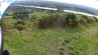
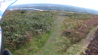
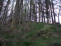
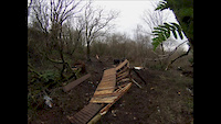
Popular Belfast Mountain Biking Trails
• 100 ★ 2.6 • 1,716 ft • 2 ft • 175 •
is the longest red option on the trails and snakes its way through the demesne’s woodland on winding singletrack. Technical trail features include rock gardens, berms, drop offs and a short log ride thrown in to keep you on your toes.
• 95 ★ 2.2 • 1,201 ft • 26 ft • 160 •
can be directly linked with ‘ ’ and is packed full of tight twists and turns as it winds up towards Malone House. Riders will be able to pick up speed on the berms and rollers on the short descent before rejoining the main .
• 90 ★ 1.8 • 1,073 ft • 3 ft • 139 •
will suit more experienced mountain bikers with a number of sweeping berms, double rollers and sections of elevated plastic boardwalk.
• 100 ★ 2.0 • 3,714 ft • 59 ft • 123 •
Popular blue difficulty machine groomed. This mountain bike primary trail can be used one direction. It features berm. On average it takes 6 minutes to complete this trail.
• 95 ★ 2.0 • 2,310 ft • 0 ft • 122 •
Popular blue difficulty machine groomed. This mountain bike primary trail can be used one direction. It features berm and bridge. Trail visibility is always easy to follow. On average it takes 3 minutes to complete this trail.
• 5 ★ 0.0 • 1,880 ft • 17 ft • 116 • • hike
Less popular green difficulty family friendly paved path. This hike primary trail can be used both directions and has a easy overall physical rating with a 17 ft green climb. On average it takes 1 minutes to complete this trail.
• 95 ★ 2.0 • 1,365 ft • 17 ft • 114 •
Popular blue difficulty machine groomed. This mountain bike primary trail can be used one direction. It features berm. Trail visibility is always easy to follow. On average it takes 2 minutes to complete this trail.
• 100 ★ 2.0 • 1,086 ft • 35 ft • 105 •
Popular blue difficulty machine groomed. This mountain bike primary trail can be used one direction. It features berm. Trail visibility is always easy to follow. On average it takes 1 minutes to complete this trail.
Photos of Belfast Mountain Bike
Videos of Belfast Mountain Bike

trail: Middle Trail Hiking Shortcut
0:08 |
61 |
Aug 19, 2022

trail: Middle
0:07 |
980 |
Nov 6, 2014
trail: Middle
0:23 |
489 |
Sep 9, 2014
trail: Middle
0:44 |
468 |
Sep 9, 2014
trail: Middle
0:15 |
68 |
Aug 14, 2014
trail: Quarry
5:32 |
499 |
Jan 12, 2014
trail: Quarry
0:18 |
885 |
Jan 5, 2014
trail: Quarry
0:41 |
235 |
Jan 2, 2014
Recent Trail Reports
| status | trail | date | condition | info | user |
|---|---|---|---|---|---|
| Middle Cave Hill | May 26, 2026 @ 3:51pm (Europe/Isle_of_Man) May 26, 2026 | Variable | Jxroussel | ||
| Mad Again Cave Hill | May 26, 2026 @ 3:51pm (Europe/Isle_of_Man) May 26, 2026 | Dry | Jxroussel | ||
| Forest Path Barnett Demesne | May 26, 2026 @ 9:18am (Europe/Isle_of_Man) May 26, 2026 | Ideal | Jxroussel | ||
| By the Lagan Barnett Demesne | May 26, 2026 @ 9:18am (Europe/Isle_of_Man) May 26, 2026 | Ideal | Jxroussel | ||
| BMX Track Belfast | Apr 7, 2026 @ 4:59pm (Europe/London) Apr 7, 2026 | Ideal | YanisMTB | ||
| Gaga Cave Hill | Mar 24, 2026 @ 7:50am (Europe/London) Mar 24, 2026 | Unknown | TheCorminator GRASS | ||
| Rush Cave Hill | Mar 23, 2026 @ 5:21pm (Europe/London) Mar 23, 2026 | Ideal | TheCorminator GRASS | ||
| Swayze Train Cave Hill | Mar 23, 2026 @ 5:21pm (Europe/London) Mar 23, 2026 | Ideal | TheCorminator GRASS | ||
| Forest Path Shortcut Cave Hill | Mar 23, 2026 @ 5:21pm (Europe/London) Mar 23, 2026 | Ideal | TheCorminator GRASS | ||
| Forest Path Cave Hill | Mar 23, 2026 @ 5:21pm (Europe/London) Mar 23, 2026 | Dry | TheCorminator GRASS |
Activity Feed
| username | action | type | title | date |
|---|---|---|---|---|
| DNHinch | wishlist | region | activity #96591895 | Jun 9, 2026 @ 2:07am Jun 9, 2026 |
| DanielMTB123456789 | ridden | trail | activity #95966469 and 2 more | May 31, 2026 @ 12:12pm May 31, 2026 |
| Jxroussel | add | karma | activity #95585661 | May 26, 2026 @ 1:06pm May 26, 2026 |
| Jxroussel | add | report | activity #95585428 and 1 more | May 26, 2026 @ 1:02pm May 26, 2026 |
| Jxroussel | add | report | activity #95563857 and 1 more | May 26, 2026 @ 7:40am May 26, 2026 |
Recent Comments
| username | type | title | comment | date |
|---|---|---|---|---|
| trail | Blocked by fallen trees 25/07/25 | Jul 25, 2025 @ 11:06am Jul 25, 2025 | ||
| trail | Completely overgrown 25/07/25 | Jul 25, 2025 @ 10:45am Jul 25, 2025 | ||
| trail | True! Updated the report now and cant delete... | Feb 4, 2022 @ 2:29am Feb 4, 2022 | ||
| trail | Reports are better for this kind of info:... | Feb 3, 2022 @ 11:52am Feb 3, 2022 | ||
| trail | Trail currently closed for... | Feb 3, 2022 @ 10:40am Feb 3, 2022 |
Local Badges
-

Epic Ride Climb 2k6 awarded -

Climbing 10k Badge29 awarded -

Climbing 100k Badge4 awarded -

Epic Ride Descent 2k6 awarded -

Descent 10k Badge32 awarded -

Descent 100k Badge4 awarded
Bike & Skill Parks
| name | type | city | rating |
|---|---|---|---|
| Barnett Demesne Jumps Park | skill park | Belfast | |
| Pairc Nua Chollan | skill park | Belfast |
Activity Type Stats
| activitytype | trails | distance | descent | descent distance | total vertical | rating | global rank | state rank | photos | reports | routes | ridelogs |
|---|---|---|---|---|---|---|---|---|---|---|---|---|
| Mountain Bike | 70 | 30 miles | 5,492 ft | 14 miles | 1,155 ft | 203 | 665 | 13,348 | ||||
| E-Bike | 69 | 30 miles | 5,728 ft | 15 miles | 1,155 ft | 657 | 251 | |||||
| Hike | 37 | 24 miles | 3,924 ft | 11 miles | 1,155 ft | 601 | 294 | |||||
| Trail Running | 45 | 25 miles | 4,094 ft | 11 miles | 1,155 ft | 602 | 760 |
Frequently Asked Questions About Belfast
▼
What are the best places to ride in Belfast?
Belfast has 3 areas to explore for mountain biking. The top rated areas are:
▼
What are the highest rated mountain biking trails in Belfast?
The highest rated mountain biking trails in Belfast are:
- Swayze Train (4.3/5)
- Rootflow (4.1/5)
- Mad Again (4.1/5)
- Jensen Express (4/5)
- The Shire (4/5)
▼
What is the best time of the year to ride in Belfast?
Based on ride log data, the most popular months to ride in Belfast are:
- August (24 activities)
- July (23 activities)
- April (19 activities)
▼
What is the longest trail in Belfast?
The longest trail in Belfast is Lagan Towpath at 3.1 miles. View all trails sorted by distance.
Activities
Trails
Points of Interest
- By brenthillier
 NSMBA TRAILFORKS & contributors
 - Admins: UKTP, 20twenty-p, GRASS
- #6470 - 7,652 views
- belfast activity log | embed map of Belfast mountain bike trails | belfast mountain biking points of interest
Downloading of trail gps tracks in kml & gpx formats is enabled for Belfast.
You must login to download files.