close
-
Layers w
- Weather Layers
- Pro
- Pro
- Pro
- Pro
- Pro
- Pro
- More Layers
- Pro
- Pro
- Pro
- Pro
-
Upgrade to

3D
Trail Conditions
- Unknown
- Snow Groomed
- Snow Packed
- Snow Covered
- Snow Cover Partial
- Freeze/thaw Cycle
- Icy
- Prevalent Mud
- Wet
- Variable
- Ideal
- Dry
- Very Dry
Trail Flow (Ridden Direction)
Trailforks scans users ridelogs to determine the most popular direction each trail is ridden. A good flowing trail network will have most trails flowing in a single direction according to their intension.
The colour categories are based on what percentage of riders are riding a trail in its intended direction.
The colour categories are based on what percentage of riders are riding a trail in its intended direction.
- > 96%
- > 90%
- > 80%
- > 70%
- > 50%
- < 50%
- bi-directional trail
- no data
Trail Last Ridden
Trailforks scans ridelogs to determine the last time a trail was ridden.
- < 2 days
- < 1 week
- < 2 weeks
- < 1 month
- < 6 months
- > 6 months
Trail Ridden Direction
The intended direction a trail should be ridden.
- Downhill Only
- Downhill Primary
- Both Directions
- Uphill Primary
- Uphill Only
- One Direction
Contribute Details
Colors indicate trail is missing specified detail.
- Description
- Photos
- Description & Photos
- Videos
Trail Popularity ?
Trailforks scans ridelogs to determine which trails are ridden the most in the last 9 months.
Trails are compared with nearby trails in the same city region with a possible 25 colour shades.
Think of this as a heatmap, more rides = more kinetic energy = warmer colors.
- most popular
- popular
- less popular
- not popular
ATV/ORV/OHV Filter
Max Vehicle Width
inches
US Cell Coverage
Legend

Radar Time
Activity Recordings
Trailforks uses anonymized public activity data.
?
Activity Recordings
Trailforks uses anonymized public activity data.
?
Personal Heatmap
▶
Activity Types
all
/
none
▶
Options
2
Date range
month
–
Winter Trails
Warning
A routing network for winter maps does not exist. Selecting trails using the winter trails layer has been disabled.
Missing Trails
Most Popular
Least Popular
Trails are colored based on popularity. The more popular a trail is, the more red. Less popular trails trend towards green.
Jump Magnitude Heatmap
Heatmap of where riders jump on trails. Zoom in to see individual jumps, click circles to view jump details.
BC Backroad Status
![map legend]()
Service Road Atlas is a free to use, community-driven service for viewing and creating reports on the numerous back-country service roads around B.C. and Alberta.

Slope Aspect
Direction the slope faces
Trails Deemphasized
Trails are shown in grey.
Only show trails with no bike usage.
Suggested Layers
Based on selected activity type
Save the current map location and zoom level as your default home location whenever this page is loaded.
SaveThe hierarchy used in Belgium is as follows:
>Sub Region 1 = Region (Brussels, Flanders, Wallonia)
>>Sub Region 2 = Province
>>>City = per Administrative arrondissement (not per municipality).
Guideline regarding trail difficulties:
Purple = Paved roads/paths and gravel roads
Light purple = doubletrack, gravel paths
Green/Blue/Red/Black = mainly singletracks, using these rules.
eBikes Allowed:
Yes
AKA: Belgique, België, Belgien
Links
This region uses the Uk/Euro style trail grading system.
Stats
- Avg Trail Rating
- Trails (view details)
- 3,547
- Trails Mountain Bike
- 3,546
- Trails E-Bike
- 1,866
- Trails Gravel Bike
- 20
- Trails Adaptive Bike
- 13
- Trails Winter Fat Bike
- 10
- Trails Horse
- 209
- Trails Hike
- 3,208
- Trails Trail Running
- 3,215
- Trails Dirtbike/Moto
- 94
- Trails Observed Trials
- 3
- Trails ATV/ORV/OHV
- 47
- Total Distance
- 1,787 miles
- Total Descent
- 187,507 ft
- Total Vertical
- 2,125 ft
- Highest Trailhead
- 2,125 ft
- Reports
- 9,139
- Photos
- 1,871
- Ridden Counter
- 203,960
Articles
The Sand Track Video
Mar 7, 2023 from pinkbike.com
Hundreads hours of shape, and no regrets, stokage with buddies on every way down !
@Florian29 @theo98
Winter Ride 2015 - 20/12
Video: Hitting Gap Jumps & Kicking Up Dust in Belgium
Jun 5, 2020 from pinkbike.com
The riding in Belgium looks legit.
Must Watch: Blasting the Biggest Jumps in Mountain Biking in LooseFest XL's Official Highlights [Re-Uploaded]
Jul 30, 2019 from pinkbike.com
An incredible roster of riders deliver a weekend to remember.
Photo Epic: Good Times & Massive Lines - Final Loosefest XL Recap
Jul 21, 2019 from pinkbike.com
Loosefest XL provided the goods with massive jumps and some of the best riders in the world sending huge tricks.
Popular Trail Networks
view all areas »Sub Regions
- Brussels-Capital Region (40)
- Brussels (39)
- Brussels (39)
- Flanders (2,778)
- Antwerp (109)
- East Flanders (1,058)
- Aalst (118)
- Dendermonde (460)
- Eeklo (26)
- Gent (219)
- Oudenaarde (61)
- Flemish Brabant (540)
- Halle-Vilvoorde (196)
- Leuven (340)
- Limburg (205)
- West Flanders (886)
- Roeselare (61)
- Sint-Niklaas (160)
- Tielt (85)
- Veurne (59)
- Wallonia (725)
- Hainaut (114)
- Liège (216)
- Luxembourg (144)
- Arlon (7)
- Bastogne (41)
- Marche-en-famenne (6)
- Neufchâteau (83)
- virton (3)
- Namur (187)
- Dinant (40)
- Namur (41)
- Philippeville (98)
- Wallon Brabant (67)
- Nivelles (67)
- Thuin (16)
- Tournai (42)
- Frasnes-les-Anvaing (1)
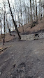
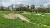
Popular Belgium Mountain Biking Trails
• 100 ★ 4.9 • 1,841 ft • 0 ft • 577 •
Du flow avec des virages plus rapides, des sauts et des freinages plus conséquents. Flow with faster turns, jumps and more consistent braking.
• 100 ★ 4.9 • 1,814 ft • 12 ft • 546 •
Rapide et sinueux de haut en bas. Un sentier connecteur croise à mi-parcours — attention aux riders qui remontent. Se termine par une dalle rocheuse iconique. Fast and twisty from top to bottom. A connector trail crosses midway —...
• 100 ★ 4.3 • 3,514 ft • 0 ft • 530 •
The “Wasflam” special stage at the Emblève Trail Center is renowned for its steep gradients, technical challenges, and varied terrain. It’s a track that offers a thrilling mix of fast sections, technical features, and rugged...
• 100 ★ 5.0 • 1,634 ft • 0 ft • 517 •
Highly rated popular red difficulty singletrack. This mountain bike primary trail can be used downhill only. On average it takes 3 minutes to complete this trail.
• 95 ★ 4.7 • 1,329 ft • 0 ft • 495 •
Quelques sauts enroulables, des petites sections de pierriers, du dénivelé et une fin splendide dans une cuvette qui fera serrer les fesses à plus d'un(e)s! A few rollable jumps, small rocky sections, a lot of elevation change and a...
• 100 ★ 4.0 • 1 mile • 300 ft • 474 •
One of the two loops on the terril in Beringen. This is the easier "green" trail. On top of the terril you can find a skill park with some jumps and drops.
• 95 ★ 4.8 • 3,576 ft • 0 ft • 459 •
Highly rated popular red difficulty singletrack. This mountain bike primary trail can be used downhill only and has a moderate overall physical rating. Trail visibility is always easy to follow. On average it takes 12 minutes to complete this trail.
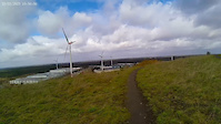
Belgium Mountain Bike Routes
★ 3.7 • 26 miles • 4,003 ft • 8 • Loop •
This is the officially sanctioned route of the Bouillon Trail Center Right now, there are 7 trails...
★ 4.3 • 18 miles • 395 ft • 9 • Loop •
The Blue Loop of Middelkerke is a relatively new route (12th of June 2016) dedicated postume to the...
★ 5.0 • 17 miles • 4,235 ft • 8 • Out & Back •
Best loop for Trail Center De l'Amblève!
★ 3.5 • 27 miles • 560 ft • 25 • Loop •
Rondje rond de haven van Zeebrugge, vertrekkend aan de Sporthal de Polder in Dudzele
★ 4.0 • 39 miles • 1,004 ft • 15 • Loop •
Mtb ride in Lokeren region. Flat region , 3 bike area s included
★ 4.0 • 34 miles • 1,134 ft • 16 • Loop •
Flat region with rivers and wood sections . Long offroad sections .
Photos of Belgium Mountain Bike
Videos of Belgium Mountain Bike
featured
![One Hour, Six Stages]()
trail: Bois des Rêves 1
8:09 |
1649 |
Feb 14, 2016
trail: La Duchesse
0:08 |
13 |
Sep 28, 2025
trail: Haustère
0:09 |
7 |
May 12, 2025

trail: La Lolo
2:38 |
18 |
Nov 13, 2024
trail: Enduro 4
0:10 |
40 |
Mar 12, 2024
trail: Keep cool (New variant)
0:12 |
72 |
May 1, 2023
trail: Easy Peasy
2:46 |
46 |
Mar 25, 2023
Recent Comments
| username | type | title | comment | date |
|---|---|---|---|---|
| trail | Technische track met jumps en rotsig | May 24, 2026 @ 5:23am May 24, 2026 | ||
| trail | Technische rots stukken met op het eind een... | May 24, 2026 @ 4:18am May 24, 2026 | ||
| trail | Mooie flow met wat jumps. Constante moeilijkheid | May 24, 2026 @ 4:14am May 24, 2026 | ||
| trail | Épingles assez compliquées , rendues très... | Apr 15, 2026 @ 4:13am Apr 15, 2026 | ||
| trail | Très belle trace dans la pente , beaux... | Mar 30, 2026 @ 11:05am Mar 30, 2026 |
Bike & Skill Parks
| name | type | city | rating |
|---|---|---|---|
| Bikepark Ferme Libert | bike park | Verviers | |
| Bike Park des Lacs | bike park | Thuin | |
| Bikepark Sankt Vith | bike park | Verviers | |
| Filthy Trails 2.0 | bike park | Trois-Ponts | |
| Crossbosje Lovendegem | skill park | Gent |
Activity Type Stats
| activitytype | trails | distance | descent | descent distance | total vertical | rating | global rank | state rank | photos | reports | routes | ridelogs |
|---|---|---|---|---|---|---|---|---|---|---|---|---|
| Mountain Bike | 3,546 | 1,759 miles | 185,217 ft | 743 miles | 2,126 ft | #20 | 1,848 | 9,134 | 258 | 487,674 | ||
| E-Bike | 1,866 | 951 miles | 113,271 ft | 410 miles | 2,031 ft | #25 | 1 | 8,556 | 66 | 41,658 | ||
| Gravel Bike | 20 | #18 | 3 | 19 | 6 | 6,512 | ||||||
| Adaptive Bike | 13 | #20 | 1 | 3 | ||||||||
| Winter Fat Bike | 10 | #21 | 1 | 1 | ||||||||
| Horse | 209 | 97 miles | 4,731 ft | 37 miles | 1,398 ft | #25 | 1,117 | 1 | 10 | |||
| Hike | 3,208 | 1,630 miles | 157,733 ft | 680 miles | 2,116 ft | #23 | 5 | 8,753 | 11 | 15,141 | ||
| Trail Running | 3,215 | 1,641 miles | 158,258 ft | 682 miles | 2,116 ft | #23 | 5 | 8,746 | 11 | 23,761 | ||
| Dirtbike/Moto | 94 | 38 miles | 1,060 ft | 12 miles | 1,325 ft | #26 | 1,110 | 7 | ||||
| Observed Trials | 3 | #20 | 14 | 1 | ||||||||
| ATV/ORV/OHV | 47 | 20 miles | 466 ft | 7 miles | 197 ft | #23 | 1,099 | 3 |
Activities
Trails
- By canadaka
 Trailforks & contributors
 - Admins: oli4m, Jenstin
- #3175 - 90,758 views
- belgium activity log | embed map of Belgium mountain bike trails | belgium mountain biking points of interest polygons
Downloading of trail gps tracks in kml & gpx formats is enabled for Belgium.
You must login to download files.