close
-
Layers w
- Weather Layers
- Pro
- Pro
- Pro
- Pro
- Pro
- Pro
- More Layers
- Pro
- Pro
- Pro
- Pro
-
Upgrade to

3D
Trail Conditions
- Unknown
- Snow Groomed
- Snow Packed
- Snow Covered
- Snow Cover Partial
- Freeze/thaw Cycle
- Icy
- Prevalent Mud
- Wet
- Variable
- Ideal
- Dry
- Very Dry
Trail Flow (Ridden Direction)
Trailforks scans users ridelogs to determine the most popular direction each trail is ridden. A good flowing trail network will have most trails flowing in a single direction according to their intension.
The colour categories are based on what percentage of riders are riding a trail in its intended direction.
The colour categories are based on what percentage of riders are riding a trail in its intended direction.
- > 96%
- > 90%
- > 80%
- > 70%
- > 50%
- < 50%
- bi-directional trail
- no data
Trail Last Ridden
Trailforks scans ridelogs to determine the last time a trail was ridden.
- < 2 days
- < 1 week
- < 2 weeks
- < 1 month
- < 6 months
- > 6 months
Trail Ridden Direction
The intended direction a trail should be ridden.
- Downhill Only
- Downhill Primary
- Both Directions
- Uphill Primary
- Uphill Only
- One Direction
Contribute Details
Colors indicate trail is missing specified detail.
- Description
- Photos
- Description & Photos
- Videos
Trail Popularity ?
Trailforks scans ridelogs to determine which trails are ridden the most in the last 9 months.
Trails are compared with nearby trails in the same city region with a possible 25 colour shades.
Think of this as a heatmap, more rides = more kinetic energy = warmer colors.
- most popular
- popular
- less popular
- not popular
ATV/ORV/OHV Filter
Max Vehicle Width
inches
US Cell Coverage
Legend

Radar Time
Activity Recordings
Trailforks uses anonymized public activity data.
?
Activity Recordings
Trailforks uses anonymized public activity data.
?
Personal Heatmap
▶
Activity Types
all
/
none
▶
Options
2
Date range
month
–
Winter Trails
Warning
A routing network for winter maps does not exist. Selecting trails using the winter trails layer has been disabled.
Missing Trails
Most Popular
Least Popular
Trails are colored based on popularity. The more popular a trail is, the more red. Less popular trails trend towards green.
Jump Magnitude Heatmap
Heatmap of where riders jump on trails. Zoom in to see individual jumps, click circles to view jump details.
BC Backroad Status
![map legend]()
Service Road Atlas is a free to use, community-driven service for viewing and creating reports on the numerous back-country service roads around B.C. and Alberta.

Slope Aspect
Direction the slope faces
Trails Deemphasized
Trails are shown in grey.
Only show trails with no bike usage.
Suggested Layers
Based on selected activity type
Save the current map location and zoom level as your default home location whenever this page is loaded.
Save
No description for Bellinzona has been added yet!
Login or register to submit one.
This region uses the Uk/Euro style trail grading system.
Activities Click to view
- Mountain Bike
56 trails
- E-Bike
52 trails
- Adaptive Bike
0 trails
- Hike
55 trails
- Trail Running
55 trails
Region Details
- 7
- 20
- 25
- 3
Region Status
Caution as of May 19, 2026Stats
- Avg Trail Rating
- Trails (view details)
- 56
- Trails Mountain Bike
- 56
- Trails E-Bike
- 52
- Trails Hike
- 55
- Trails Trail Running
- 55
- Total Distance
- 65 miles
- Total Descent Distance
- 38 miles
- Total Descent
- 35,189 ft
- Total Vertical
- 5,903 ft
- Highest Trailhead
- 6,728 ft
- Reports
- 112
- Photos
- 30
- Ridden Counter
- 1,307
Popular Bellinzona Mountain Biking Trails
• 100 ★ 3.8 • 4,770 ft • 11 ft • 64 •
Popular blue difficulty singletrack. This multi-use trail can be used downhill primary and has a moderate overall physical rating with a 11 ft green climb. It features rock garden. Trail visibility is always easy to follow. On average it takes 5 minutes to complete this trail.
• 20 ★ 3.5 • 1 mile • 5 ft • 54 •
Less popular black difficulty wilderness trail. This multi-use trail can be used downhill primary and has a moderate overall physical rating. It features bridge, rock garden and skinny. Trail visibility is sometimes hard to follow. On average it takes 35 minutes to complete this trail.
• 85 ★ 3.0 • 3,812 ft • 16 ft • 53 • • hike
Popular red difficulty singletrack. This hike primary trail can be used downhill primary and has a moderate overall physical rating. Trail visibility is sometimes hard to follow. On average it takes 15 minutes to complete this trail.
• 25 ★ 3.5 • 2 miles • 3 ft • 52 • • hike
Less popular red difficulty alpine singletrack. This hike primary trail. It features drop, rock face and rock garden. On average it takes 1 hour15 minutes to complete this trail.
• 65 ★ 3.4 • 3,031 ft • 0 ft • 36 • • hike
Moderately popular red difficulty singletrack. This hike primary trail can be used downhill primary and has a hard overall physical rating. Trail visibility is always easy to follow. On average it takes 15 minutes to complete this trail.
• 90 ★ 2.0 • 1,247 ft • 84 ft • 35 •
Popular blue difficulty alpine singletrack. This multi-use trail can be used downhill primary. Trail visibility is always easy to follow. On average it takes 4 minutes to complete this trail.
• 65 ★ 3.0 • 1,736 ft • 0 ft • 35 • • hike
Moderately popular blue difficulty singletrack. This hike primary trail can be used downhill primary and has a moderate overall physical rating. On average it takes 15 minutes to complete this trail.
• 95 ★ 0.0 • 3,068 ft • 15 ft • 31 • • hike
Popular blue difficulty singletrack. This hike primary trail can be used downhill primary.
Bellinzona Mountain Bike Routes
25 miles • 5,795 ft • 6 • Loop •
Wir beginnen die Tour beim Militärareal (225m) am Ende der Viale Giuseppe Motta in Bellinzona. Zunächst...
12 miles • 3,122 ft • 2 • Loop •
The starting point of the mountain bike tour is Giubiasco, the southernmost district of the municipality...
30 miles • 7,171 ft • 11 • Loop •
This route start in Bellinzona and leads over Roveredo, Laura up to the . Back over the over to Bellinzona
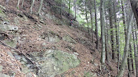
Photos of Bellinzona Mountain Bike
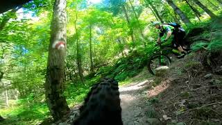
Videos of Bellinzona Mountain Bike
trail: Cima di Dentro sopra
0:18 |
182 |
Oct 17, 2019

trail: Monti di Saurù - Cauri
8:10 |
309 |
Mar 29, 2022 , Bellinzona
trail: Cima di Dentro sopra
10:06 |
314 |
Aug 22, 2021 , Bellinzona
Recent Trail Reports
| status | trail | date | condition | info | user |
|---|---|---|---|---|---|
| Piano Dolce | May 19, 2026 @ 8:33pm (Europe/Zurich) May 19, 2026 | Dry | petzi70 | ||
| Bolletta | Apr 9, 2026 @ 5:00pm (Europe/Zurich) Apr 9, 2026 | Ideal | paraenggu VS-Admin | ||
| Monti di Artore | Apr 9, 2026 @ 9:26pm (Europe/Zurich) Apr 9, 2026 | Dry | paraenggu VS-Admin | ||
| Motto della Croce Bassa | Apr 9, 2026 @ 9:20pm (Europe/Zurich) Apr 9, 2026 | Dry | paraenggu VS-Admin | ||
| Rosetta | Apr 9, 2026 @ 9:19pm (Europe/Zurich) Apr 9, 2026 | Ideal | paraenggu VS-Admin | ||
| Paudo Basso | Apr 9, 2026 @ 9:19pm (Europe/Zurich) Apr 9, 2026 | Ideal | paraenggu VS-Admin | ||
| Enduro Paudo Basso - Acquedotto | Apr 9, 2026 @ 9:18pm (Europe/Zurich) Apr 9, 2026 | Dry | paraenggu VS-Admin | ||
| Paudo I | Apr 9, 2026 @ 9:18pm (Europe/Zurich) Apr 9, 2026 | Dry | paraenggu VS-Admin | ||
| Paudo | Apr 9, 2026 @ 9:17pm (Europe/Zurich) Apr 9, 2026 | Dry | paraenggu VS-Admin | ||
| Monti di Paudo | Apr 9, 2026 @ 9:16pm (Europe/Zurich) Apr 9, 2026 | Ideal | paraenggu VS-Admin |
Activity Feed
| username | action | type | title | date |
|---|---|---|---|---|
| nike-ch | add | photo | activity #95783379 and 2 more | May 29, 2026 @ 9:29am May 29, 2026 |
| petzi70 | add | report | activity #95056026 | May 19, 2026 @ 11:33am May 19, 2026 |
| lexmex | vote | trail | activity #94619577 | May 13, 2026 @ 5:08am May 13, 2026 |
| lexmex | comment | trail | activity #94618200 and 1 more | May 13, 2026 @ 4:29am May 13, 2026 |
| lexmex | ridden | trail | activity #94618183 | May 13, 2026 @ 4:28am May 13, 2026 |
Recent Comments
| username | type | title | comment | date |
|---|---|---|---|---|
| trail | awesome! freshly cleaned 🧹 perfect 👌 | May 13, 2026 @ 4:29am May 13, 2026 | ||
| trail | Naturally built cobblestone path from top to... | Apr 9, 2026 @ 12:43pm Apr 9, 2026 | ||
| trail | this trail is almost unridable. In total you... | Oct 12, 2025 @ 12:13pm Oct 12, 2025 | ||
| trail | Netter Weg, gut in Schuss, eher blau als rot. | Apr 21, 2025 @ 11:54am Apr 21, 2025 | ||
| trail | On contrary of the two upper sectors, this is... | Jun 2, 2024 @ 3:00am Jun 2, 2024 |
Local Badges
-

Epic Mountain Bike Climb 2k64 awarded -

Climbing 10k Badge12 awarded -

Mountain Biking 100k Badge2 awarded -

Epic Ride Descent 2k64 awarded -

Descent 10k Badge12 awarded -

Descent 100k Badge2 awarded
Activity Type Stats
| activitytype | trails | distance | descent | descent distance | total vertical | rating | global rank | state rank | photos | reports | routes | ridelogs |
|---|---|---|---|---|---|---|---|---|---|---|---|---|
| Mountain Bike | 56 | 63 miles | 33,524 ft | 37 miles | 5,902 ft | #3,364 | #55 | 29 | 111 | 4 | 3,013 | |
| E-Bike | 52 | 58 miles | 28,471 ft | 32 miles | 5,902 ft | #1,708 | #79 | 1 | 103 | 3 | 356 | |
| Hike | 55 | 63 miles | 32,894 ft | 36 miles | 5,902 ft | #1,927 | #41 | 107 | 1 | 216 | ||
| Trail Running | 55 | 63 miles | 32,894 ft | 36 miles | 5,902 ft | #1,944 | #38 | 106 | 1 | 44 |
Frequently Asked Questions About Bellinzona
▼
What are the highest rated mountain biking trails in Bellinzona?
The highest rated mountain biking trails in Bellinzona are:
- MTB Enduro Eldorado (4.2/5)
- Paudo Basso (4/5)
- Motto della Croce (4/5)
- Sasso Guida (4/5)
- Vigana Torrente Gomelina (3.9/5)
▼
What is the best time of the year to ride in Bellinzona?
Based on ride log data, the most popular months to ride in Bellinzona are:
- March (6 activities)
- April (5 activities)
- May (4 activities)
▼
Where can I park to ride in Bellinzona?
Check the Bellinzona trail map for trailhead and parking information. Community members regularly update access and parking details for trails in the area.
▼
What is the longest trail in Bellinzona?
The longest trail in Bellinzona is Alpe Croveggia at 3.0 miles. View all trails sorted by distance.
Activities
Trails
- By Tenco & contributors
- Admins: TIS
- #13687 - 6,348 views
- bellinzona activity log | embed map of Bellinzona mountain bike trails | bellinzona mountain biking points of interest
Downloading of trail gps tracks in kml & gpx formats is enabled for Bellinzona.
You must login to download files.