close
-
Layers w
- Weather Layers
- Pro
- Pro
- Pro
- Pro
- Pro
- Pro
- More Layers
- Pro
- Pro
- Pro
- Pro
-
Upgrade to

3D
Trail Conditions
- Unknown
- Snow Groomed
- Snow Packed
- Snow Covered
- Snow Cover Partial
- Freeze/thaw Cycle
- Icy
- Prevalent Mud
- Wet
- Variable
- Ideal
- Dry
- Very Dry
Trail Flow (Ridden Direction)
Trailforks scans users ridelogs to determine the most popular direction each trail is ridden. A good flowing trail network will have most trails flowing in a single direction according to their intension.
The colour categories are based on what percentage of riders are riding a trail in its intended direction.
The colour categories are based on what percentage of riders are riding a trail in its intended direction.
- > 96%
- > 90%
- > 80%
- > 70%
- > 50%
- < 50%
- bi-directional trail
- no data
Trail Last Ridden
Trailforks scans ridelogs to determine the last time a trail was ridden.
- < 2 days
- < 1 week
- < 2 weeks
- < 1 month
- < 6 months
- > 6 months
Trail Ridden Direction
The intended direction a trail should be ridden.
- Downhill Only
- Downhill Primary
- Both Directions
- Uphill Primary
- Uphill Only
- One Direction
Contribute Details
Colors indicate trail is missing specified detail.
- Description
- Photos
- Description & Photos
- Videos
Trail Popularity ?
Trailforks scans ridelogs to determine which trails are ridden the most in the last 9 months.
Trails are compared with nearby trails in the same city region with a possible 25 colour shades.
Think of this as a heatmap, more rides = more kinetic energy = warmer colors.
- most popular
- popular
- less popular
- not popular
ATV/ORV/OHV Filter
Max Vehicle Width
inches
US Cell Coverage
Legend

Radar Time
Activity Recordings
Trailforks uses anonymized public activity data.
?
Activity Recordings
Trailforks uses anonymized public activity data.
?
Personal Heatmap
▶
Activity Types
all
/
none
▶
Options
2
Date range
month
–
Winter Trails
Warning
A routing network for winter maps does not exist. Selecting trails using the winter trails layer has been disabled.
Missing Trails
Most Popular
Least Popular
Trails are colored based on popularity. The more popular a trail is, the more red. Less popular trails trend towards green.
Jump Magnitude Heatmap
Heatmap of where riders jump on trails. Zoom in to see individual jumps, click circles to view jump details.
BC Backroad Status
![map legend]()
Service Road Atlas is a free to use, community-driven service for viewing and creating reports on the numerous back-country service roads around B.C. and Alberta.

Slope Aspect
Direction the slope faces
Trails Deemphasized
Trails are shown in grey.
Only show trails with no bike usage.
Suggested Layers
Based on selected activity type
Save the current map location and zoom level as your default home location whenever this page is loaded.
Save
No description for Bellwald has been added yet!
Login or register to submit one.
Links
This region uses the Uk/Euro style trail grading system.
Activities Click to view
- Mountain Bike
29 trails
- E-Bike
27 trails
- Hike
22 trails
- Trail Running
22 trails
Region Details
- 4
- 13
- 7
- 3
Region Status
Open as of May 23, 2026Stats
- Avg Trail Rating
- Trails (view details)
- 27
- Trails Mountain Bike
- 29
- Trails E-Bike
- 27
- Trails Hike
- 22
- Trails Trail Running
- 22
- Total Distance
- 17 miles
- Total Descent Distance
- 15 miles
- Total Descent
- 9,312 ft
- Total Vertical
- 3,905 ft
- Highest Trailhead
- 8,366 ft
- Reports
- 117
- Photos
- 94
- Ridden Counter
- 3,314
Sub Regions
-
Bellwood Bikepark
- 2
- 3
- 2
Popular Bellwald Mountain Biking Trails
• 85 ★ 4.8 • 2 miles • 12 ft • 320 •
Der von Hand gebaute Single Trail wird von leuchtenden Lärchenwäldern, saftigen Wiesen und Heidelbeerfeldern umgarnt und bringt somit alle Zutaten für ein eindrückliches Natur- und Landschaftserlebnis mit sich. Er eignet sich...
• 95 ★ 4.8 • 2 miles • 0 ft • 303 •
The great variety offered by the Bellwald Bikepark is epitomised by this flowtrail where curves, waves and small jumps guarantee fun and adrenaline for the whole family. Beginners and experts alike set off from the Fleschen mid-station,...
• 60 ★ 4.7 • 3,432 ft • 0 ft • 239 •
Es dreht und fliegt – spielerisch und gespickt mit vielen Sprüngen, Steinfeldern, Hips, Shark Fins und Anliegern. Der «Sliderman» bedient Mountainbiker*innen, die grosse Sprünge aller Art und viel Airtime suchen und ist der...
• 70 ★ 4.5 • 3 miles • 3 ft • 205 •
Der Trail startet am höchsten Punkt des Bikeparks auf 2562 m.ü.M. und wurde so angelegt, dass die Aussicht und Panorama bestmöglich zur Geltung kommen. Zahlreiche kreative Features wie Sprünge aller Art und Grössen, Kurven und...
• 45 ★ 4.9 • 1 mile • 0 ft • 204 •
Die " " wurde 2005 gebaut und ist die allererste Strecke des Bike Park Bellwald. Seit dann findet auf dieser Strecke auch das legendäre Rennen des iXS Downhill Cup mit über 400 Teilnehmenden statt. Die ehemals "National" genannte...
• 50 ★ 4.9 • 2 miles • 0 ft • 169 •
The 2024 opened was also one of the Stages at the Enduro World Cup / EDR of Aletsch Bellwald. A true enduro trail with fantastic views!
• 95 ★ 0.0 • 1 mile • 14 ft • 87 • • hike
Popular blue difficulty singletrack. This hike primary trail. On average it takes 9 minutes to complete this trail.
• 100 ★ 0.0 • 2,192 ft • 0 ft • 71 • • hike
Popular blue difficulty singletrack. This hike primary trail can be used downhill primary.
Bellwald Mountain Bike Routes
14 miles • 3,222 ft • 4 • Point to Point •
Quaint little railways and bike park action are the orders of the day at the start of this leg. Featuring...
24 miles • 5,485 ft • 1 •
Highlights Hängebrücke, Bellwald 2 Optionen Downhill schwarz oder Denis x-Trail easy
Photos of Bellwald Mountain Bike
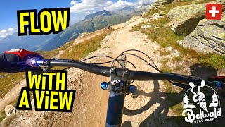
Videos of Bellwald Mountain Bike
trail: Dirty Cranking
4:35 |
285 |
Aug 6, 2015
youtuber
![BIKEPARK BELLWALD Vast & Furious First...]()
trail: Vast & Furious
13:38 |
46 |
Nov 21, 2025 , Bellwald
youtuber
![BIKEPARK BELLWALD Into The Wild + bissl...]()
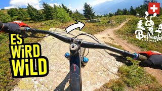
trail: Into the Wild
11:26 |
76 |
Nov 7, 2025 , Bellwald
youtuber
![BIKEPARK BELLWALD Lord Of The Rims Trail ...]()
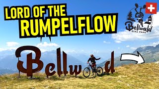
trail: Lord of the Rims
13:11 |
68 |
Oct 31, 2025 , Bellwald
youtuber
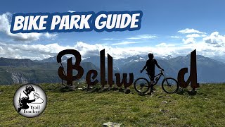
![Bellwald Bike Park Guide]()

trail: Forest Bump Flowtrail
18:01 |
231 |
Apr 30, 2025 , Bellwald
youtuber
![Bellwald Bike Park Guide]()

trail: Into the Wild
18:01 |
93 |
Apr 30, 2025 , Bellwald
youtuber
![Bellwald Bike Park Guide]()

trail: Lord of the Rims
18:01 |
122 |
Apr 30, 2025 , Bellwald
youtuber
![Bellwald Bike Park Guide]()
trail: Vast & Furious
18:01 |
126 |
Apr 29, 2025 , Bellwald
Recent Trail Reports
| status | trail | date | condition | info | user |
|---|---|---|---|---|---|
| Slider Man | May 23, 2026 @ 12:02pm (Europe/Zurich) May 23, 2026 | Dry | marc84 Dielsdorf | ||
| Station Connector | May 23, 2026 @ 12:02pm (Europe/Zurich) May 23, 2026 | Ideal | marc84 Dielsdorf | ||
| Into the Wild | May 23, 2026 @ 12:02pm (Europe/Zurich) May 23, 2026 | Dry | marc84 Dielsdorf | ||
| Richinen | May 23, 2026 @ 12:02pm (Europe/Zurich) May 23, 2026 | Ideal | marc84 Dielsdorf | ||
| Last Mile | May 23, 2026 @ 12:02pm (Europe/Zurich) May 23, 2026 | Ideal | marc84 Dielsdorf | ||
| Forest Bump Flowtrail | May 23, 2026 @ 12:02pm (Europe/Zurich) May 23, 2026 | Very Dry | marc84 Dielsdorf | ||
| Flesche Access | Oct 19, 2025 @ 10:41am (Europe/Zurich) Oct 19, 2025 | Ideal | retosedrun | ||
| Vast & Furious | Oct 19, 2025 @ 10:41am (Europe/Zurich) Oct 19, 2025 | Ideal | retosedrun | ||
| Furggulti | Oct 19, 2025 @ 10:41am (Europe/Zurich) Oct 19, 2025 | Ideal | retosedrun | ||
| Lord of the Rims | Oct 19, 2025 @ 10:41am (Europe/Zurich) Oct 19, 2025 | Ideal | retosedrun |
Activity Feed
| username | action | type | title | date |
|---|---|---|---|---|
| FreddysTrail | wishlist | trail | activity #97525382 | Jun 21, 2026 @ 3:26pm 2 days |
| womoe | wishlist | trail | activity #96595906 | Jun 9, 2026 @ 4:22am Jun 9, 2026 |
| darrenregina | wishlist | route | activity #96233298 | Jun 4, 2026 @ 9:22am Jun 4, 2026 |
| marc84 | add | report | activity #95380829 | May 23, 2026 @ 11:25pm May 23, 2026 |
| marc84 | add | report | activity #95380786 and 4 more | May 23, 2026 @ 11:23pm May 23, 2026 |
Recent Comments
| username | type | title | comment | date |
|---|---|---|---|---|
| trail | In my opinion This is Not Blue. It’s more... | Sep 2, 2025 @ 5:55am Sep 2, 2025 | ||
| trail | Oh look what a refreshing change another flow... | Aug 18, 2025 @ 7:13am Aug 18, 2025 | ||
| trail | Einige schiebepassagen uphill da sehr steil | Jun 28, 2025 @ 9:03pm Jun 28, 2025 | ||
| trail | This has to be the new benchmark for... | Jun 28, 2021 @ 1:21am Jun 28, 2021 |
Local Badges
-

Epic Mountain Bike Climb 2k24 awarded -

Climbing 10k Badge1 awarded -

Mountain Biking 100k Badge0 awarded -

Epic Ride Descent 2k24 awarded -

Descent 10k Badge4 awarded -

Descent 100k Badge0 awarded
Bike & Skill Parks
| name | type | city | rating |
|---|---|---|---|
| Bellwood Bikepark | bike park | Bellwald | |
| Pumptrack Bellwald | skill park | Bellwald |
Activity Type Stats
| activitytype | trails | distance | descent | descent distance | total vertical | rating | global rank | state rank | photos | reports | routes | ridelogs |
|---|---|---|---|---|---|---|---|---|---|---|---|---|
| Mountain Bike | 29 | 17 miles | 9,311 ft | 15 miles | 3,904 ft | #2,849 | #37 | 93 | 117 | 2 | 1,637 | |
| E-Bike | 27 | 14 miles | 7,900 ft | 13 miles | 3,904 ft | #3,017 | #114 | 114 | 1 | 141 | ||
| Hike | 22 | 6 miles | 2,661 ft | 4 miles | 3,238 ft | #4,773 | #108 | 102 | 206 | |||
| Trail Running | 22 | 6 miles | 2,661 ft | 4 miles | 3,238 ft | #4,582 | #100 | 102 | 16 |
Frequently Asked Questions About Bellwald
▼
What are the best places to ride in Bellwald?
Bellwald has 1 areas to explore for mountain biking. The top rated areas are:
▼
What are the highest rated mountain biking trails in Bellwald?
The highest rated mountain biking trails in Bellwald are:
- Forest Bump Flowtrail (4.6/5)
- Lord of the Rims (4.5/5)
- Into the Wild (4.5/5)
- Dirty Cranking (4.4/5)
- Slider Man (4.4/5)
▼
What is the best time of the year to ride in Bellwald?
Based on ride log data, the most popular months to ride in Bellwald are:
- July (7 activities)
- August (3 activities)
- December (1 activities)
▼
Where can I park to ride in Bellwald?
There are 3 parking locations listed in Bellwald. The most popular parking spots are: View all parking and trailhead locations on the map to plan your visit.
Activities
Trails
Points of Interest
- By inversedotch
 & contributors
 - Admins: VS-Admin, VAST, VS-Admin
- #25252 - 3,547 views
- bellwald activity log | embed map of Bellwald mountain bike trails | bellwald mountain biking points of interest polygons
Downloading of trail gps tracks in kml & gpx formats is enabled for Bellwald.
You must login to download files.