close
-
Layers w
- Weather Layers
- Pro
- Pro
- Pro
- Pro
- Pro
- Pro
- More Layers
- Pro
- Pro
- Pro
- Pro
-
Upgrade to

3D
Trail Conditions
- Unknown
- Snow Groomed
- Snow Packed
- Snow Covered
- Snow Cover Partial
- Freeze/thaw Cycle
- Icy
- Prevalent Mud
- Wet
- Variable
- Ideal
- Dry
- Very Dry
Trail Flow (Ridden Direction)
Trailforks scans users ridelogs to determine the most popular direction each trail is ridden. A good flowing trail network will have most trails flowing in a single direction according to their intension.
The colour categories are based on what percentage of riders are riding a trail in its intended direction.
The colour categories are based on what percentage of riders are riding a trail in its intended direction.
- > 96%
- > 90%
- > 80%
- > 70%
- > 50%
- < 50%
- bi-directional trail
- no data
Trail Last Ridden
Trailforks scans ridelogs to determine the last time a trail was ridden.
- < 2 days
- < 1 week
- < 2 weeks
- < 1 month
- < 6 months
- > 6 months
Trail Ridden Direction
The intended direction a trail should be ridden.
- Downhill Only
- Downhill Primary
- Both Directions
- Uphill Primary
- Uphill Only
- One Direction
Contribute Details
Colors indicate trail is missing specified detail.
- Description
- Photos
- Description & Photos
- Videos
Trail Popularity ?
Trailforks scans ridelogs to determine which trails are ridden the most in the last 9 months.
Trails are compared with nearby trails in the same city region with a possible 25 colour shades.
Think of this as a heatmap, more rides = more kinetic energy = warmer colors.
- most popular
- popular
- less popular
- not popular
ATV/ORV/OHV Filter
Max Vehicle Width
inches
US Cell Coverage
Legend

Radar Time
Activity Recordings
Trailforks uses anonymized public activity data.
?
Activity Recordings
Trailforks uses anonymized public activity data.
?
Personal Heatmap
▶
Activity Types
all
/
none
▶
Options
2
Date range
month
–
Winter Trails
Warning
A routing network for winter maps does not exist. Selecting trails using the winter trails layer has been disabled.
Missing Trails
Most Popular
Least Popular
Trails are colored based on popularity. The more popular a trail is, the more red. Less popular trails trend towards green.
Jump Magnitude Heatmap
Heatmap of where riders jump on trails. Zoom in to see individual jumps, click circles to view jump details.
BC Backroad Status
![map legend]()
Service Road Atlas is a free to use, community-driven service for viewing and creating reports on the numerous back-country service roads around B.C. and Alberta.

Slope Aspect
Direction the slope faces
Trails Deemphasized
Trails are shown in grey.
Only show trails with no bike usage.
Suggested Layers
Based on selected activity type
Save the current map location and zoom level as your default home location whenever this page is loaded.
Save
No description for Ben Bowie has been added yet!
Login or register to submit one.
This region uses the Uk/Euro style trail grading system.
Activities Click to view
- Mountain Bike
24 trails
- E-Bike
24 trails
- Hike
20 trails
- Trail Running
20 trails
Region Details
- 10
- 2
- 6
- 5
- 1
Region Status
Caution as of Jun 7, 2026Stats
- Avg Trail Rating
- Trails (view details)
- 24
- Trails Mountain Bike
- 24
- Trails E-Bike
- 24
- Trails Hike
- 20
- Trails Trail Running
- 20
- Total Distance
- 15 miles
- Total Descent
- 3,832 ft
- Total Vertical
- 911 ft
- Highest Trailhead
- 1,002 ft
- Reports
- 262
- Photos
- 140
- Ridden Counter
- 1,179
Popular Ben Bowie Mountain Biking Trails
• 85 ★ 4.5 • 1 mile • 7 ft • 129 • • hike
Part of the old track from Cardross to Ballack via Muir. Upper trail is a bit wider and on open moorland. Lower trail is rockier. A fun easy fast descent! (Look out for the trail in the woods to the R about half way down the lower...
• 90 ★ 4.8 • 1 mile • 14 ft • 107 • • hike
Path up the south side of Ben Bouie from Helensburgh & Craigendoran. Part of The Three Lochs Way long distance trail from Balloch to Inveruglas (Loch Lomond) via Helensburgh & Garelochhead. Makes a good easy fast descent but be...
• 75 ★ 3.0 • 2,579 ft • 30 ft • 80 • • hike
Built by The Three Lochs Way (3LW) long distance trail originally to provide a "missing link" to join up the existing forestry tracks either side of the steep Killoeter escarpment. Also now used by the John Muir Way (JMW). Primarily...
• 95 ★ 5.0 • 840 ft • 11 ft • 76 • • hike
Short trail to the Xmas Tree Viewpoint (so called because of the pine tree which the local running club decorate at Xmas!). A steep climb to start which may be need a push!
• 50 ★ 5.0 • 4,656 ft • 0 ft • 34 •
Moderately popular red difficulty singletrack. This mountain bike primary trail can be used downhill only and has a hard overall physical rating with a 0 ft double black diamond climb. It features berm, drop and rock garden. Adaptive MTB rating: amtb black. Trail visibility is always easy to follow. On average it takes 8 minutes to complete this trail.
• 40 ★ 2.0 • 814 ft • 0 ft • 23 • • hike
A short but fun trail down the ridge line with an optional jump near the bottom. The trail ends at a forest track which you can use to get back up to the start. The trail isn't too challenging but there are some fairly large roots in...
• 5 ★ 3.0 • 669 ft • 20 ft • 18 •
Less popular green difficulty singletrack. This multi-use trail can be used both directions and has a easy overall physical rating with a 20 ft green climb. Trail visibility is always easy to follow. On average it takes 1 minutes to complete this trail.
• 55 ★ 4.0 • 1,227 ft • 0 ft • 17 •
Continuation from Xmas Tree Ridge (or the increasingly vague end of the forestry track) down the Strone (the nose/ridge/spur**) and exit via Strone Wood. A useful trail to open up longer routes down to Arden and allowing loops with or...
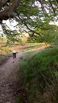
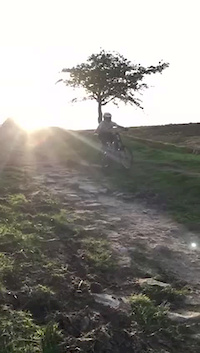
Photos of Ben Bowie Mountain Bike
Videos of Ben Bowie Mountain Bike
trail: Stoneymollan
0:16 |
222 |
May 18, 2018
trail: Stoneymollan
0:22 |
200 |
May 18, 2018
trail: Ben Bouie Climb
2:41 |
144 |
Nov 20, 2016

trail: Ben Bouie Descent
0:45 |
419 |
Sep 25, 2019 , Helensburgh

trail: Ben Bouie Descent
7:41 |
785 |
Sep 25, 2019 , Helensburgh
Recent Trail Reports
| status | trail | date | condition | info | user |
|---|---|---|---|---|---|
| Xmas Tree View | May 23, 2026 @ 9:42am (Europe/London) May 23, 2026 | Ideal | Craig085 | ||
| Missing Link | Dec 28, 2025 @ 4:57pm (Europe/London) Dec 28, 2025 | Unknown | PHmotorsport | ||
| Hame'll Dae Me | Dec 28, 2025 @ 4:57pm (Europe/London) Dec 28, 2025 | Unknown | PHmotorsport | ||
| Farm Track | Aug 11, 2025 @ 6:01pm Aug 11, 2025 | Ideal | huck-lover | ||
| Landy Track | Aug 11, 2025 @ 6:01pm Aug 11, 2025 | Ideal | huck-lover | ||
| Ben Bouie Descent | Jun 7, 2025 @ 3:38pm Jun 7, 2025 | Ideal | huck-lover | ||
| Social Distancing | Dec 16, 2024 @ 5:43pm Dec 16, 2024 | Wet | smogweegie | ||
| Killoeter Escarpment Direct | May 27, 2024 @ 1:22am May 27, 2024 | Dry | PHmotorsport | ||
| Slippery Fish | Nov 17, 2023 @ 10:45am Nov 17, 2023 | Wet | smogweegie | ||
| The Other Top | Aug 15, 2023 @ 2:59am Aug 15, 2023 | Variable | huck-lover |
Activity Feed
| username | action | type | title | date |
|---|---|---|---|---|
| SimonBian | ridden | trail | activity #96822435 | Jun 12, 2026 @ 12:43pm Jun 12, 2026 |
| Craig085 | add | report | activity #95414761 | May 24, 2026 @ 8:48am May 24, 2026 |
| PHmotorsport | add | report | activity #86216808 and 1 more | Dec 28, 2025 @ 8:57am Dec 28, 2025 |
| huck-lover | add | report | activity #77920380 and 1 more | Aug 11, 2025 @ 12:03pm Aug 11, 2025 |
| huck-lover | add | report | activity #73281606 and 3 more | Jun 7, 2025 @ 11:14am Jun 7, 2025 |
Recent Comments
| username | type | title | comment | date |
|---|---|---|---|---|
| trail | No real trail, area has been felled | Nov 1, 2024 @ 7:30am Nov 1, 2024 | ||
| trail | Pretty boggy in places | Nov 1, 2024 @ 7:29am Nov 1, 2024 | ||
| report | Didn't even think to check this when I was up... | Oct 30, 2023 @ 7:20am Oct 30, 2023 | ||
| report | Yep, it's a work in progress but cutting back... | Oct 19, 2023 @ 1:24am Oct 19, 2023 | ||
| report | Trees still down not sure how to access the... | Aug 1, 2022 @ 7:33am Aug 1, 2022 |
Nearby Areas
| name | distance | ||||
|---|---|---|---|---|---|
| Helensburgh | 1 | 8 | 4.3 km | ||
| Conic Hill | 4 | 1 | 7.9 km | ||
| Old Kilpatrick | 8 | 18 | 8.4 km | ||
| The Whangie | 1 | 9.8 km | |||
| Beinn Bhreac | 9.9 km |
Local Badges
-

Completionist0 awarded
Activity Type Stats
| activitytype | trails | distance | descent | descent distance | total vertical | rating | global rank | state rank | photos | reports | routes | ridelogs |
|---|---|---|---|---|---|---|---|---|---|---|---|---|
| Mountain Bike | 24 | 15 miles | 3,832 ft | 8 miles | 912 ft | #7,322 | #239 | 137 | 262 | 939 | ||
| E-Bike | 24 | 15 miles | 3,832 ft | 8 miles | 912 ft | #4,826 | #206 | 3 | 209 | 654 | ||
| Hike | 20 | 13 miles | 3,100 ft | 7 miles | 912 ft | #8,994 | #234 | 245 | 145 | |||
| Trail Running | 20 | 13 miles | 3,100 ft | 7 miles | 912 ft | #8,847 | #247 | 244 | 153 |
Frequently Asked Questions About Ben Bowie
▼
What are the highest rated mountain biking trails in Ben Bowie?
The highest rated mountain biking trails in Ben Bowie are:
- Social Distancing (4.3/5)
- Ben Bouie Descent (4.3/5)
- Stoneymollan (4.2/5)
- Xmas Tree View (4.1/5)
- The Strone (4/5)
▼
What is the best time of the year to ride in Ben Bowie?
Based on ride log data, the most popular months to ride in Ben Bowie are:
- July (12 activities)
- August (10 activities)
- June (5 activities)
▼
Where can I park to ride in Ben Bowie?
Check the Ben Bowie trail map for trailhead and parking information. Community members regularly update access and parking details for trails in the area.
▼
What is the longest trail in Ben Bowie?
The longest trail in Ben Bowie is Ben Bouie Descent at 1.4 miles. View all trails sorted by distance.
Activities
- By huck-lover & contributors
- Admins: apply
- #32129 - 3,170 views
- ben bowie activity log | embed map of Ben Bowie mountain bike trails | ben bowie mountain biking points of interest polygons
Downloading of trail gps tracks in kml & gpx formats is enabled for Ben Bowie.
You must login to download files.