close
-
Layers w
- Weather Layers
- Pro
- Pro
- Pro
- Pro
- Pro
- Pro
- More Layers
- Pro
- Pro
- Pro
- Pro
-
Upgrade to

3D
Trail Conditions
- Unknown
- Snow Groomed
- Snow Packed
- Snow Covered
- Snow Cover Partial
- Freeze/thaw Cycle
- Icy
- Prevalent Mud
- Wet
- Variable
- Ideal
- Dry
- Very Dry
Trail Flow (Ridden Direction)
Trailforks scans users ridelogs to determine the most popular direction each trail is ridden. A good flowing trail network will have most trails flowing in a single direction according to their intension.
The colour categories are based on what percentage of riders are riding a trail in its intended direction.
The colour categories are based on what percentage of riders are riding a trail in its intended direction.
- > 96%
- > 90%
- > 80%
- > 70%
- > 50%
- < 50%
- bi-directional trail
- no data
Trail Last Ridden
Trailforks scans ridelogs to determine the last time a trail was ridden.
- < 2 days
- < 1 week
- < 2 weeks
- < 1 month
- < 6 months
- > 6 months
Trail Ridden Direction
The intended direction a trail should be ridden.
- Downhill Only
- Downhill Primary
- Both Directions
- Uphill Primary
- Uphill Only
- One Direction
Contribute Details
Colors indicate trail is missing specified detail.
- Description
- Photos
- Description & Photos
- Videos
Trail Popularity ?
Trailforks scans ridelogs to determine which trails are ridden the most in the last 9 months.
Trails are compared with nearby trails in the same city region with a possible 25 colour shades.
Think of this as a heatmap, more rides = more kinetic energy = warmer colors.
- most popular
- popular
- less popular
- not popular
ATV/ORV/OHV Filter
Max Vehicle Width
inches
US Cell Coverage
Legend

Radar Time
Activity Recordings
Trailforks uses anonymized public activity data.
?
Activity Recordings
Trailforks uses anonymized public activity data.
?
Personal Heatmap
▶
Activity Types
all
/
none
▶
Options
2
Date range
month
–
Winter Trails
Warning
A routing network for winter maps does not exist. Selecting trails using the winter trails layer has been disabled.
Missing Trails
Most Popular
Least Popular
Trails are colored based on popularity. The more popular a trail is, the more red. Less popular trails trend towards green.
Jump Magnitude Heatmap
Heatmap of where riders jump on trails. Zoom in to see individual jumps, click circles to view jump details.
BC Backroad Status
![map legend]()
Service Road Atlas is a free to use, community-driven service for viewing and creating reports on the numerous back-country service roads around B.C. and Alberta.

Slope Aspect
Direction the slope faces
Trails Deemphasized
Trails are shown in grey.
Only show trails with no bike usage.
Suggested Layers
Based on selected activity type
Save the current map location and zoom level as your default home location whenever this page is loaded.
SaveProbably the busiest trail center in the country, with an extensive network of singletracks at varied levels.
Every rider will find here trails
Every rider will find here trails
Primary Trail Type: All-Mountain & Downhill
AKA: בן שמן
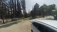
 google parking directions
This region uses the Uk/Euro style trail grading system.
Activities Click to view
- Mountain Bike
51 trails
- E-Bike
47 trails
- Hike
40 trails
- Trail Running
38 trails
Region Details
- 17
- 31
- 3
Region Status
Open as of May 21, 2026Stats
- Avg Trail Rating
- Trails (view details)
- 51
- Trails Mountain Bike
- 51
- Trails E-Bike
- 47
- Trails Hike
- 40
- Trails Trail Running
- 38
- Total Distance
- 45 miles
- Total Descent
- 7,627 ft
- Total Vertical
- 505 ft
- Highest Trailhead
- 805 ft
- Reports
- 881
- Photos
- 77
- Ridden Counter
- 7,870
Popular Ben Shemen Mountain Biking Trails
• 95 ★ 4.7 • 6 miles • 389 ft • 372 •
Highly rated popular blue difficulty singletrack. This mountain bike primary trail can be used downhill primary and has a moderate overall physical rating with a 389 ft green climb. On average it takes 52 minutes to complete this trail.
• 100 ★ 4.2 • 1,122 ft • 0 ft • 271 •
One of the oldest, short and very fast lane, leave the brakes cold all the way, don't forget to use them towards the end
• 90 ★ 3.5 • 1,735 ft • 12 ft • 258 •
Popular green difficulty singletrack. This mountain bike primary trail can be used both directions and has a easy overall physical rating with a 12 ft green climb. On average it takes 2 minutes to complete this trail.
• 65 ★ 4.7 • 7 miles • 657 ft • 252 •
The most Popular trail in Ben Shemen, all marked White-Blue-White. riding direction is CCW, It's a round trip but you can combine sections with other trails in the forest. on weekend it is very busy !
• 100 ★ 0.0 • 1,762 ft • 0 ft • 243 •
Popular blue difficulty singletrack. This mountain bike primary trail can be used downhill primary. On average it takes 1 minutes to complete this trail.
• 100 ★ 4.4 • 4,150 ft • 3 ft • 242 •
Popular blue difficulty singletrack. This mountain bike primary trail can be used downhill primary. On average it takes 6 minutes to complete this trail.
• 90 ★ 4.5 • 1,498 ft • 34 ft • 226 •
Popular green difficulty singletrack. This mountain bike primary trail can be used uphill primary. On average it takes 2 minutes to complete this trail.
• 80 ★ 3.0 • 1,784 ft • 0 ft • 223 •
Popular blue difficulty singletrack. This mountain bike primary trail can be used downhill primary and has a moderate overall physical rating with a 0 ft blue climb. On average it takes 1 minutes to complete this trail.
Ben Shemen Mountain Bike Routes
★ 2.7 • 7 miles • 579 ft • 0 • Loop •
Hadid was built to lead us to all the and special corners of the forest, including ones that would also...
• 5 miles • 568 ft • 0 •
• 14 miles • 1,563 ft • 9 •
• 6 miles • 647 ft • 6 •
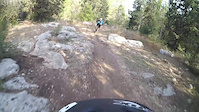
Photos of Ben Shemen Mountain Bike
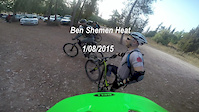
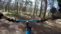
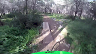
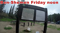
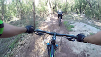
Videos of Ben Shemen Mountain Bike
trail: The Pagoda
3:39 |
484 |
Apr 24, 2016
4:31 |
58 |
Oct 19, 2015
5:25 |
55 |
Aug 3, 2015
2:43 |
127 |
May 10, 2015
3:44 |
85 |
Apr 6, 2015
5:57 |
76 |
Feb 7, 2015
3:06 |
137 |
Dec 26, 2014
3:32 |
106 |
Dec 8, 2014
Recent Trail Reports
| status | trail | date | condition | info | user |
|---|---|---|---|---|---|
| Paradise | May 21, 2026 @ 11:30am (Asia/Jerusalem) May 21, 2026 | Very Dry | MikyJ24 | ||
| Franklin | May 21, 2026 @ 11:30am (Asia/Jerusalem) May 21, 2026 | Very Dry | MikyJ24 | ||
| Hidden | Jan 23, 2026 @ 8:44am (Asia/Jerusalem) Jan 22, 2026 | Ideal | MikyJ24 | ||
| The Fathers | Jan 23, 2026 @ 8:44am (Asia/Jerusalem) Jan 22, 2026 | Ideal | MikyJ24 | ||
| The Mothers | Jan 23, 2026 @ 8:44am (Asia/Jerusalem) Jan 22, 2026 | Ideal | MikyJ24 | ||
| The Fork | Jan 23, 2026 @ 8:44am (Asia/Jerusalem) Jan 22, 2026 | Ideal | MikyJ24 | ||
| To Be Shvat | Jan 23, 2026 @ 8:44am (Asia/Jerusalem) Jan 22, 2026 | Ideal | MikyJ24 | ||
| Bumps | Apr 11, 2025 @ 7:21am Apr 11, 2025 | Dry | Platipus | ||
| The Sons | Apr 11, 2025 @ 7:21am Apr 11, 2025 | Dry | Platipus | ||
| Climb to Franklin | Apr 11, 2025 @ 7:21am Apr 11, 2025 | Ideal | Platipus |
Activity Feed
| username | action | type | title | date |
|---|---|---|---|---|
| RoyIeOHrn | checkin | trail | activity #95915183 | May 31, 2026 @ 1:23am May 31, 2026 |
| RoyIeOHrn | ridden | trail | activity #95915171 | May 31, 2026 @ 1:23am May 31, 2026 |
| RoyIeOHrn | vote | route | activity #95914870 | May 31, 2026 @ 1:14am May 31, 2026 |
| Daberz | wishlist | trail | activity #95322591 and 1 more | May 23, 2026 @ 8:43am May 23, 2026 |
| Daberz | ridden | trail | activity #95322505 | May 23, 2026 @ 8:42am May 23, 2026 |
Recent Comments
| username | type | title | comment | date |
|---|---|---|---|---|
| trail | Love it. Recommend for beginners and even... | Dec 27, 2024 @ 6:30am Dec 27, 2024 | ||
| trail | Gggt | Jan 24, 2024 @ 8:53pm Jan 24, 2024 | ||
| trail | Ggg | Jan 24, 2024 @ 8:53pm Jan 24, 2024 | ||
| trail | Ttt | Jan 24, 2024 @ 8:53pm Jan 24, 2024 | ||
| report | עץ נפל על המסלול | Dec 21, 2019 @ 1:31am Dec 21, 2019 |
Nearby Areas
| name | distance | ||||
|---|---|---|---|---|---|
| Karmei Yosef | 2 | 8 | 7.3 km | ||
| Canada Park | 11 | 8.2 km | |||
| Neve Shalom | 1 | 9.1 km | |||
| Tsor'a | 3 | 11.9 km | |||
| Horashim | 8 | 17 | 13.1 km |
Local Badges
-

Completionist0 awarded
Local Mountain Biking Directory
-
GALGALIM- PRO
![GALGALIM- PRO]()
-
Giant IsraelBike Shop
-
Slalum Beit HerutBike Shop
Local Products
Activity Type Stats
| activitytype | trails | distance | descent | descent distance | total vertical | rating | global rank | state rank | photos | reports | routes | ridelogs |
|---|---|---|---|---|---|---|---|---|---|---|---|---|
| Mountain Bike | 51 | 45 miles | 7,628 ft | 24 miles | 505 ft | 74 | 881 | 3 | 21,623 | |||
| E-Bike | 47 | 44 miles | 7,382 ft | 23 miles | 505 ft | #570 | #7 | 3 | 846 | 3 | 3,880 | |
| Hike | 40 | 42 miles | 6,263 ft | 22 miles | 495 ft | #1,186 | #6 | 880 | 36 | |||
| Trail Running | 38 | 42 miles | 6,043 ft | 21 miles | 495 ft | #640 | #6 | 879 | 73 |
Frequently Asked Questions About Ben Shemen
▼
What are the highest rated mountain biking trails in Ben Shemen?
The highest rated mountain biking trails in Ben Shemen are:
- Herzel (4.4/5)
- New Tel Hadid (4.3/5)
- The Fathers (4.2/5)
- Cracked Olives (4.2/5)
- Rotten Goat (4.1/5)
▼
What is the best time of the year to ride in Ben Shemen?
Based on ride log data, the most popular months to ride in Ben Shemen are:
- October (79 activities)
- July (67 activities)
- August (66 activities)
▼
Where can I park to ride in Ben Shemen?
There are 1 parking locations listed in Ben Shemen. The most popular parking spots are:
▼
What is the longest trail in Ben Shemen?
The longest trail in Ben Shemen is Anava Singletrack at 14.2 miles. View all trails sorted by distance.
Activities
- By ziv2102
 TRAILFORKS & contributors
 - Admins: ziv2102
- #5780 - 12,236 views
- ben shemen activity log | embed map of Ben Shemen mountain bike trails | ben shemen mountain biking points of interest
Downloading of trail gps tracks in kml & gpx formats is enabled for Ben Shemen.
You must login to download files.