close
-
Layers w
- Weather Layers
- Pro
- Pro
- Pro
- Pro
- Pro
- Pro
- More Layers
- Pro
- Pro
- Pro
- Pro
-
Upgrade to

3D
Trail Conditions
- Unknown
- Snow Groomed
- Snow Packed
- Snow Covered
- Snow Cover Partial
- Freeze/thaw Cycle
- Icy
- Prevalent Mud
- Wet
- Variable
- Ideal
- Dry
- Very Dry
Trail Flow (Ridden Direction)
Trailforks scans users activity logs to determine the most popular direction each trail is ridden. A good flowing trail network will have most trails flowing in a single direction according to their intension.
The colour categories are based on what percentage of users are riding a trail in its intended direction.
The colour categories are based on what percentage of users are riding a trail in its intended direction.
- > 96%
- > 90%
- > 80%
- > 70%
- > 50%
- < 50%
- bi-directional trail
- no data
Trail Last Ridden
Trailforks scans activity logs to determine the last time a trail was ridden.
- < 2 days
- < 1 week
- < 2 weeks
- < 1 month
- < 6 months
- > 6 months
Trail Ridden Direction
The intended direction a trail should be ridden.
- Downhill Only
- Downhill Primary
- Both Directions
- Uphill Primary
- Uphill Only
- One Direction
Contribute Details
Colors indicate trail is missing specified detail.
- Description
- Photos
- Description & Photos
- Videos
Trail Popularity ?
Trailforks scans activity logs to determine which trails are ridden the most in the last 9 months.
Trails are compared with nearby trails in the same city region with a possible 25 colour shades.
Think of this as a heatmap, more activities = more kinetic energy = warmer colors.
- most popular
- popular
- less popular
- not popular
ATV/ORV/OHV Filter
Max Vehicle Width
inches
US Cell Coverage
Legend

Radar Time
Activity Recordings
Trailforks uses anonymized public activity data.
?
Activity Recordings
Trailforks uses anonymized public activity data.
?
Personal Heatmap
▶
Activity Types
all
/
none
▶
Options
2
Date range
month
–
Winter Trails
Warning
A routing network for winter maps does not exist. Selecting trails using the winter trails layer has been disabled.
Missing Trails
Most Popular
Least Popular
Trails are colored based on popularity. The more popular a trail is, the more red. Less popular trails trend towards green.
Jump Magnitude Heatmap
Heatmap of where users jump on trails. Zoom in to see individual jumps, click circles to view jump details.
BC Backroad Status
![map legend]()
Service Road Atlas is a free to use, community-driven service for viewing and creating reports on the numerous back-country service roads around B.C. and Alberta.

Slope Aspect
Direction the slope faces
Trails Deemphasized
Trails are shown in grey.
Only show trails with no bike usage.
Suggested Layers
Based on selected activity type
Save the current map location and zoom level as your default home location whenever this page is loaded.
Save
No description for Bendigo has been added yet!
Login or register to submit one.
Activities Click to view
- Mountain Bike
134 trails
- E-Bike
91 trails
- Gravel Bike
10 trails
- Adaptive Bike
18 trails
- Winter Fat Bike
11 trails
- Horse
4 trails
- Hike
100 trails
- Trail Running
108 trails
Region Details
- 12
- 5
- 35
- 79
- 3
Region Status
Open as of Mar 4, 2026Stats
- Avg Trail Rating
- Trails (view details)
- 135
- Trails Mountain Bike
- 134
- Trails E-Bike
- 91
- Trails Gravel Bike
- 10
- Trails Adaptive Bike
- 18
- Trails Winter Fat Bike
- 11
- Trails Horse
- 4
- Trails Hike
- 100
- Trails Trail Running
- 108
- Trails Dirtbike/Moto
- 1
- Total Distance
- 186 miles
- Total Descent
- 13,660 ft
- Total Vertical
- 969 ft
- Highest Trailhead
- 1,490 ft
- Reports
- 219
- Photos
- 43
- Completed Counter
- 10,388
Sub Regions
-
One Tree Hill Regional Park
- 5
- 34
- 74
- 3
Popular Bendigo Mountain Biking Trails
• 100 ★ 5.0 • 4,495 ft • 118 ft • 317 •
The first Green Circle graded trail has been built in Spring Gully due to the clubs monthly working bees. The trail has been extended to form a return loop. From the car park, ride 500m to the junction and turn right and look for a...
• 100 ★ 5.0 • 1,099 ft • 16 ft • 293 •
Loose on hard pack/rock cross country link trail.
• 100 ★ 5.0 • 3,228 ft • 0 ft • 290 •
Popular green difficulty singletrack. This multi-use trail can be used downhill only. On average it takes 2 minutes to complete this trail.
• 100 ★ 5.0 • 3,288 ft • 140 ft • 230 •
Loose on hard pack/rock cross country trail.
• 100 ★ 5.0 • 1,955 ft • 16 ft • 210 •
Loose on hard pack and rocky singletrack. Bi-directional.
• 80 ★ 5.0 • 1 mile • 151 ft • 199 •
Loose on hard pack and rocky singletrack. Bi-directional. Holiday's Track, Bathtub Track, and The Peak
Bendigo Mountain Bike Routes
★ 5.0 • 16 miles • 1,259 ft • 20 • Out & Back •
25km of single trail which winds it's way through the Spring Gully Regional Park. The trail is...
★ 5.0 • 37 miles • 3,098 ft • 3 •
An initiation site, Leanganook was the Aboriginal name for Mt Alexander. The completes the Goldfields...
28 miles • 2,146 ft • 27 • Loop •
The new Epic track is 44 km in length with 800m climbing, approx 40km flowing single trail through old...
★ 2.0 • 3 miles • 220 ft • 3 • Point to Point •
Strathdale Switchbacks is a short route, has heaps of flow on the descents and easy climbs. Includes the...
★ 4.0 • 6 miles • 416 ft • 8 • Out & Back •
A good route that contains a variety of terrain and trail types, flowing descents, smooth climbs and...
3 miles • 295 ft • 6 • Point to Point •
Ridges takes you up to both of the ridge line trails that stem from Guys Hill Rd, depending on which...
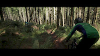
Photos of Bendigo Mountain Bike
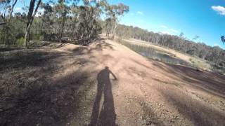
Videos of Bendigo Mountain Bike

trail: Ups and Downs
17:23 |
1091 |
Nov 13, 2015
trail: Ups and Downs
13:57 |
2232 |
Nov 12, 2015

trail: Mavic
0:41 |
527 |
Nov 16, 2012

trail: Sidewinder
6:49 |
535 |
May 13, 2021 , Bendigo
6:49 |
258 |
May 13, 2021 , Bendigo

6:49 |
1499 |
May 13, 2021 , Bendigo
Recent Trail Reports
| status | trail | date | condition | info | user |
|---|---|---|---|---|---|
| Twisty misty last one! | Mar 5, 2026 @ 8:33am (Australia/Melbourne) Mar 4, 2026 | Unknown | Johndh61 | ||
| Maddock track | Mar 5, 2026 @ 8:33am (Australia/Melbourne) Mar 4, 2026 | Ideal | Johndh61 | ||
| New rock n roll | Mar 5, 2026 @ 8:33am (Australia/Melbourne) Mar 4, 2026 | Ideal | Johndh61 | ||
| The new rock n roll | Mar 5, 2026 @ 8:33am (Australia/Melbourne) Mar 4, 2026 | Ideal | Johndh61 | ||
| Hammerhead loop | Mar 5, 2026 @ 8:33am (Australia/Melbourne) Mar 4, 2026 | Ideal | Johndh61 | ||
| After heaven comes?? | Mar 5, 2026 @ 8:33am (Australia/Melbourne) Mar 4, 2026 | Ideal | Johndh61 | ||
| Rocky Heaven | Mar 5, 2026 @ 8:33am (Australia/Melbourne) Mar 4, 2026 | Ideal | Johndh61 | ||
| Laundry Tub Time Machine | Mar 5, 2026 @ 8:33am (Australia/Melbourne) Mar 4, 2026 | Ideal | Johndh61 | ||
| car body track | Mar 5, 2026 @ 8:33am (Australia/Melbourne) Mar 4, 2026 | Ideal | Johndh61 | ||
| Sidewinder | Jun 3, 2025 @ 8:35am Jun 3, 2025 | Ideal | nigepresto195 |
Activity Feed
| username | action | type | title | date |
|---|---|---|---|---|
| timbotao | ridden | trail | activity #99600054 | Jul 20, 2026 @ 5:26am Jul 20, 2026 |
| timbotao | ridden | trail | activity #99592466 and 2 more | Jul 20, 2026 @ 1:01am Jul 20, 2026 |
| timbotao | ridden | trail | activity #99592457 | Jul 20, 2026 @ 1:00am Jul 20, 2026 |
| timbotao | wishlist | route | activity #99435921 | Jul 18, 2026 @ 5:12am Jul 18, 2026 |
| JoshB50WLX | ridden | trail | activity #97957233 | Jun 27, 2026 @ 7:42pm Jun 27, 2026 |
Recent Comments
| username | type | title | comment | date |
|---|---|---|---|---|
| trail | Starts off steep and loose, then along the... | Apr 2, 2022 @ 12:45am Apr 2, 2022 | ||
| trail | Good clear trail, rocky in places but nothing... | Dec 22, 2021 @ 10:08pm Dec 22, 2021 | ||
| trail | Rocky AF with some serious drop offs. Lots of... | Dec 22, 2021 @ 10:06pm Dec 22, 2021 | ||
| trail | Heavy rain has created some large ruts on the... | Dec 22, 2021 @ 9:56pm Dec 22, 2021 | ||
| trail | Nice easy track. With some gentle rises. Good... | Mar 29, 2021 @ 5:30pm Mar 29, 2021 |
Local Badges
-

10 Blue Trails166 awarded -

Epic Ride Climb 2k35 awarded -

Climbing 10k Badge77 awarded -

Climbing 100k Badge13 awarded -

Epic Ride Descent 2k48 awarded -

Descent 10k Badge80 awarded
Bike & Skill Parks
| name | type | city | rating |
|---|---|---|---|
| Strathfieldsaye BMX Jumps (G20) | skill park | Bendigo | |
| Spring Gully BMX Park | skill park | Bendigo | |
| Strathdale Soccer Grounds BMX Jumps | skill park | Bendigo |
Local Mountain Biking Directory
-
Cyclescape
-
Connections BmxBike Shop
-
Bendigo CyclesBike Shop
Activity Type Stats
| activitytype | trails | distance | descent | descent distance | total vertical | rating | global rank | state rank | photos | reports | routes | activity logs |
|---|---|---|---|---|---|---|---|---|---|---|---|---|
| Mountain Bike | 134 | 185 miles | 13,599 ft | 77 miles | 968 ft | #612 | #34 | 41 | 219 | 12 | 26,757 | |
| E-Bike | 91 | 154 miles | 9,488 ft | 63 miles | 968 ft | #667 | #53 | 2 | 206 | 4 | 1,717 | |
| Gravel Bike | 10 | 6 miles | 535 ft | 2 miles | 413 ft | #144 | #84 | 6 | 3 | 55 | ||
| Adaptive Bike | 18 | 16 miles | 1,578 ft | 6 miles | 509 ft | #87 | #125 | 19 | 1 | |||
| Winter Fat Bike | 11 | 12 miles | 1,516 ft | 5 miles | 423 ft | #81 | #67 | 5 | ||||
| Horse | 4 | 28 miles | 981 ft | 15 miles | 459 ft | #338 | #26 | 7 | 1 | 5 | ||
| Hike | 100 | 150 miles | 10,427 ft | 64 miles | 968 ft | #1,148 | #39 | 219 | 3 | 319 | ||
| Trail Running | 108 | 158 miles | 10,981 ft | 67 miles | 968 ft | #765 | #29 | 219 | 5 | 752 | ||
| Dirtbike/Moto | 1 | 2,398 ft | 7 ft | 719 ft | 13 ft | 7 | 1 | 27 |
Frequently Asked Questions About Bendigo
▼
What are the best places to ride in Bendigo?
Bendigo has 1 areas to explore for mountain biking. The top rated areas are:
▼
What are the highest rated mountain biking trails in Bendigo?
The highest rated mountain biking trails in Bendigo are:
- Spring Gully Green Circle Trail Up (4.1/5)
- Sidewinder (4.1/5)
- Spring Gully Green Circle Trail Down (4.1/5)
- Sneaky Bunyip (4.1/5)
- To The Tower! (4.1/5)
▼
What is the best time of the year to ride in Bendigo?
Based on activity log data, the most popular months to ride in Bendigo are:
- August (117 activities)
- November (114 activities)
- October (111 activities)
▼
Where can I park to ride in Bendigo?
There are 8 parking locations listed in Bendigo. The most popular parking spots are:
- Pieper Hill Parking and Entrance
- Cousins Street Parking Area and Entrance
- Strathfieldsaye Road Lower Parking Area
- Guys Hill Road Parking Area
- Butcher Street Parking Area
Activities
Trails
- By Cameron-1 & contributors
- Admins: Victoria
- #7116 - 22,809 views
- bendigo activity log | embed map of Bendigo mountain bike trails | bendigo mountain biking points of interest
Downloading of trail gps tracks in kml & gpx formats is enabled for Bendigo.
You must login to download files.