close
-
Layers w
- Weather Layers
- Pro
- Pro
- Pro
- Pro
- Pro
- Pro
- More Layers
- Pro
- Pro
- Pro
- Pro
-
Upgrade to

3D
Trail Conditions
- Unknown
- Snow Groomed
- Snow Packed
- Snow Covered
- Snow Cover Partial
- Freeze/thaw Cycle
- Icy
- Prevalent Mud
- Wet
- Variable
- Ideal
- Dry
- Very Dry
Trail Flow (Ridden Direction)
Trailforks scans users ridelogs to determine the most popular direction each trail is ridden. A good flowing trail network will have most trails flowing in a single direction according to their intension.
The colour categories are based on what percentage of riders are riding a trail in its intended direction.
The colour categories are based on what percentage of riders are riding a trail in its intended direction.
- > 96%
- > 90%
- > 80%
- > 70%
- > 50%
- < 50%
- bi-directional trail
- no data
Trail Last Ridden
Trailforks scans ridelogs to determine the last time a trail was ridden.
- < 2 days
- < 1 week
- < 2 weeks
- < 1 month
- < 6 months
- > 6 months
Trail Ridden Direction
The intended direction a trail should be ridden.
- Downhill Only
- Downhill Primary
- Both Directions
- Uphill Primary
- Uphill Only
- One Direction
Contribute Details
Colors indicate trail is missing specified detail.
- Description
- Photos
- Description & Photos
- Videos
Trail Popularity ?
Trailforks scans ridelogs to determine which trails are ridden the most in the last 9 months.
Trails are compared with nearby trails in the same city region with a possible 25 colour shades.
Think of this as a heatmap, more rides = more kinetic energy = warmer colors.
- most popular
- popular
- less popular
- not popular
ATV/ORV/OHV Filter
Max Vehicle Width
inches
US Cell Coverage
Legend

Radar Time
Activity Recordings
Trailforks uses anonymized public activity data.
?
Activity Recordings
Trailforks uses anonymized public activity data.
?
Personal Heatmap
▶
Activity Types
all
/
none
▶
Options
2
Date range
month
–
Winter Trails
Warning
A routing network for winter maps does not exist. Selecting trails using the winter trails layer has been disabled.
Missing Trails
Most Popular
Least Popular
Trails are colored based on popularity. The more popular a trail is, the more red. Less popular trails trend towards green.
Jump Magnitude Heatmap
Heatmap of where riders jump on trails. Zoom in to see individual jumps, click circles to view jump details.
BC Backroad Status
![map legend]()
Service Road Atlas is a free to use, community-driven service for viewing and creating reports on the numerous back-country service roads around B.C. and Alberta.

Slope Aspect
Direction the slope faces
Trails Deemphasized
Trails are shown in grey.
Only show trails with no bike usage.
Suggested Layers
Based on selected activity type
Save the current map location and zoom level as your default home location whenever this page is loaded.
Save
No description for Benevento has been added yet!
Login or register to submit one.
This region uses the Uk/Euro style trail grading system.
Activities Click to view
- Mountain Bike
149 trails
- E-Bike
147 trails
- Horse
15 trails
- Hike
116 trails
- Trail Running
111 trails
Stats
- Avg Trail Rating
- Trails (view details)
- 155
- Trails Mountain Bike
- 150
- Trails E-Bike
- 147
- Trails Gravel Bike
- 3
- Trails Horse
- 15
- Trails Hike
- 116
- Trails Trail Running
- 111
- Total Distance
- 172 miles
- Total Descent Distance
- 102 miles
- Total Descent
- 61,900 ft
- Total Vertical
- 5,105 ft
- Highest Trailhead
- 5,344 ft
- Reports
- 674
- Photos
- 734
- Ridden Counter
- 2,229
Sub Regions
- Laiano (17)
- Taburno Bike Arena (79)
- Pontelandolfo (18)
- Monte Calvello Area (17)
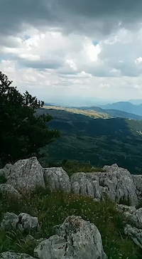
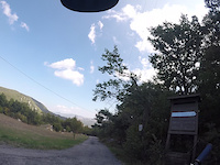
Popular Benevento Mountain Biking Trails
• 100 ★ 5.0 • 1 mile • 0 ft • 55 •
Sentiero enduro in sottobosco, fondo compatto con passaggi su pietre fisse e radici. Visuale ampia e andatura flow.
• 95 ★ 5.0 • 4,826 ft • 35 ft • 42 •
Sentiero naturale, fondo misto, sottobosco nella parte iniziale per poi diventare sempre più tecnico sul finale..
• 80 ★ 4.9 • 2 miles • 4 ft • 41 •
sentiero enduro, fondo compatto, sottobosco con sezioni flow, alcuni passaggi esposti e tratti rocciosi. Uno dei sentieri più belli della regione.
• 100 ★ 5.0 • 3,360 ft • 0 ft • 39 •
Sentiero enduro con serie di salti e drop, flow veloce e fondo compatto. Parte finale con rollercoaster naturale che vi porta all'inizio del sentiero " ò" oppure mantenendo la sinistra vi riporta sulla strada asfaltata nei pressi del...
• 75 ★ 4.7 • 4,964 ft • 10 ft • 38 •
Sentiero enduro, prima parte ricca di rocce scivolose fisse, tornanti stretti e piccoli drop. Seconda parte molto scorrevole e dal flow veloce spezzato da un paio di passaggi stretti. Fondo compatto e visuale ampia. Gass
• 95 ★ 4.8 • 1 mile • 0 ft • 36 •
Variante bassa del superpizzo trail, sentiero enduro dal fondo compatto con alcuni passaggi su rocce fisse, andatura flow veloce, visibilità ampia. Fine sentiero con cancello per bestiame, da chiudere tassativamente. Good ride
• 80 ★ 4.7 • 2,703 ft • 0 ft • 35 •
Sentiero enduro di difficoltà medio-alta, fondo misto roccioso spesso smosso con drops naturali non evitabili, ampia visibilità su tutto il percorso, finale impegnativo con percorrenza su lastroni ripidi. Livello esperto!
Benevento Mountain Bike Routes
16 miles • 4,502 ft • 7 •
Partenza da Laiano (parcheggio antenne) prima parte di salita su asfalto, seconda parte su sterrato...
Photos of Benevento Mountain Bike
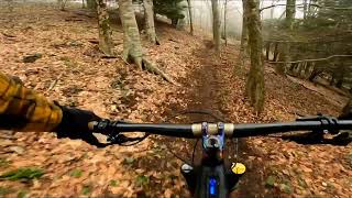
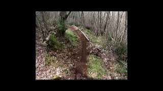
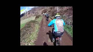
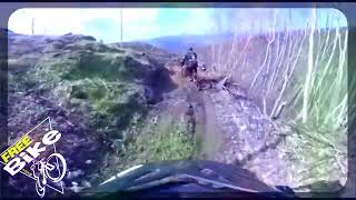
Videos of Benevento Mountain Bike
0:19 |
10 |
Aug 3, 2022
trail: Widow's Rock Trail
2:32 |
43 |
Oct 4, 2021
trail: Vado Sambuco Trail
0:54 |
242 |
Apr 3, 2023 , Laiano
trail: Fosca natural trail
4:17 |
178 |
Mar 13, 2023 , Laiano
trail: Sterrato Mazzoni
3:45 |
207 |
Mar 13, 2023 , Laiano
trail: Carpino Flow
9:44 |
324 |
Mar 13, 2023 , Laiano
Recent Trail Reports
Activity Feed
| username | action | type | title | date |
|---|---|---|---|---|
| Emanueleciarlo | add | report | activity #97549502 | Jun 22, 2026 @ 2:12am Jun 22, 2026 |
| Emanueleciarlo | add | report | activity #97549500 and 1 more | Jun 22, 2026 @ 2:12am Jun 22, 2026 |
| Emanueleciarlo | add | report | activity #96529820 and 1 more | Jun 8, 2026 @ 4:09am Jun 8, 2026 |
| spakkaruotefreerider | add | report | activity #96152112 | Jun 3, 2026 @ 6:54am Jun 3, 2026 |
| Emanueleciarlo | vote | poi | activity #95977902 and 1 more | May 31, 2026 @ 2:23pm May 31, 2026 |
Recent Comments
| username | type | title | comment | date |
|---|---|---|---|---|
| report | In che senso impraticabile? Ci passo 3 volte a... | Sep 29, 2025 @ 10:28am Sep 29, 2025 | ||
| trail | Percorso molto tecnico e pieno di rocce ,... | Oct 12, 2024 @ 6:28am Oct 12, 2024 | ||
| report | Sentiero ben mantenuto e curato il team... | Mar 13, 2023 @ 1:02pm Mar 13, 2023 | ||
| report | Gruppo @freebikeacerra | Mar 13, 2023 @ 10:02am Mar 13, 2023 | ||
| trail | DO NOT TRY THIS! This is no longer a trail.... | Jun 26, 2022 @ 7:15am Jun 26, 2022 |
Local Badges
-

10 Green Trails1 awarded -

Climbing 10k Badge0 awarded -
Climbing 10k Badge2 awarded -

Epic Mountain Bike Climb 2k0 awarded -
Epic Mountain Bike Climb 2k5 awarded -

Epic Ride 50k0 awarded
Bike & Skill Parks
| name | type | city | rating |
|---|---|---|---|
| Taburno Bike Arena | bike park | Laiano |
Activity Type Stats
| activitytype | trails | distance | descent | descent distance | total vertical | rating | global rank | state rank | photos | reports | routes | ridelogs |
|---|---|---|---|---|---|---|---|---|---|---|---|---|
| Mountain Bike | 149 | 164 miles | 57,717 ft | 99 miles | 5,105 ft | 639 | 674 | 3 | 2,447 | |||
| E-Bike | 147 | 161 miles | 55,863 ft | 96 miles | 5,105 ft | 88 | 652 | 4 | 1,148 | |||
| Gravel Bike | 3 | 7 | 9 | |||||||||
| Horse | 15 | 24 miles | 4,701 ft | 12 miles | 3,622 ft | 12 | ||||||
| Hike | 116 | 129 miles | 42,854 ft | 74 miles | 5,079 ft | 7 | 639 | 2 | 119 | |||
| Trail Running | 111 | 125 miles | 41,467 ft | 72 miles | 5,069 ft | 648 | 2 | 2 |
Frequently Asked Questions About Benevento
▼
What are the best places to ride in Benevento?
Benevento has 3 areas to explore for mountain biking. The top rated areas are:
▼
What are the highest rated mountain biking trails in Benevento?
The highest rated mountain biking trails in Benevento are:
- Carpino Flow (4.5/5)
- pizzo classico pt.1 (4.5/5)
- Castelluccio trail (4.4/5)
- Fosca natural trail (4.4/5)
- Hillbilly (4.4/5)
▼
What is the best time of the year to ride in Benevento?
Based on ride log data, the most popular months to ride in Benevento are:
- June (27 activities)
- February (25 activities)
- January (22 activities)
▼
What is the longest trail in Benevento?
The longest trail in Benevento is Anello grande Rifugio-Trinità at 3.9 miles. View all trails sorted by distance.
Activities
Trails
Points of Interest
- Rifugio altaquota Information
- Uscita Momentanea Other
- Falesia "La Sala" Other
- Falesia Ciesco Other
- Mausoleo del Pizzillo Other
- Panorama Palombella Viewpoint
- Morgione Viewpoint
- Badia Santa Maria in Grupis Other
- Grotta Dei Briganti Viewpoint
- Rifugio della volpe Lodge
- Tuoro Alto (4,291 ft)
- Tuoro Verro (4,114 ft)
- Monte Cornacchia (3,743 ft)
- By denitopia
 TRAILFORKS VTA & contributors
 - Admins: denitopia, marcoangeletti, cemoorelife, yuribu
- #11667 - 3,235 views
- benevento activity log | embed map of Benevento mountain bike trails | benevento mountain biking points of interest
Downloading of trail gps tracks in kml & gpx formats is enabled for Benevento.
You must login to download files.