close
-
Layers w
- Weather Layers
- Pro
- Pro
- Pro
- Pro
- Pro
- Pro
- More Layers
- Pro
- Pro
- Pro
- Pro
-
Upgrade to

3D
Trail Conditions
- Unknown
- Snow Groomed
- Snow Packed
- Snow Covered
- Snow Cover Partial
- Freeze/thaw Cycle
- Icy
- Prevalent Mud
- Wet
- Variable
- Ideal
- Dry
- Very Dry
Trail Flow (Ridden Direction)
Trailforks scans users ridelogs to determine the most popular direction each trail is ridden. A good flowing trail network will have most trails flowing in a single direction according to their intension.
The colour categories are based on what percentage of riders are riding a trail in its intended direction.
The colour categories are based on what percentage of riders are riding a trail in its intended direction.
- > 96%
- > 90%
- > 80%
- > 70%
- > 50%
- < 50%
- bi-directional trail
- no data
Trail Last Ridden
Trailforks scans ridelogs to determine the last time a trail was ridden.
- < 2 days
- < 1 week
- < 2 weeks
- < 1 month
- < 6 months
- > 6 months
Trail Ridden Direction
The intended direction a trail should be ridden.
- Downhill Only
- Downhill Primary
- Both Directions
- Uphill Primary
- Uphill Only
- One Direction
Contribute Details
Colors indicate trail is missing specified detail.
- Description
- Photos
- Description & Photos
- Videos
Trail Popularity ?
Trailforks scans ridelogs to determine which trails are ridden the most in the last 9 months.
Trails are compared with nearby trails in the same city region with a possible 25 colour shades.
Think of this as a heatmap, more rides = more kinetic energy = warmer colors.
- most popular
- popular
- less popular
- not popular
ATV/ORV/OHV Filter
Max Vehicle Width
inches
US Cell Coverage
Legend

Radar Time
Activity Recordings
Trailforks uses anonymized public activity data.
?
Activity Recordings
Trailforks uses anonymized public activity data.
?
Personal Heatmap
▶
Activity Types
all
/
none
▶
Options
2
Date range
month
–
Winter Trails
Warning
A routing network for winter maps does not exist. Selecting trails using the winter trails layer has been disabled.
Missing Trails
Most Popular
Least Popular
Trails are colored based on popularity. The more popular a trail is, the more red. Less popular trails trend towards green.
Jump Magnitude Heatmap
Heatmap of where riders jump on trails. Zoom in to see individual jumps, click circles to view jump details.
BC Backroad Status
![map legend]()
Service Road Atlas is a free to use, community-driven service for viewing and creating reports on the numerous back-country service roads around B.C. and Alberta.

Slope Aspect
Direction the slope faces
Trails Deemphasized
Trails are shown in grey.
Only show trails with no bike usage.
Suggested Layers
Based on selected activity type
Save the current map location and zoom level as your default home location whenever this page is loaded.
Save
No description for Benidorm has been added yet!
Login or register to submit one.
This region uses the Uk/Euro style trail grading system.
Activities Click to view
- Mountain Bike
688 trails
- E-Bike
688 trails
- Adaptive Bike
0 trails
- Horse
21 trails
- Hike
697 trails
- Trail Running
697 trails
Region Details
- 228
- 47
- 318
- 90
- 5
Region Status
Caution as of Apr 30, 2026Stats
- Avg Trail Rating
- Trails (view details)
- 698
- Trails Mountain Bike
- 688
- Trails E-Bike
- 688
- Trails Horse
- 21
- Trails Hike
- 697
- Trails Trail Running
- 697
- Total Distance
- 330 miles
- Total Descent Distance
- 184 miles
- Total Descent
- 101,909 ft
- Total Vertical
- 4,532 ft
- Highest Trailhead
- 4,557 ft
- Reports
- 265
- Photos
- 19
- Ridden Counter
- 16,130
Sub Regions
-
Bernia Sur
- 11
- 4
-
Cala Finestrat
- 3
- 22
- 2
-
Calpe-Oltá
- 9
- 35
- 26
-
Guadalest-Confrides
- 1
-
La Nucía-Polop
- 12
- 17
-
Puig Campana-Ponoig-Xirles-Callosa de Sarriá
- 6
- 84
- 34
-
Sierra Cortina-Finestrat
- 16
- 39
-
Sierra de Orxeta-Pantano del Amadorio
- 98
- 17
-
Sierra Helada
- 2
- 16
- 4
- 4
Popular Benidorm Mountain Biking Trails
• 100 ★ 0.0 • 2,152 ft • 0 ft • 146 •
entre tramos que salva la carretera a través de un túnel
• 100 ★ 0.0 • 577 ft • 15 ft • 137 •
Popular green difficulty singletrack. This multi-use trail can be used both directions. On average it takes minutes to complete this trail.
• 100 ★ 3.0 • 1,434 ft • 26 ft • 98 •
Trail que se puede hacer en ambas direcciones, muy bonito entre pinos.
• 100 ★ 3.0 • 2,428 ft • 36 ft • 89 •
Popular green difficulty singletrack. This multi-use trail can be used both directions. On average it takes 2 minutes to complete this trail.
• 100 ★ 3.0 • 1,781 ft • 21 ft • 87 •
Popular blue difficulty mixed. This multi-use trail can be used both directions with a 21 ft blue climb. On average it takes 1 minutes to complete this trail.
• 95 ★ 0.0 • 525 ft • 9 ft • 86 •
Popular blue difficulty singletrack. This multi-use trail can be used both directions. On average it takes 1 minutes to complete this trail.
Benidorm Mountain Bike Routes
★ 4.0 • 17 miles • 4,049 ft • 18 • Loop •
Ruta Endurera pasando por sendas conocidas de la Zona del Puiga Campana y Ponoig, de varios niveles de...
26 miles • 3,806 ft • 18 • Loop •
Ruta salida y llegada en Benidorm, gran parte de ella transcurre por carreteras secundarias para enlazar...
23 miles • 3,971 ft • 9 • Loop •
Ruta Endurera pasando por sendas conocidas de la Zona de Sierra del Puig Campana, de varios niveles de...
40 miles • 6,583 ft • 35 • Loop •
Ruta que inicia y acaba desde Benidorm, bordeando la zona del Puig Campana y llegando a la zona de Bernia...
11 miles • 2,662 ft • 15 • Loop •
Ruta por la Zona de Calpe-Olta sendas de varias dificultades, media alta , enlazando las sendas por pistas...
18 miles • 3,655 ft • 5 • Loop •
Recorrido perteneciente a la Btt La Nucia de 2024
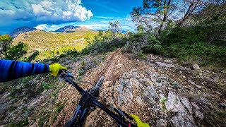
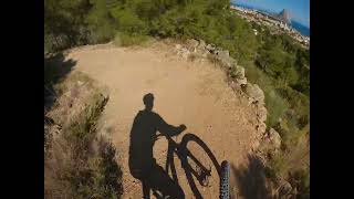
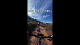
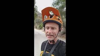
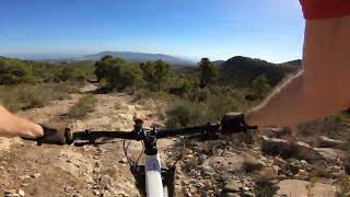
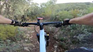
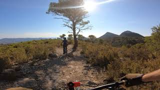
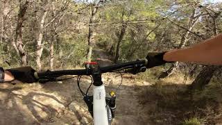
Photos of Benidorm Mountain Bike
Videos of Benidorm Mountain Bike
trail: SuperEnduroBeni
9:09 |
63 |
Dec 30, 2025 , Benidorm
trail: Mincho
9:52 |
147 |
Feb 11, 2025 , Benidorm
trail: La Interminable
0:52 |
101 |
Jan 21, 2025 , Benidorm
trail: El Tardeo
5:21 |
104 |
Feb 17, 2024 , Benidorm
trail: Ruedas Gordas
13:26 |
270 |
Jan 23, 2024 , Benidorm
trail: León Dormido
17:58 |
306 |
Jan 19, 2024 , Benidorm
trail: Ruedas Gordas
20:58 |
195 |
Jan 12, 2024 , Benidorm
trail: SuperEnduroBeni
14:15 |
314 |
Dec 10, 2023 , Benidorm
Recent Trail Reports
| status | trail | date | condition | info | user |
|---|---|---|---|---|---|
| Pinar de Calces | Apr 30, 2026 @ 10:14am (Africa/Algiers) Apr 30, 2026 | Very Dry | Takolo | ||
| Puerta Cerrada | Apr 3, 2026 @ 10:02am (Europe/Madrid) Apr 3, 2026 | Unknown | TrekFuel05 | ||
| Tapiada 2 | Mar 30, 2026 @ 9:02am (Africa/Algiers) Mar 30, 2026 | Unknown | Franklim | ||
| Neko Ponoig | Mar 30, 2026 @ 9:02am (Africa/Algiers) Mar 30, 2026 | Unknown | Franklim | ||
| Acceso Amanellons-Antons | Mar 30, 2026 @ 9:02am (Africa/Algiers) Mar 30, 2026 | Unknown | Franklim | ||
| Camí Vell D'alacant | Mar 30, 2026 @ 9:02am (Africa/Algiers) Mar 30, 2026 | Unknown | Franklim | ||
| Anxero | Mar 30, 2026 @ 9:02am (Africa/Algiers) Mar 30, 2026 | Unknown | Franklim | ||
| Corta Amadorio | Mar 30, 2026 @ 9:02am (Africa/Algiers) Mar 30, 2026 | Unknown | Franklim | ||
| Amadorio | Mar 30, 2026 @ 9:02am (Africa/Algiers) Mar 30, 2026 | Unknown | Franklim | ||
| Alginenc | Mar 30, 2026 @ 9:02am (Africa/Algiers) Mar 30, 2026 | Unknown | Franklim |
Activity Feed
| username | action | type | title | date |
|---|---|---|---|---|
| JaimeMb2nGs | wishlist | trail | activity #97582807 | Jun 22, 2026 @ 1:37pm 2 days |
| Joannar3BbLv | wishlist | route | activity #97398449 | Jun 20, 2026 @ 8:28am Jun 20, 2026 |
| Joannar3BbLv | wishlist | route | activity #97310416 | Jun 19, 2026 @ 5:44am Jun 19, 2026 |
| AMG | add | trail | activity #97191763 | Jun 17, 2026 @ 9:56am Jun 17, 2026 |
| AMG | add | trail | activity #97191191 and 6 more | Jun 17, 2026 @ 9:48am Jun 17, 2026 |
Recent Comments
| username | type | title | comment | date |
|---|---|---|---|---|
| trail | Sic trail with 1 or 2 hard sections, otherwise... | Jan 15, 2026 @ 9:38am Jan 15, 2026 | ||
| trail | Nice trail. The start is prime, some sketchy... | Dec 31, 2025 @ 3:53am Dec 31, 2025 | ||
| trail | Personalmente me ha decepcionado bastante.... | Dec 28, 2025 @ 12:11pm Dec 28, 2025 | ||
| trail | Primera parte llevadera, en ladera, sobre... | Dec 27, 2025 @ 5:39am Dec 27, 2025 | ||
| trail | No he visto ninguna prohibición de cartel.... | Dec 27, 2025 @ 5:32am Dec 27, 2025 |
Local Badges
-

Completionist0 awarded -

Epic Ride 50k800 awarded -
Completionist0 awarded -
Completionist0 awarded -

Big Ride 30k1,608 awarded -
Completionist0 awarded
Bike & Skill Parks
| name | type | city | rating |
|---|---|---|---|
| Alfaz del pi motocross | skill park | Benidorm |
Activity Type Stats
| activitytype | trails | distance | descent | descent distance | total vertical | rating | global rank | state rank | photos | reports | routes | ridelogs |
|---|---|---|---|---|---|---|---|---|---|---|---|---|
| Mountain Bike | 688 | 322 miles | 99,711 ft | 181 miles | 4,531 ft | #432 | #50 | 12 | 265 | 20 | 11,404 | |
| E-Bike | 688 | 322 miles | 99,711 ft | 181 miles | 4,531 ft | #126 | #63 | 6 | 263 | 15 | 1,728 | |
| Horse | 21 | 10 miles | 1,975 ft | 3 miles | 4,091 ft | #1,010 | #65 | 18 | ||||
| Hike | 697 | 329 miles | 101,818 ft | 183 miles | 4,531 ft | #230 | #51 | 263 | 21 | 793 | ||
| Trail Running | 697 | 329 miles | 101,818 ft | 183 miles | 4,531 ft | #178 | #50 | 263 | 355 |
Frequently Asked Questions About Benidorm
▼
What are the best places to ride in Benidorm?
Benidorm has 9 areas to explore for mountain biking. The top rated areas are:
▼
What are the highest rated mountain biking trails in Benidorm?
The highest rated mountain biking trails in Benidorm are:
- SuperEnduroBeni (4.4/5)
- No Name (4.1/5)
- No Name (4.1/5)
- La Fonteta de Llopis Pt2 (4.1/5)
- Zona de Acampada (4.1/5)
▼
What is the best time of the year to ride in Benidorm?
Based on ride log data, the most popular months to ride in Benidorm are:
- March (54 activities)
- February (43 activities)
- October (42 activities)
▼
Where can I park to ride in Benidorm?
There are 6 parking locations listed in Benidorm. The most popular parking spots are: View all parking and trailhead locations on the map to plan your visit.
Activities
Trails
- By brenthillier
 NSMBA TRAILFORKS & contributors
 - Admins: AMG, juanx, Fjavi
- #14822 - 7,843 views
- benidorm activity log | embed map of Benidorm mountain bike trails | benidorm mountain biking points of interest
Downloading of trail gps tracks in kml & gpx formats is enabled for Benidorm.
You must login to download files.