close
-
Layers w
- Weather Layers
- Pro
- Pro
- Pro
- Pro
- Pro
- Pro
- More Layers
- Pro
- Pro
- Pro
- Pro
-
Upgrade to

3D
Trail Conditions
- Unknown
- Snow Groomed
- Snow Packed
- Snow Covered
- Snow Cover Partial
- Freeze/thaw Cycle
- Icy
- Prevalent Mud
- Wet
- Variable
- Ideal
- Dry
- Very Dry
Trail Flow (Ridden Direction)
Trailforks scans users ridelogs to determine the most popular direction each trail is ridden. A good flowing trail network will have most trails flowing in a single direction according to their intension.
The colour categories are based on what percentage of riders are riding a trail in its intended direction.
The colour categories are based on what percentage of riders are riding a trail in its intended direction.
- > 96%
- > 90%
- > 80%
- > 70%
- > 50%
- < 50%
- bi-directional trail
- no data
Trail Last Ridden
Trailforks scans ridelogs to determine the last time a trail was ridden.
- < 2 days
- < 1 week
- < 2 weeks
- < 1 month
- < 6 months
- > 6 months
Trail Ridden Direction
The intended direction a trail should be ridden.
- Downhill Only
- Downhill Primary
- Both Directions
- Uphill Primary
- Uphill Only
- One Direction
Contribute Details
Colors indicate trail is missing specified detail.
- Description
- Photos
- Description & Photos
- Videos
Trail Popularity ?
Trailforks scans ridelogs to determine which trails are ridden the most in the last 9 months.
Trails are compared with nearby trails in the same city region with a possible 25 colour shades.
Think of this as a heatmap, more rides = more kinetic energy = warmer colors.
- most popular
- popular
- less popular
- not popular
ATV/ORV/OHV Filter
Max Vehicle Width
inches
US Cell Coverage
Legend

Radar Time
Activity Recordings
Trailforks uses anonymized public activity data.
?
Activity Recordings
Trailforks uses anonymized public activity data.
?
Personal Heatmap
▶
Activity Types
all
/
none
▶
Options
2
Date range
month
–
Winter Trails
Warning
A routing network for winter maps does not exist. Selecting trails using the winter trails layer has been disabled.
Missing Trails
Most Popular
Least Popular
Trails are colored based on popularity. The more popular a trail is, the more red. Less popular trails trend towards green.
Jump Magnitude Heatmap
Heatmap of where riders jump on trails. Zoom in to see individual jumps, click circles to view jump details.
BC Backroad Status
![map legend]()
Service Road Atlas is a free to use, community-driven service for viewing and creating reports on the numerous back-country service roads around B.C. and Alberta.

Slope Aspect
Direction the slope faces
Trails Deemphasized
Trails are shown in grey.
Only show trails with no bike usage.
Suggested Layers
Based on selected activity type
Save the current map location and zoom level as your default home location whenever this page is loaded.
SaveThe Mountain Bike Capital
IMBA Ride Center

Bentonville
Activities Click to view
- Mountain Bike
364 trails
- E-Bike
366 trails
- Gravel Bike
16 trails
- Adaptive Bike
0 trails
- Winter Fat Bike
0 trails
- Hike
354 trails
- Trail Running
354 trails
Region Details
- 9
- 88
- 75
- 100
- 41
- 8
- 2
Region Status
Open as of 8 hoursStats
- Avg Trail Rating
- Trails (view details)
- 328
- Trails Mountain Bike
- 367
- Trails E-Bike
- 366
- Trails Gravel Bike
- 16
- Trails Horse
- 3
- Trails Hike
- 354
- Trails Trail Running
- 354
- Trails Dirtbike/Moto
- 3
- Trails Observed Trials
- 3
- Total Distance
- 135 miles
- Total Descent
- 11,947 ft
- Total Vertical
- 418 ft
- Highest Trailhead
- 1,356 ft
- Reports
- 12,718
- Photos
- 1,989
- Ridden Counter
- 870,966
Articles
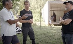
Video: Exploring Bentonville Arkansas's Mountain Biking & Food Scenes With Biju Thomas
Jun 17, 2025 from pinkbike.com
You know about Walmart. You’ve heard about the trails. But how’s the food?

Bentonville Bike Fest Announce 2025 Event Details
Feb 6, 2025 from pinkbike.com
Early bird Bentonville Bike Fest passes are available now.
Video: Remy Metailler & Ryan Rodriguez Chase Rock Features In Bentonville
Jun 8, 2023 from pinkbike.com
Remy went to check out the huge investment that has gone into building trails in Arkansas.... courtesy of Walmart.
Sub Regions
-
Bentonville Greenways and Access Paths
- 25
- 1
-
Coler Mountain Bike Preserve
- 3
- 12
- 16
- 5
- 4
- 2
-
Elm Tree Elementary School
- 8
- 2
-
HandCut Hollow
- 2
- 3
- 15
- 12
-
Park Spring Park
- 1
- 5
- 5
- 2
-
Slaughter Pen Trails
- 17
- 42
- 63
- 20
- 3
-
Southwest Bentonville
- 12
-
Walmart Home Office Campus
- 7
-
Wolf Creek Park
- 4
Popular Bentonville Mountain Biking Trails
• 90 ★ 3.5 • 2,001 ft • 55 ft • 8,747 •
has almost completely replaced this in places. Great for the wee ones and relaxing way to get down to the new trails in the south section of Phase 1
• 100 ★ 4.4 • 2,405 ft • 0 ft • 8,218 •
Highly rated popular green difficulty singletrack. This multi-use trail can be used downhill only. Adaptive MTB rating: amtb green. On average it takes 1 minutes to complete this trail.
• 95 ★ 4.4 • 2,457 ft • 80 ft • 7,289 •
Highly rated popular green difficulty singletrack. This multi-use trail can be used downhill only. Adaptive MTB rating: amtb green. On average it takes 3 minutes to complete this trail.
• 90 ★ 4.8 • 3,520 ft • 43 ft • 7,288 •
This directional intermediate downhill flow/jump trail starts at the Hub and ends at the northeast end of . The trail includes many rollers, jumps and berms. It is great fun for all ages that are moderately skilled on a mountain bike.
• 95 ★ 3.7 • 725 ft • 0 ft • 7,203 •
is a green flow downhill in Phase III of the Slaughter Pen Trail
• 95 ★ 4.3 • 784 ft • 0 ft • 6,819 •
Highly rated popular blue difficulty singletrack. This multi-use trail can be used downhill only and has a hard overall physical rating. It features berm, bridge, jump, gap jump and roller coaster. Adaptive MTB rating: amtb green. Trail visibility is always easy to follow. On average it takes 1 minutes to complete this trail.
• 100 ★ 4.7 • 1,447 ft • 0 ft • 6,701 •
New dual-slalom racetrack, it has been re-constructed for all abilities. There is an egress for timid riders to leave before the last bridge feature. When in doubt, walk it out! This trail is a super fun trail that the family can lap as...
Bentonville Mountain Bike Routes
★ 4.5 • 5 miles • 270 ft • 13 • Loop •
This is a route for beginner rides who are focusing on learning the basics of mountain biking. There is...
★ 5.0 • 7 miles • 638 ft • 6 • Loop •
This route is intended for adaptive riders. Most aMTBs will be good on this route, but be sure to consult...
★ 5.0 • 16 miles • 1,535 ft • 54 •
This route is a great place to start for first-time visitors to Slaughter Pen Trails. It hits all the...
★ 5.0 • 138 miles • 12,933 ft • 95 •
This is the route Payson McElveen posted on his strava for the Bentonville trail challenge 2021.
★ 4.0 • 10 miles • 369 ft • 3 • Out & Back •
Price house coffee road, up Sugar Creek, to Ryan Road, up the connector, lil lollipop loop, and back
★ 5.0 • 17 miles • 1,986 ft • 36 • Loop •
This route hits most of my Slaughter Pen favorites.
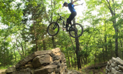
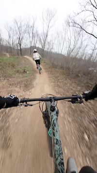
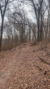
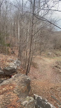
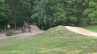
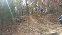
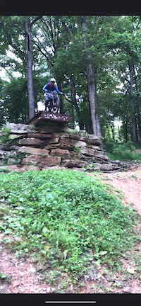
Photos of Bentonville Mountain Bike
Videos of Bentonville Mountain Bike
trail: Medieval
0:06 |
93 |
Feb 2, 2025

trail: Choo Choo
0:29 |
59 |
Apr 23, 2024
trail: Masterplan
0:08 |
172 |
Feb 25, 2024
trail: Bone Yard
0:09 |
185 |
Feb 24, 2024
trail: All-American Skill Line
0:15 |
174 |
May 28, 2023
trail: The Boneyard
0:12 |
317 |
May 1, 2023
trail: Cease and Desist
0:07 |
1287 |
Mar 4, 2023
trail: Choo Choo
0:06 |
205 |
Dec 11, 2022
Current Trail Warnings
| status | trail | date | condition | user | info |
|---|---|---|---|---|---|
| Ravine Trail | Jun 19, 2026 @ 9:31pm (America/Chicago) 8 hours | Unknown | admiralwindows | Closed due Crystal Bridges construction | |
| Rock Ledge trail | Jun 19, 2026 @ 9:31pm (America/Chicago) 8 hours | Unknown | admiralwindows | Closed due Crystal Bridges construction | |
| Checks in the Mail | Jun 18, 2026 @ 5:00pm (America/Chicago) 2 days | Unknown | Sebski01 Rock Solid | Trees down and very overgrown |
Recent Trail Reports
| status | trail | date | condition | info | user |
|---|---|---|---|---|---|
| Heading Home | Jun 19, 2026 @ 3:43pm (America/Chicago) 13 hours | Unknown | chrisjennings | ||
| Elbow Room | Jun 18, 2026 @ 5:06pm (America/Chicago) 1 day | Unknown | Sebski01 Rock Solid | ||
| Red Barn | Jun 18, 2026 @ 3:55pm (America/Chicago) 2 days | Unknown | tylerstanleyphotography | ||
| Dark Holler Connector | Jun 17, 2026 @ 4:33pm (America/Chicago) 3 days | Unknown | Geebs82 | ||
| Milk Run | Jun 17, 2026 @ 1:44pm (America/Chicago) 3 days | Ideal | tj34pike | ||
| Creekside | Jun 16, 2026 @ 6:39pm (America/Chicago) Jun 16, 2026 | Ideal | tbubier | ||
| Oeste Vista | Jun 16, 2026 @ 1:30pm (America/Chicago) Jun 16, 2026 | Unknown | gcon2000 | ||
| 3rd Street Protected Bike Lane | Jun 16, 2026 @ 6:25am (America/Indiana/Vincennes) Jun 16, 2026 | Ideal | admiralwindows | ||
| Oscar's Bridge | Jun 16, 2026 @ 6:25am (America/Indiana/Vincennes) Jun 16, 2026 | Ideal | admiralwindows | ||
| Applegate | Jun 16, 2026 @ 6:25am (America/Indiana/Vincennes) Jun 16, 2026 | Ideal | admiralwindows |
Activity Feed
| username | action | type | title | date |
|---|---|---|---|---|
| admiralwindows | add | report | activity #97361860 and 1 more | Jun 19, 2026 @ 7:32pm 8 hours |
| EmilyDGpdq | ridden | trail | activity #97342502 | Jun 19, 2026 @ 1:49pm 13 hours |
| chrisjennings | add | report | activity #97342111 | Jun 19, 2026 @ 1:43pm 13 hours |
| admiralwindows | add | photo | activity #97332845 and 2 more | Jun 19, 2026 @ 11:28am 16 hours |
| enriquelazaro | wishlist | route | activity #97296720 | Jun 18, 2026 @ 9:52pm 1 day |
Recent Comments
| username | type | title | comment | date |
|---|---|---|---|---|
| trail | Mother nature has reclaimed this trail. | Jun 9, 2026 @ 7:10am Jun 9, 2026 | ||
| trail | Giant downed tree blocking path | Jun 9, 2026 @ 6:35am Jun 9, 2026 | ||
| trail | Recent storms have completely washed out the... | Jun 9, 2026 @ 5:19am Jun 9, 2026 | ||
| report | This post is old may not be relevant | Jun 6, 2026 @ 12:50pm Jun 6, 2026 | ||
| report | :s14 s,:;tgeeeay!{ tcege, xd wR q q qcqqzs. ... | May 29, 2026 @ 12:41pm May 29, 2026 |
Local Badges
-

Completionist55 awarded -

Epic Ride 50k8,166 awarded -

Top 10 Trails38 awarded -
Completionist90 awarded -
Completionist13 awarded -

10 Expert Trails131 awarded
Bike & Skill Parks
| name | type | city | rating |
|---|---|---|---|
| Freeride Park | skill park | Bentonville | |
| North Skills Park | skill park | Bentonville | |
| Bentonville Bike Playground | skill park | Bentonville | |
| Challenger Motocross Park | skill park | Bentonville | |
| Thaden Pump Track | skill park | Bentonville |
Local Trail Supporters
- NWA Trailblazers
Activity Type Stats
| activitytype | trails | distance | descent | descent distance | total vertical | rating | global rank | state rank | photos | reports | routes | ridelogs |
|---|---|---|---|---|---|---|---|---|---|---|---|---|
| Mountain Bike | 364 | 134 miles | 11,890 ft | 51 miles | 417 ft | #6 | #2 | 1,935 | 12,807 | 76 | 194,026 | |
| E-Bike | 366 | 127 miles | 11,677 ft | 48 miles | 387 ft | #14 | #639 | 60 | 12,641 | 30 | 31,134 | |
| Gravel Bike | 16 | #49 | #749 | 105 | 4 | 1,623 | ||||||
| Horse | 3 | 4,406 ft | 3 ft | 551 ft | 243 ft | 484 | 10 | |||||
| Hike | 354 | 119 miles | 9,698 ft | 43 miles | 417 ft | #355 | #168 | 4 | 12,596 | 11 | 3,986 | |
| Trail Running | 354 | 119 miles | 9,757 ft | 43 miles | 417 ft | #357 | #137 | 9 | 12,600 | 10 | 11,827 | |
| Dirtbike/Moto | 3 | 1,801 ft | 135 ft | 233 ft | 484 | 20 | ||||||
| Observed Trials | 3 | 4,980 ft | 135 ft | 262 ft | 16 | 36 |
Frequently Asked Questions About Bentonville
▼
What are the best places to ride in Bentonville?
Bentonville has 10 areas to explore for mountain biking. The top rated areas are:
▼
What are the highest rated mountain biking trails in Bentonville?
The highest rated mountain biking trails in Bentonville are:
- Fire Line (4.7/5)
- Family Flow (4.6/5)
- Tristan Trail (4.6/5)
- Interplanet Janet (4.6/5)
- Thunder Dome (4.6/5)
▼
What is the best time of the year to ride in Bentonville?
Based on ride log data, the most popular months to ride in Bentonville are:
- October (1,167 activities)
- July (1,008 activities)
- September (1,006 activities)
▼
Where can I park to ride in Bentonville?
There are 25 parking locations listed in Bentonville. The most popular parking spots are: View all parking and trailhead locations on the map to plan your visit.
Activities
Trails
- By brenthillier
 NSMBA TRAILFORKS & contributors
 - Admins: Trailblazers, Rock Solid, FAST, jpmcghee, OZ TRAILS, thomcerny
- #3747 - 191,505 views
- bentonville activity log | embed map of Bentonville mountain bike trails | bentonville mountain biking points of interest
Downloading of trail gps tracks in kml & gpx formats is enabled for Bentonville.
You must login to download files.