close
-
Layers w
- Weather Layers
- Pro
- Pro
- Pro
- Pro
- Pro
- Pro
- More Layers
- Pro
- Pro
- Pro
- Pro
-
Upgrade to

3D
Trail Conditions
- Unknown
- Snow Groomed
- Snow Packed
- Snow Covered
- Snow Cover Partial
- Freeze/thaw Cycle
- Icy
- Prevalent Mud
- Wet
- Variable
- Ideal
- Dry
- Very Dry
Trail Flow (Ridden Direction)
Trailforks scans users ridelogs to determine the most popular direction each trail is ridden. A good flowing trail network will have most trails flowing in a single direction according to their intension.
The colour categories are based on what percentage of riders are riding a trail in its intended direction.
The colour categories are based on what percentage of riders are riding a trail in its intended direction.
- > 96%
- > 90%
- > 80%
- > 70%
- > 50%
- < 50%
- bi-directional trail
- no data
Trail Last Ridden
Trailforks scans ridelogs to determine the last time a trail was ridden.
- < 2 days
- < 1 week
- < 2 weeks
- < 1 month
- < 6 months
- > 6 months
Trail Ridden Direction
The intended direction a trail should be ridden.
- Downhill Only
- Downhill Primary
- Both Directions
- Uphill Primary
- Uphill Only
- One Direction
Contribute Details
Colors indicate trail is missing specified detail.
- Description
- Photos
- Description & Photos
- Videos
Trail Popularity ?
Trailforks scans ridelogs to determine which trails are ridden the most in the last 9 months.
Trails are compared with nearby trails in the same city region with a possible 25 colour shades.
Think of this as a heatmap, more rides = more kinetic energy = warmer colors.
- most popular
- popular
- less popular
- not popular
ATV/ORV/OHV Filter
Max Vehicle Width
inches
US Cell Coverage
Legend

Radar Time
Activity Recordings
Trailforks uses anonymized public activity data.
?
Activity Recordings
Trailforks uses anonymized public activity data.
?
Personal Heatmap
▶
Activity Types
all
/
none
▶
Options
2
Date range
month
–
Winter Trails
Warning
A routing network for winter maps does not exist. Selecting trails using the winter trails layer has been disabled.
Missing Trails
Most Popular
Least Popular
Trails are colored based on popularity. The more popular a trail is, the more red. Less popular trails trend towards green.
Jump Magnitude Heatmap
Heatmap of where riders jump on trails. Zoom in to see individual jumps, click circles to view jump details.
BC Backroad Status
![map legend]()
Service Road Atlas is a free to use, community-driven service for viewing and creating reports on the numerous back-country service roads around B.C. and Alberta.

Slope Aspect
Direction the slope faces
Trails Deemphasized
Trails are shown in grey.
Only show trails with no bike usage.
Suggested Layers
Based on selected activity type
Save the current map location and zoom level as your default home location whenever this page is loaded.
Save
No description for Berkeley Springs has been added yet!
Login or register to submit one.
Activities Click to view
- Mountain Bike
50 trails
- E-Bike
44 trails
- Adaptive Bike
0 trails
- Winter Fat Bike
0 trails
- Hike
47 trails
- Trail Running
47 trails
Region Details
- 1
- 2
- 10
- 16
- 6
Region Status
Open as of Jun 17, 2026Stats
- Avg Trail Rating
- Trails (view details)
- 36
- Trails Mountain Bike
- 50
- Trails E-Bike
- 44
- Trails Gravel Bike
- 2
- Trails Horse
- 2
- Trails Hike
- 47
- Trails Trail Running
- 47
- Total Distance
- 76 miles
- Total Descent Distance
- 22 miles
- Total Descent
- 7,788 ft
- Total Vertical
- 1,882 ft
- Highest Trailhead
- 2,332 ft
- Reports
- 228
- Photos
- 41
- Ridden Counter
- 8,413
Sub Regions
-
Cacapon Resort State Park
- 10
- 16
- 6
Popular Berkeley Springs Mountain Biking Trails
• 100 ★ 4.9 • 617 ft • 0 ft • 478 •
The map only shows the main drop line that leads through first a 12" easy drop and then the choice of a 12", 24" or 36" drop. All of the drops have down slope landings and are 24" wide and sturdy. There is also a rock line with a big...
• 100 ★ 4.4 • 2,877 ft • 151 ft • 473 •
Fantastic effort from a large group of Boy Scouts in 2019. Very well built, mainly for climbing. This trail makes riding uphill fun!
• 85 ★ 4.4 • 1 mile • 0 ft • 399 •
is an abandoned horseback riding trail that connects the Batt Picnic area to the at the top of the mountain. It currently is in the process of being re-opened. It can be ridden if you're feeling adventurous, but there are over 10 large...
• 70 ★ 4.5 • 3,474 ft • 0 ft • 396 •
Thunderstruck is a new trail added in 2022. This middle section is a blue/black trail that has a fun, fast descent with many rocks, rock gardens, and small jumps and drops.
• 70 ★ 3.6 • 2 miles • 220 ft • 388 •
This trail starts and ends at the base of the mountain near the Nature Center and lower lake on Campfire Circle road. Rock & Roll forms a 2.2-mile figure 8 trail with the very short connector trail Crossroad. The inner loop is 1.2 miles...
• 90 ★ 5.0 • 2,090 ft • 0 ft • 375 •
Opened spring 2023. Reroute of lower portion of that ends at the new skills area. Mostly flowy with a few rocks and drops. Fun and fast way to end a run down .
• 60 ★ 4.4 • 1 mile • 7 ft • 351 •
A new trail added in 2022. Accessed from the lookout. No bail outs until the blue lower section and the trail is very rocky. If the very start of the trail intimidates you, I would suggest riding something else. Tons of fun if you enjoy...
• 50 ★ 3.5 • 4,908 ft • 209 ft • 334 •
This trail has been updated with the addition of the new Rock & Rock & Roll / NICA Race Loop trail. now starts at the far end of Rock & Roll / NICA Race Loop and continues to the Batt Picnic Area, which is the center of mountain biking...
Berkeley Springs Mountain Bike Routes
★ 1.0 • 14 miles • 2,793 ft • 5 •
Twin loop of Cacapon , 14 miles including all of Thunderstruck and parts of ziler.
★ 2.4 • 18 miles • 3,498 ft • 0 • Loop • Race •
2022 Cacapon Enduro route for all categories except Sport and U14 (Sport and U14 skip stage 1) Stage 1:...
★ 1.0 • 19 miles • 3,524 ft • 0 • Loop • Race •
Race course anticipated for 2024 Ecacapon Enduro
29 miles • 4,630 ft • 14 • Race •
The WV Enduro Series brings you the 2025 Cacapon Enduro "Ziler's Revenge"!! Make sure to come out and...
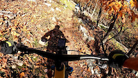
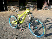
Photos of Berkeley Springs Mountain Bike
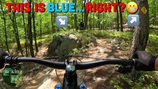
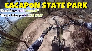
Videos of Berkeley Springs Mountain Bike
trail: Upper Thunderstruck
0:56 |
28 |
Jan 25, 2026

trail: Get Down
4:17 |
308 |
May 11, 2013
trail: Upper Giddy-Up!
0:54 |
699 |
Feb 25, 2013
28:18 |
57 |
May 13, 2025

13:26 |
47 |
May 13, 2025

trail: Upper Giddy-Up!
19:17 |
204 |
May 13, 2025 , Berkeley Springs
trail: Upper Giddy-Up!
8:32 |
141 |
May 2, 2025 , Berkeley Springs

trail: Upper Thunderstruck
29:48 |
102 |
Oct 25, 2024 , Berkeley Springs
Recent Trail Reports
Activity Feed
| username | action | type | title | date |
|---|---|---|---|---|
| AlysaSimmsOiM | ridden | trail | activity #97330413 | Jun 19, 2026 @ 10:54am 1 day |
| BaxterAuburn | add | report | activity #97220445 and 1 more | Jun 17, 2026 @ 5:32pm 3 days |
| dtdaniels | add | trail | activity #97172941 | Jun 17, 2026 @ 4:11am Jun 17, 2026 |
| Bbliss318 | comment | trail | activity #96732125 | Jun 11, 2026 @ 6:08am Jun 11, 2026 |
| Bbliss318 | comment | trail | activity #96709553 and 1 more | Jun 10, 2026 @ 6:21pm Jun 10, 2026 |
Recent Comments
| username | type | title | comment | date |
|---|---|---|---|---|
| trail | so incredibly impressed by the ease of this... | Jun 11, 2026 @ 6:08am Jun 11, 2026 | ||
| trail | fun continuation of the Giddy Ups but upper is... | Jun 10, 2026 @ 6:23pm Jun 10, 2026 | ||
| trail | Definitely my favorite section of the Giddy... | Jun 10, 2026 @ 6:21pm Jun 10, 2026 | ||
| trail | This is a proper fast, very chunky/rocky, fun... | Apr 6, 2026 @ 5:33pm Apr 6, 2026 | ||
| trail | This trail is not properly represented on the... | Aug 15, 2025 @ 3:41am Aug 15, 2025 |
Local Badges
-

Completionist0 awarded -

10 Blue Trails22 awarded -

Epic Mountain Bike Climb 2k0 awarded -

Climbing 10k Badge0 awarded -

Mountain Biking 100k Badge0 awarded -

Epic Ride Descent 2k0 awarded
Activity Type Stats
| activitytype | trails | distance | descent | descent distance | total vertical | rating | global rank | state rank | photos | reports | routes | ridelogs |
|---|---|---|---|---|---|---|---|---|---|---|---|---|
| Mountain Bike | 50 | 75 miles | 7,575 ft | 22 miles | 1,883 ft | #2,471 | #883 | 34 | 228 | 5 | 4,119 | |
| E-Bike | 44 | 32 miles | 7,507 ft | 16 miles | 1,437 ft | #3,431 | #1,208 | 5 | 211 | 1 | 500 | |
| Gravel Bike | 2 | 2 | 8 | |||||||||
| Horse | 2 | 1 mile | 105 ft | 2,425 ft | 98 ft | 3 | ||||||
| Hike | 47 | 75 miles | 7,162 ft | 21 miles | 1,883 ft | #3,919 | #1,387 | 1 | 227 | 181 | ||
| Trail Running | 47 | 75 miles | 7,162 ft | 21 miles | 1,883 ft | #3,380 | #1,000 | 227 | 11 |
Frequently Asked Questions About Berkeley Springs
▼
What are the best places to ride in Berkeley Springs?
Berkeley Springs has 1 areas to explore for mountain biking. The top rated areas are:
▼
What are the highest rated mountain biking trails in Berkeley Springs?
The highest rated mountain biking trails in Berkeley Springs are:
- Drop Zone Skills Area (4.4/5)
- Middle Thunderstruck (4.3/5)
- Lower Thunderstruck (4.3/5)
- Lower Giddy-Up! (4.2/5)
- Middle Giddy-Up! (4.2/5)
▼
What is the best time of the year to ride in Berkeley Springs?
Based on ride log data, the most popular months to ride in Berkeley Springs are:
- May (35 activities)
- September (30 activities)
- July (20 activities)
▼
Where can I park to ride in Berkeley Springs?
There are 3 parking locations listed in Berkeley Springs. The most popular parking spots are: View all parking and trailhead locations on the map to plan your visit.
Activities
Trails
Points of Interest
- By bikeskibikeski & contributors
- Admins: THUMB, SHARC, UWV
- #32882 - 3,256 views
- berkeley springs activity log | embed map of Berkeley Springs mountain bike trails | berkeley springs mountain biking points of interest
Downloading of trail gps tracks in kml & gpx formats is enabled for Berkeley Springs.
You must login to download files.