close
-
Layers w
- Weather Layers
- Pro
- Pro
- Pro
- Pro
- Pro
- Pro
- More Layers
- Pro
- Pro
- Pro
- Pro
-
Upgrade to

3D
Trail Conditions
- Unknown
- Snow Groomed
- Snow Packed
- Snow Covered
- Snow Cover Partial
- Freeze/thaw Cycle
- Icy
- Prevalent Mud
- Wet
- Variable
- Ideal
- Dry
- Very Dry
Trail Flow (Ridden Direction)
Trailforks scans users ridelogs to determine the most popular direction each trail is ridden. A good flowing trail network will have most trails flowing in a single direction according to their intension.
The colour categories are based on what percentage of riders are riding a trail in its intended direction.
The colour categories are based on what percentage of riders are riding a trail in its intended direction.
- > 96%
- > 90%
- > 80%
- > 70%
- > 50%
- < 50%
- bi-directional trail
- no data
Trail Last Ridden
Trailforks scans ridelogs to determine the last time a trail was ridden.
- < 2 days
- < 1 week
- < 2 weeks
- < 1 month
- < 6 months
- > 6 months
Trail Ridden Direction
The intended direction a trail should be ridden.
- Downhill Only
- Downhill Primary
- Both Directions
- Uphill Primary
- Uphill Only
- One Direction
Contribute Details
Colors indicate trail is missing specified detail.
- Description
- Photos
- Description & Photos
- Videos
Trail Popularity ?
Trailforks scans ridelogs to determine which trails are ridden the most in the last 9 months.
Trails are compared with nearby trails in the same city region with a possible 25 colour shades.
Think of this as a heatmap, more rides = more kinetic energy = warmer colors.
- most popular
- popular
- less popular
- not popular
ATV/ORV/OHV Filter
Max Vehicle Width
inches
US Cell Coverage
Legend

Radar Time
Activity Recordings
Trailforks uses anonymized public activity data.
?
Activity Recordings
Trailforks uses anonymized public activity data.
?
Personal Heatmap
▶
Activity Types
all
/
none
▶
Options
2
Date range
month
–
Winter Trails
Warning
A routing network for winter maps does not exist. Selecting trails using the winter trails layer has been disabled.
Missing Trails
Most Popular
Least Popular
Trails are colored based on popularity. The more popular a trail is, the more red. Less popular trails trend towards green.
Jump Magnitude Heatmap
Heatmap of where riders jump on trails. Zoom in to see individual jumps, click circles to view jump details.
BC Backroad Status
![map legend]()
Service Road Atlas is a free to use, community-driven service for viewing and creating reports on the numerous back-country service roads around B.C. and Alberta.

Slope Aspect
Direction the slope faces
Trails Deemphasized
Trails are shown in grey.
Only show trails with no bike usage.
Suggested Layers
Based on selected activity type
Save the current map location and zoom level as your default home location whenever this page is loaded.
SaveThis region is Unsanctioned, Ride at your own Risk!
No description for Beroun has been added yet! Login or register to submit one.This region uses the Uk/Euro style trail grading system.
Activities Click to view
- Mountain Bike
100 trails
- Gravel Bike
0 trails
- Adaptive Bike
0 trails
- Winter Fat Bike
0 trails
- Hike
94 trails
- Trail Running
96 trails
Region Details
- 32
- 11
- 19
- 28
- 2
Region Status
Open as of Jun 19, 2026Stats
- Avg Trail Rating
- Global Ranking
- #1,002
- State Ranking
- #5
- Trails (view details)
- 97
- Trails Mountain Bike
- 100
- Trails E-Bike
- 2
- Trails Horse
- 1
- Trails Hike
- 94
- Trails Trail Running
- 96
- Total Distance
- 103 miles
- Total Descent
- 22,897 ft
- Total Vertical
- 1,261 ft
- Highest Trailhead
- 1,958 ft
- Reports
- 815
- Photos
- 71
- Ridden Counter
- 3,260
Sub Regions
-
Damil
- 3
- 6
-
Děd
- 4
- 4
- 2
-
Koda
- 2
- 5
-
Svatý Jan
- 1
- 8
-
Údolí Loděnice
- 1
- 1
Popular Beroun Mountain Biking Trails
• 100 ★ 0.0 • 4,831 ft • 100 ft • 88 •
Popular white difficulty dirt/gravel road. This mountain bike primary trail can be used both directions and has a easy overall physical rating with a 100 ft green climb. On average it takes 5 minutes to complete this trail.
• 85 ★ 4.0 • 1 mile • 0 ft • 58 •
Popular blue difficulty singletrack. This mountain bike primary trail can be used downhill primary and has a moderate overall physical rating with a 0 ft black diamond climb. It features berm and skinny. On average it takes 4 minutes to complete this trail.
• 95 ★ 4.0 • 2,707 ft • 0 ft • 58 •
Stará sjezdová trať od rozhledny na vrcholu Dědu. Sporadicky udržována místními, občasné známky diverzní činnosti: klacky v zatáčkách, hřebíky v kořenech. Doporučeno před jízdou projít a zkontrolovat! Všechny...
• 95 ★ 3.5 • 2 miles • 55 ft • 52 •
Prvních 300 metrů lesní trail, poté asi 3 km rychlá štěrková cesta a konec asi 500 m korytem.
• 90 ★ 3.0 • 1 mile • 41 ft • 52 •
Popular green difficulty mixed. This mountain bike primary trail can be used both directions with a 41 ft blue climb. It features rock garden. On average it takes 11 minutes to complete this trail.
• 85 ★ 4.0 • 6 miles • 684 ft • 47 •
Popular white difficulty mixed. This mountain bike primary trail can be used both directions. On average it takes 36 minutes to complete this trail.
• 85 ★ 2.5 • 4,551 ft • 21 ft • 38 •
Popular white difficulty family friendly gravel path. This mountain bike primary trail can be used both directions and has a easy overall physical rating with a 21 ft green climb. On average it takes 3 minutes to complete this trail.
• 60 ★ 4.0 • 1 mile • 25 ft • 36 • • hike
Po červené turistické značce do Brdatek. Trasa je součástí Svatojakubské cesty.
Beroun Mountain Bike Routes
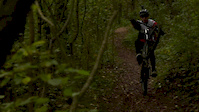
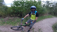
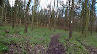
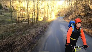
Photos of Beroun Mountain Bike
Videos of Beroun Mountain Bike
trail: Trať
0:37 |
151 |
Oct 9, 2019
trail: Děd
3:13 |
1137 |
Sep 29, 2018
trail: Podkozí
5:29 |
304 |
May 18, 2017
trail: Vráž - Sedlec
32:22 |
102 |
Feb 15, 2024 , Beroun

trail: Korytnačka
0:38 |
390 |
Dec 18, 2019 , Beroun
Recent Trail Reports
| status | trail | date | condition | info | user |
|---|---|---|---|---|---|
| Lavičky | Jun 11, 2026 @ 7:38pm (Europe/Prague) Jun 11, 2026 | Variable | IvanBerka | ||
| Habrový potok | Apr 18, 2026 @ 5:18pm (Europe/Prague) Apr 18, 2026 | Ideal | IvanBerka | ||
| Trhlina | Apr 15, 2026 @ 5:34pm (Europe/Prague) Apr 15, 2026 | Unknown | V3RTO | ||
| Jižní | Oct 24, 2025 @ 5:43pm (Europe/Prague) Oct 24, 2025 | Variable | IvanBerka | ||
| Mořinská spojka | May 1, 2025 @ 6:52am May 1, 2025 | Ideal | vorvan | ||
| Damil | Mar 23, 2025 @ 9:32am Mar 23, 2025 | Ideal | IvanBerka | ||
| Od Ptáku | Mar 8, 2025 @ 2:52pm Mar 8, 2025 | Ideal | IvanBerka | ||
| Svatoján | Feb 22, 2025 @ 9:37am Feb 22, 2025 | Icy | pixelfields | ||
| Vysoká stráň | Feb 22, 2025 @ 9:37am Feb 22, 2025 | Icy | pixelfields | ||
| Zdejcina - Beroun zelená | Oct 17, 2024 @ 1:04pm Oct 17, 2024 | Dry | spookercze |
Activity Feed
| username | action | type | title | date |
|---|---|---|---|---|
| PetrBAW71X | wishlist | region | activity #96955637 | Jun 14, 2026 @ 4:53am Jun 14, 2026 |
| IvanBerka | add | report | activity #96757294 | Jun 11, 2026 @ 1:03pm Jun 11, 2026 |
| IvanBerka | add | report | activity #95652845 | May 27, 2026 @ 12:13pm May 27, 2026 |
| OndejzCu813 | ridden | trail | activity #95234581 | May 22, 2026 @ 5:20am May 22, 2026 |
| IvanBerka | add | report | activity #92924513 | Apr 19, 2026 @ 1:11am Apr 19, 2026 |
Recent Comments
| username | type | title | comment | date |
|---|---|---|---|---|
| trail | Sebevražda | Jan 19, 2025 @ 4:28am Jan 19, 2025 | ||
| trail | Nádherná triala | Sep 2, 2024 @ 6:43am Sep 2, 2024 | ||
| trail | Moc pekna palba na takovem vlnitem flow... | Apr 1, 2024 @ 8:20am Apr 1, 2024 | ||
| trail | Koryto je teď v pohodě průjezdne a je... | Mar 31, 2024 @ 5:10pm Mar 31, 2024 | ||
| trail | Není to singletrack, jde o normální... | Mar 31, 2024 @ 5:07pm Mar 31, 2024 |
Local Badges
-

10 Green Trails7 awarded -

10 Blue Trails5 awarded -

10 Black Trails1 awarded -

Epic Ride Climb 2k117 awarded -

Climbing 10k Badge35 awarded -

Climbing 100k Badge2 awarded
Bike & Skill Parks
| name | type | city | rating |
|---|---|---|---|
| Netopýr Bike Park | skill park | Beroun | |
| BMX Nižbor | skill park | Beroun | |
| Skatepark Beroun | skill park | Beroun | |
| Pumptrack Nižbor | skill park | Beroun | |
| Pumptrack Levín | skill park | Beroun |
Activity Type Stats
| activitytype | trails | distance | descent | descent distance | total vertical | rating | global rank | state rank | photos | reports | routes | ridelogs |
|---|---|---|---|---|---|---|---|---|---|---|---|---|
| Mountain Bike | 100 | 103 miles | 22,897 ft | 59 miles | 1,260 ft | #1,002 | #5 | 70 | 814 | 7,640 | ||
| E-Bike | 2 | 1 mile | 807 ft | 1 mile | 728 ft | 554 | 314 | |||||
| Horse | 1 | 4 miles | 180 ft | 4,160 ft | 545 ft | 296 | ||||||
| Hike | 94 | 100 miles | 21,850 ft | 57 miles | 1,260 ft | #922 | #6 | 790 | 264 | |||
| Trail Running | 96 | 100 miles | 22,172 ft | 57 miles | 1,260 ft | #663 | #6 | 795 | 304 |
Frequently Asked Questions About Beroun
▼
What are the best places to ride in Beroun?
Beroun has 5 areas to explore for mountain biking. The top rated areas are:
▼
What are the highest rated mountain biking trails in Beroun?
The highest rated mountain biking trails in Beroun are:
- Korytnačka (4.2/5)
- Trať (4.1/5)
- Krobián (4.1/5)
- Děd (4/5)
- Habrový potok (4/5)
▼
What is the best time of the year to ride in Beroun?
Based on ride log data, the most popular months to ride in Beroun are:
- October (16 activities)
- June (15 activities)
- February (13 activities)
▼
Where can I park to ride in Beroun?
There are 1 parking locations listed in Beroun. The most popular parking spots are:
Trails
- By zvirze
 ČeMBA & contributors
 - Admins: ČeMBA, ČeMBA, ČeMBA, ČeMBA, ČeMBA, ČeMBA, ČeMBA, ČeMBA, ČeMBA, ČeMBA
- #17051 - 8,755 views
- beroun activity log | embed map of Beroun mountain bike trails | beroun mountain biking points of interest
Downloading of trail gps tracks in kml & gpx formats is enabled for Beroun.
You must login to download files.