close
-
Layers w
- Weather Layers
- Pro
- Pro
- Pro
- Pro
- Pro
- Pro
- More Layers
- Pro
- Pro
- Pro
- Pro
-
Upgrade to

3D
Trail Conditions
- Unknown
- Snow Groomed
- Snow Packed
- Snow Covered
- Snow Cover Partial
- Freeze/thaw Cycle
- Icy
- Prevalent Mud
- Wet
- Variable
- Ideal
- Dry
- Very Dry
Trail Flow (Ridden Direction)
Trailforks scans users ridelogs to determine the most popular direction each trail is ridden. A good flowing trail network will have most trails flowing in a single direction according to their intension.
The colour categories are based on what percentage of riders are riding a trail in its intended direction.
The colour categories are based on what percentage of riders are riding a trail in its intended direction.
- > 96%
- > 90%
- > 80%
- > 70%
- > 50%
- < 50%
- bi-directional trail
- no data
Trail Last Ridden
Trailforks scans ridelogs to determine the last time a trail was ridden.
- < 2 days
- < 1 week
- < 2 weeks
- < 1 month
- < 6 months
- > 6 months
Trail Ridden Direction
The intended direction a trail should be ridden.
- Downhill Only
- Downhill Primary
- Both Directions
- Uphill Primary
- Uphill Only
- One Direction
Contribute Details
Colors indicate trail is missing specified detail.
- Description
- Photos
- Description & Photos
- Videos
Trail Popularity ?
Trailforks scans ridelogs to determine which trails are ridden the most in the last 9 months.
Trails are compared with nearby trails in the same city region with a possible 25 colour shades.
Think of this as a heatmap, more rides = more kinetic energy = warmer colors.
- most popular
- popular
- less popular
- not popular
ATV/ORV/OHV Filter
Max Vehicle Width
inches
US Cell Coverage
Legend

Radar Time
Activity Recordings
Trailforks uses anonymized public activity data.
?
Activity Recordings
Trailforks uses anonymized public activity data.
?
Personal Heatmap
▶
Activity Types
all
/
none
▶
Options
2
Date range
month
–
Winter Trails
Warning
A routing network for winter maps does not exist. Selecting trails using the winter trails layer has been disabled.
Missing Trails
Most Popular
Least Popular
Trails are colored based on popularity. The more popular a trail is, the more red. Less popular trails trend towards green.
Jump Magnitude Heatmap
Heatmap of where riders jump on trails. Zoom in to see individual jumps, click circles to view jump details.
BC Backroad Status
![map legend]()
Service Road Atlas is a free to use, community-driven service for viewing and creating reports on the numerous back-country service roads around B.C. and Alberta.

Slope Aspect
Direction the slope faces
Trails Deemphasized
Trails are shown in grey.
Only show trails with no bike usage.
Suggested Layers
Based on selected activity type
Save the current map location and zoom level as your default home location whenever this page is loaded.
SaveThis region west of Leuven contains mainly the trails of Bertembos, but also those of Eikenbos, Grevenbos and the small Hollander forest.
Primary Trail Type: Cross-Country
eBikes Allowed:
Yes
Land Status: Community Forest
Access Info:
Central: Crossroads at the house of the forest ranger (near the large water tower) on the Bosstraat.
or
South: 't Vossenhol with plenty of parking spots.
or
South: 't Vossenhol with plenty of parking spots.
Disclaimer:
Certain trails listed here are off-limits for riding, they're on for archival purposes!
This region uses the Uk/Euro style trail grading system.
Activities Click to view
- Mountain Bike
12 trails
- E-Bike
9 trails
- Hike
14 trails
- Trail Running
14 trails
Region Details
- 6
- 6
Region Status
Caution as of Jun 2, 2024Stats
- Avg Trail Rating
- Trails (view details)
- 14
- Trails Mountain Bike
- 12
- Trails E-Bike
- 9
- Trails Hike
- 14
- Trails Trail Running
- 14
- Total Distance
- 4 miles
- Total Descent Distance
- 3 miles
- Total Descent
- 948 ft
- Total Vertical
- 148 ft
- Highest Trailhead
- 338 ft
- Reports
- 55
- Photos
- 15
- Ridden Counter
- 2,349
Popular Bertembos Mountain Biking Trails
• 80 ★ 5.0 • 2,165 ft • 0 ft • 126 •
Popular green difficulty singletrack. This mountain bike primary trail can be used both directions. On average it takes 1 minutes to complete this trail.
• 95 ★ 4.0 • 3,041 ft • 3 ft • 124 •
A long twisty trail where you always need to keep pushing those pedals to keep your speed.
• 70 ★ 5.0 • 935 ft • 3 ft • 106 •
A short aggressive XC downhill with loamy ground in the beginning and close trees in the end.
• 85 ★ 3.0 • 1,010 ft • 0 ft • 97 •
After a flat start you turn right into two loamy turns. The second left is off-camber and is followed by a small compression that launches you to a sharp right (around the three). At the end turn right and sprint for 60-70 meters for...
• 75 ★ 3.7 • 2,149 ft • 11 ft • 87 •
A flat physical start with wide turns. Eventually you drop down in a small valley, which you leave with a short steep hill that can be very slippery when there is mud. The last part you have to work through bumps and turns. At the end...
• 85 ★ 0.0 • 728 ft • 0 ft • 84 •
A new B-Line for the Trail. This one is also used a lot for climbing back up.
Bertembos Mountain Bike Routes
12 miles • 937 ft • 9 • Loop •
The best route to ride all trails in Bertembos. It also includes the Akka trails in the small Kinderenbos....
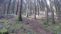
Photos of Bertembos Mountain Bike

Recent Trail Reports
| status | trail | date | condition | info | user |
|---|---|---|---|---|---|
| Ma Geul | Jun 2, 2024 @ 5:15am Jun 2, 2024 | Prevalent Mud | dodgems | ||
| To Bertembos Up | Jul 25, 2023 @ 12:03pm Jul 25, 2023 | Ideal | MCallens | ||
| Bertembos East | Jul 25, 2023 @ 12:03pm Jul 25, 2023 | Ideal | MCallens | ||
| Bertembos North | Jul 25, 2023 @ 12:03pm Jul 25, 2023 | Ideal | MCallens | ||
| Il Gigante Up | Jul 25, 2023 @ 12:03pm Jul 25, 2023 | Ideal | MCallens | ||
| Il Gigante | Jul 25, 2023 @ 12:03pm Jul 25, 2023 | Ideal | MCallens | ||
| To Il Gigante | Jul 25, 2023 @ 12:03pm Jul 25, 2023 | Ideal | MCallens | ||
| To Ahaa! & Golden Hour | Jul 25, 2023 @ 12:03pm Jul 25, 2023 | Ideal | MCallens | ||
| Takketoe | May 18, 2023 @ 4:17am May 18, 2023 | Dry | Chigoami | ||
| Keep On Pushing | Nov 26, 2022 @ 11:37pm Nov 26, 2022 | Wet | MisterTimbo |
Activity Feed
| username | action | type | title | date |
|---|---|---|---|---|
| RikV84 | wishlist | region | activity #71775336 | May 16, 2025 @ 10:43am May 16, 2025 |
| TompwDrnS | wishlist | region | activity #64851692 | Jan 19, 2025 @ 6:31am Jan 19, 2025 |
| miriwiri | wishlist | region | activity #56548541 | Aug 1, 2024 @ 12:39pm Aug 1, 2024 |
| fbielejec | wishlist | trail | activity #54130050 | Jun 14, 2024 @ 2:08pm Jun 14, 2024 |
| dodgems | add | report | activity #53504112 | Jun 2, 2024 @ 5:15am Jun 2, 2024 |
Recent Comments
| username | type | title | comment | date |
|---|---|---|---|---|
| trail | Hoe lang kan ik me ongeveer in Bertembos bezig... | Dec 7, 2022 @ 9:43am Dec 7, 2022 | ||
| trail | At the beginning of the trail there is a big... | May 4, 2020 @ 2:29am May 4, 2020 | ||
| trail | Some youngsters are building the jumps, now... | May 3, 2020 @ 11:09am May 3, 2020 | ||
| trail | Somebody is working on new jumps and at the... | Apr 30, 2020 @ 10:40am Apr 30, 2020 |
Nearby Areas
| name | distance | ||||
|---|---|---|---|---|---|
| Sterbike | 3 | 4 | 4.1 km | ||
| Sven Nys Cycling Center | 4 | 10.4 km | |||
| Champles | 1 | 10.8 km | |||
| BXL Pump Park | 11.8 km | ||||
| Bois de la Cambre - Ter Komerenbos | 5 | 11.8 km |
Local Mountain Biking Directory
-
FonceBike Shop
Activity Type Stats
| activitytype | trails | distance | descent | descent distance | total vertical | rating | global rank | state rank | photos | reports | routes | ridelogs |
|---|---|---|---|---|---|---|---|---|---|---|---|---|
| Mountain Bike | 12 | 4 miles | 794 ft | 3 miles | 148 ft | #1,906 | #9 | 15 | 55 | 1 | 2,197 | |
| E-Bike | 9 | 2 miles | 636 ft | 2 miles | 138 ft | #1,477 | #11 | 53 | 2 | 163 | ||
| Hike | 14 | 4 miles | 948 ft | 3 miles | 148 ft | #2,042 | #6 | 53 | 32 | |||
| Trail Running | 14 | 4 miles | 948 ft | 3 miles | 148 ft | #1,389 | #8 | 54 | 162 |
Frequently Asked Questions About Bertembos
▼
What are the highest rated mountain biking trails in Bertembos?
The highest rated mountain biking trails in Bertembos are:
- Ma Geul (4.2/5)
- Takketoe (4.1/5)
- Bosstraat offroad (4.1/5)
- Keep On Pushing (4/5)
- Long Shot (4/5)
▼
What is the best time of the year to ride in Bertembos?
Based on ride log data, the most popular months to ride in Bertembos are:
- July (5 activities)
- August (4 activities)
- June (3 activities)
▼
Where can I park to ride in Bertembos?
Check the Bertembos trail map for trailhead and parking information. Community members regularly update access and parking details for trails in the area.
▼
What is the longest trail in Bertembos?
The longest trail in Bertembos is Keep On Pushing at 3,041 ft. View all trails sorted by distance.
- By jeffieridesmtb
 & contributors
 - Admins: apply
- #37294 - 4,308 views
- bertembos activity log | embed map of Bertembos mountain bike trails |
Downloading of trail gps tracks in kml & gpx formats is enabled for Bertembos.
You must login to download files.